Hemed(@725Hemeed) 's Twitter Profileg
Hemed

@725Hemeed

Mapper | IT
🌐|🗺️|🇹🇿

ID:1545326332942467072

calendar_today08-07-2022 08:38:13

2,7K Tweets

2,4K Followers

1,8K Following

Hemed(@725Hemeed) 's Twitter Profile Photo

Couple of Climate Map visuals🌦️🗺️ showing Monthly 🗓️Evapotranspiration, Wind Speed ,Soil Moisture and Atmospheric Vapor Pressure of different countries 🇸🇦🇹🇿🇫🇷 created using ClimateR package📦

Couple of Climate Map visuals🌦️🗺️ showing Monthly 🗓️Evapotranspiration, Wind Speed ,Soil Moisture and Atmospheric Vapor Pressure of different countries 🇸🇦🇹🇿🇫🇷 created using ClimateR package📦 #gischat #SaudiArabia #Tanzania #EastAfrica #France #Europe #map #geospatial #rstats
account_circle
FOSS4G Europe 2024(@foss4ge) 's Twitter Profile Photo

The FOSS4GE 2024 Tartu Map Gallery is seeking contributions to showcase the imagination and skills of the FOSS4G community!🗺️

🙌Take advantage of the opportunity to have your work featured in the gallery!

Check our website to learn more about it👉2024.europe.foss4g.org/map-gallery-su…

The FOSS4GE 2024 Tartu Map Gallery is seeking contributions to showcase the imagination and skills of the FOSS4G community!🗺️ 🙌Take advantage of the opportunity to have your work featured in the gallery! Check our website to learn more about it👉2024.europe.foss4g.org/map-gallery-su…
account_circle
Johanes Petro Machela(@johanespetro) 's Twitter Profile Photo

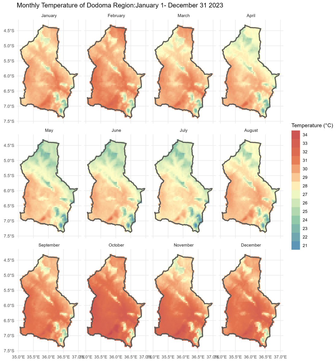
Rainfall and temperature maps are crucial for decision-making. These maps provide insights into when to plant, irrigate, and harvest, ensuring optimal crop yields and resource management. @tzagriculture , Thanks to Hemed for the Tutorial

Rainfall and temperature maps are crucial for decision-making. These maps provide insights into when to plant, irrigate, and harvest, ensuring optimal crop yields and resource management. @tzagriculture #rclimate #Agriculture #ClimateData, Thanks to @725Hemeed for the Tutorial
account_circle
Hemed(@725Hemeed) 's Twitter Profile Photo

Hello guys I'm going to be presenting at QGIS Open Day today.... approximately 5 hours 1100 hrs UTC, The topic would be 'How to visualize Digital Surface Model in 3-D using QGIS and Blender' you can come watch it live via this link ,So warmly welcome guys
youtube.com/live/S0Of3CdUF…

account_circle
Kurt Menke - geomenke@fosstodon.org(@geomenke) 's Twitter Profile Photo

The new Elevation controller widget is going to be really helpful for exploring your elevation data. It's the equivalent of the temporal controller, but for Z filtering. Now available in the nightly release. Trelleborg, the Viking ring fortress in Denmark North Road

account_circle