Hemed(@725Hemeed) 's Twitter Profileg
Hemed

@725Hemeed

Mapper | IT
🌐|🗺️|🇹🇿

ID:1545326332942467072

calendar_today08-07-2022 08:38:13

2,7K Tweets

2,4K Followers

1,8K Following

Ujaval Gandhi(@spatialthoughts) 's Twitter Profile Photo

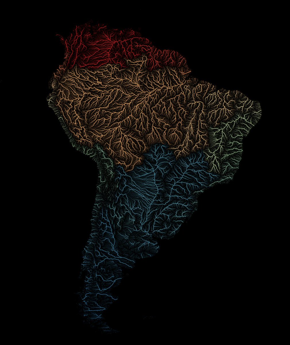
Hot off the presses! A new tutorial in our series focusing on leveraging expressions for cartography. svg unveils his techniques for crafting stunning visualizations of rivers using the HydroRIVERS dataset. Check out the tutorial at qgistutorials.com/en/docs/3/rive…

Hot off the presses! A new tutorial in our series focusing on leveraging #QGIS expressions for cartography. @newgeographer2 unveils his techniques for crafting stunning visualizations of rivers using the HydroRIVERS dataset. Check out the tutorial at qgistutorials.com/en/docs/3/rive…
account_circle
Hugh Graham @hughagraham@fosstodon.org(@hughagraham) 's Twitter Profile Photo

This dataset is remarkable! There is also room for improvement. I want to understand the performance better but that's a big job to do alone... so I've written an / package to download and compare the data against other models. Introducing {chmloader}. quick🧵...

account_circle
Raoni Adão(@rjonusan) 's Twitter Profile Photo

REM do Rio Amazonas próximo ao Lago do Acará, Amazonas.

Dados do ALOS Global Digital Surface Model (JAXA) extraídos do OpenTopography (opentopography.org).

Segui o excelente tutorial do Daniel Coe!
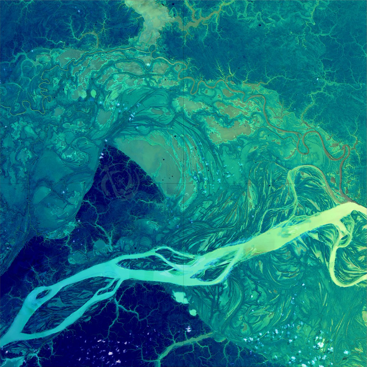
REM do Rio Amazonas próximo ao Lago do Acará, Amazonas. Dados do ALOS Global Digital Surface Model (JAXA) extraídos do OpenTopography (opentopography.org). Segui o excelente tutorial do @geo_coe!
account_circle
Raoni Adão(@rjonusan) 's Twitter Profile Photo

Depois das enchentes que BH enfrentou, decidi botar a mão na massa e criar uns mapas sobre as áreas de risco e estimei as edificações e população vulneráveis usando dados da BHGEO (Paul Heymann) e estimativas da população da Kontur.

account_circle
OpenMap Development Tanzania(@OMDTZ) 's Twitter Profile Photo

Can you believe it's already April? Time to rewind a bit📼

Take a trip down memory lane and revisit all the incredible things we achieved in 2023, from OpenStreetMap contribution, and empowering youth, to building strong collaborations.

Read the blog👉: bit.ly/3UmJqLP

account_circle
Grant Huang(@yanchen00) 's Twitter Profile Photo

Hong Kong🇭🇰 is full of steep hills and islands. These features create a spectacular landscape rarely seen in other global cities. These hills functioned like room screens divideing HK into different areas.

Hong Kong🇭🇰 is full of steep hills and islands. These features create a spectacular landscape rarely seen in other global cities. These hills functioned like room screens divideing HK into different areas. #HongKong #Blender
account_circle
Simon Kuestenmacher(@simongerman600) 's Twitter Profile Photo

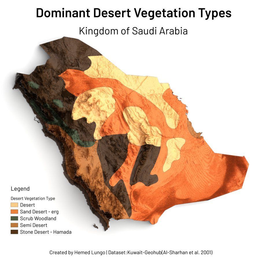
This map by Hemed shows the dominant desert vegetation types in Saudi Arabia. It was really handy to find oil! Not many other resources to extort otherwise...

This map by @725Hemeed shows the dominant desert vegetation types in Saudi Arabia. It was really handy to find oil! Not many other resources to extort otherwise...
account_circle
ericktamba(@Erick_tambah) 's Twitter Profile Photo

Thrilled to share success stories and opportunities within the vibrant OpenStreetMap community!

Training students from YouthMappers chapter in dar es salaam on using JOSM for mapping and empowering the next generation of mappers to shape their communities digitally. 🌍🗺️

account_circle
Hemed(@725Hemeed) 's Twitter Profile Photo

Been extremely Busy at moment and still am😞(no new outputs for the moment) but I'm proud of this 4 for couple of last Months (some new and old entries🗺️ on app) made using QGIS🟢 and Blender🟠

Been extremely Busy at moment and still am😞(no new outputs for the moment) but I'm proud of this 4 for couple of last Months (some new and old entries🗺️ on app) made using QGIS🟢 and Blender🟠 #viz #Map
account_circle
Hemed(@725Hemeed) 's Twitter Profile Photo

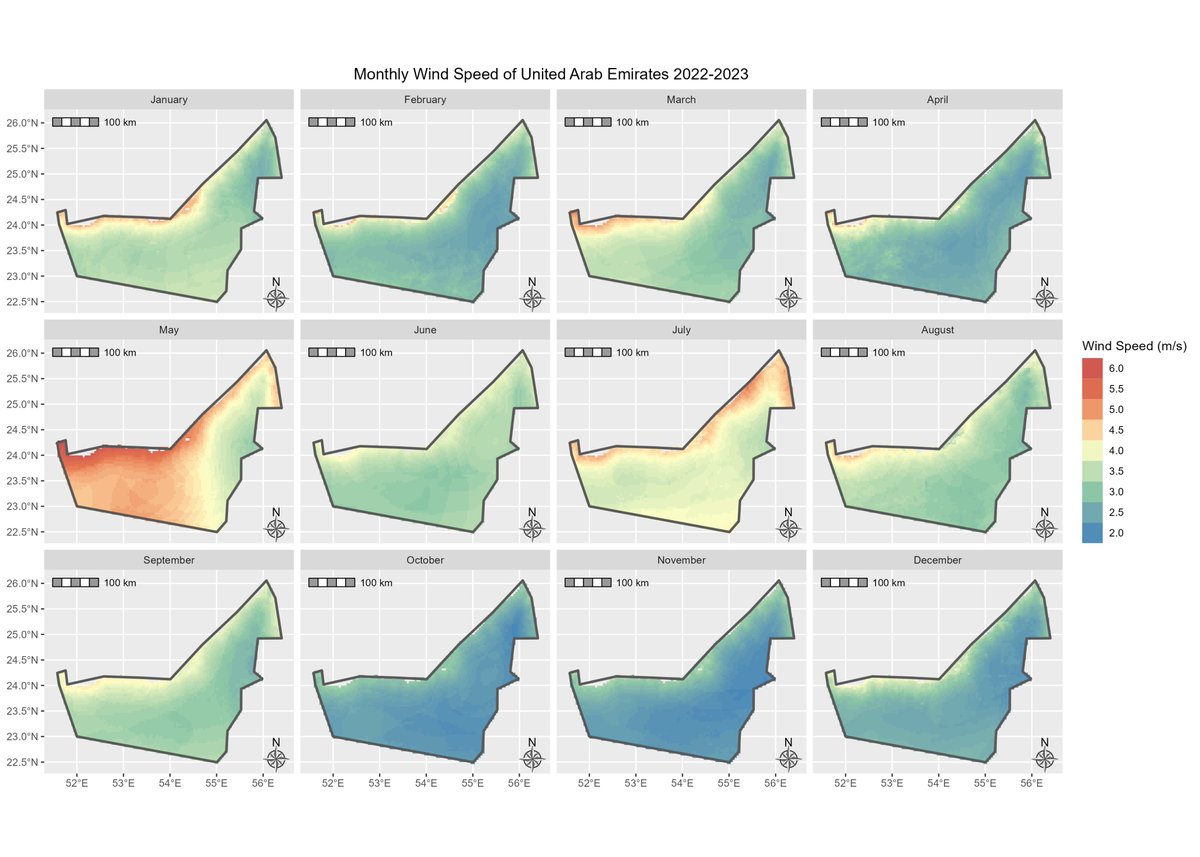
Couple of Climate Map visuals🌦️🗺️ showing Monthly 🗓️Evapotranspiration, Wind Speed ,Soil Moisture and Atmospheric Vapor Pressure of different countries 🇸🇦🇹🇿🇫🇷 created using ClimateR package📦

Couple of Climate Map visuals🌦️🗺️ showing Monthly 🗓️Evapotranspiration, Wind Speed ,Soil Moisture and Atmospheric Vapor Pressure of different countries 🇸🇦🇹🇿🇫🇷 created using ClimateR package📦 #gischat #SaudiArabia #Tanzania #EastAfrica #France #Europe #map #geospatial #rstats
account_circle
FOSS4G Europe 2024(@foss4ge) 's Twitter Profile Photo

The FOSS4GE 2024 Tartu Map Gallery is seeking contributions to showcase the imagination and skills of the FOSS4G community!🗺️

🙌Take advantage of the opportunity to have your work featured in the gallery!

Check our website to learn more about it👉2024.europe.foss4g.org/map-gallery-su…

The FOSS4GE 2024 Tartu Map Gallery is seeking contributions to showcase the imagination and skills of the FOSS4G community!🗺️ 🙌Take advantage of the opportunity to have your work featured in the gallery! Check our website to learn more about it👉2024.europe.foss4g.org/map-gallery-su…
account_circle