Milos Makes Maps(@milos_agathon) 's Twitter Profileg
Milos Makes Maps

@milos_agathon

I paint the world with R and teach you how to unleash your inner map artist. Join my map adventures and tutorials now:
▶️https://t.co/VMqCi7KkGr

ID:2905330823

linkhttps://www.youtube.com/@milos-makes-maps calendar_today04-12-2014 17:31:40

11,9K Tweets

26,4K Followers

1,3K Following

Follow People
Sofia Lazar(@LAZARSofia1) 's Twitter Profile Photo

🏔️🇨🇭 Ever wondered how tall Swiss forests get?

🌳 I mapped it out in stunning using & !

🤯 Check out the breathtaking map & 😎how I did it, simply following Milos Makes Maps tutorial 👏

🏔️🇨🇭 Ever wondered how tall Swiss forests get? 🌳 I mapped it out in stunning #3D using #RStats & #rayshader! 🤯 Check out the breathtaking map & 😎how I did it, simply following @milos_agathon tutorial 👏 #dataviz #gis #Switzerland #30DayChartChallenge #Europe #ETH #europe
account_circle
Milos Makes Maps(@milos_agathon) 's Twitter Profile Photo

Making stunning 3D maps of forest canopy height in R with & has never been easier!

Click the link below & explore my new tutorial that walks you through the process!

youtu.be/4ScYWPMzy6E

Making stunning 3D maps of forest canopy height in R with #ggplot2 & #rayshader has never been easier! Click the link below & explore my new tutorial that walks you through the process! youtu.be/4ScYWPMzy6E
account_circle
Victor_apollo47(@victorA47) 's Twitter Profile Photo

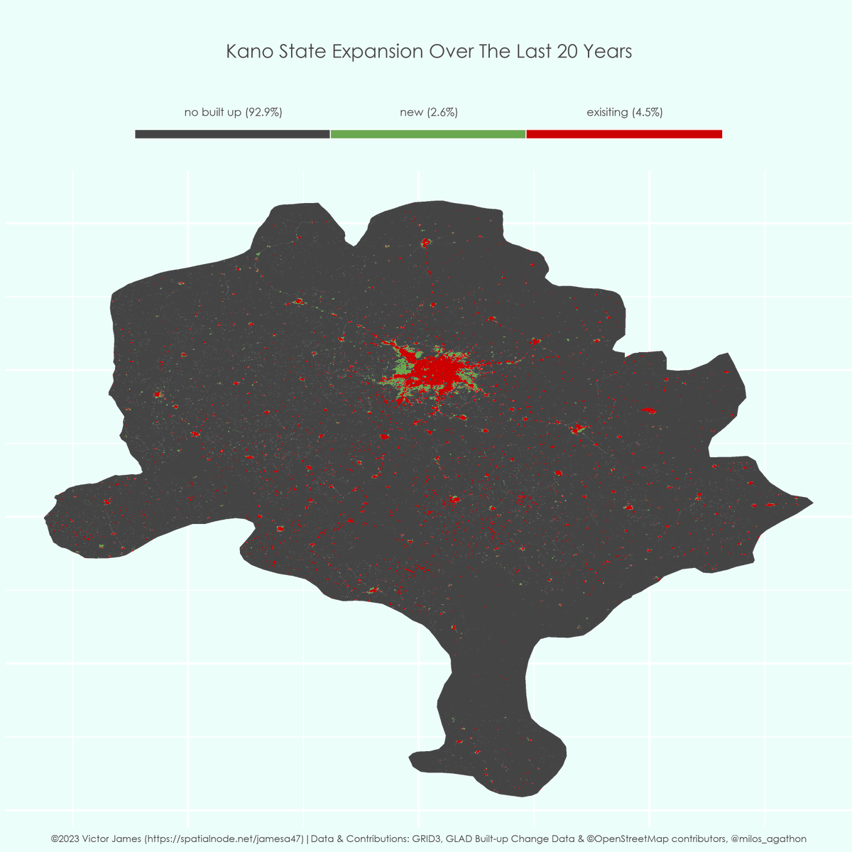
Here's a map showing Kano State's growth over the past two decades.

Previous open fields have become built up, what has driven this growth😀

Compared with states like Lagos, do you think Kano has expanded enough?

StatiSense Kano Chronicle Milos Makes Maps

Here's a map showing Kano State's growth over the past two decades. Previous open fields have become built up, what has driven this growth😀 Compared with states like Lagos, do you think Kano has expanded enough? @StatiSense @KanoChronicle @milos_agathon #rstats
account_circle
Milos Makes Maps(@milos_agathon) 's Twitter Profile Photo

Ready to embark on your own cartographic journey? With R and this remarkable dataset, you can start mapping today. All it takes is a computer and an internet connection. 💼🌐

Begin your mapping adventure here: youtu.be/y_Kzg24Ciuo

Ready to embark on your own cartographic journey? With R and this remarkable dataset, you can start mapping today. All it takes is a computer and an internet connection. 💼🌐 Begin your mapping adventure here: youtu.be/y_Kzg24Ciuo
account_circle
Milos Makes Maps(@milos_agathon) 's Twitter Profile Photo

Lovely work Sofia Lazar 😍!
Thank you for taking my tutorial on a journey across Europe and sharing those fantastic maps of 3D light and elevation

account_circle
Sofia Lazar(@LAZARSofia1) 's Twitter Profile Photo

🇨🇭🇷🇸 Excited to share my latest work!
😀Explore the landscapes of Switzerland 🇨🇭 and Serbia 🇷🇸 with in R and data.
🌍✨Transforming intricate geography into stunning visuals. Huge shoutout to Milos Makes Maps for the invaluable tutorial!

🇨🇭🇷🇸 Excited to share my latest work! 😀Explore the #3D landscapes of Switzerland 🇨🇭 and Serbia 🇷🇸 with #rayshader in R and #OpenStreetMap data. 🌍✨Transforming intricate geography into stunning visuals. Huge shoutout to @milos_agathon for the invaluable tutorial! #DataViz #Map
account_circle
Milos Makes Maps(@milos_agathon) 's Twitter Profile Photo

Thrilled to unveil my new tutorial! 🎉 Dive into 3D mapping with in R and data. It's all about making complex geography simple and visual. Check it out here: youtu.be/pn8wgwhn4Yc

Thrilled to unveil my new tutorial! 🎉 Dive into 3D mapping with #rayshader in R and #OpenStreetMap data. It's all about making complex geography simple and visual. Check it out here: youtu.be/pn8wgwhn4Yc #DataViz #3DMapping #rayshader #RStats
account_circle
Python Maps(@PythonMaps) 's Twitter Profile Photo

Here is a thread of my favourite maps of South America. Let me know which you like most and give me your best theories for how thel all fit together. Starting with Forests. 1/13

Here is a thread of my favourite maps of South America. Let me know which you like most and give me your best theories for how thel all fit together. Starting with Forests. 1/13
account_circle
Milos Makes Maps(@milos_agathon) 's Twitter Profile Photo

Thank you for an inspiring map and for cleverly combining my tutorials on mapping earthquakes and rendering lights with !

Tutorial on earthquakes:
youtu.be/olNYYynSJfI

Tutorial on rendering lights:
youtu.be/nlSu5-Ueuqo

account_circle
Milos Makes Maps(@milos_agathon) 's Twitter Profile Photo

Once again, a fantastic application of my tutorial on mapping wind direction ⤴️ and speed Sofia Lazar 🌬️ 😍

Check it out here: youtu.be/d8VZMjhBFwE

account_circle
Milos Makes Maps(@milos_agathon) 's Twitter Profile Photo

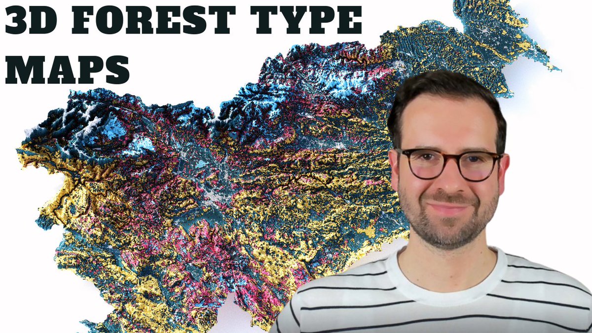
Want to make your own map for any country in the world? Check out my video tutorial where I teach you how to make relief maps with forest type 🎬

youtu.be/MFbJrjpf_2M

Like, share, and follow me for more maps and tutorials

Want to make your own map for any country in the world? Check out my video tutorial where I teach you how to make relief maps with forest type 🎬 youtu.be/MFbJrjpf_2M Like, share, and follow me for more maps and tutorials
account_circle