Jake Disinger⛈ (@jakedisingerwx) 's Twitter Profile
Jake Disinger⛈

@jakedisingerwx

Meteorologist | WKU Alumni | Former WxornotBG Moderator & Contributor

ID: 1100936977925505024

linkhttps://ambientweather.net/dashboard/fdd87845d615087cd2d35efe273fc954 calendar_today28-02-2019 01:53:24

1,1K Tweet

340 Followers

648 Following

Jake Disinger⛈ (@jakedisingerwx) 's Twitter Profile Photo

1 year ago to this day and time (roughly) a high-end EF3 tornado struck Bowling Green, changing the lives of everyone in the community. It’s amazing seeing how resilient the town I’ve grown to call home is and the progress that has been made in recovering. #BGstrong

1 year ago to this day and time (roughly) a high-end EF3 tornado struck Bowling Green, changing the lives of everyone in the community. 

It’s amazing seeing how resilient the town I’ve grown to call home is and the progress that has been made in recovering. #BGstrong
Western Kentucky University (@wku) 's Twitter Profile Photo

WKU's Disaster Science Operations Center prepares students with applied learning experiences in emergency management and meteorology. Listen as Amy Bingham shares more about this collaborative effort in this week's View from the Hill. #WKU White Squirrel Weather WKU Ogden College WKU EEAS

WX History (@weather_history) 's Twitter Profile Photo

February 28-March 1, 2017: A substantial severe weather outbreak spawned 69 tornadoes in numerous states from Oklahoma to Ohio. Twelve of the tornadoes were significant (EF2+). Along with the tornadoes, the SPC received several hundred wind and hail reports. #wxhistory

February 28-March 1, 2017:

A substantial severe weather outbreak spawned 69 tornadoes in numerous states from Oklahoma to Ohio. Twelve of the tornadoes were significant (EF2+). Along with the tornadoes, the SPC received several hundred wind and hail reports.

#wxhistory
NWS Storm Prediction Center (@nwsspc) 's Twitter Profile Photo

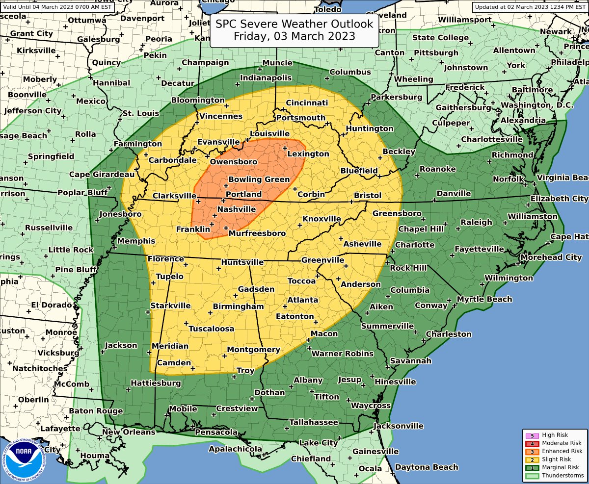
It's going to be busy weather-wise today and tomorrow. Today, a Moderate risk (level 4/5) for severe weather stretches from north-central TX (including the DFW metro) into southwest AR. Tomorrow, the severe weather threat shifts east towards TN and KY and parts of the Mid-South.

It's going to be busy weather-wise today and tomorrow. Today, a Moderate risk (level 4/5) for severe weather stretches from north-central TX (including the DFW metro) into southwest AR. Tomorrow, the severe weather threat shifts east towards TN and KY and parts of the Mid-South.
Jake Disinger⛈ (@jakedisingerwx) 's Twitter Profile Photo

I think it's now impossible for us to go through a severe weather event without getting the HRRR trending at last once, I love it. #wxtwitter

White Squirrel Weather (@wkuweather) 's Twitter Profile Photo

MiaVAwx Interested in a contemporary program that offers professional operational service-learning experiences like working with NASCAR, Bourbon Trail, major marathons, D1 athletics, major facilities, along with nationally awarded field programs, local chapters, & initiatives? #WKU

<a href="/ForecasterMia/">MiaVAwx</a> Interested in a contemporary program that offers professional operational service-learning experiences like working with NASCAR, Bourbon Trail, major marathons, D1 athletics, major facilities, along with nationally awarded field programs, local chapters, &amp; initiatives? #WKU
White Squirrel Weather (@wkuweather) 's Twitter Profile Photo

Our Lead Emergency Management Operator, General Forecaster, and wxornotBG contributor, Jake Disinger recently assisted the NWS Louisville office with drone damage surveying in southern Indiana, where EF-1 tornadoes occurred. Jake also worked with NWS Paducah, KY this summer. #WKU

Our Lead Emergency Management Operator, General Forecaster, and <a href="/wxornotBG/">wxornotBG</a> contributor, Jake Disinger recently assisted the <a href="/NWSLouisville/">NWS Louisville</a> office with drone damage surveying in southern Indiana, where EF-1 tornadoes occurred. Jake also worked with <a href="/NWSPaducah/">NWS Paducah, KY</a> this summer. #WKU
Jake Disinger⛈ (@jakedisingerwx) 's Twitter Profile Photo

While volunteering with NWS Paducah, KY this summer, I had the opportunity to create this story map with a PAH meteorologist. Today marks the 18th anniversary of that event and although I don't remember much from that night, I remember the lasting affects it had on the area. #inwx

NWS Storm Prediction Center (@nwsspc) 's Twitter Profile Photo

2/24: Severe storms capable of damaging winds, large hail, and a few tornadoes are possible on Tue 2/27 from the Ozarks into the Lower Great Lakes. Severe-storm potential will then extend into the OH/TN Valleys on Wed 2/28. For the latest forecast: spc.noaa.gov

2/24: Severe storms capable of damaging winds, large hail, and a few tornadoes are possible on Tue 2/27 from the Ozarks into the Lower Great Lakes. Severe-storm potential will then extend into the OH/TN Valleys on Wed 2/28. For the latest forecast: spc.noaa.gov