Alex Liggitt (@alexliggittwx) 's Twitter Profile
Alex Liggitt

@alexliggittwx

Communications Manager at VDOT Northern Virginia, born in Fairfax, VA., obsessed with everything weather and a running nut. NC State Meteorology #GoPack

ID: 172851165

linkhttps://www.virginiadot.org/about/nova_quick.asp calendar_today30-07-2010 19:35:51

34,34K Tweet

8,8K Takipçi

3,3K Takip Edilen

NWS Storm Prediction Center (@nwsspc) 's Twitter Profile Photo

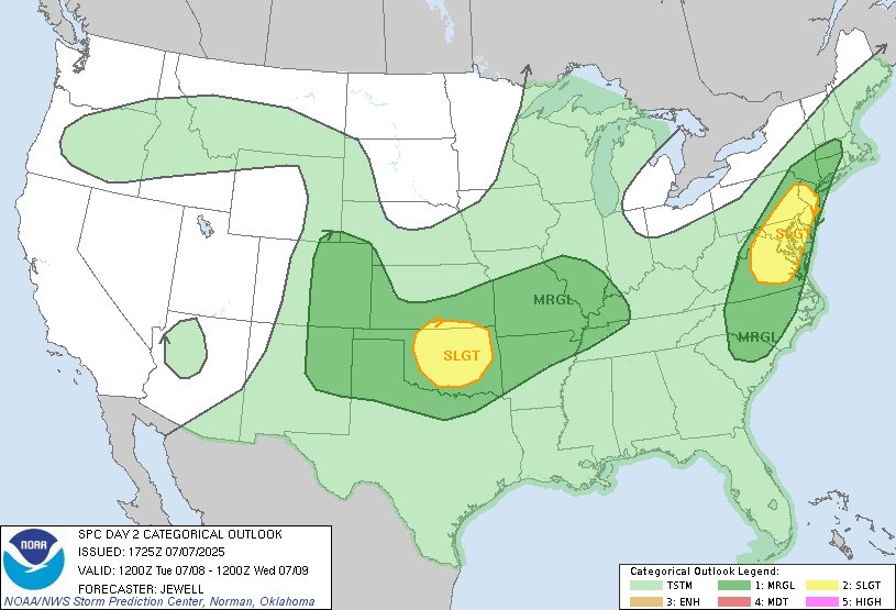
12:27pm CDT #SPC Day2 Outlook Slight Risk: over parts of the Mid Atlantic, and over a portion of the southern Plains spc.noaa.gov/products/outlo…

12:27pm CDT #SPC Day2 Outlook Slight Risk: over parts of the Mid Atlantic, and over a portion of the southern Plains spc.noaa.gov/products/outlo…
NWS Baltimore-Washington (@nws_baltwash) 's Twitter Profile Photo

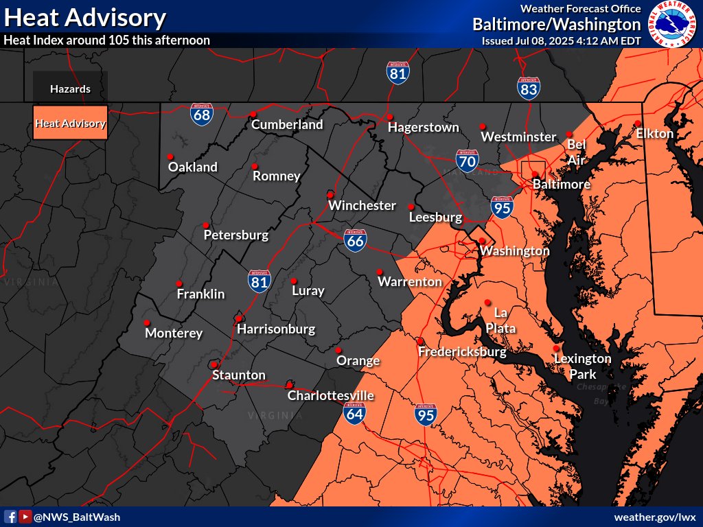
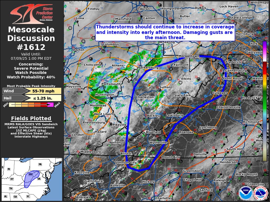
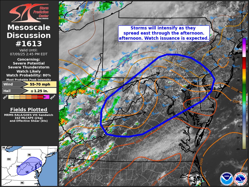
A hot and humid afternoon will lead to numerous thunderstorms developing which will move eastward through the evening. Storms will be capable of producing damaging wind gusts and heavy rain that may lead to flash flooding.

A hot and humid afternoon will lead to numerous thunderstorms developing which will move eastward through the evening. Storms will be capable of producing damaging wind gusts and heavy rain that may lead to flash flooding.
Philip Klotzbach (@philklotzbach) 's Twitter Profile Photo

CSU reduces seasonal #hurricane forecast a bit but still predicts slightly above-normal Atlantic season, with 16 named storms, 8 hurricanes and 3 major (Category 3+ hurricanes): tropical.colostate.edu/Forecast/2025-… Relatively warm Atlantic and likely absence of #ElNino the primary factors.

CSU reduces seasonal #hurricane forecast a bit but still predicts slightly above-normal Atlantic season, with 16 named storms, 8 hurricanes and 3 major (Category 3+ hurricanes):

tropical.colostate.edu/Forecast/2025-…

Relatively warm Atlantic and likely absence of #ElNino  the primary factors.
NWS Baltimore-Washington (@nws_baltwash) 's Twitter Profile Photo

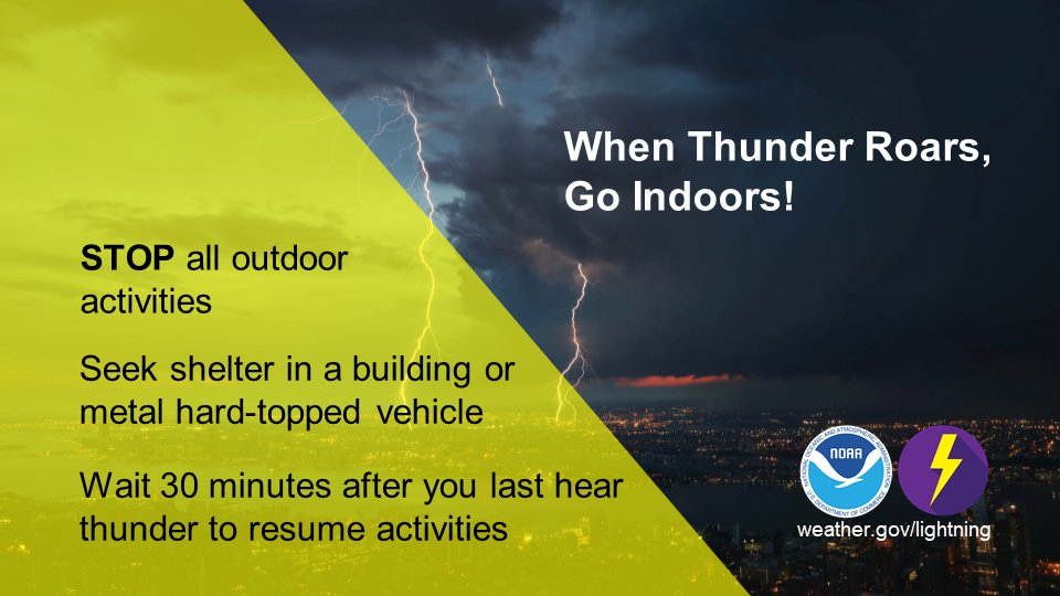
A number of thunderstorms have begun to fire up across the D.C. metro area, many of which are producing lightning far removed from the storm themselves. If you're out and about, keep an eye on the sky. When Thunder Roars, Go Indoors. #MDwx #VAwx #DCwx #WVwx

A number of thunderstorms have begun to fire up across the D.C. metro area, many of which are producing lightning far removed from the storm themselves. If you're out and about, keep an eye on the sky. When Thunder Roars, Go Indoors. #MDwx #VAwx #DCwx #WVwx
NWS Baltimore-Washington (@nws_baltwash) 's Twitter Profile Photo

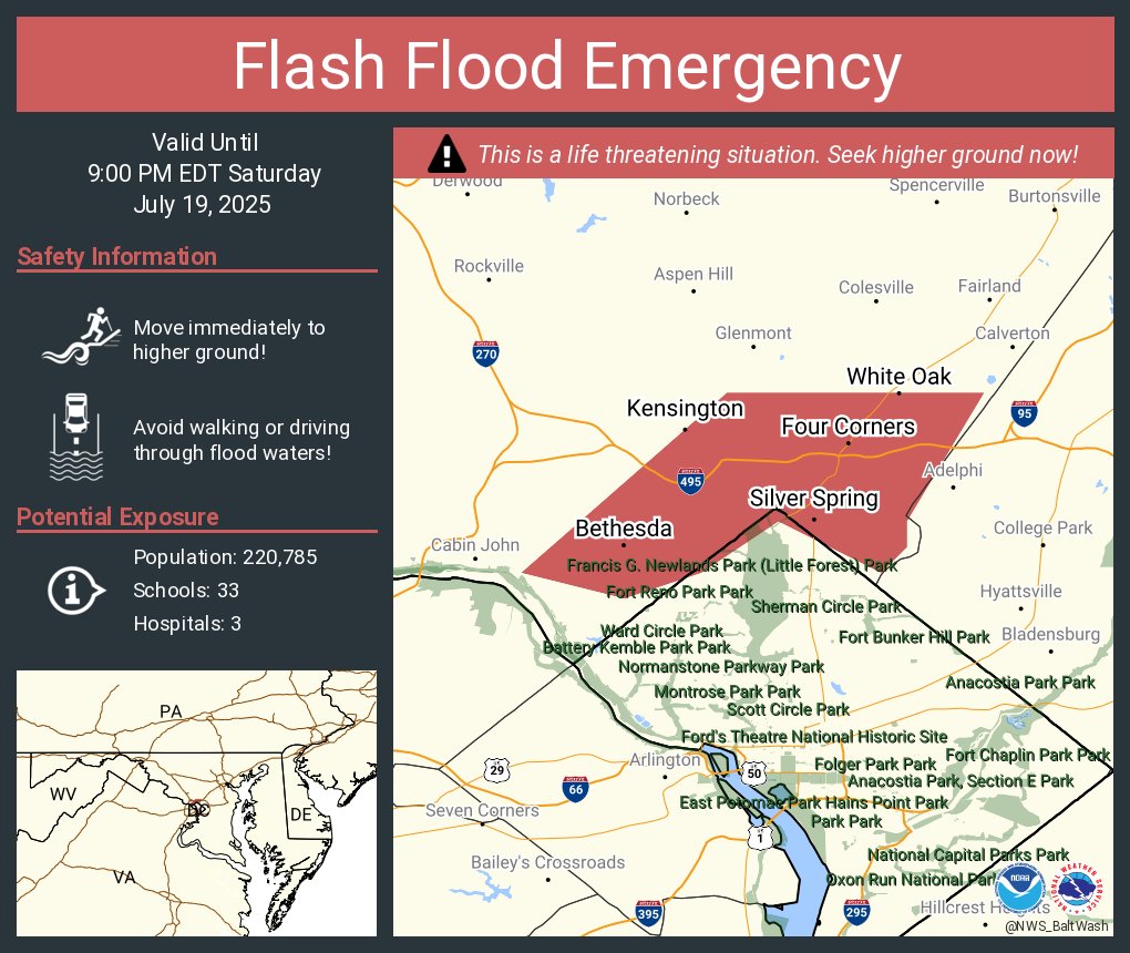
Significant Flash Flooding is occurring along Sligo Creek from Bethesda through Takoma Park. Seek higher ground IMMEDIATELY if you are in these areas! Head all road closures and avoid this area. FLASH FLOOD EMERGENCY is in effect!

Alex Liggitt (@alexliggittwx) 's Twitter Profile Photo

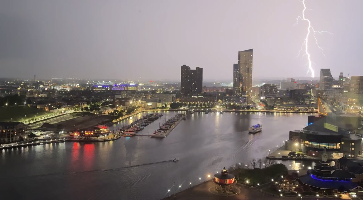
Went to Baltimore with the fam this week and caught some amazing lightning from the hotel room. Glad we bailed out of the O’s game a little early!

Went to Baltimore with the fam this week and caught some amazing lightning from the hotel room. Glad we bailed out of the O’s game a little early!
NWS Weather Prediction Center (@nwswpc) 's Twitter Profile Photo

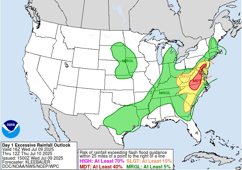
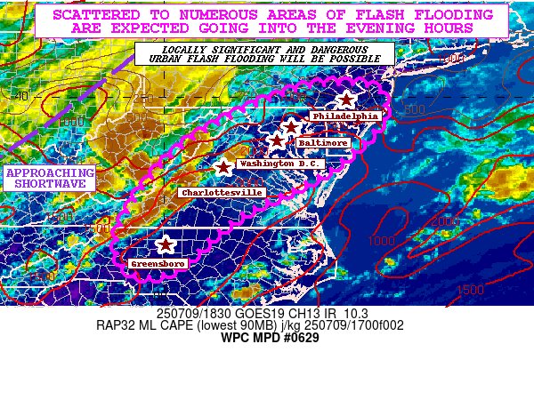
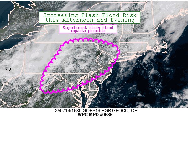
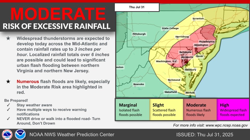
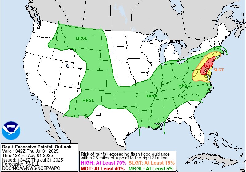
A Moderate Risk (level 3/4) of Excessive Rainfall is in effect today across parts of the Mid-Atlantic and Northeast, specifically the I-95 corridor between Washington D.C. and northern New Jersey. Thunderstorms containing torrential rainfall are likely to produce flash flooding.

A Moderate Risk (level 3/4) of Excessive Rainfall is in effect today across parts of the Mid-Atlantic and Northeast, specifically the I-95 corridor between Washington D.C. and northern New Jersey. Thunderstorms containing torrential rainfall are likely to produce flash flooding.
VDOT Northern VA (@vadotnova) 's Twitter Profile Photo

A #FloodWatch is in effect this PM with storms and heavy rain in the forecast. ⚠️ Follow NWS Baltimore-Washington for alerts 🌊 Do NOT cross flooded roads 🚘 Keep headlights on with wipers 🐢 Slow down #TurnAroundDontDrown Report flooding: my.vdot.virginia.gov or 800-FOR-ROAD

A #FloodWatch is in effect this PM with storms and heavy rain in the forecast.

⚠️ Follow <a href="/NWS_BaltWash/">NWS Baltimore-Washington</a> for alerts
🌊 Do NOT cross flooded roads
🚘 Keep headlights on with wipers
🐢 Slow down
#TurnAroundDontDrown

Report flooding: my.vdot.virginia.gov or 800-FOR-ROAD
NOAA Communications (@noaacomms) 's Twitter Profile Photo

JUST IN: NOAA outlook for Atlantic hurricane season remains 'above-normal' --> News release with downloadable infographics: bit.ly/AtlanticHurric… #HurricaneOutlook #HurricaneSeason National Weather Service NWS Climate Prediction Center

JUST IN: <a href="/NOAA/">NOAA</a> outlook for Atlantic hurricane season remains 'above-normal'

--&gt; News release with downloadable infographics: bit.ly/AtlanticHurric…

#HurricaneOutlook #HurricaneSeason 
<a href="/NWS/">National Weather Service</a> <a href="/NWSCPC/">NWS Climate Prediction Center</a>
WX History (@weather_history) 's Twitter Profile Photo

September 24, 2001: An outbreak of nine tornadoes impacted several states in the Eastern US. An F3 tore through the University of Maryland campus, tragically killing two students. Near Rixeyville, Virginia, a violent F4 destroyed a large home. 57 people were injured. #wxhistory

September 24, 2001:

An outbreak of nine tornadoes impacted several states in the Eastern US. An F3 tore through the University of Maryland campus, tragically killing two students. Near Rixeyville, Virginia, a violent F4 destroyed a large home. 57 people were injured.

#wxhistory