NWS Anchorage(@NWSAnchorage) 's Twitter Profileg
NWS Anchorage

@NWSAnchorage

Official Twitter account for the National Weather Service Anchorage. Details: https://t.co/pZTCFSLB54 #AKwx #Alaska #AK #Anchorage

ID:743599406

linkhttp://weather.gov/Anchorage calendar_today07-08-2012 19:42:38

8,4K Tweets

21,8K Followers

226 Following

Follow People
NWS Anchorage(@NWSAnchorage) 's Twitter Profile Photo

(2/2) Here's a quick look at the snow total stats so far this year for Anchorage. In first place 2011-2012 with 134.5', second 1954-1955 with 132.6', third 2023-2024 with 131.8'.
We're on the podium!🥉 We would need, 0.9' more to take second, and 2.8' for the record!

account_circle
NWS Anchorage(@NWSAnchorage) 's Twitter Profile Photo

(1/2)🧠❄For those interested in Anchorage's snowfall totals this season, you may follow this link, weather.gov/arh/climate?wf…
Follow the clicks captioned below to stay up to date on our latest official measurements!

For this, and more info, check weather.gov/afc

(1/2)🧠❄For those interested in Anchorage's snowfall totals this season, you may follow this link, weather.gov/arh/climate?wf… Follow the clicks captioned below to stay up to date on our latest official measurements! For this, and more info, check weather.gov/afc #akwx
account_circle
NWS Anchorage(@NWSAnchorage) 's Twitter Profile Photo

🌨💨 Strong Bering Storm is pushing into Southwest Alaska now! This storm is expected to persist as it pushes inland.
See attached images for a round-up on our statements regarding the progression of this system.

Stay tuned, weather.gov/afc

🌨💨 Strong Bering Storm is pushing into Southwest Alaska now! This storm is expected to persist as it pushes inland. See attached images for a round-up on our statements regarding the progression of this system. Stay tuned, weather.gov/afc #AKwx
account_circle
NWS Anchorage(@NWSAnchorage) 's Twitter Profile Photo

⚠Heads up for our friends down in Homer and Soldotna!
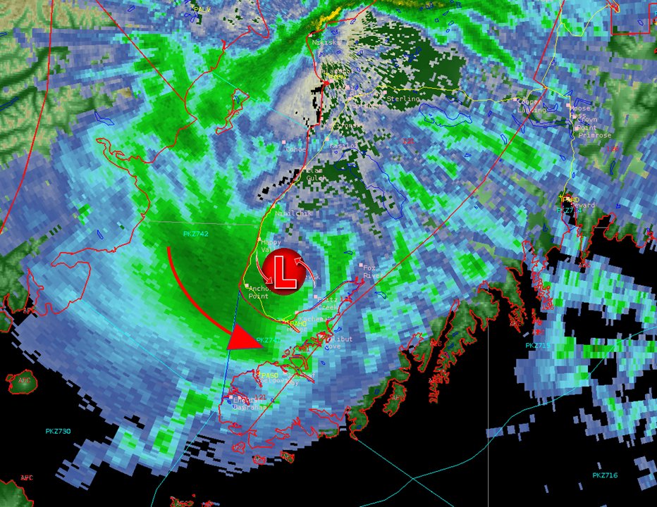
Moderate to heavy snowfall and reduced visibilities can be expected the next 2-3 hours for the Southern Kenai Peninsula. 🌨

⚠Heads up for our friends down in Homer and Soldotna! Moderate to heavy snowfall and reduced visibilities can be expected the next 2-3 hours for the Southern Kenai Peninsula. 🌨
account_circle
NWS Anchorage(@NWSAnchorage) 's Twitter Profile Photo

‼️Reminder to mariners‼️ Expect heavy to extreme freezing spray to persist through Tuesday along the ice edge from Nunivak Island to Bristol Bay. Some areas of heavy freezing spray could be possible through the gaps south of the Alaska Peninsula.

‼️Reminder to mariners‼️ Expect heavy to extreme freezing spray to persist through Tuesday along the ice edge from Nunivak Island to Bristol Bay. Some areas of heavy freezing spray could be possible through the gaps south of the Alaska Peninsula. #AKwx
account_circle
NWS Anchorage(@NWSAnchorage) 's Twitter Profile Photo

Use the link below to follow the eclipse from afar! It is the GOES-East CONUS loop & it will be updated every 5 mins along the path of the eclipse. Although Anchorage won't see anything, it will occur from 9 am AKDT thru noon ADKT on the link. 😎star.nesdis.noaa.gov/GOES/conus_ban…

account_circle
NWS Juneau(@NWSJuneau) 's Twitter Profile Photo

Are you like us and missing out on today's eclipse? Well no worries, 2033 is when the next eclipse will happen in the US and it will be in western Alaska!

account_circle
NWS Anchorage(@NWSAnchorage) 's Twitter Profile Photo

Snow showers are likely Tuesday in the Southcentral and the Kenai Peninsula. The heaviest is expected along the eastern Kenai Peninsula including Whittier and Seward, to the Prince William Sound.

Snow showers are likely Tuesday in the Southcentral and the Kenai Peninsula. The heaviest is expected along the eastern Kenai Peninsula including Whittier and Seward, to the Prince William Sound.
account_circle
NWS Anchorage(@NWSAnchorage) 's Twitter Profile Photo

Cold air continues to surge into the Southwest. Low temperatures Tuesday morning will range from the lower teens to single digits below zero. Wind chill values could reach as low as -25 for some areas too. The coldest and windiest area will be the Kuskokwim Delta.

Cold air continues to surge into the Southwest. Low temperatures Tuesday morning will range from the lower teens to single digits below zero. Wind chill values could reach as low as -25 for some areas too. The coldest and windiest area will be the Kuskokwim Delta.
account_circle
NWS Anchorage(@NWSAnchorage) 's Twitter Profile Photo

Areas of patchy fog have persisted this morning from Elmendorf Air Force Base thru downtown Anchorage & S along Minnesota Dr. Fog is expected to persist thru mid morning before dissipating. If driving slow down, use your headlights, & leave plenty of distance ahead of you.

Areas of patchy fog have persisted this morning from Elmendorf Air Force Base thru downtown Anchorage & S along Minnesota Dr. Fog is expected to persist thru mid morning before dissipating. If driving slow down, use your headlights, & leave plenty of distance ahead of you. #akwx
account_circle
NWS Anchorage(@NWSAnchorage) 's Twitter Profile Photo

A shortwave trough will bring cold air surging southward Sunday night through Tuesday morning resulting in wind chills dropping as low as -25 from Monday night into Tuesday morning. The windiest locations and the lowest wind chills are expected in the Kuskokwim Delta.

A shortwave trough will bring cold air surging southward Sunday night through Tuesday morning resulting in wind chills dropping as low as -25 from Monday night into Tuesday morning. The windiest locations and the lowest wind chills are expected in the Kuskokwim Delta.
account_circle
NWS Anchorage(@NWSAnchorage) 's Twitter Profile Photo

📢Mariners! Arctic air will bring gales, cold temps, & building seas into the Bering. This could cause extreme vessel icing from Sun night-Tue. Expect heavy to extreme freezing spray off of the coast of Cape Newenham early Mon afternoon & Bristol Bay late Mon night.

📢Mariners! Arctic air will bring gales, cold temps, & building seas into the Bering. This could cause extreme vessel icing from Sun night-Tue. Expect heavy to extreme freezing spray off of the coast of Cape Newenham early Mon afternoon & Bristol Bay late Mon night. #AKwx
account_circle
NWS Anchorage(@NWSAnchorage) 's Twitter Profile Photo

⚠ A High Wind Watch for the Central Aleutians has been upgraded to a High Wind Warning in effect from 1am to 10am AKDT Saturday. Sustained winds of 50 to 65 mph are expected to gust as high as 80 mph across the Central Aleutians, including the communities of Adak and Atka.

⚠ A High Wind Watch for the Central Aleutians has been upgraded to a High Wind Warning in effect from 1am to 10am AKDT Saturday. Sustained winds of 50 to 65 mph are expected to gust as high as 80 mph across the Central Aleutians, including the communities of Adak and Atka. #akwx
account_circle
NWS Anchorage(@NWSAnchorage) 's Twitter Profile Photo

🥉Last night Anchorage moved into 3rd place for the snowiest seasons on record with 130.5 inches of ❄as of 10am AKDT this morning. We need 2.2 inches of ❄ to take over 2nd place and just 4.1 inches of ❄to claim 1st.

🥉Last night Anchorage moved into 3rd place for the snowiest seasons on record with 130.5 inches of ❄as of 10am AKDT this morning. We need 2.2 inches of ❄ to take over 2nd place and just 4.1 inches of ❄to claim 1st. #akwx
account_circle
NWS Anchorage(@NWSAnchorage) 's Twitter Profile Photo

⚠ A hurricane force low is forecast to enter the western Bering early Friday. A High Wind Watch is in effect for the Central Aleutians from Friday evening through Saturday afternoon. Southwest winds of 50 to 65 mph could gust as high as 80 mph.

⚠ A hurricane force low is forecast to enter the western Bering early Friday. A High Wind Watch is in effect for the Central Aleutians from Friday evening through Saturday afternoon. Southwest winds of 50 to 65 mph could gust as high as 80 mph. #akwx
account_circle
NWS Anchorage(@NWSAnchorage) 's Twitter Profile Photo

Snow continues to fall over Anchorage & the Mat-Su today. Snow is expected to persist thru Friday afternoon, but could mix with rain at times for the Anchorage area.

Total Snow Accumulations:
Mat-Su (3-6 inches)
Anchorage (2-6 inches) Highest amounts along the mountains

Snow continues to fall over Anchorage & the Mat-Su today. Snow is expected to persist thru Friday afternoon, but could mix with rain at times for the Anchorage area. Total Snow Accumulations: Mat-Su (3-6 inches) Anchorage (2-6 inches) Highest amounts along the mountains #akwx
account_circle