🇧🇿 Belize GEO 🛰️ (@bzgeo) 's Twitter Profile
🇧🇿 Belize GEO 🛰️

@bzgeo

Belize GEO: Belize Group on #EarthObservation & GIS. #SciComm re: EO, GIS relevant to #Belize, the #Caribbean. Administered by a real live Belizean scientist.

ID: 731808469301493760

linkhttp://www.bzgeo.net calendar_today15-05-2016 11:28:30

75,75K Tweet

9,9K Followers

7,7K Following
Iban Ameztoy (@i_ameztoy) 's Twitter Profile Photo

Dear all! It's time to say good bye! This will not be a break but I'll stop this account the 10th of September. It has been a pleasure to share so many images, videos, information & experiences with you. I hope you are now a bit closer to the #EO community. THANK YOU! 🧵 1/15->

svg (@newgeographer2) 's Twitter Profile Photo

Finally going to write tutorials for ALL of my map making. I'll be sharing how I use gis tools for design and art. If you've followed my work over the years, what's the best platform/format to post tutorials?

Finally going to write tutorials for ALL of my map making. I'll be sharing how I use gis tools for design and art.
If you've followed my work over the years, what's the best platform/format to post tutorials?
NASA Acres (@acresprogram) 's Twitter Profile Photo

🚀 The NASA International NASA International Space Apps Challenge Challenge has launched! NASA Acres and Harvest challenge YOU to leverage Earth observation (#EO) data to help farmers manage water-related concerns, like flooding &droughts. 🌱 💦 🛰 More on the challenge ⬇ spaceappschallenge.org/nasa-space-app…

🚀  The NASA International <a href="/SpaceApps/">NASA International Space Apps Challenge</a> Challenge has launched!

NASA Acres and <a href="/HarvestProgram/">Harvest</a> challenge YOU to leverage Earth observation (#EO) data to help farmers manage water-related concerns, like flooding &amp;droughts. 🌱 💦 🛰

More on the challenge ⬇
spaceappschallenge.org/nasa-space-app…
Hannah Kerner (@hannah_kerner) 's Twitter Profile Photo

If you don't know Gedeon Muhawenayo yet, you will know him! He is doing his PhD in machine learning for remote sensing data in my lab and is on his way to becoming a leading expert in the field. Check out this article about him and his experience at the Data Science Africa Summer School 🌍

Dr Robbi Bishop-Taylor 🛰️🌎🌊 (@satellitesci) 's Twitter Profile Photo

We have liftoff! 🚀 🛰 Amazing to witness the launch of the #Sentinel2C #EarthObservation satellite, continuing the incredible legacy of the Copernicus #Sentinel2 satellite program into the future! All status "nominal" so far 🤞 - live: youtube.com/watch?v=BZzcOx…

We have liftoff! 🚀 🛰

Amazing to witness the launch of the #Sentinel2C #EarthObservation satellite, continuing the incredible legacy of the Copernicus #Sentinel2  satellite program into the future!

All status "nominal" so far 🤞  - live: youtube.com/watch?v=BZzcOx…
NASAEarthdata (@nasaearthdata) 's Twitter Profile Photo

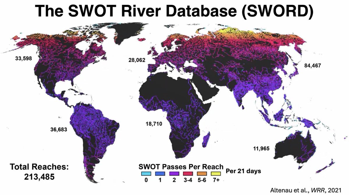
Would you like to learn more about #hydrology datasets from the Surface Water and Ocean Topography (SWOT) mission? In a new video, Dr. Tamlin Pavelsky, NASA's Hydrology Lead for the SWOT mission, introduces the hydrology data products. ➡️View video: go.nasa.gov/3Zc4BEs

Would you like to learn more about #hydrology datasets from the Surface Water and Ocean Topography (SWOT) mission?  In a new video, Dr. Tamlin Pavelsky, NASA's Hydrology Lead for the SWOT mission, introduces the hydrology data products. 

➡️View video: go.nasa.gov/3Zc4BEs
Planet (@planet) 's Twitter Profile Photo

September 5th marks “Amazon Day,” started in Brazil, a day coinciding with the creation of the Province of Amazonas in 1850. It’s a day to acknowledge the incredible global importance of the Amazon biome and all of its unique biodiversity. 🌳 We capture data about this

September 5th marks “Amazon Day,” started in Brazil, a day coinciding with the creation of the Province of Amazonas in 1850. It’s a day to acknowledge the incredible global importance of the Amazon biome and all of its unique biodiversity. 🌳

We capture data about this
NASA Landsat (@nasa_landsat) 's Twitter Profile Photo

Want to develop a way for people to better utilize #Landsat Surface Reflectance data? 🛰️ Join the NASA #SpaceApps challenge on Oct. 5-6 to use NASA data and collaborate with innovators around the world! bit.ly/3xPvfbb

Want to develop a way for people to better utilize #Landsat Surface Reflectance data? 🛰️ 

Join the NASA #SpaceApps challenge on Oct. 5-6 to use NASA data and collaborate with innovators around the world!

bit.ly/3xPvfbb
Beth Tellman, Phd (@pazjusticiavida) 's Twitter Profile Photo

Excited to share the newest Floodbase publication- Rapid Inundation Mapping Using the US National Water Model, Satellite Observations, and a Convolutional Neural Network - in Geophysical Research Letters - agupubs.onlinelibrary.wiley.com/doi/full/10.10… led by Jonathan Frame (1/n)

ir. CHEPKOCHEI, Lucy (@lucychepkosgei) 's Twitter Profile Photo

UN GIS opportunity in UNDP Careers , UNDP Philippines 🇵🇭 is looking for GIS Specialist for the Generation of Built-Up Areas Using AI Link: procurement-notices.undp.org/view_negotiati… Contract : IC - Individual Contract Deadline: 16th Sept 2024

UN GIS opportunity in <a href="/UNDPCareers/">UNDP Careers</a> ,
<a href="/UNDPPH/">UNDP Philippines 🇵🇭</a> is looking for GIS Specialist for the Generation of Built-Up Areas Using AI
Link: procurement-notices.undp.org/view_negotiati… 
Contract : IC - Individual Contract
Deadline: 16th Sept 2024
Google Earth Engine Nairobi. (@geedevs) 's Twitter Profile Photo

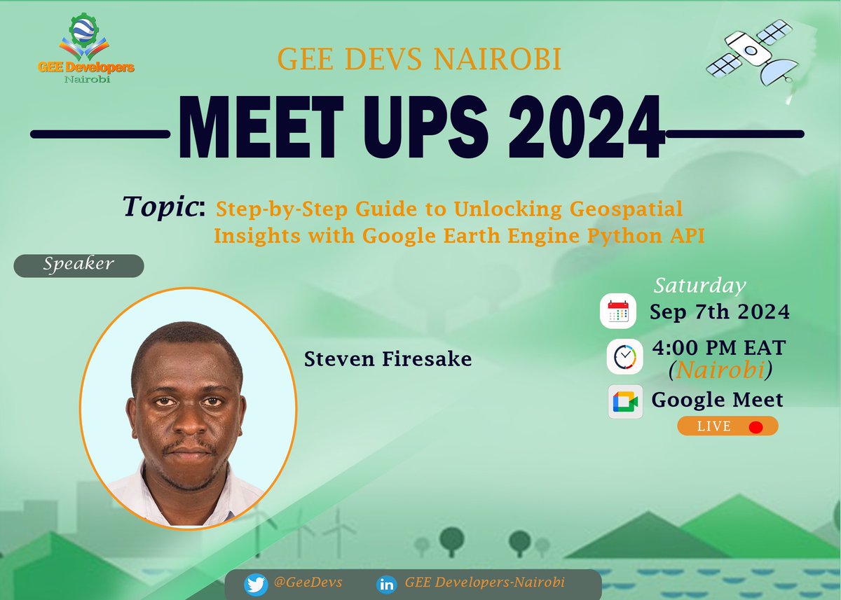
Unlock Geospatial Insights with Google Earth Engine Python API 🌍 🗓️ Date: Saturday, Sep 7th ⏰ Time: 4:00 PM EAT (Nairobi) 🔗 Meet Link: meet.google.com/dut-oryt-zkp Join us for a step-by-step guide to leveraging GEE for powerful geospatial analysis! #Geospatial #GEE #PythonAPI

Unlock Geospatial Insights with Google Earth Engine Python API 🌍
🗓️ Date: Saturday, Sep 7th
⏰ Time: 4:00 PM EAT (Nairobi)
🔗 Meet Link: meet.google.com/dut-oryt-zkp
Join us for a step-by-step guide to leveraging GEE for powerful geospatial analysis!
#Geospatial #GEE #PythonAPI
Humanitarian OpenStreetMap Team (@hotosm) 's Twitter Profile Photo

#StateOfTheMap2024 🗺️ Yesterday, we had an inspiring time at the #EsaHub office connecting with the #OSM community, exchanging ideas and experiences. 🌍 From first-time attendees to seasoned members, we were excited to see how #OSM supports communities across the continent. 🤝

#StateOfTheMap2024 🗺️ Yesterday, we had an inspiring time at the #EsaHub office connecting with the #OSM community, exchanging ideas and experiences. 🌍 

From first-time attendees to seasoned members, we were excited to see how #OSM supports communities across the continent. 🤝
Harvest (@harvestprogram) 's Twitter Profile Photo

Check out our August newsletter! 👉conta.cc/4gapOVn We're announcing a new partnership with Mathematica, highlighting a FEWS NET report looking at drought across Southern Africa, and discussing our new high resolution maps of sunflower cropland across Ukraine.

Check out our August newsletter! 👉conta.cc/4gapOVn

We're announcing a new partnership with <a href="/MathematicaNow/">Mathematica</a>, highlighting a <a href="/FEWSNET/">FEWS NET</a> report looking at drought across Southern Africa, and discussing our new high resolution maps of sunflower cropland across Ukraine.
🇧🇿 Belize GEO 🛰️ (@bzgeo) 's Twitter Profile Photo

#OTD in 1872, Karl S. Heusner was born to Jacob and Emelia Heusner in #Belize Town, British Honduras. Eight years ago today, his granddaughter June Heusner honored him by publishing a book about his legacy. May he continue to rest in everlasting peace. #BelizeanTwitter 🇧🇿

NASA Landsat (@nasa_landsat) 's Twitter Profile Photo

Our August newsletter just dropped! 🗞️ Write your name in Landsat, explore featured publications, and learn about how scientists are studying vegetation in the far north. View the latest issue and subscribe to stay up-to-date on all things #Landsat: go.nasa.gov/3UIqQ0O

Our August newsletter just dropped! 🗞️

Write your name in Landsat, explore featured publications, and learn about how scientists are studying vegetation in the far north.

View the latest issue and subscribe to stay up-to-date on all things #Landsat: go.nasa.gov/3UIqQ0O