ZhangYan (@zhangyangiser) 's Twitter Profile
ZhangYan

@zhangyangiser

Giser,postdoc at Cuhk, phd at WHU

ID: 1190986680271917056

linkhttps://giserzhang.xyz/ calendar_today03-11-2019 13:38:58

89 Tweet

55 Followers

257 Following

IJGIS (@ijgis) 's Twitter Profile Photo

New research: Extracting knowledge from legacy maps to delineate eco-geographical regions by L Yang, X Li, Q Yang, L Zhang, S Zhang, S Wu & C Zhou. #ijgis tandfonline.com/doi/full/10.10…

Trung Phan (@trungtphan) 's Twitter Profile Photo

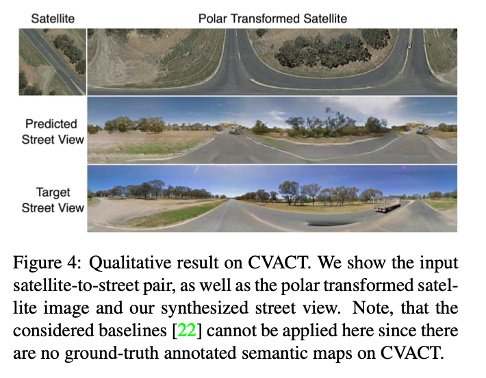
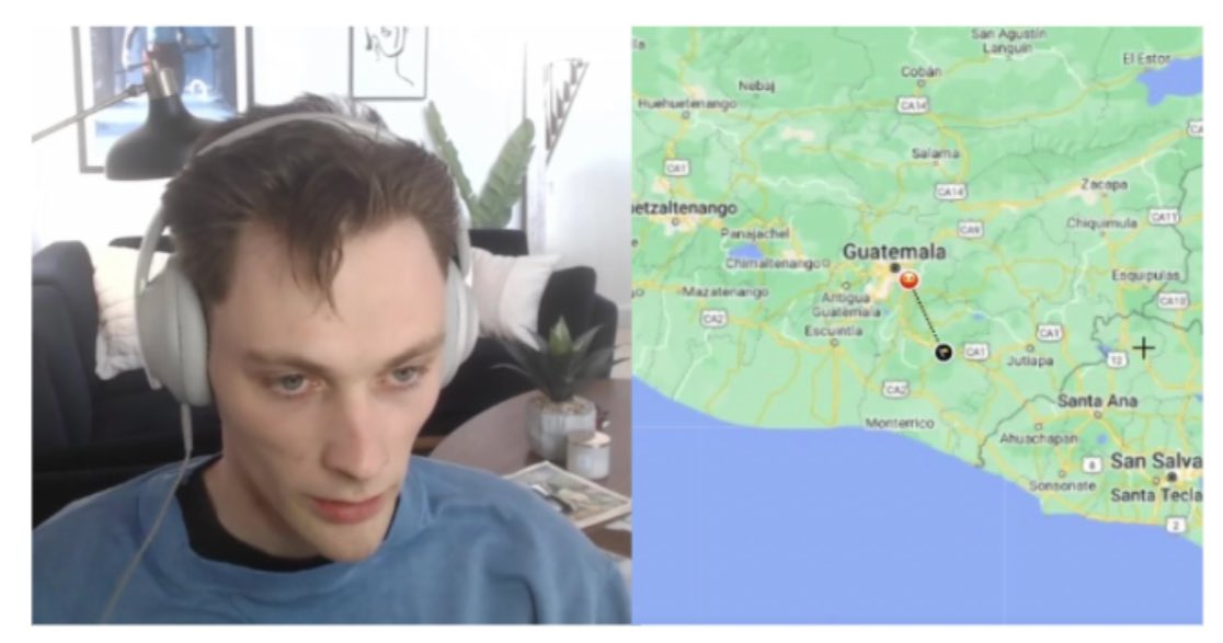
Rainbolt is a pro Google Maps player. He can guess the location of a Google Street View after seeing it for 0.1 seconds. You may have seen his ridiculous skills in viral TikTok videos. Here's how he does it🧵

Rainbolt is a pro Google Maps player.
 
He can guess the location of a Google Street View after seeing it for 0.1 seconds. You may have seen his ridiculous skills in viral TikTok videos.
 
Here's how he does it🧵
Nikola Milojević-Dupont (@nikola_md) 's Twitter Profile Photo

Data folks, I am searching for more open data on building construction year (aka building “age”) in Europe. We could find data mostly in Western European countries and a few more cities and regions. Any leads (ideally building-level but not only) would be super appreciated!

Data folks, I am searching for more open data on building construction year (aka building “age”) in Europe. 

We could find data mostly in Western European countries and a few more cities and regions. 

Any leads (ideally building-level but not only) would be super appreciated!
Python Maps (@pythonmaps) 's Twitter Profile Photo

Day 26 of the #30DayMapChallenge - Islands. 3D digital elevation model of Taiwan This map was made with #Python using #Numpy, #matplotlib and #earthpy. #data #DataScience #data #dataviz #DataScientist #geography #artwork #art

Day 26 of the #30DayMapChallenge - Islands. 3D digital elevation model of Taiwan
This map was made with #Python using #Numpy, #matplotlib and #earthpy. #data #DataScience #data  #dataviz #DataScientist #geography #artwork #art
ZhangYan (@zhangyangiser) 's Twitter Profile Photo

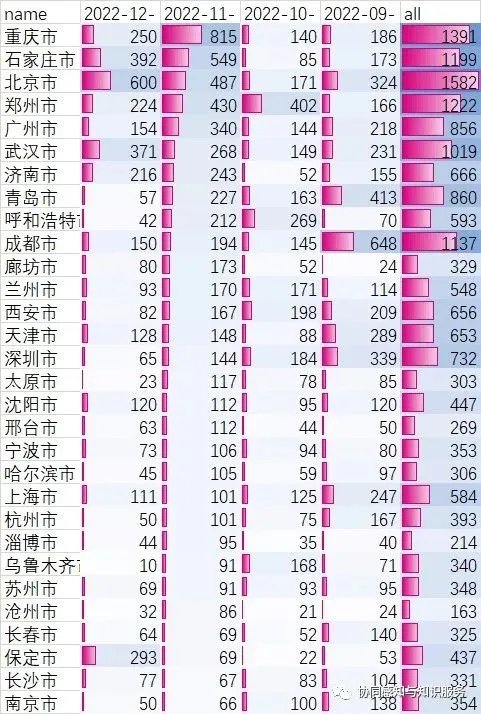
Ranking of china cities with COVID-19 severity based on data extracted from over 10 million social media platform (基于超千万社交媒体数据提取的covid相关疫情严重程度中国城市排名)

Ranking of china cities with COVID-19 severity based on data extracted from over 10 million social media platform  (基于超千万社交媒体数据提取的covid相关疫情严重程度中国城市排名)
Sebastian Raschka (@rasbt) 's Twitter Profile Photo

Convolutional networks strike back, again. The fully convolutional ConvNeXt v2 extends the successful ConvNeXt architecture by adding self-supervised learning capabilities. What's new? 1/5

Convolutional networks strike back, again. The fully convolutional ConvNeXt v2 extends the successful ConvNeXt architecture by adding self-supervised learning capabilities.

What's new?
1/5
Qiusheng Wu (@giswqs) 's Twitter Profile Photo

How to create a #Python package and publish it on PyPI in less than 5 minutes? Video: youtu.be/EIwLZiTuYoA Demo: geosdemo.gishub.org #geospatial #geopython

How to create a #Python package and publish it on PyPI in less than 5 minutes?
Video: youtu.be/EIwLZiTuYoA 
Demo: geosdemo.gishub.org 

#geospatial #geopython
Mapillary (@mapillary) 's Twitter Profile Photo

Now available on Mapillary: Neural Radiance Fields (NeRFs)! 🎊 NeRFs allow for the transformation of a collection of 2D images into detailed, immersive 3D reconstructions. Read our blog post to learn more and see how you can get started with NeRFs: blog.mapillary.com/update/2024/03…

ZhangYan (@zhangyangiser) 's Twitter Profile Photo

Excited to share our research on urban noise exposure in AppliedGeography with Prof.Mei-Po Kwan! We used 17,000+ noise complaints, applied SVI to identify noise sources and found higher & more unequal noise exposure in wealthy community. Free access via authors.elsevier.com/a/1jeHlWf-BQ03J

ZhangYan (@zhangyangiser) 's Twitter Profile Photo

Urban functional zones play important roles in cities. Traditional methods classify them in a binary (black and white) way, while UFZ often exist in mixed forms. With Prof Mei-Po Kwan, we discussed this issue in TGIS. Visit link: doi.org/10.1111/tgis.1…
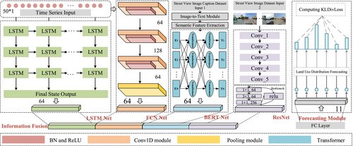
Urban functional zones play important roles in cities. Traditional methods classify them in a binary (black and white) way, while UFZ often exist in mixed forms. With Prof <a href="/meipokwan/">Mei-Po Kwan</a>, we discussed this issue in TGIS. Visit link: doi.org/10.1111/tgis.1…
ZhangYan (@zhangyangiser) 's Twitter Profile Photo

Just published in Scientific Data: Our LLM-driven dataset revealing spatiotemporal patterns of street & neighborhood crime across China! With ~1 million geo-tagged crime records, supports SDG 11 & 16 research. Mei-Po Kwan #OpenData rdcu.be/eejq2

Just published in Scientific Data: Our LLM-driven dataset revealing spatiotemporal patterns of street &amp; neighborhood crime across China! With ~1 million geo-tagged crime records, supports SDG 11 &amp; 16 research. <a href="/meipokwan/">Mei-Po Kwan</a>  #OpenData rdcu.be/eejq2
ZhangYan (@zhangyangiser) 's Twitter Profile Photo

New paper with Mei-Po Kwan published at Science Bulletin(IF=21.1)! 📊 Framework: Challenges the assumption where you live = your environmental exposure. 🚀 Future Vision: AI simulate population mobility patterns while protecting privacy, enabling large-scale exposure assessment.
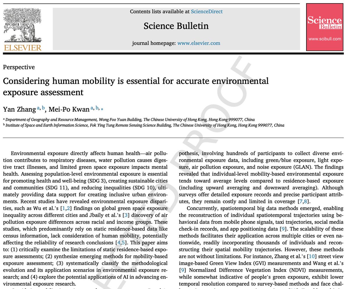
New paper with <a href="/meipokwan/">Mei-Po Kwan</a> published at Science Bulletin(IF=21.1)!
📊 Framework: Challenges the assumption where you live = your environmental exposure.
🚀 Future Vision: AI simulate population mobility patterns while protecting privacy, enabling large-scale exposure assessment.