Volkan Yılmaz(@volkanylmz61) 's Twitter Profileg
Volkan Yılmaz

@volkanylmz61

Associate Professor of #RemoteSensing @tcktu1955 | Associate Editor of @IJRemoteSensing | Member of @isprs |

ID:1593007136

calendar_today14-07-2013 09:42:49

254 Tweets

1,0K Followers

5,0K Following

International Journal of Remote Sensing(@IJRemoteSensing) 's Twitter Profile Photo

🔓 OPEN ACCESS article:

Hu et al. describe a case study from Chornobyl Exclusion Zone in which a tuning-free moderate-scale detection algorithm - AT&RF (adaptive threshold & ) - was assessed.

🔗 doi.org/10.1080/014311…

🔓 OPEN ACCESS article: Hu et al. describe a case study from Chornobyl Exclusion Zone in which a tuning-free moderate-scale #BurnedArea detection algorithm - AT&RF (adaptive threshold & #RandomForest) - was assessed. 🔗 doi.org/10.1080/014311… #IJRS #RemoteSensing #ForestFire
account_circle
International Journal of Remote Sensing(@IJRemoteSensing) 's Twitter Profile Photo

🔔 New article:

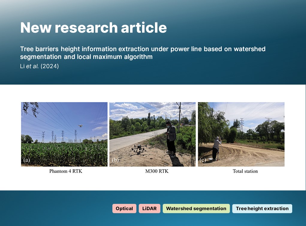
Li et al. combine and a local maximum algorithm to extract barrier height from -derived optical imagery and data of trees in close proximity to powerlines.

🔗 doi.org/10.1080/014311…

🔔 New article: Li et al. combine #watershed #segmentation and a local maximum algorithm to extract #tree barrier height from #UAV-derived optical imagery and #LiDAR data of trees in close proximity to powerlines. 🔗 doi.org/10.1080/014311… #IJRS #RemoteSensing #geospatial
account_circle
International Journal of Remote Sensing(@IJRemoteSensing) 's Twitter Profile Photo

🔔 New REVIEW article:

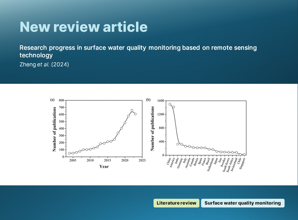
Zheng et al. provide a systematic review of the state of the art in remote sensing technology in the context of surface water quality monitoring.

🔗 doi.org/10.1080/014311…

🔔 New REVIEW article: Zheng et al. provide a systematic review of the state of the art in remote sensing technology in the context of surface water quality monitoring. 🔗 doi.org/10.1080/014311… #IJRS #RemoteSensing #SurfaceWater #WaterQualityMonitoring
account_circle
International Journal of Remote Sensing(@IJRemoteSensing) 's Twitter Profile Photo

🔔 New article:

Akishina et al. present measurements and analysis of total columns of both fluoride (HF) and hydrogen chloride (HCl) in the between 2009 and 2023.

🔗 doi.org/10.1080/014311…

🔔 New article: Akishina et al. present measurements and analysis of #atmospheric total columns of both #hydrogen fluoride (HF) and hydrogen chloride (HCl) in the #atmosphere between 2009 and 2023. 🔗 doi.org/10.1080/014311… #IJRS #RemoteSensing #FourierTransform #infrared
account_circle
International Journal of Remote Sensing(@IJRemoteSensing) 's Twitter Profile Photo

🔔 New article:

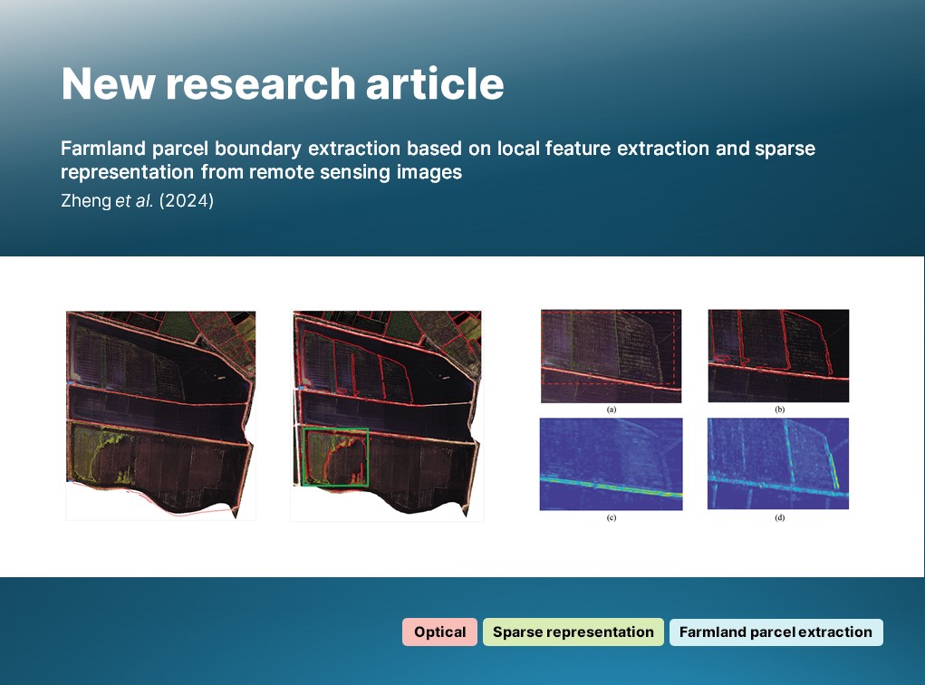
Zheng et al. investigate a detection and approach to parcel boundary extraction, demonstrating the approach to be both fast and accurate.

🔗 doi.org/10.1080/014311…

🔔 New article: Zheng et al. investigate a #contour detection and #SparseRepresentation approach to #farmland parcel boundary extraction, demonstrating the approach to be both fast and accurate. 🔗 doi.org/10.1080/014311… #IJRS #RemoteSensing #agriculture
account_circle
International Journal of Remote Sensing(@IJRemoteSensing) 's Twitter Profile Photo

🔓 OPEN ACCESS article:

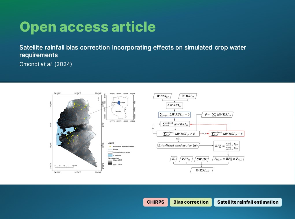
Omondi (Faculty ITC | University of Twente) et al. present an error correction method for satellite 🛰️ estimates ( ) based on the determination of effective window sizes for SRE bias correction.

🔗 doi.org/10.1080/014311…

🔓 OPEN ACCESS article: Omondi (@FacultyITC) et al. present an error correction method for satellite 🛰️ #rainfall estimates (#SRE) based on the determination of effective window sizes for SRE bias correction. 🔗 doi.org/10.1080/014311… #IJRS #RemoteSensing #CHIRPS
account_circle
International Journal of Remote Sensing(@IJRemoteSensing) 's Twitter Profile Photo

🔔 New article:

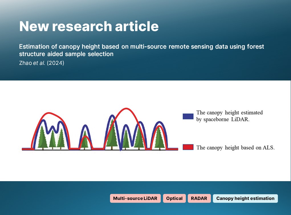
Zhao et al. propose a canopy height estimation method which combines , & optical data from multiple sources, & integrates these with information on forest .

🔗 doi.org/10.1080/014311…

🔔 New article: Zhao et al. propose a #forest canopy height estimation method which combines #LiDAR, #radar & optical data from multiple sources, & integrates these with information on forest #structure. 🔗 doi.org/10.1080/014311… #IJRS #RemoteSensing #CanopyHeightModel
account_circle
Dr. Joanne C. White(@Joanne_C_White) 's Twitter Profile Photo

📢New review: Characterizing forest recovery following stand replacing disturbances in boreal forests: contributions of optical time series and airborne laser scanning data

👉doi.org/10.14214/sf.23…

Silva Fennica @IBFRA

📢New review: Characterizing forest recovery following stand replacing disturbances in boreal forests: contributions of optical time series and airborne laser scanning data 👉doi.org/10.14214/sf.23… @SilvaFennica @IBFRA #OpenAccess #forestrecovery #remotesensing #lidar #boreal
account_circle
International Journal of Remote Sensing(@IJRemoteSensing) 's Twitter Profile Photo

🔔 New article:

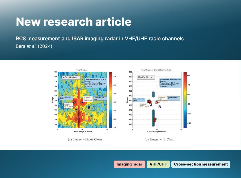
Bera (IIT Kharagpur🇮🇳 #StaySafe) et al. propose a novel, polyphase-coded spread spectrum (PCSS) system for cross section (RCS) and inverse ( ) imaging across VHF and UHF channels in open environments.

🔗 doi.org/10.1080/014311…

🔔 New article: Bera (@IITKgp) et al. propose a novel, polyphase-coded spread spectrum (PCSS) #radar system for #radar cross section (RCS) and inverse #SAR (#ISAR) imaging across VHF and UHF channels in open environments. 🔗 doi.org/10.1080/014311… #IJRS #RemoteSensing
account_circle
International Journal of Remote Sensing(@IJRemoteSensing) 's Twitter Profile Photo

🔔 New article:

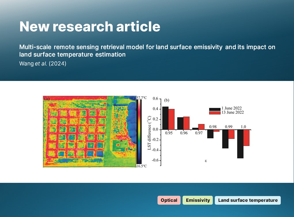
Wang et al. examine and characterise land surface emissivity (LSE) using a model developed from Fengyun-4A data and evaluated using imagery acquired with a .

🔗 doi.org/10.1080/014311…

🔔 New article: Wang et al. examine and characterise land surface emissivity (LSE) using a model developed from Fengyun-4A data and evaluated using imagery acquired with a #UAV. 🔗 doi.org/10.1080/014311… #IJRS #RemoteSensing #LandSurfaceTemperature
account_circle
International Journal of Remote Sensing(@IJRemoteSensing) 's Twitter Profile Photo

🔔 New article:

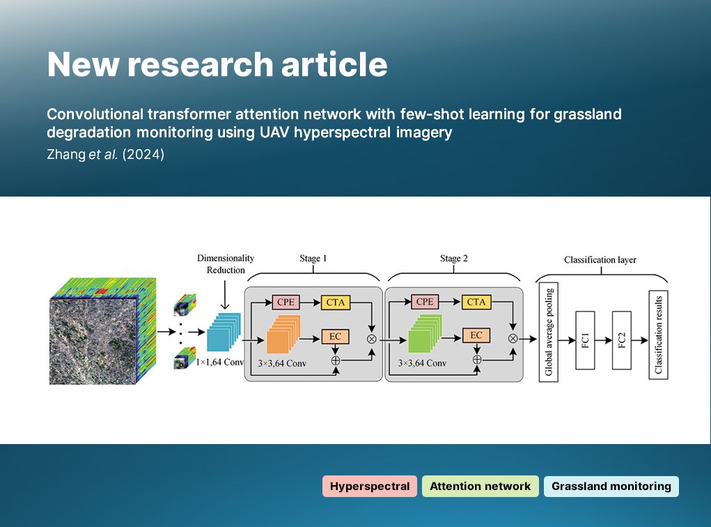
Zhang et al. propose a convolutional transformer attention network ( ) designed to identify desert objects in UAV-derived imagery for the purpose of degradation .

🔗 doi.org/10.1080/014311…

🔔 New article: Zhang et al. propose a convolutional transformer attention network (#CTAN) designed to identify desert #grassland objects in UAV-derived #hyperspectral imagery for the purpose of degradation #monitoring. 🔗 doi.org/10.1080/014311… #IJRS #RemoteSensing
account_circle
IEEE-GRSS(@IEEE_GRSS) 's Twitter Profile Photo

🆕GRSS article of the week
📰 IEEE MGRS
👉Title: Deep Learning for Downscaling Remote Sensing Images: Fusion and super-resolution
✍️Authors: M. Sdraka, I. Papoutsis, B. Psomas, K. Vlachos, K. Ioannidis, K. Karantzalos
📎DOI: doi.org/10.1109/MGRS.2…

🆕GRSS article of the week 📰 IEEE MGRS 👉Title: Deep Learning for Downscaling Remote Sensing Images: Fusion and super-resolution ✍️Authors: M. Sdraka, I. Papoutsis, B. Psomas, K. Vlachos, K. Ioannidis, K. Karantzalos 📎DOI: doi.org/10.1109/MGRS.2…
account_circle
Dr. Joanne C. White(@Joanne_C_White) 's Twitter Profile Photo

What can we learn about northern following using data? Plenty! Canopy height decreased 8–10 years post fire and recovered between 60% and 85% of pre-fire canopy height within 30 years post fire.
doi.org/10.1080/014311…

account_circle
International Journal of Remote Sensing(@IJRemoteSensing) 's Twitter Profile Photo

🔔 New article:

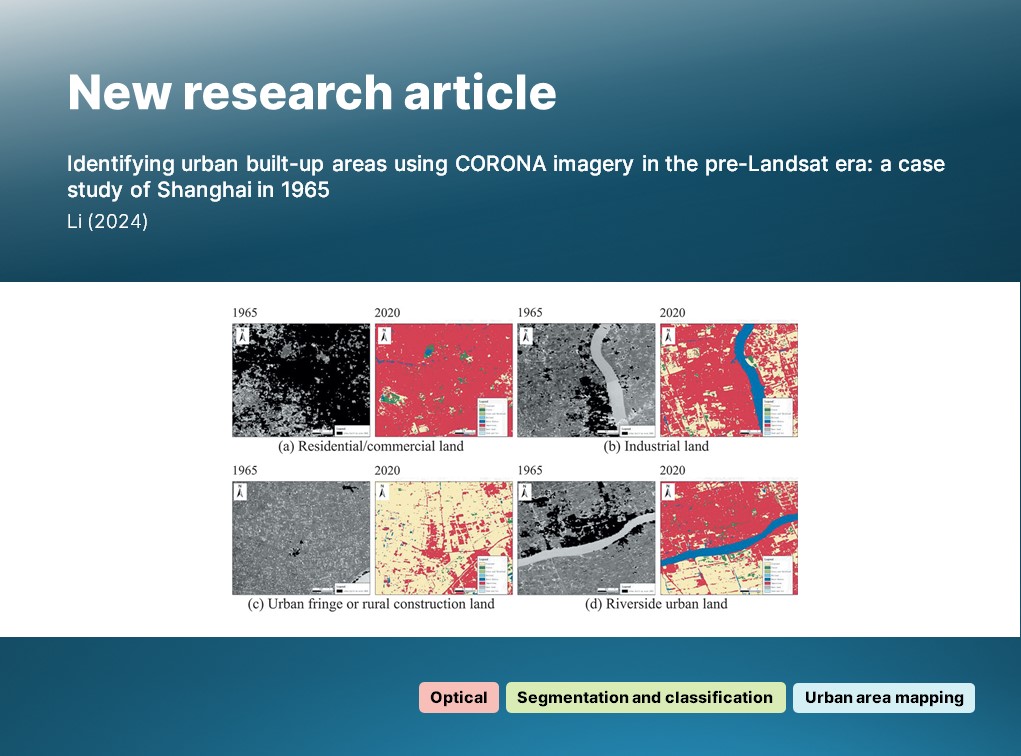
Li examines eight archived images (1959-1972) of Shanghai and, using automated and , discusses the process of and consequential increases in pollution.

🔗 doi.org/10.1080/014311…

🔔 New article: Li examines eight archived #Corona images (1959-1972) of Shanghai and, using automated #ImageSegmentation and #classification, discusses the process of #urbanisation and consequential increases in pollution. 🔗 doi.org/10.1080/014311… #IJRS #RemoteSensing

account_circle
International Journal of Remote Sensing(@IJRemoteSensing) 's Twitter Profile Photo

🔓 OPEN ACCESS article:

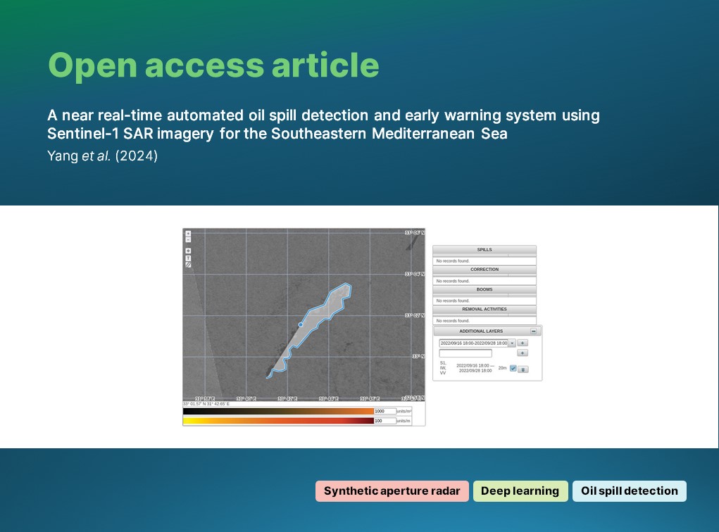
Yang (DLR - English) et al. propose an automated, operational detection and early warning system based on imagery and a -based oil object detector.

🔗 doi.org/10.1080/014311…

🔓 OPEN ACCESS article: Yang (@DLR_en) et al. propose an automated, operational #OilSpill detection and early warning system based on #Sentinel1 #SAR imagery and a #DeepLearning-based oil object detector. 🔗 doi.org/10.1080/014311… #IJRS #RemoteSensing #SyntheticApertureRadar
account_circle
International Journal of Remote Sensing(@IJRemoteSensing) 's Twitter Profile Photo

🔔 New article:

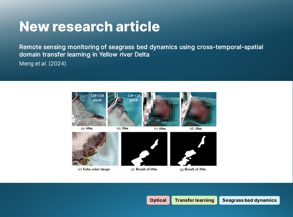
Meng et al. present a novel method for monitoring seagrass bed dynamics with data, using an enhanced version of DeepLab V3+ and a approach to .

🔗 doi.org/10.1080/014311…

🔔 New article: Meng et al. present a novel method for monitoring seagrass bed dynamics with #Landsat data, using an enhanced version of DeepLab V3+ and a #TransferLearning approach to #classification. 🔗 doi.org/10.1080/014311… #IJRS #RemoteSensing #TimeSeries #MarineScience
account_circle
International Journal of Remote Sensing(@IJRemoteSensing) 's Twitter Profile Photo

🔓 OPEN ACCESS article:

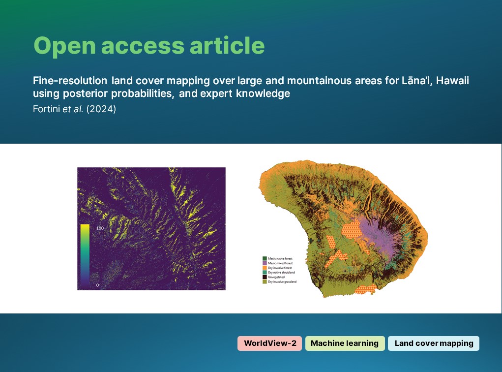
Fortini (USGS) et al. leverage imagery, and expert knowledge to classify vegetation in topographically-complex Hawai'i at a high accuracy.

🔗 doi.org/10.1080/014311…

🔓 OPEN ACCESS article: Fortini (@USGS) et al. leverage #WorldView2 #optical imagery, #MachineLearning and expert knowledge to classify vegetation in topographically-complex Hawai'i at a high accuracy. 🔗 doi.org/10.1080/014311… #IJRS #RemoteSensing #NeuralNetworks #LandCover
account_circle
International Journal of Remote Sensing(@IJRemoteSensing) 's Twitter Profile Photo

🔔 New article:

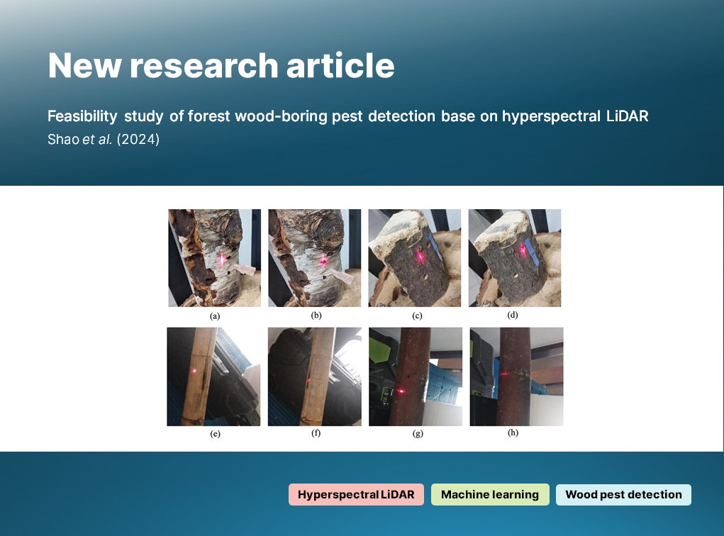
Shao et al. present a system - based on an acousto-optic tunable filter (AOTF) - which they use to examine the echo intensity of trunks as part of wood-boring detection.

🔗 doi.org/10.1080/014311…

🔔 New article: Shao et al. present a #hyperspectral #LiDAR system - based on an acousto-optic tunable filter (AOTF) - which they use to examine the echo intensity of #tree trunks as part of #forest wood-boring #pest detection. 🔗 doi.org/10.1080/014311… #IJRS #RemoteSensing
account_circle