Geospatial Stuff
@geospatialstuff
We tweet everything Geospatial related including GIS, geomatics, drones, open data, location technology, maps & much more
ID: 171357669
27-07-2010 04:38:43
14,14K Tweet
5,5K Takipçi
5,5K Takip Edilen
 's Twitter Profile Photo")
 on Twitter photo Indigenous Place Names in Canada Map, depicting Indigenous place names all across Canada, through permission from First Nations, Métis, & Inuit communities can be downloaded free & printed for personal or educational uses ... canadiangis.com/indigenous-pla…
#geography #cartography")
 's Twitter Profile Photo")
Introducing Esri Canada's #3D City Model Resource Site: 3dcitymodels.esri.ca! Preview & download ArcGIS CityEngine rules for your 3D models. #3DModels #Esri #3DGIS #GIS #HigherEducation #gischat #gischatbot @SandsofJura ECCE 🇨🇦 GIS & Geomatics Addy Pope
 's Twitter Profile Photo")
 on Twitter photo Join us tomorrow for our workshop \"How to get started in community geography!\" On-campus at Mitchell Hall 202 or via Zoom. All experience levels are welcome. Visit our website for more: tinyurl.com/2j5ryhjs")
 's Twitter Profile Photo")
 on Twitter photo Our world is 3D so why not use #ArcGIS to make your maps 3D?
Join our webinar to discover how ArcGIS Online has made #3D mapping something we can all use. Register today: ow.ly/Gz0n50IqkJi")
 's Twitter Profile Photo")
 on Twitter photo The next session in the OCDSB's Career Development Workshop series, \"Customer Service Training\", is coming up on Monday! Students are welcome to join us March 28th at 1:00 p.m. Learn more: ow.ly/yqyh50Ic50Y")
 's Twitter Profile Photo")
We've just open sourced the code behind PEARL, our platform that allows you to do fast AI-based land classification without writing a line of code. We hope this code will accelerate responsible efforts to monitor our planet and address climate change 🧵 developmentseed.org/blog/2022-03-1…
 on Twitter photo We've just open sourced the code behind PEARL, our platform that allows you to do fast AI-based land classification without writing a line of code. We hope this code will accelerate responsible efforts to monitor our planet and address climate change 🧵
developmentseed.org/blog/2022-03-1…")
 's Twitter Profile Photo")
 (@cdncarto) 's Twitter Profile Photo")
 on Twitter photo")
 's Twitter Profile Photo")
Nice Ontario Government GeoHub geohub.lio.gov.on.ca #Ontario #Canada #data #apps #GIO #ONT #govtech #esriCanada #esri #arcgis #WebGIS #GIS #mapping #maps #geospatial Esri Canada Esri Esri State & Local Gov ArcGIS Hub ArcGIS Online
 on Twitter photo Nice <a href=\"/ONgov/\">Ontario Government</a> GeoHub geohub.lio.gov.on.ca
#Ontario #Canada #data #apps #GIO #ONT #govtech #esriCanada #esri #arcgis #WebGIS #GIS #mapping #maps #geospatial <a href=\"/esricanada/\">Esri Canada</a> <a href=\"/Esri/\">Esri</a> <a href=\"/EsriSLGov/\">Esri State & Local Gov</a> <a href=\"/ArcGISHub/\">ArcGIS Hub</a> <a href=\"/ArcGISOnline/\">ArcGIS Online</a>")
 's Twitter Profile Photo")
Really excited to present to Canadian Cartographic Association (CCA) this morning! This is my very first time representing "industry" at a conference 😳
 on Twitter photo Really excited to present to <a href=\"/CdnCarto/\">Canadian Cartographic Association (CCA)</a> this morning! This is my very first time representing \"industry\" at a conference 😳")
 's Twitter Profile Photo")
Geoff Zeiss is a Damage Prevention Hero – A True Visionary in the Geospatial Sector. article here bit.ly/3atkVJN Congrats Geoff and thanks for all your work and #leadership. #geospatial #mapping
 on Twitter photo <a href=\"/gzeiss/\">Geoff Zeiss</a> is a Damage Prevention Hero – A True Visionary in the Geospatial Sector. article here bit.ly/3atkVJN Congrats Geoff and thanks for all your work and #leadership. #geospatial #mapping")
 's Twitter Profile Photo")
 on Twitter photo You have downloaded the #opendata. But, how does #Landsat9 get from space to you and what happens along the way? Satellite info including mission architecture. 🛰️
See: Masek et al. #Landsat 9: Empowering open science and applications through continuity.
🔗tinyurl.com/328n9hyz")
 's Twitter Profile Photo")
 on Twitter photo 3D webmaps are available in <a href=\"/MapLibre/\">MapLibre</a> thanks to a great effort made by the community. New features include migration to TypeScript, pitch up to 85°, Internet Explorer is no longer supported. Find out more on our blog: maptiler.link/3PPzszw
#maplibre #3d #javascript #webmapping")
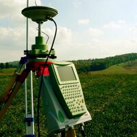
 on Twitter photo Geomatics Job - GIS Technician dlvr.it/SRjszP #geojob #gisjob")
 's Twitter Profile Photo")
 on Twitter photo Bordered by 3 oceans, Canada has the world’s longest coastline. This #WorldOceansDay, we are looking forward to SWOT 🛰! Led by <a href=\"/NASA/\">NASA</a> and <a href=\"/CNES/\">CNES</a>, the SWOT mission will measure water surface elevation with high precision. 🌊
asc-csa.gc.ca/eng/satellites…
📷 : CNES")
 (@cdncarto) on Twitter photo Carto 2023 – CCA / ACMLA Joint Conference
cca-acc.org/conferences/cu…")
 (@cdncarto) on Twitter photo Submit your map to the 2023 CCA Student Mapping Competitions
cca-acc.org/cca-mapping-co…")