

3D Light Painting 🎨
48 GoPros and Luma AI
#LightPainting #Volumetric #Spatial #NeRF #3D #AI #LumaAI #BulletTime #GaussianSplatting #XR #VR #VFX #Cinematography #CameraRig #Rig #GoPro #VideoArt #PointCloud #PointCloud s #Surrealism

🌳 Learn how the Compare Point Cloud tool enables users to automatically compare point clouds to raster terrain layers in this vlog! Check it out: ow.ly/pgjQ50RvKam
#GlobalMapper #TreeHeight #Forestry #pointcloud





May the 4th be with you! 🦾
No matter which side of the force you're on:
PointCab Origins makes sure the force is with you.
Evaluate any kind of point cloud data in one software.
#pointcloud #starwars #maythefourth #maythe4th bewithyou #maythe4th #starwars fanart #starwars nerd


(BONUS TIPS below.) Do you know the best practices for bringing Point Clouds into Revit? In this 6th and final step, we discuss the final rotation for best fit and the final check of levels, sections, and floors. #myBIMteam #pointcloud #revit #TipTuesday #TuesdayTips

There's only a few days left for Early Bird tickets for FOSS4G Europe 2024. Make sure you register on time and join the workshop on #PointCloud Processing with #QGIS .👇🏽


EDiscover the unmatched capabilities of #DJI #Drones and #DJI Terra for creating detailed #3D models and maps with unparalleled accuracy.
surveydrones.ie
#SurveyDronesIreland #terrasolid #lidar #dronemapping #DJI Enterprise #geospatial #UAV #mapping #pointcloud


🌳 Learn how the Compare Point Cloud tool enables users to automatically compare point clouds to raster terrain layers in this vlog! Check it out: youtu.be/7WLijBKyPs4?si…
#GlobalMapper #TreeHeight #Forestry #pointcloud


Arjun K Haridas Open3D PointCloudLibrary Robot Operating System (ROS) opencv surface reconstruction has its own field, may be try out some models online. eg,
1. github.com/rsy6318/GeoUDF
2.github.com/mabaorui/Predi…
Or you can just interpolate the points in the pointcloud by some amount to make it look more smooth.

Hangar-One The days of unscrupulous inspections using fake library images and inconsistent inspections in the #retrofit industry are GONE!! #Drone tech is driving change in terms of #compliance #photogrammetry #pointcloud #capturingreality #ewi #cavityextraction #cwi #retrofit

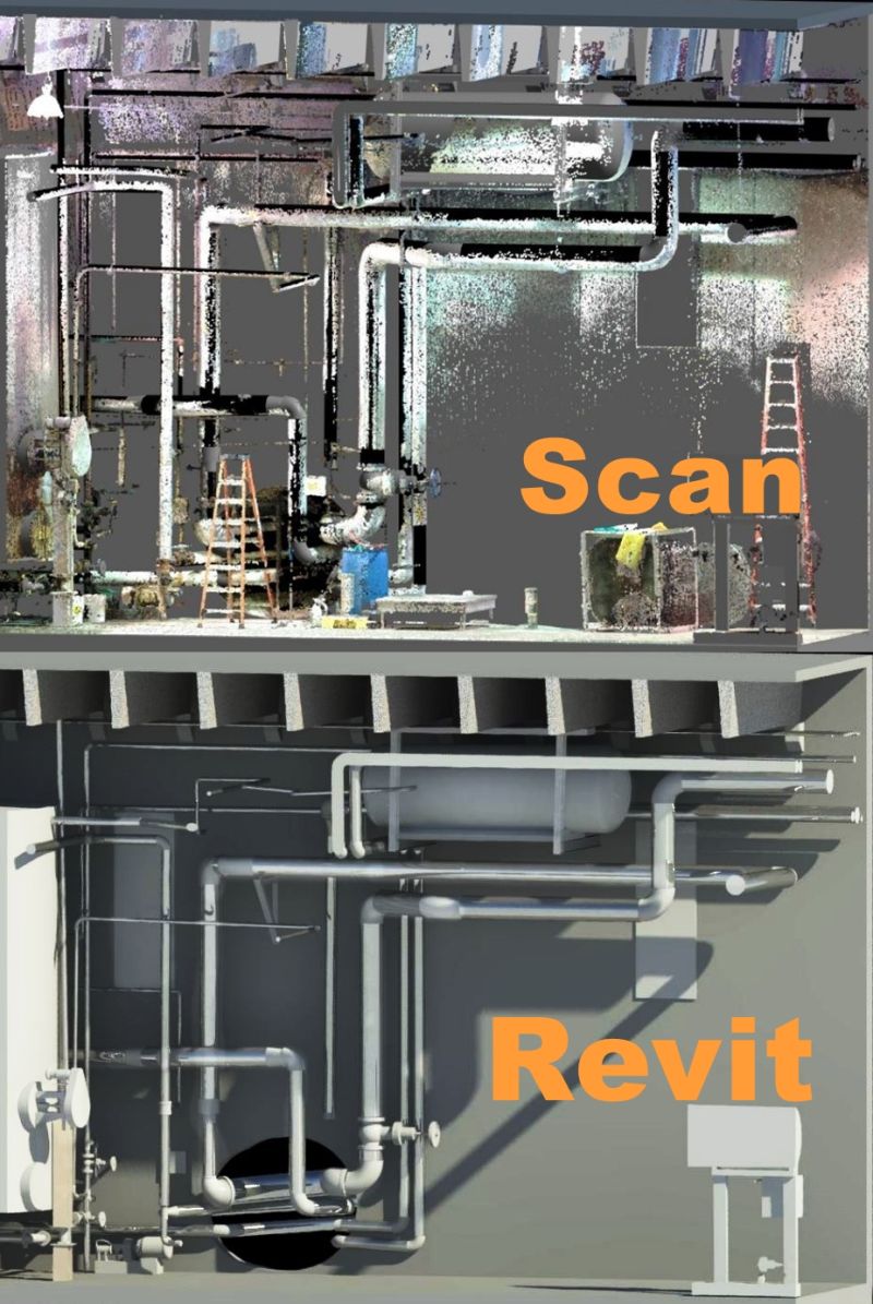
Industrial Plant modeling | Revit MEP
Scan to BIM conversion #Lod300
Business Page:- Rvtcad.com
#pointcloud #lidar #bim #scantobim #gis #autocad #MEP #archicad #landsurveying #3d #realitycapture #3d scan #asbuilt #geospatial #laserscanning #geoslam #Revit #MEP #3d


Why hire us for LiDAR land survey rather than photos/photogrammetry? youtu.be/iyxDT0yysLM?si… via YouTube #drones #lidar #lidar mapping #3dmapping #pointcloud #surveying
