NWS Baltimore-Washington(@NWS_BaltWash) 's Twitter Profile Photo

Not as hot today with highs in the mid to upper 80s. Numerous showers & storms will move over the mountains late today. Storms will become more scattered as they move east across the region tonight. Drier & slightly cooler Wednesday.

Not as hot today with highs in the mid to upper 80s. Numerous showers & storms will move over the mountains late today. Storms will become more scattered as they move east across the region tonight. Drier & slightly cooler Wednesday. #MDwx #VAwx #WVwx #DCwx
account_circle
NWS Baltimore-Washington(@NWS_BaltWash) 's Twitter Profile Photo

Warm and more humid today with scattered to numerous showers and thunderstorms mainly during the afternoon and evening as a cold front approaches the area.

Warm and more humid today with scattered to numerous showers and thunderstorms mainly during the afternoon and evening as a cold front approaches the area. #DCwx #MDwx #VAwx #WVwx
account_circle
NWS Baltimore-Washington(@NWS_BaltWash) 's Twitter Profile Photo

After some locations hit the 90 degree mark today, temperatures will cool off into the night. On average, the first 90 degree day across the region is around the 3rd-4th week of May.

After some locations hit the 90 degree mark today, temperatures will cool off into the night. On average, the first 90 degree day across the region is around the 3rd-4th week of May. #MDwx #VAwx #DCwx #WVwx
account_circle
NWS Baltimore-Washington(@NWS_BaltWash) 's Twitter Profile Photo

A few spotty showers are possible tonight, mainly west of the Blue Ridge/north of US-50. Otherwise, clouds will linger with low temperatures mainly in the 50s.

A few spotty showers are possible tonight, mainly west of the Blue Ridge/north of US-50. Otherwise, clouds will linger with low temperatures mainly in the 50s. #DCwx #MDwx #VAwx #WVwx
account_circle
NWS Baltimore-Washington(@NWS_BaltWash) 's Twitter Profile Photo

Strong high pressure to the south delivers near record heat to the region today. Highs today in the mid to upper 80s & low 90s. A spotty mountain afternoon t-storm cannot be ruled out with more widespread t-storm chances Tuesday. Relief later this week.

Strong high pressure to the south delivers near record heat to the region today. Highs today in the mid to upper 80s & low 90s. A spotty mountain afternoon  t-storm cannot be ruled out with more widespread t-storm chances Tuesday. Relief later this week. #MDwx #VAwx #WVwx #DCwx
account_circle
Weather U.S.(@Weather__US) 's Twitter Profile Photo

🇺🇸 Beckley, WV - Long-term weather forecast

In , will be unstable, and a combination of sunny, cloudy, rainy and stormy weather is expected...

✨ Explore: weather-us.com/en/west-virgin…

🇺🇸 Beckley, WV - Long-term weather forecast

In #Beckley, #weather will be unstable, and a combination of sunny, cloudy, rainy and stormy weather is expected... 

✨ Explore: weather-us.com/en/west-virgin…

 #wvwx  #westvirginia
account_circle
NWS Baltimore-Washington(@NWS_BaltWash) 's Twitter Profile Photo

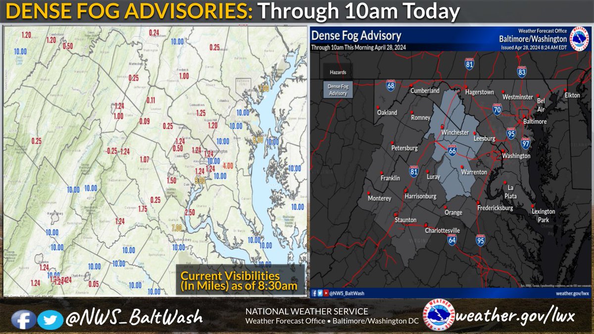
Dense Fog Advisories continue for portions of northern/ central VA & the eastern WV panhandle through 10am. Visibilities remain less than 1/4 mile in many locations with improvement midday. Use caution traveling along the VA-7, US-15, & I-66 corridors.

Dense Fog Advisories continue for portions of northern/ central VA  & the eastern WV panhandle through 10am. Visibilities remain less than 1/4 mile in many locations with improvement midday. Use caution traveling along the VA-7, US-15, & I-66 corridors. #MDwx #VAwx #WVwx #DCwx
account_circle
Weather U.S.(@Weather__US) 's Twitter Profile Photo

🇺🇸 Buckhannon, WV - Long-term weather forecast

For the next ten days, a combination of stormy, cloudy and rainy is expected.

✨ Explore: weather-us.com/en/west-virgin…

🇺🇸 Buckhannon, WV - Long-term weather forecast

For the next ten days, a combination of stormy, cloudy and rainy #weather is expected.

✨ Explore: weather-us.com/en/west-virgin…

 #Buckhannon  #wvwx  #westvirginia
account_circle
NWS Baltimore-Washington(@NWS_BaltWash) 's Twitter Profile Photo

An early preview of summer arrives this week as highs reach the 80s each day. Hottest temps today in the upper 80s to low 90s. A cold front brings scattered showers/storms Tuesday afternoon and evening, and again Wednesday.

An early preview of summer arrives this week as highs reach the 80s each day. Hottest temps today in the upper 80s to low 90s. A cold front brings scattered showers/storms Tuesday afternoon and evening, and again Wednesday. #MDwx #VAwx #DCwx #WVwx
account_circle
NWS Baltimore-Washington(@NWS_BaltWash) 's Twitter Profile Photo

Dry & cool conditions continue today with more sun especially across central & southern MD. Afternoon temps will range from the upper 40s over the mountains to mid 60s toward the metros where sun prevails. More clouds tonight with lows in the 40s.

Dry & cool conditions continue today with more sun especially across central & southern MD. Afternoon temps will range from the upper 40s over the mountains to mid 60s toward the metros where sun prevails. More clouds tonight with lows in the 40s. #MDwx #VAwx #WVwx #DCwx
account_circle
Spencer Adkins(@SpencerWeather) 's Twitter Profile Photo

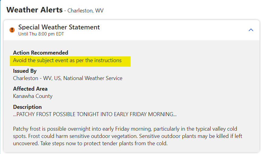
As seen on a very popular channel about weather's website. I guess we aren't allowed to talk about frost? I'll avoid the subject. 🤷‍♂️😆

As seen on a very popular channel about weather's website.  I guess we aren't allowed to talk about frost?  I'll avoid the subject.  🤷‍♂️😆 #wvwx #ohwx #kywx
account_circle
Weather U.S.(@Weather__US) 's Twitter Profile Photo

🇺🇸 Charleston, WV - Long-term weather forecast

In , will be unstable, and a combination of stormy, cloudy, rainy and sunny weather is...

✨ Explore: weather-us.com/en/west-virgin…

🇺🇸 Charleston, WV - Long-term weather forecast

In #Charleston, #weather will be unstable, and a combination of stormy, cloudy, rainy and sunny weather is... 

✨ Explore: weather-us.com/en/west-virgin…

 #wvwx  #westvirginia
account_circle
NWS Baltimore-Washington(@NWS_BaltWash) 's Twitter Profile Photo

Freeze Warnings & Frost Advisories are in effect for most of the area from 2am tonight to 8am Tuesday as temperatures drop into the low to mid 30s. The growing season hasn't started yet in the Alleghenies. For the latest see: weather.gov/lwx

Freeze Warnings & Frost Advisories are in effect for most of the area from 2am tonight to 8am Tuesday as temperatures drop into the low to mid 30s. The growing season hasn't started yet in the Alleghenies. For the latest see: weather.gov/lwx #DCwx #MDwx #VAwx #WVwx
account_circle
NWS Baltimore-Washington(@NWS_BaltWash) 's Twitter Profile Photo

More clouds than sun today as high pressure wedges itself into the region. Highs today as a result will be cooler in the mid to upper 50s & low 60s. Cloud cover remains prevalent heading into Friday as onshore flow develops. Lows tonight in the 30s & 40s.

More clouds than sun today as high pressure wedges itself into the region. Highs today as a result will be cooler in the mid to upper 50s & low 60s. Cloud cover remains prevalent heading into Friday as onshore flow develops. Lows tonight in the 30s & 40s. #MDwx #VAwx #WVwx #DCwx
account_circle
NWS Charleston, WV(@NWSCharlestonWV) 's Twitter Profile Photo

As a cold front tries to break the heat today, it will do so more via showers and a few thunderstorms, than cooler, drier air, as the front bogs down. Drier, slightly cooler air will arrive for Wednesday, but then it warms right back up on Thursday.

As a cold front tries to break the heat today, it will do so more via showers and a few thunderstorms, than cooler, drier air, as the front bogs down. Drier, slightly cooler air will arrive for Wednesday, but then it warms right back up on Thursday. #WVWx #OHWx #KYWx #VAWx
account_circle