Xavier C. Llano(@XavierCLL) 's Twitter Profile Photo

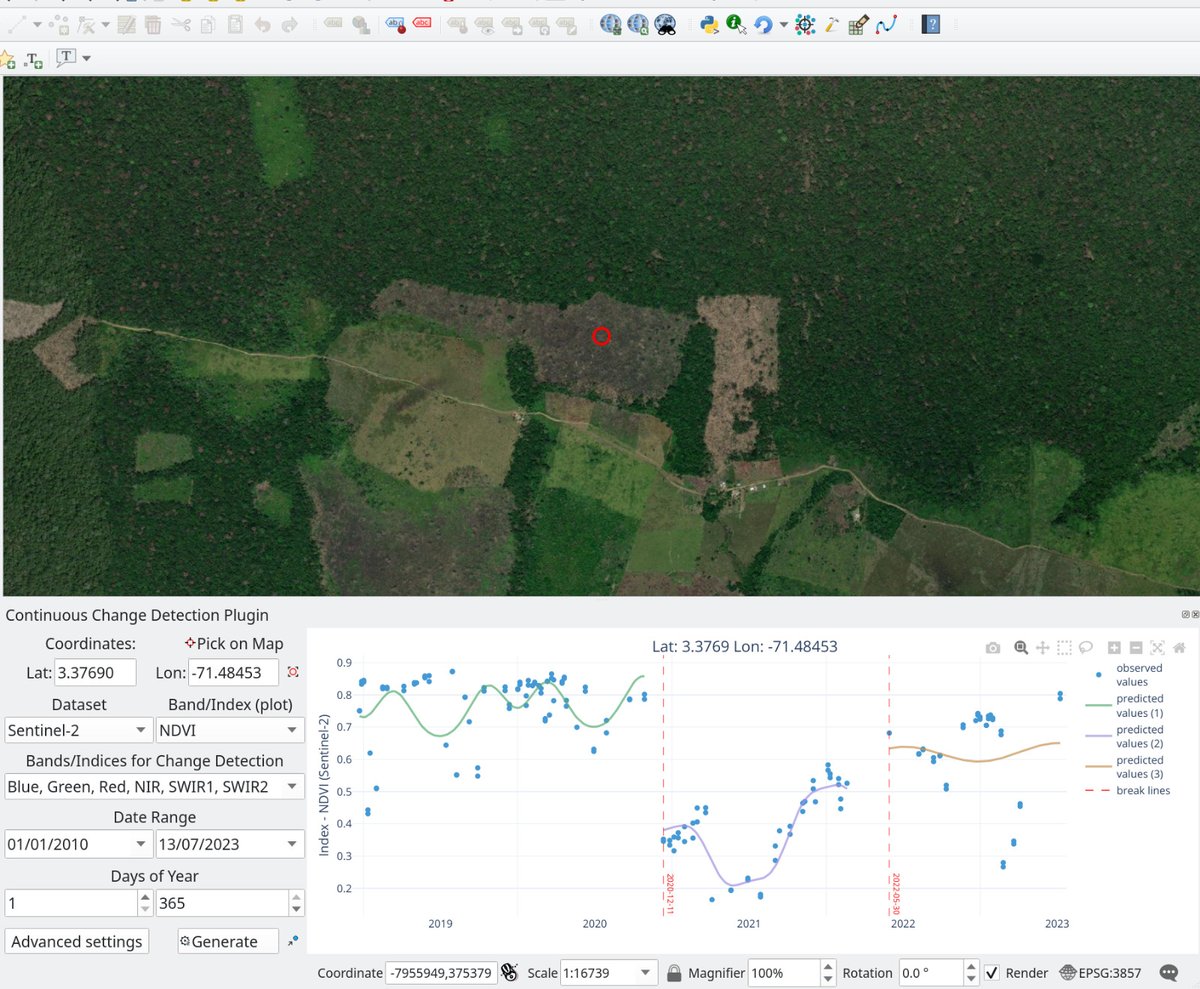
Hello and enthusiasts! The new version 23.7 of the plugin has Sentinel-2, and the process runs over with more options. Check it out: github.com/SMByC/CCD-Plug…

Hello #Qgis and #RemoteSensing enthusiasts! The new version 23.7 of the #CCDC #Qgis plugin has Sentinel-2, and the process runs over #GoogleEarthEngine with more options. Check it out: github.com/SMByC/CCD-Plug…
account_circle
Mohammadali Hemati(@Hemati_) 's Twitter Profile Photo

📢 Thrilled to announce the publication of our new research article: 'Iranian Inventory Map at a Spatial Resolution of 10 m using and Data on the ( ) Cloud Computing Platform'! 🌍🛰️

🔗link.springer.com/article/10.100…
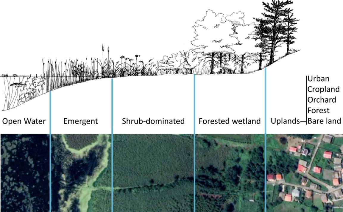
📢 Thrilled to announce the publication of our new research article: 'Iranian #Wetland Inventory Map at a Spatial Resolution of 10 m using #Sentinel1 and #Sentinel2 Data on the #GoogleEarthEngine (#GEE) Cloud Computing Platform'! 🌍🛰️

🔗link.springer.com/article/10.100…

account_circle
Emma Izquierdo-Verdiguier(@EVerdiguier) 's Twitter Profile Photo

Are you interested in how to work on Google Earth Engine? If so, hope to see you here in BOKU, Vienna, for the Google Earth Engine European Spring School (GEE-ESS'24). Registration starts next month. You can find all the info here: gee-ess.eu

Are you interested in how to work on Google Earth Engine? If so, hope to see you here in BOKU, Vienna, for the Google Earth Engine European Spring School (GEE-ESS'24). Registration starts next month. You can find all the info here: gee-ess.eu
#googleearthengine #GDE
account_circle
nathan gonçalves(@nathanborgesgo1) 's Twitter Profile Photo

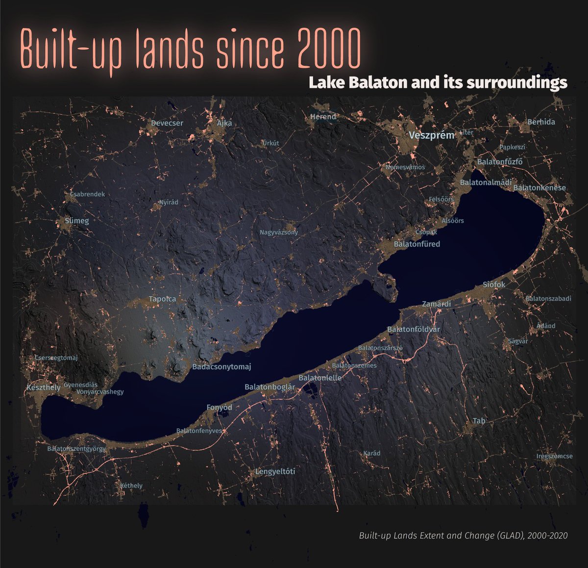
Exploring canopy height regional patterns in the using the dataset and . Spatial resolution of 1x1 km - Visualization on with an exaggerated hillshade - strech 15 to 35 m.

account_circle
Asim Ali(@asim__alii) 's Twitter Profile Photo

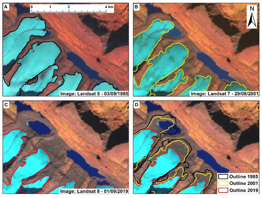
Exciting news! Our latest paper titled 'Glacier Area Changes in the Arctic and High Latitudes Using Satellite Remote Sensing' has been published in the Journal of Maps.
doi.org/10.1080/174456…

Exciting news! Our latest paper titled 'Glacier Area Changes in the Arctic and High Latitudes Using Satellite Remote Sensing' has been published in the Journal of Maps. #GlacierChanges #RemoteSensing #GoogleEarthEngine 
doi.org/10.1080/174456…
account_circle
Francis Ndiritu(@SurveyorNdiritu) 's Twitter Profile Photo

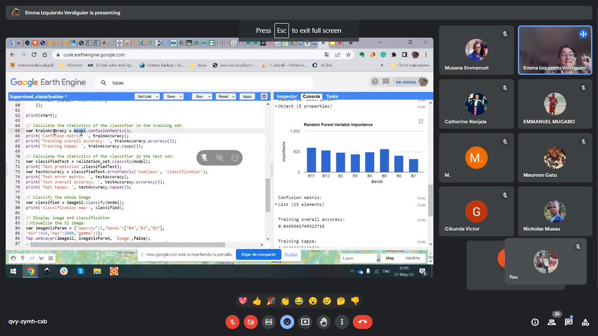
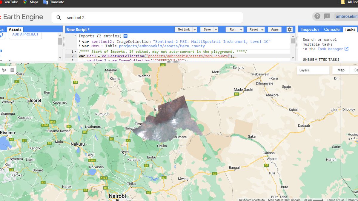
Just attended a mind-blowing presentation on Geospatial Machine Learning with Google Earth Engine! The intersection of AI and satellite imagery is unlocking endless possibilities . Excited to explore this powerful tool further! Google Earth Engine Nairobi.

Just attended a mind-blowing presentation on Geospatial Machine Learning with Google Earth Engine! The intersection of AI and satellite imagery is unlocking endless possibilities . Excited to explore this powerful tool further! #GeoML #GoogleEarthEngine #AI @GeeDevs
account_circle
David Montero Loaiza(@dmlmont) 's Twitter Profile Photo

🧵(1/) BIG NEWS! 😁 I'm happy to announce that v2024.1.0 can create cubes from in addition to catalogues! 🛰️📷

📜 gh: github.com/ESDS-Leipzig/c…

account_circle
Linda Toča(@linda_toca) 's Twitter Profile Photo

What an awesome Google Earth Engine Workshop in Warsaw last week! 🛰
GEE was a big part of my PhD and I’m excited to further explore its potential. And what an absolute joy to learn from the very best: Noel Gorelick, Michael DeWitt &the team

What an awesome Google Earth Engine Workshop in Warsaw last week! 🛰
GEE was a big part of my PhD and I’m excited to further explore its potential. And what an absolute joy to learn from the very best: Noel Gorelick, Michael DeWitt &the team #GoogleEarthEngine #GEE #RemoteSensing
account_circle
Jyoti(@geo_tei) 's Twitter Profile Photo


Day 13 – Choropleth
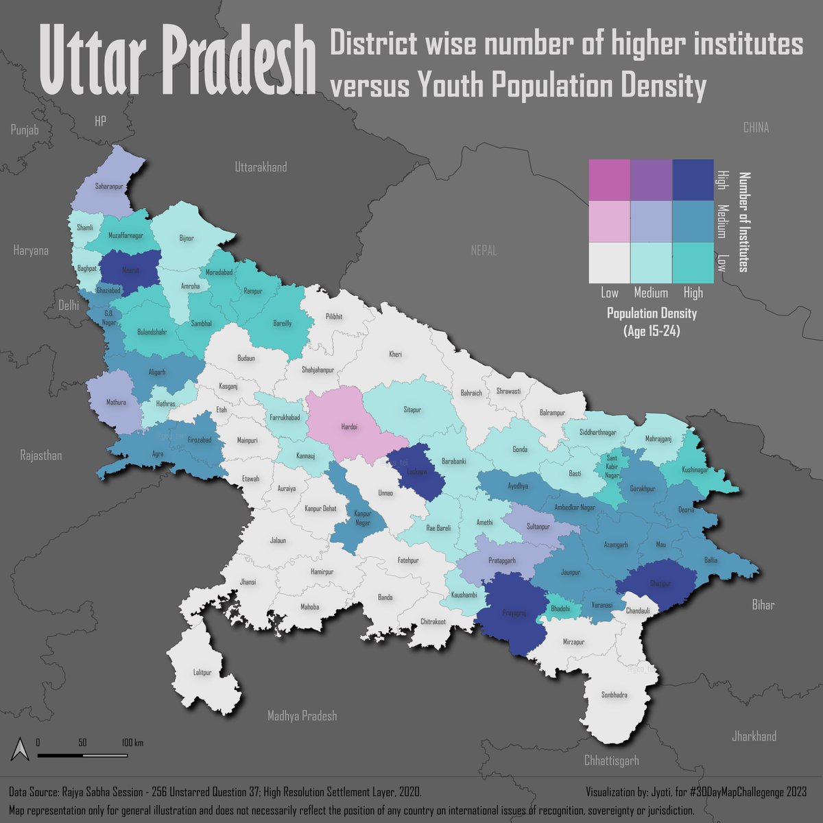
is a bivariate choropleth comparing the number of higher institutes with youth (15-24 years of age) population density in the Uttar Pradesh state of India. (1/3)

#30DayMapChallenge
Day 13 – Choropleth
#Map is a bivariate choropleth comparing the number of higher institutes with youth (15-24 years of age) population density in the Uttar Pradesh state of India. (1/3)
#gis #geospatial #choropleth #googleearthengine #qgis #highereducation
account_circle
Rafaela Tiengo 🇧🇷🛰️(@RafaelaTiengo_) 's Twitter Profile Photo

Are you interested in understanding the primary applications of the and which articles are most frequently cited?👩🏾‍💻

📰 Check out this new paper: 'Google Earth Engine: A Global Analysis and Future Trends': mdpi.com/2072-4292/15/1…

👥Andrés Velástegui-Montoya 🇪🇨🌎🛰️ et al. (2023)

Are you interested in understanding the primary applications of the #GoogleEarthEngine and which articles are most frequently cited?👩🏾‍💻

📰 Check out this new paper: 'Google Earth Engine: A Global Analysis and Future Trends': mdpi.com/2072-4292/15/1…

👥@andvelastegui et al. (2023)
account_circle
Osman Salih Yılmaz(@osman_salih61) 's Twitter Profile Photo

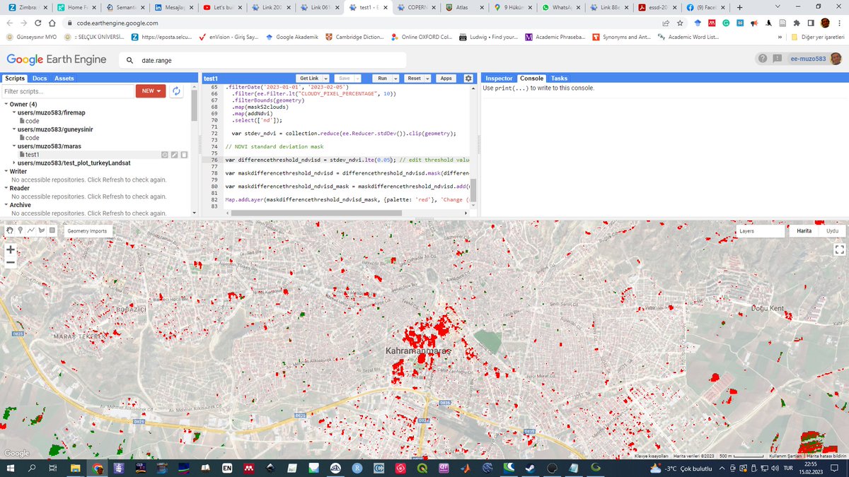
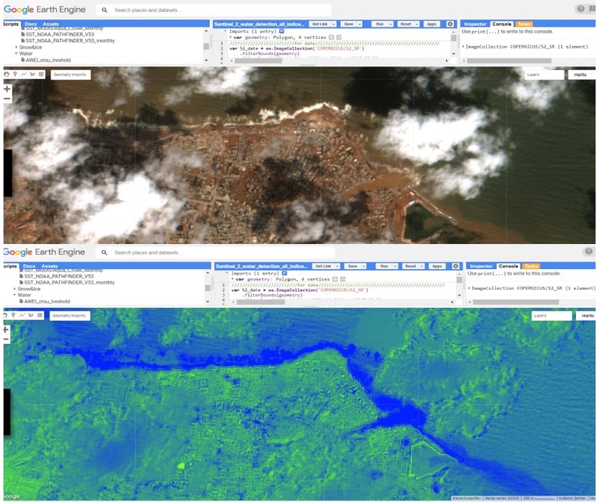
Libya 'de meydana gelen sel afeti için yapmış olduğum çalışma ektedir. Sentinel-2 görüntüsü kullanılmıştır. Suyun kumla karışması ve yoğun bulut tespiti zorlaştırsada kullanılan indeksin kısmende olsa başarılı olduğu görülmüştür.

Libya #Derne'de meydana gelen sel afeti için yapmış olduğum çalışma ektedir. Sentinel-2 görüntüsü kullanılmıştır. Suyun kumla karışması ve yoğun bulut tespiti zorlaştırsada kullanılan indeksin kısmende olsa başarılı olduğu görülmüştür. #GoogleEarthEngine
account_circle
Louise Rayne(@LouiseRayne1) 's Twitter Profile Photo

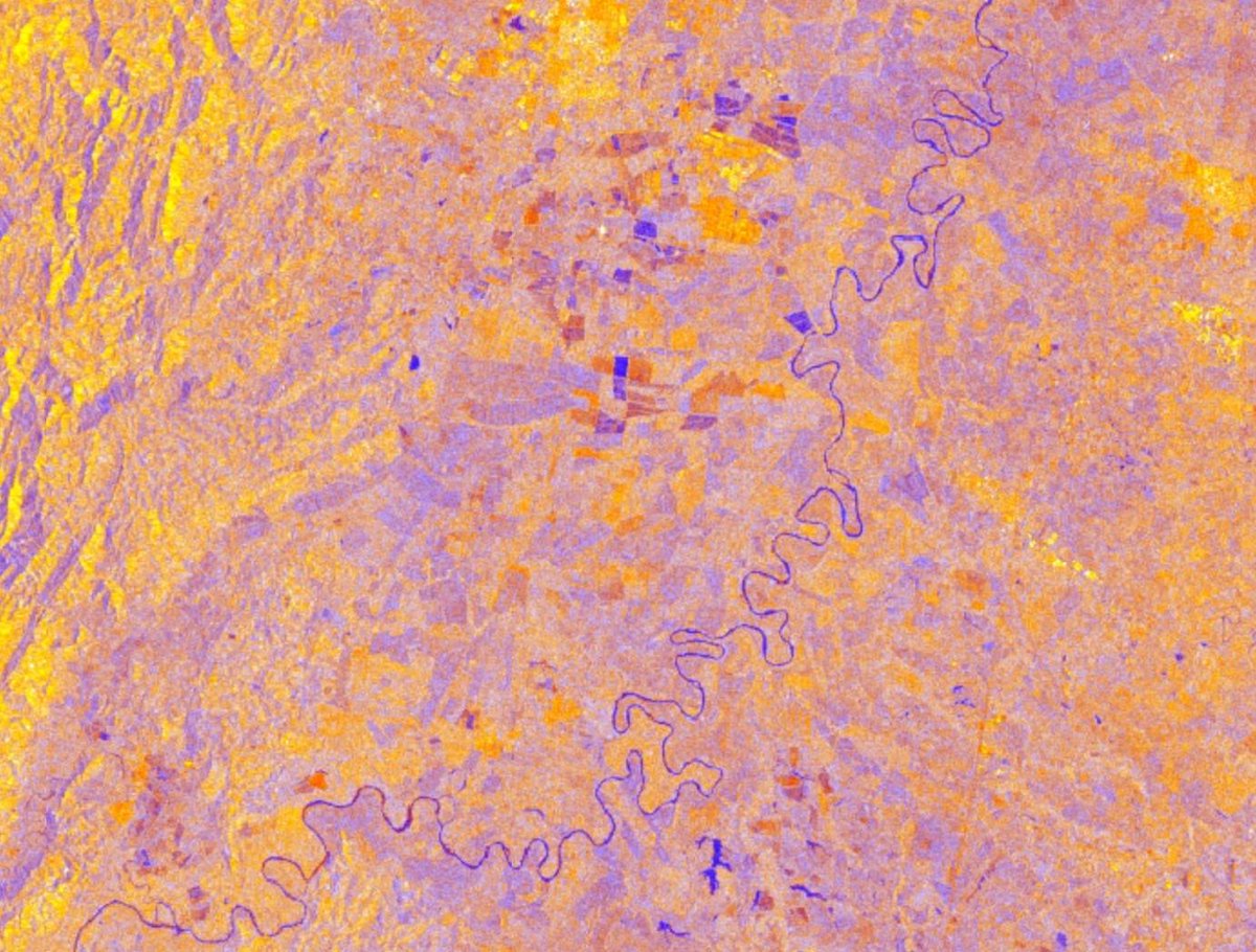
Testing out Francesc C. Conesa and Hector A. Orengo's new open-source code for mapping archaeological sites endangered by modern agriculture (read their paper here! mdpi.com/2072-4292/15/1…) . In my study area, it's showing me new agriculture cutting into ancient fields.
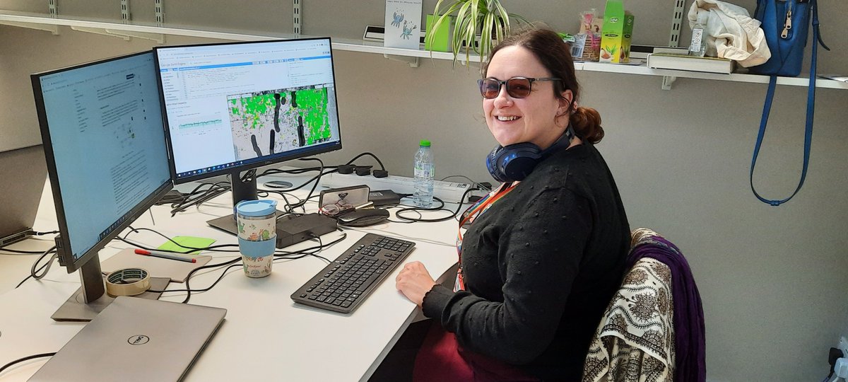
Testing out @fc_conesa and @hector_orengo's new open-source #GoogleEarthEngine code for mapping archaeological sites endangered by modern agriculture (read their paper here! mdpi.com/2072-4292/15/1…) . In my study area, it's showing me new agriculture cutting into ancient fields.
account_circle
Lawrence #Geospatial🌍(@lawrence_kim_) 's Twitter Profile Photo

🗺️Some important map packages for Geospatial Analysis in to check out include: (A thread👇)
1. Geemap: A python package for interactive mapping with Google Earth Engine by Qiusheng Wu 🌍🌎🌏

🗺️Some important map packages for Geospatial Analysis in #Python  to check out include: (A thread👇)
1. Geemap: A python package for interactive mapping with Google Earth Engine by @giswqs  #geemap #EE #gischat #geospatial #googleearthengine 🌍🌎🌏 #dataviz
account_circle