natural inquirer
@naturalinquirer
Free science ed materials by the Forest Service & cooperators. Page created & written by FIND Outdoors. Follows/RTs don't=endorsement
ID: 21790656
http://www.naturalinquirer.org 24-02-2009 20:05:06
21,21K Tweet
1,1K Takipçi
2,2K Takip Edilen
 's Twitter Profile Photo")
 on Twitter photo “It’s Amphibian Week! Yayyyyyyyy!!!!”-Kermit, probably. 🐸
This week, we celebrate amphibians in all their slippery glory.
Learn more about our Amphibian Research and Monitoring Initiative here: armi.usgs.gov
#AmphibianWeek")
 on Twitter photo What do beavers, crawfish, and tortoises have to do with #AmphibianWeek? They help create vital frog habitats: beaver dams form wetlands for Oregon spotted frogs, while crawfish and tortoise burrows shelter crawfish frogs and gopher frogs.
🐸 Learn more: ow.ly/RMQH50VOART")
Check out our newest resource: Meet Smokey Bear's Team read-along video! Meet Smokey Bear and some of the people who work with him to prevent human-caused wildfires! This video is based on our Reader series for children from K-2nd grade! youtu.be/qyU5edHI89o?si…
 's Twitter Profile Photo")
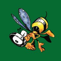
 on Twitter photo Let’s get ready to bumble!
It’s #NationalPollinatorWeek! Did you know more than 75 percent of the Earth's flowering plants depend on bees, butterflies, birds, bats, and other pollinators? Bee-lieve it! 🐝
Learn more about pollinators at nps.gov/subjects/polli…")
 's Twitter Profile Photo")
 on Twitter photo When you take care of your tools, you're also looking out for everything around you. Well-maintained equipment helps stop sparks before they start. #OnlyYou can protect your home and nearby wildlands.")
 on Twitter photo Summer starts now! ☀️
Celebrate the summer solstice by planning your next outdoor escape.
Get started today: recreation.gov
Photo at Crater Lake National Park by Logan Villarreal")
 on Twitter photo As the Fourth of July holiday approaches, we’d like to remind you that all fireworks are prohibited on federal lands.
Let the night sky be your show! ✨
Have a safe and festive Independence Day!
Photo by John Vermette")
 on Twitter photo Happy #ForestFriday! We hope you are able to get outside this weekend and enjoy the great outdoors! Remember to always recreate responsibly!")