Luciano (@luciano___98) 's Twitter Profile
Luciano

@luciano___98

Computer Engineer

ID: 2376129623

linkhttp://lucianowx.com calendar_today02-03-2014 14:37:19

17,17K Tweet

510 Followers

284 Following

Joey Krastel (@nimbusstorms) 's Twitter Profile Photo

Banding enhancement developing east of the higher terrain and should move into the northern tier over the next few hours. Excited to see how much more we could get. Approaching 2.5”.

Mike Thomas (@miketfox5) 's Twitter Profile Photo

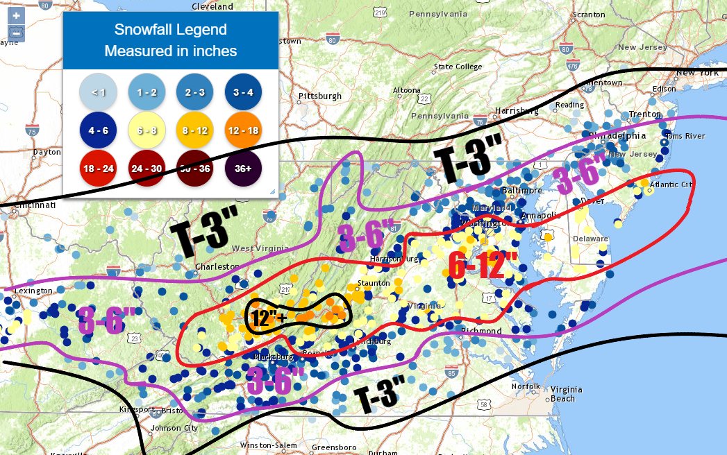
Based off ground observation data...here's my really rough attempt at contouring this snowfall event through 3am Wednesday! ❄️

Based off ground observation data...here's my really rough attempt at contouring this snowfall event through 3am Wednesday! ❄️
Jason Prichard (@realcoldrain) 's Twitter Profile Photo

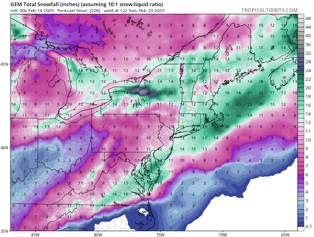
Really liking the mid-Atlantic for next week's potential. Red area has the highest risk for heavy snow, the way I see it right now. The yellow area has more uncertainty. The southern areas could see more in the way of icing or mix. Western sections may be too far west.

Really liking the mid-Atlantic for next week's potential.  Red area has the highest risk for heavy snow, the way I see it right now.

The yellow area has more uncertainty.  The southern areas could see more in the way of icing or mix.  Western sections may be too far west.
Mike Thomas (@miketfox5) 's Twitter Profile Photo

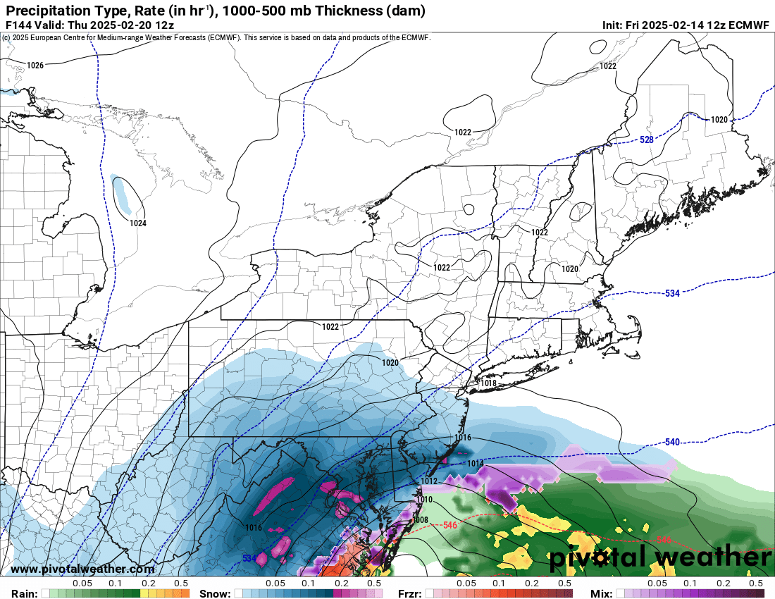
That is a very, very nice nor’easter signature from the Euro Ensemble at this time frame. Winter just might wrap up with a bang this year. ❄️

Mike Thomas (@miketfox5) 's Twitter Profile Photo

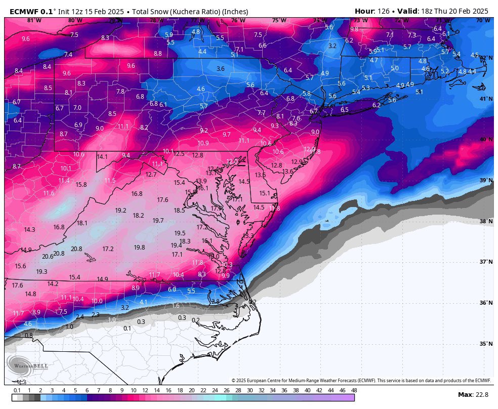
New 0z Euro continues to be very consistent with a major winter storm in the Mid-Atlantic & Northeast next Wednesday-Thursday. That’s about as textbook a Miller-A run as you could possibly have. If this remains consistent throughout the weekend, we’ll be talking some big

Ryan Hall, Y’all (@ryanhallyall) 's Twitter Profile Photo

This is devastating news. Today's reported layoffs at the NWS will impact our ability to keep Americans safe from extreme weather. These forecasters are essential frontline workers who save lives during hurricanes, tornadoes, and floods. Cutting these meteorologists isn't just

Tony Pann (@tonypannwbal) 's Twitter Profile Photo

Capital Weather Gang HOW ARE TORNADO WARNINGS ISSUED? Each NWS office around the country has a team of highly trained meteorologists that analyze every storm. In addition to a degree in meteorology, each NWS forecast employee has to go through a rigorous radar analysis course. The warnings are issued

Tony Pann (@tonypannwbal) 's Twitter Profile Photo

Ok. I guess I have to address this. The information on your phone app comes FROM data provided by NOAA for free. NOAA gathers weather data (daily balloon launches) and feeds it into the modeling so your phone can tell you it's going to rain tomorrow. Saying we don't need NOAA or

Zohran Kwame Mamdani (@zohrankmamdani) 's Twitter Profile Photo

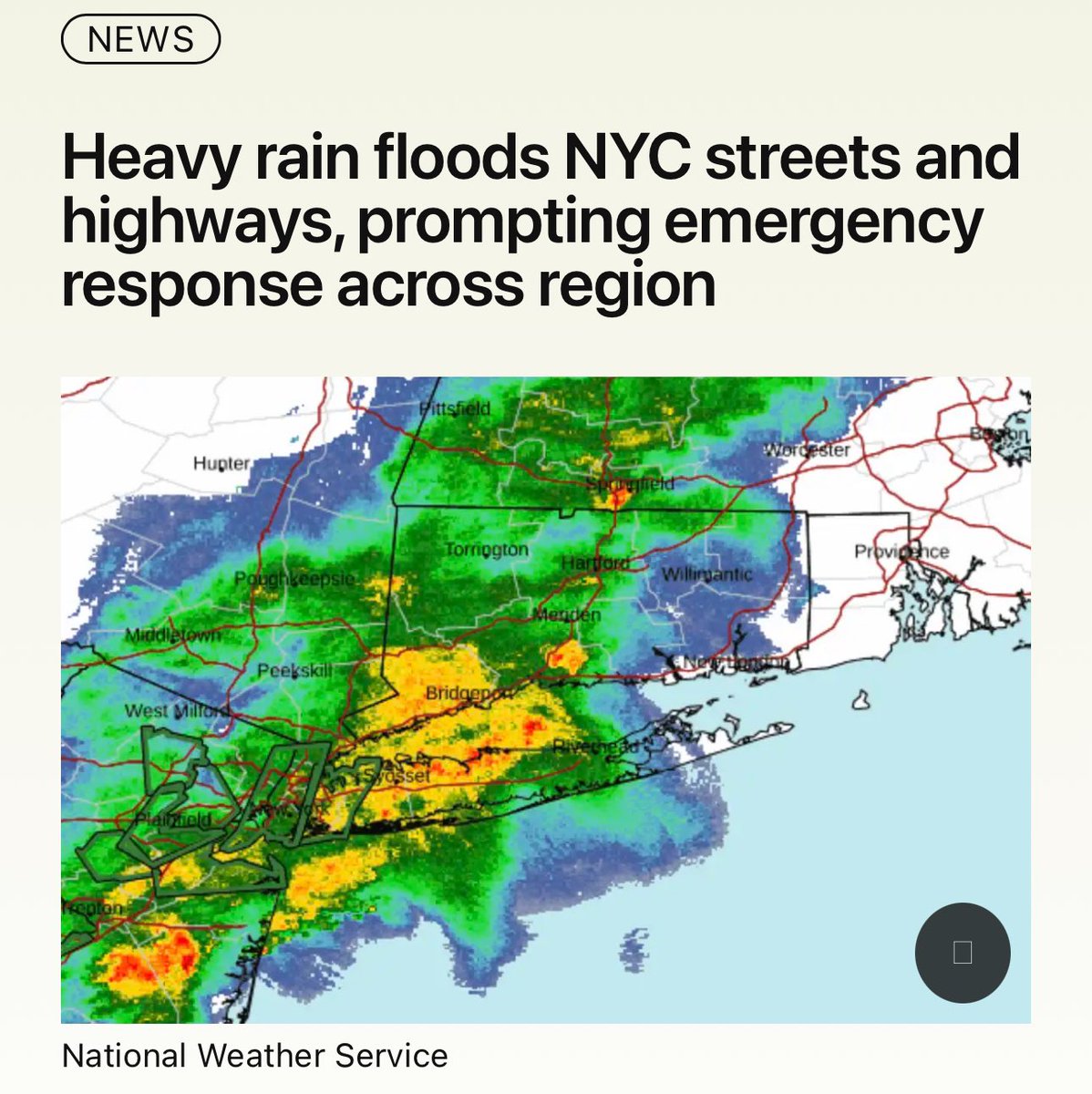
Earlier tonight, NYC was drenched by more than 2” of rain in a single hour, flooding streets, basements and subways. I’m grateful to the city workers and emergency responders we rely on in these events. But we must upgrade our infrastructure for this new climate reality.

Earlier tonight, NYC was drenched by more than 2” of rain in a single hour, flooding streets, basements and subways. I’m grateful to the city workers and emergency  responders we rely on in these events. But we must upgrade our infrastructure for this new climate reality.