James-Paul Dice (@jpdiceatp) 's Twitter Profile
James-Paul Dice

@jpdiceatp

Airline Transport Pilot, Corporate Pilot, Flight Instructor

ID: 17784896

calendar_today01-12-2008 18:19:19

22,22K Tweet

24,24K Followers

4,4K Following

James-Paul Dice (@jpdiceatp) 's Twitter Profile Photo

Weather data for engineering, insurance industry, and legal firms. Don’t rely on “rip and read” automated data when you can have expert analysis. #weather consulting #consulting meteorology #meteorology

Weather data for engineering, insurance industry, and legal firms. Don’t rely on “rip and read” automated data when you can have expert analysis. #weather consulting #consulting meteorology #meteorology
NWS Birmingham (@nwsbirmingham) 's Twitter Profile Photo

As of 3:50pm, we have broken the record high at Birmingham (new record 82), and tied the records at Anniston (82) and Tuscaloosa (83). Montgomery's high so far of 84 is short of the record (86). #alwx

NWS Birmingham (@nwsbirmingham) 's Twitter Profile Photo

We continue to monitor potential for severe storms across all of Central Alabama through the morning hours on Friday. Check back for updates and further details as more information becomes available.

We continue to monitor potential for severe storms across all of Central Alabama through the morning hours on Friday. Check back for updates and further details as more information becomes available.
NWS Birmingham (@nwsbirmingham) 's Twitter Profile Photo

This storm in northern Marion County spun up quickly, and is now a radar confirmed tornado with a debris signature. If you are in the northern part of Marion County, including Hackleburg, TAKE SHELTER NOW! Interior room -- lowest floor. #alwx

This storm in northern Marion County spun up quickly, and is now a radar confirmed tornado with a debris signature. If you are in the northern part of Marion County, including Hackleburg, TAKE SHELTER NOW! Interior room -- lowest floor. #alwx
World Meteorological Organization (@wmo) 's Twitter Profile Photo

WMO's Hurricane Committee retires Fiona and Ian from the list of rotating names because of the death and destruction they caused in 2022. They will be replaced by Farrah and Idris in 2028. đź”—bit.ly/3zi0N6y

WMO's Hurricane Committee retires Fiona and Ian from the list of rotating names because of the death and destruction they caused in 2022.
They will be replaced by Farrah and Idris in 2028.
đź”—bit.ly/3zi0N6y
Mount St. Helens (@mtsthelensnvm) 's Twitter Profile Photo

At 8:32 am on May 18th 1980, the right flank of Mount St Helens, which had grown over 500ft of material, would slide off the mountain, uncorking a tremendous force of power that would forever change the landscape and the lives of those living near. PC Gary Rosenquist #43YearsAgo

At 8:32 am on May 18th 1980, the right flank of Mount St Helens, which had grown over 500ft of material, would slide off the mountain, uncorking a tremendous force of power that would forever change the landscape and the lives of those living near. PC Gary Rosenquist #43YearsAgo
Matt Daniel (@mattdanielwx) 's Twitter Profile Photo

12:37 PM (7/2/23): A Severe Thunderstorm Watch has been issued for most of Central Alabama until 8 PM CDT. Main threats include damaging winds and large hail. The watch does NOT include: Sumter, Greene, Hale, Bibb, Chilton, Coosa, and Clay counties. #alwx

12:37 PM (7/2/23): A Severe Thunderstorm Watch has been issued for most of Central Alabama until 8 PM CDT. Main threats include damaging winds and large hail. 

The watch does NOT include: Sumter, Greene, Hale, Bibb, Chilton, Coosa, and Clay counties. #alwx
NWS Birmingham (@nwsbirmingham) 's Twitter Profile Photo

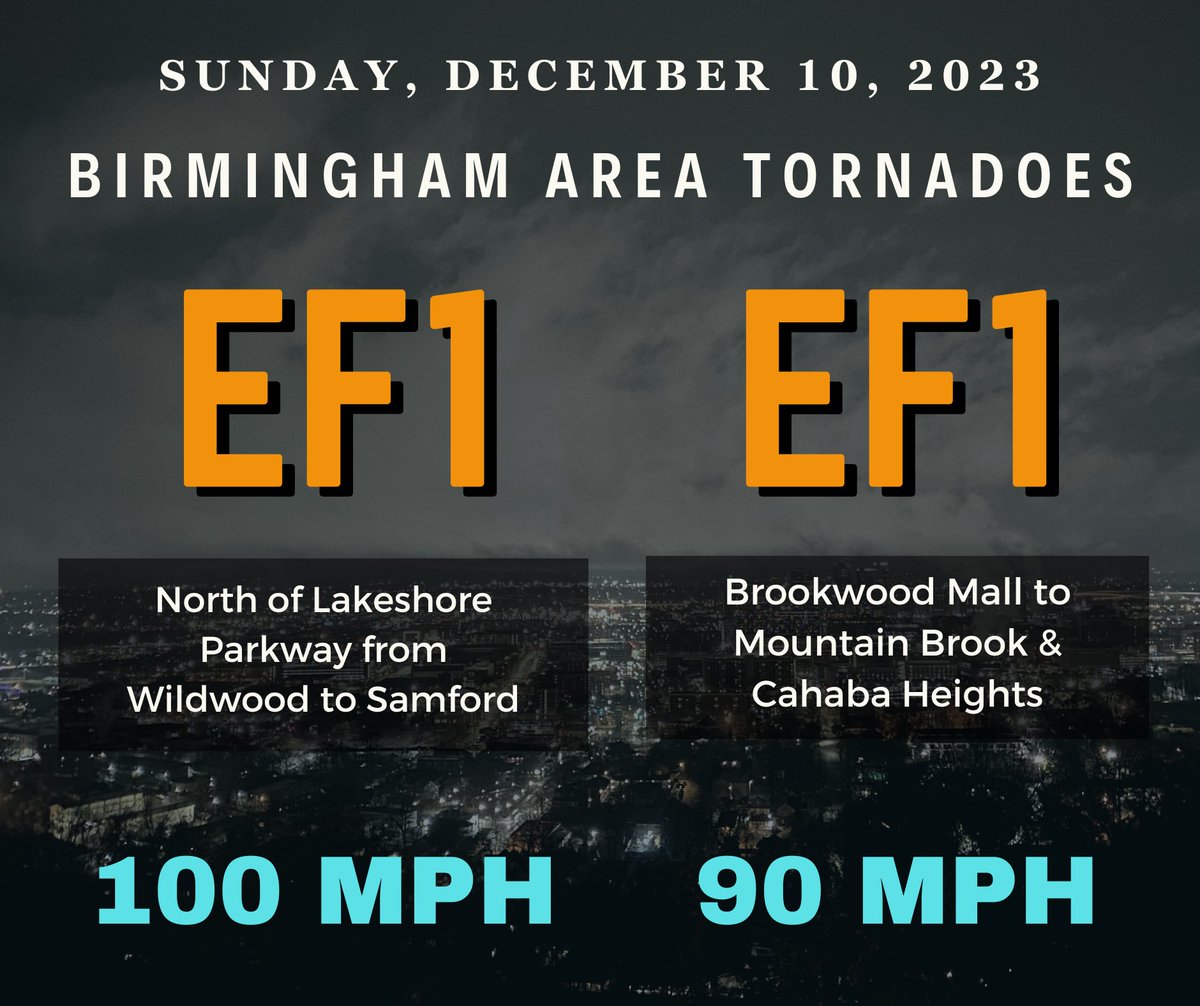
Survey Update from Sat night's storms in Jefferson County: Two short tornado tracks have been confirmed: (1) Just north of Lakeshore Pkwy from generally Wildwood to Samford - EF1/100mph. (2) From Brookwood Mall into Cahaba Heights - EF1/90mph. More details to come. #ALwx

Lauren Linahan (@laurenlinahan) 's Twitter Profile Photo

Absolutely surreal! 🤩 Northern lights spotted all the way down in Alabama over Tuscaloosa and Logan Martin Lake. 📸: Lorrie Lane, Judy Davis, & Suzanne Sciveley | #alwx WBRC 6 News

Absolutely surreal! 🤩 Northern lights spotted all the way down in Alabama over Tuscaloosa and Logan Martin Lake.

📸: Lorrie Lane, Judy Davis, &amp; Suzanne Sciveley | #alwx <a href="/WBRCnews/">WBRC 6 News</a>