Jonathan Van Dusen (@jevandusen) 's Twitter Profile
Jonathan Van Dusen

@jevandusen

Passionate about GIS & design for social/enviro issues. UI+UX dabbler, tech generalist, music nerd. Higher Ed. Specialist at Esri Canada; views my own; he/him.

ID: 73139633

calendar_today10-09-2009 15:21:34

3,3K Tweet

484 Takipçi

1,1K Takip Edilen

Jonathan Van Dusen (@jevandusen) 's Twitter Profile Photo

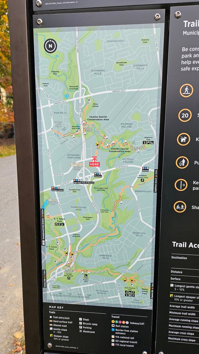
Nice new signage and wayfinding at the entrance to the East Don River Trail near me. Makes the trail feel like an important piece of infrastructure, which of course it is.

Nice new signage and wayfinding at the entrance to the East Don River Trail near me. Makes the trail feel like an important piece of infrastructure, which of course it is.
Vote Norm Di Pasquale Spadina-Harbourfront NDP🇨🇦 (@normsworld) 's Twitter Profile Photo

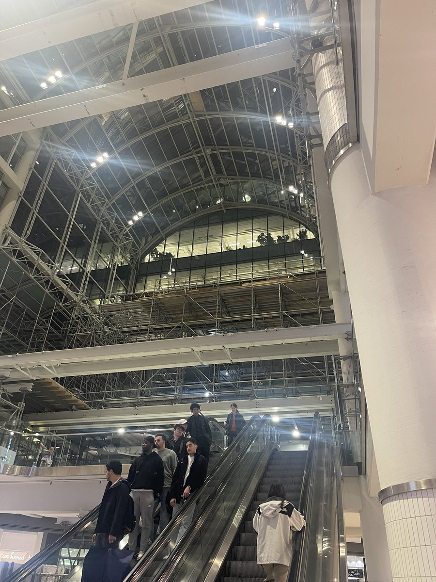
Eaton Centre still repairing their roof while the mall stays open. Do they have technology that the Ford Government doesn’t possess, or did the govt shut the Science Centre with the roof repair as a convenient excuse? #topoli #onpoli

Eaton Centre still repairing their roof while the mall stays open. Do they have technology that the Ford Government doesn’t possess, or did the govt shut the Science Centre with the roof repair as a convenient excuse? #topoli #onpoli
Mayor Olivia Chow 🇨🇦 (@mayoroliviachow) 's Twitter Profile Photo

Today, I joined Elder Shelley Charles of the Chippewas of Georgina Island First Nation, Waterfront Toronto, ausma malik and Paula Fletcher to announce the name of the new island in the Port Lands — Ookwemin Minising, Anishinaabemowin for “place of the black cherry trees.”
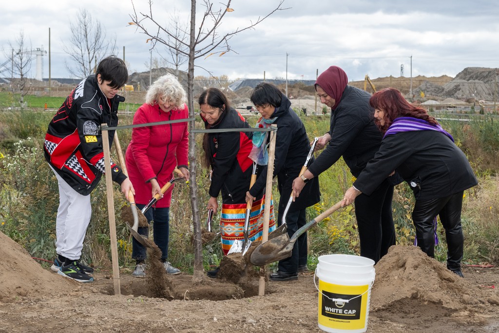
Today, I joined Elder Shelley Charles of the Chippewas of Georgina Island First Nation, <a href="/WaterfrontTO/">Waterfront Toronto</a>, <a href="/ausmalik/">ausma malik</a> and <a href="/PaulaFletcherTO/">Paula Fletcher</a> to announce the name of the new island in the Port Lands — Ookwemin Minising,  Anishinaabemowin for “place of the black cherry trees.”
Warren Davison (@warrendz) 's Twitter Profile Photo

Ever been working in ArcGIS StoryMaps and wondered where else is this layer used, what other stories use this map, or what apps have I embedded in my stories? Wonder no more. My talented colleague has created a #Python tool to inventory your content and find related items.
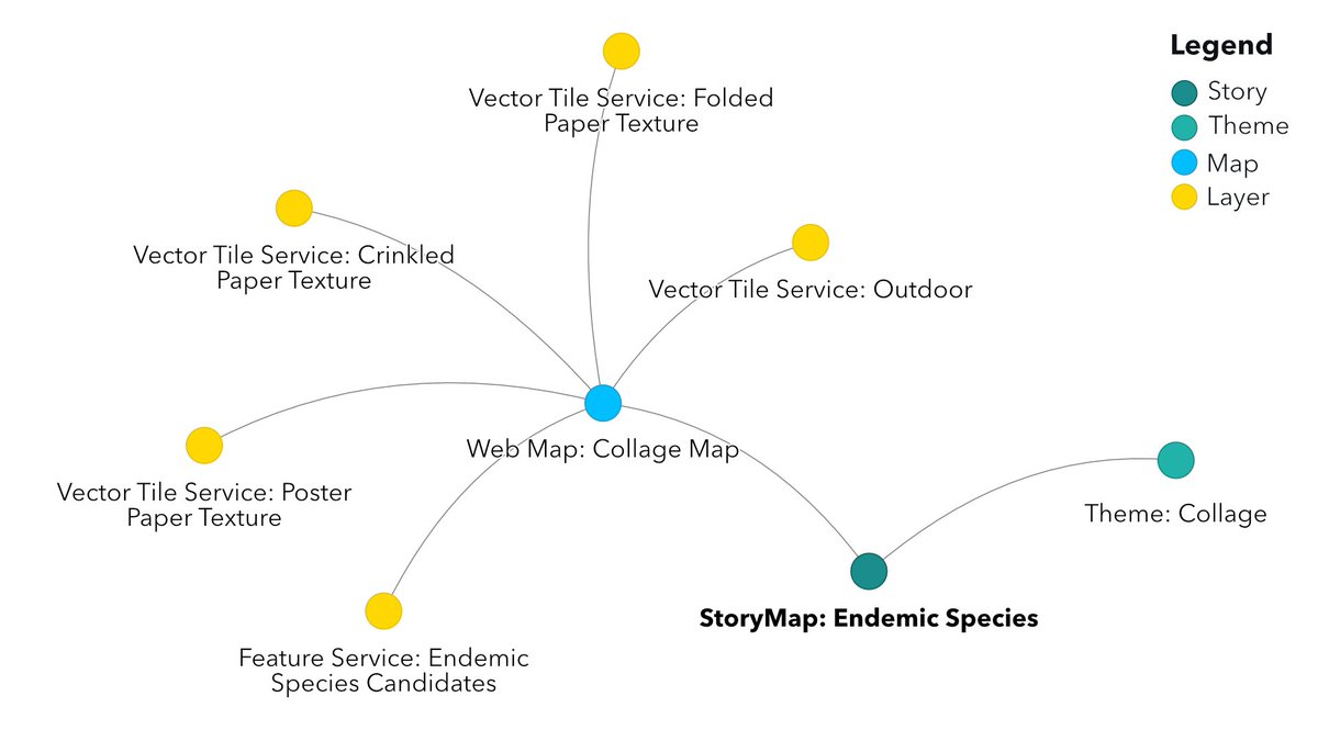
Ever been working in <a href="/ArcGISStoryMaps/">ArcGIS StoryMaps</a> and wondered where else is this layer used, what other stories use this map, or what apps have I embedded in my stories?

Wonder no more. My talented colleague has created a #Python tool to inventory your content and find related items.
Angela Alexander, FRCGS (she/her) (@angealexander88) 's Twitter Profile Photo

Happy #GeographyAwarenessWeek! Congrats Ms. C.Bettio on the #MakingaDiffferenceAward! It was wonderful to see you today at the Esri Canada office. #ChampionTeacher #OntheMap #GIS #ArcGISStoryMaps #ArcGIS #engagestudentswithmaps #mapping #community #GISDay #MapsMatter

GIS in Education (@gis4teachers) 's Twitter Profile Photo

Thank you @MAEEChaput on your talk at the Esri Canada #GISDay event. It was great to hear about @CanGeoEdu Royal Canadian Geographical Society efforts in enhancing the #geography curriculum to strengthen #criticalthinking skills, helping students understand our world and their role in it. #GIS #mapping
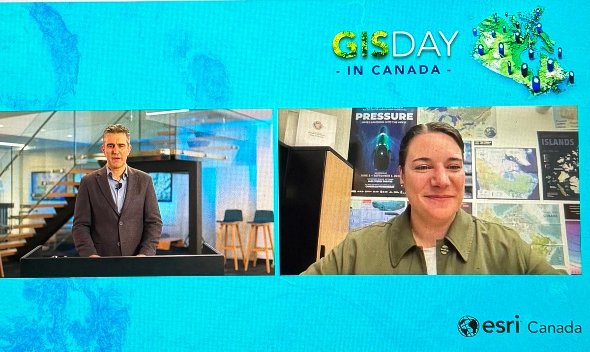
Thank you @MAEEChaput on your talk at the <a href="/esricanada/">Esri Canada</a> #GISDay event. It was great to hear about @CanGeoEdu <a href="/RCGS_SGRC/">Royal Canadian Geographical Society</a> efforts in enhancing the #geography curriculum to strengthen #criticalthinking skills, helping students understand our world and their role in it. #GIS #mapping
Esri Canada (@esricanada) 's Twitter Profile Photo

GIS helps Indigenous communities preserve culture, protect land and assert sovereignty. From mapping traditional knowledge to visualizing historical impacts, it fosters self-determination and data sovereignty. See how communities are leading change. 👉 esri.social/kc4z50UfmeA

GIS helps Indigenous communities preserve culture, protect land and assert sovereignty. From mapping traditional knowledge to visualizing historical impacts, it fosters self-determination and data sovereignty. See how communities are leading change. 
👉 esri.social/kc4z50UfmeA
Laura Stone (@l_stone) 's Twitter Profile Photo

NEW: Ontario Place redevelopment now estimated at $2.2-billion as Auditor-General notes ‘irregular’ bid process /via Jeff Gray & me #onpoli theglobeandmail.com/canada/article…

Alex Bozikovic (@alexbozikovic) 's Twitter Profile Photo

Doug Ford spent $2.2-billion to destroy the Science Centre and Ontario Place. It is sickening. The waste, the dishonesty, the missed opportunity.

GIS for Higher Education and Research (@gis4hed) 's Twitter Profile Photo

Check out this interesting blog by our own, Kendra Munn, on the use of ArcGIS Data Pipelines that supports the creation of reproducible, no-code data preparation workflows, making it accessible to users without extensive programming experience! #DataEngineering #Cloud

Jinglai He 🇨🇦 (@jinglaihe) 's Twitter Profile Photo

608 votes are what stopped a 172 seat Liberal Majority Government. 608 votes.. - NDP won in Nunavut by 77 votes. - CPC won another riding by 238 votes. - CPC won another riding by 298 votes. Never ever let anyone tell you that your vote doesn't matter, because it clearly does.