Jason Dunning (@jasondunning) 's Twitter Profile
Jason Dunning

@jasondunning

Morning Meteorologist at Gulf Coast News in SWFL• weather geek and Florida Gator fanatic • UF and MSU alum • Thoughts and opinions are my own •

ID: 303944623

linkhttp://nbc-2.com/weather calendar_today23-05-2011 17:39:15

10,10K Tweet

4,4K Takipçi

2,2K Takip Edilen

Jason Dunning (@jasondunning) 's Twitter Profile Photo

I see you 👀 This adorable Burrowing Owl in Cape Coral seems to know it's being watched and is putting on a show🦉😂 Thanks to Cindy Felice for sharing! Gulf Coast News #swfl

NHC_TAFB (@nhc_tafb) 's Twitter Profile Photo

5/30 - A massive plume of Saharan dust is sweeping across the tropical Atlantic, with the densest layer currently situated between Africa and the Lesser Antilles. This dry, dusty air suppresses thunderstorm development, reduces visibility and can cause respiratory problems.

5/30 - A massive plume of Saharan dust is sweeping across the tropical Atlantic, with the densest layer currently situated between Africa and the Lesser Antilles. This dry, dusty air suppresses thunderstorm development, reduces visibility and can cause respiratory problems.
Jason Dunning (@jasondunning) 's Twitter Profile Photo

GULF COAST WEATHER IMPACT DAY⚠️ 🔴Heavy rain & flood threat increasing for #swfl Will need to watch for training bands of heavy rain today, which could put out 3-5" in some neighborhoods. Count on Gulf Coast News to keep you updated.
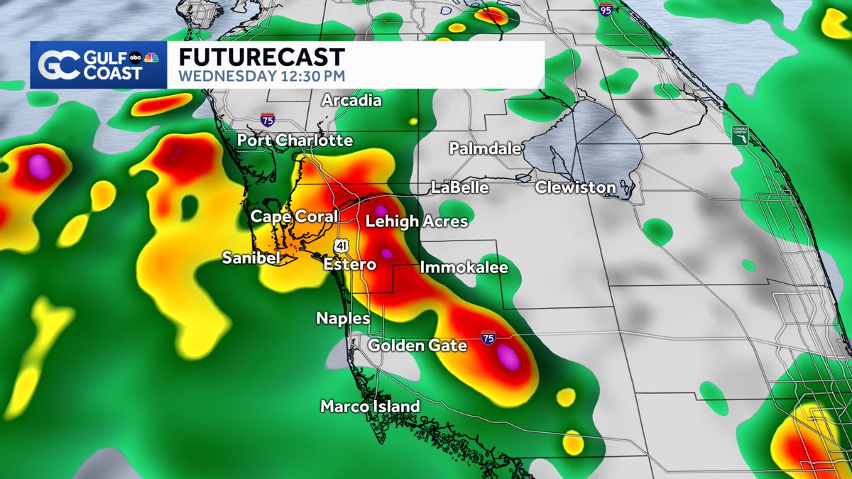
GULF COAST WEATHER IMPACT DAY⚠️
🔴Heavy rain & flood threat increasing for #swfl
Will need to watch for training bands of heavy rain today, which could put out 3-5" in some neighborhoods. 
Count on <a href="/GCNNow/">Gulf Coast News</a> to keep you updated.
NWS Miami (@nwsmiami) 's Twitter Profile Photo

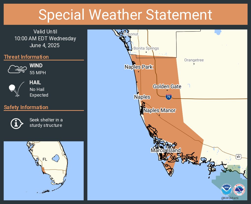
Radar Update: A large squall line is approaching the Naples metro with the potential of heavy rainfall and a few wind gusts of 40-55 mph *if* it holds together in intensity. We will be watching, have a way to receive NWS alerts as needed.

Jason Dunning (@jasondunning) 's Twitter Profile Photo

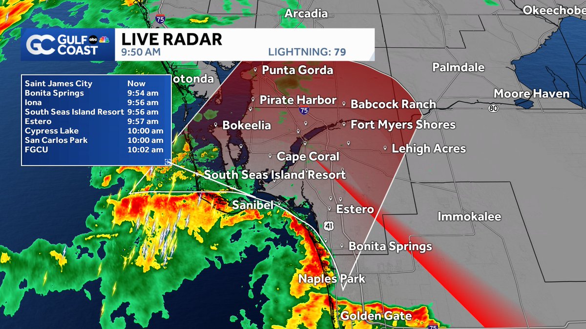
Heads up Collier County! Tracking a squall line on the Gulf Coast Live Radar racing toward Marco Island and arriving in the next hour. Some strong wind gusts above 40 mph possible along with heavy rain and lightning. Gulf Coast News

Heads up Collier County! Tracking a squall line on the Gulf Coast Live Radar racing toward Marco Island and arriving in the next hour. Some strong wind gusts above 40 mph possible along with heavy rain and lightning. 
<a href="/GCNNow/">Gulf Coast News</a>
Philip Klotzbach (@philklotzbach) 's Twitter Profile Photo

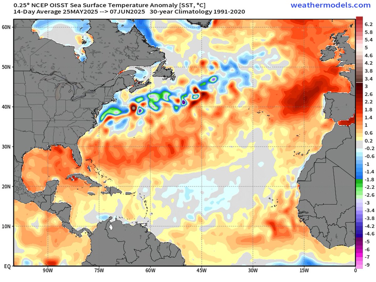
Atlantic seasonal #hurricane forecast update from Colorado State University continues call for an above-normal season: 17 named storms, 9 hurricanes & 4 major hurricanes. Relatively warm Atlantic and likely absence of #ElNino are the primary factors. tropical.colostate.edu/Forecast/2025-…

Atlantic seasonal #hurricane forecast update from <a href="/ColoradoStateU/">Colorado State University</a> continues call for an above-normal season: 17 named storms, 9 hurricanes &amp; 4 major hurricanes. Relatively warm Atlantic and likely absence of #ElNino are the primary factors.

tropical.colostate.edu/Forecast/2025-…
Jason Dunning (@jasondunning) 's Twitter Profile Photo

Active afternoon/evening on the Gulf Coast Live Radar as heavy rain and strong storms expand north into Lee County ⛈️ A lot more rain on the way this week!

Active afternoon/evening on the Gulf Coast Live Radar as heavy rain and strong storms expand north into Lee County ⛈️ 

A lot more rain on the way this week!
Tommy House (@tommyhousewx) 's Twitter Profile Photo

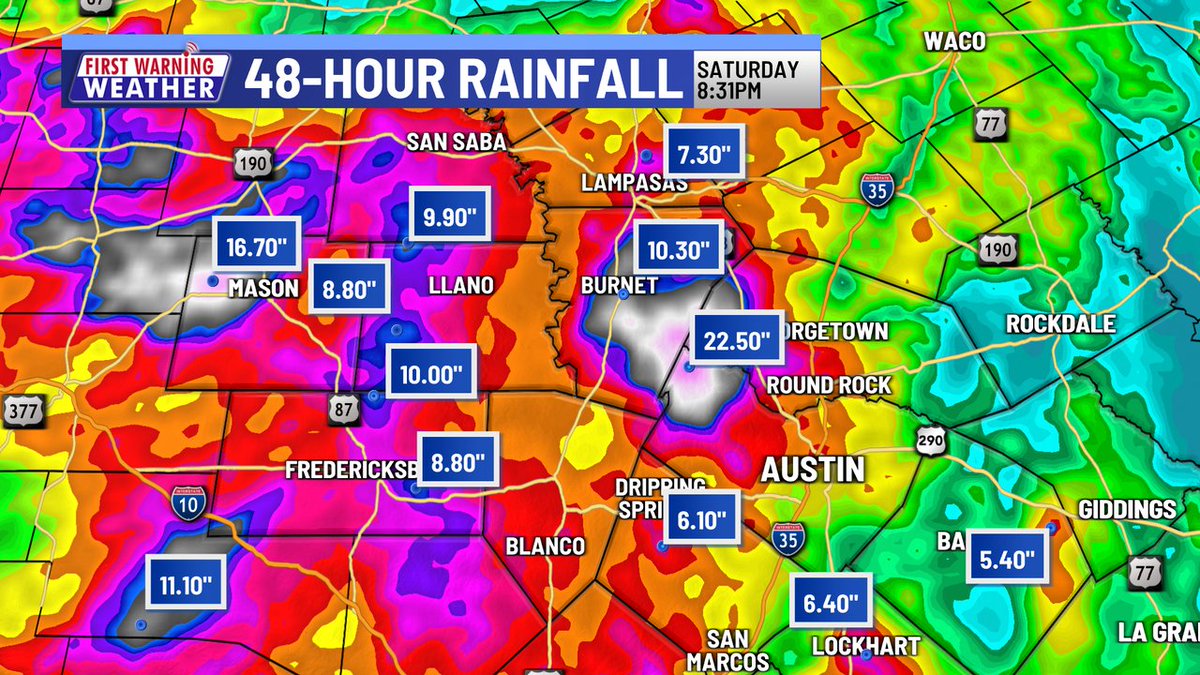
48-hour rain totals in Central Texas, look at some of these amounts! LCRA rain gauge highest totals - 19.8" (Bertram 8 SSW), 18.08" (Marble Falls 14 ESE), 16.83" (Mason 13 WNW), 13.74" (Burnet 1 WSW). WOW!

48-hour rain totals in Central Texas, look at some of these amounts! LCRA rain gauge highest totals - 19.8" (Bertram 8 SSW), 18.08" (Marble Falls 14 ESE), 16.83" (Mason 13 WNW), 13.74" (Burnet 1 WSW). WOW!