Paulsen (@bochen_szu) 's Twitter Profile
Paulsen

@bochen_szu

ID: 602631969

calendar_today08-06-2012 07:29:21

107 Tweet

22 Takipçi

96 Takip Edilen

GNS Science Te Pū Ao (@gnsscience) 's Twitter Profile Photo

New GNS Science video: an updated version of the earthquake and tsunami computer models of the Kaikoura Quake: youtu.be/1DybzjUsjN0

NASA Climate (@nasaclimate) 's Twitter Profile Photo

Btwn 2002 & 2016, Greenland shed ~280 gigatons of ice/year, causing 0.03in (0.8 mm)/year of global #sealevelrise: climate.nasa.gov/climate_resour…

ESA Earth Observation (@esa_eo) 's Twitter Profile Photo

🛰️❄️ #Sentinel1-B witnesses a behemoth #iceberg, twice the size of Luxembourg, breaking off the #LarsenC ice shelf: esa.int/Our_Activities…

🛰️❄️ #Sentinel1-B witnesses a behemoth #iceberg, twice the size of Luxembourg, breaking off the #LarsenC ice shelf: esa.int/Our_Activities…
NASA (@nasa) 's Twitter Profile Photo

Four spacecraft that orbit in the magnetic bubble surrounding Earth are starting a new mission phase. From new heights, they will study the Sun-facing side of Earth’s magnetic environment. Get the details from NASA Sun & Space: go.nasa.gov/2myvoXQ

Nature Geoscience (@naturegeosci) 's Twitter Profile Photo

New #GeoSketchUp: catastrophic glacier collapse in Tibet. Thanks again to James Tuttle Keane! nature.com/articles/s4156…, Read the full paper here: rdcu.be/Fl7i
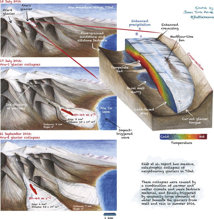
New #GeoSketchUp: catastrophic glacier collapse in Tibet. Thanks again to <a href="/jtuttlekeane/">James Tuttle Keane</a>! nature.com/articles/s4156…, Read the full paper here: rdcu.be/Fl7i
EarthScope Consortium (@earthscope_sci) 's Twitter Profile Photo

Watch the earthquake waves from the M7.9 Alaska earthquake cross the USArray (usarrya.org)! #AlaskaEarthquake #earthquake ds.iris.edu/ds/products/gm…

Jascha Polet (@cppgeophysics) 's Twitter Profile Photo

Although I have seen a few reports of this being a "seismic gap" rupturing subduction interface event, today's quake did not occur near a gap (map from mappingignorance.org/2017/09/22/wha… red/white circle approximate location of today's M7.2)

Although I have seen a few reports of this being a "seismic gap" rupturing subduction interface event, today's quake did not occur near a gap (map from mappingignorance.org/2017/09/22/wha… red/white circle approximate location of today's M7.2)
Dr Janine Krippner (@janinekrippner) 's Twitter Profile Photo

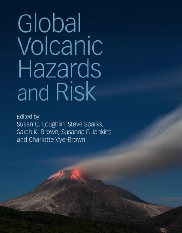
Want to learn more about volcano hazards & risk around the world? You can download 'Global volcanic hazards and risk' here: globalvolcanomodel.org/wp-content/upl… #VolcanoCup

Want to learn more about volcano hazards &amp; risk around the world? You can download 'Global volcanic hazards and risk' here: globalvolcanomodel.org/wp-content/upl… #VolcanoCup
ESA Earth Observation (@esa_eo) 's Twitter Profile Photo

Our burning of fossil fuels and forests 🌲🌳 has caused the amount of carbon dioxide in the air to increase by 3⃣0⃣ % since the start of the Industrial Revolution. This presents a major upset to the balance of the natural carbon cycling process. bit.ly/2CFZhv5

Yu Morishita (@yu__morishita) 's Twitter Profile Photo

ALOS-2 InSAR for #PNGearthquake. Deformation area extends with the length of ~170 km in NW-SE direction. The largest deformation occurred at SE part, around Lake Kutubu. gsi.go.jp/cais/topic1803…

ALOS-2 InSAR for #PNGearthquake. Deformation area extends with the length of ~170 km in NW-SE direction. The largest deformation occurred at SE part, around Lake Kutubu. gsi.go.jp/cais/topic1803…
Sensing Our Planet (@sensingrplanet) 's Twitter Profile Photo

Warnings from the ionosphere: Following Japan’s devastating March 2011 Tohoku #earthquake and #tsunami, researchers use #GPS to spot atmospheric waves that might help generate earlier tsunami warnings. goo.gl/imRo7D NASA JPL Attila Komjathy @vizcarran #CDDIS #geodesy

Warnings from the ionosphere: Following Japan’s devastating March 2011 Tohoku #earthquake and #tsunami, researchers use #GPS to spot atmospheric waves that might help generate earlier tsunami warnings. goo.gl/imRo7D <a href="/NASAJPL/">NASA JPL</a> <a href="/Komjathy/">Attila Komjathy</a> @vizcarran #CDDIS #geodesy
ESA Earth Observation (@esa_eo) 's Twitter Profile Photo

Created to study 🌍 #gravity, the #GOCE mission flies at a low orbit and that's what allowed it to feel the perturbation in air density caused by the massive #Japan #earthquake in 2011: bit.ly/2FZOZJz

National Weather Service (@nws) 's Twitter Profile Photo

What is a #tsunami? A series of waves that can strike anywhere on a coast, any time. nws.noaa.gov/om/Tsunami/abo… #TsunamiPrep

What is a #tsunami? A series of waves that can strike anywhere on a coast, any time. nws.noaa.gov/om/Tsunami/abo… #TsunamiPrep
Paulsen (@bochen_szu) 's Twitter Profile Photo

Our new #ISPRS paper on monitoring dynamics of the long-span bridge with a ground-based radar, more information here: authors.elsevier.com/c/1WhOP3I9x1V1…

Our new #ISPRS paper on monitoring dynamics of the long-span bridge with a ground-based radar, more information here: authors.elsevier.com/c/1WhOP3I9x1V1…