Mark Sudduth (@hurricanetrack) 's Twitter Profile
Mark Sudduth

@hurricanetrack

Weather documentarian. Geographer. Crowdfunded via Patreon. Storm Tracker for Fox Weather. Lots on YouTube.com/hurricanetrack

ID: 18581009

linkhttp://www.hurricanetrack.com calendar_today03-01-2009 15:53:53

31,31K Tweet

70,70K Takipçi

200 Takip Edilen

Mark Sudduth (@hurricanetrack) 's Twitter Profile Photo

Canterbury Townhomes in Carrboro, NC Pics sent to my son by his friend. My son’s townhouse is close by but not flooded. Needless to say, this has been a very bad weekend for flooding due to remnants of tropical cyclones. FOX Weather
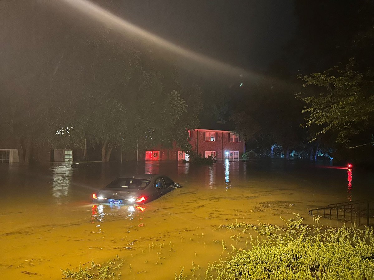
Canterbury Townhomes in Carrboro, NC 

Pics sent to my son by his friend. My son’s townhouse is close by but not flooded. 

Needless to say, this has been a very bad weekend for flooding due to remnants of tropical cyclones. 

<a href="/foxweather/">FOX Weather</a>
Greg Diamond (@gdimeweather) 's Twitter Profile Photo

For the first time since May 19, there are no active systems nor outlook areas in the Eastern Pacific. Since that time, the basin has produced 6 storms, 3 hurricanes and 2 major hurricanes. It's the most active start to the season on record in the basin

National Hurricane Center (@nhc_atlantic) 's Twitter Profile Photo

8pm EDT July 14: An area of low pressure off the east Florida Peninsula coast (Invest #93L) now has a medium chance (30%🟡2-day / 40%🟠7-day) of becoming a tropical cyclone as it moves westward into northeastern portion of the Gulf. Regardless of formation, heavy rainfall could

8pm EDT July 14: An area of low pressure off the east Florida Peninsula coast (Invest #93L) now has a medium chance (30%🟡2-day / 40%🟠7-day) of becoming a tropical cyclone as it moves westward into northeastern portion of the Gulf.

Regardless of formation, heavy rainfall could
Mark Sudduth (@hurricanetrack) 's Twitter Profile Photo

Latest on 93L with posts cited from Ben Noll Jarrod Maloney as we watch for a potentially big rainmaker for Florida and eventually the northern Gulf Coast youtu.be/fzzF2jYe5Yc?si…

Latest on 93L with posts cited from <a href="/BenNollWeather/">Ben Noll</a> <a href="/WeatherVoyage/">Jarrod Maloney</a> as we watch for a potentially big rainmaker for Florida and eventually the northern Gulf Coast 

youtu.be/fzzF2jYe5Yc?si…
Mark Sudduth (@hurricanetrack) 's Twitter Profile Photo

Live on YouTube chatting with some of our pals about storm chasing and the remainder of the hurricane season. youtube.com/watch?v=-pqbhO…

Dylan Federico (@dylanfedericowx) 's Twitter Profile Photo

INVEST #93L is now in the Gulf tonight. How far it tracks offshore will be the deciding factor as to whether or not this becomes Tropical Storm #Dexter before landfall in Louisiana on Friday. Either way, heavy flooding rain is the main threat. #TropicalUpdate #lawx 🌀

Mark Sudduth (@hurricanetrack) 's Twitter Profile Photo

Likely the best SpaceX launch my cam has ever captured. This is from Rodanthe NC early this morning as the rocket trajectory took it toward the rising sun. FOX Weather

Mark Sudduth (@hurricanetrack) 's Twitter Profile Photo

The hurricane that really started it all for me waaaaaay back in 1984. As a teen in middle school, it was exciting and scary at the same time. My science teacher tracked it on a paper map right there in the classroom and each day it became more serious. I was hooked.