Ethan Clark wx (@ethanclarkwx) 's Twitter Profile
Ethan Clark wx

@ethanclarkwx

@NCState ‘25| Meteorologist for @RaleighGov and Intern for @WRAL| Founder of North Carolina’s Weather Authority with over 370k followers on FB|

ID: 782396724316954624

linkhttps://m.facebook.com/ncweatherauthority/ calendar_today02-10-2016 01:48:10

7,7K Tweet

5,5K Followers

5,5K Following

Jim Cantore (@jimcantore) 's Twitter Profile Photo

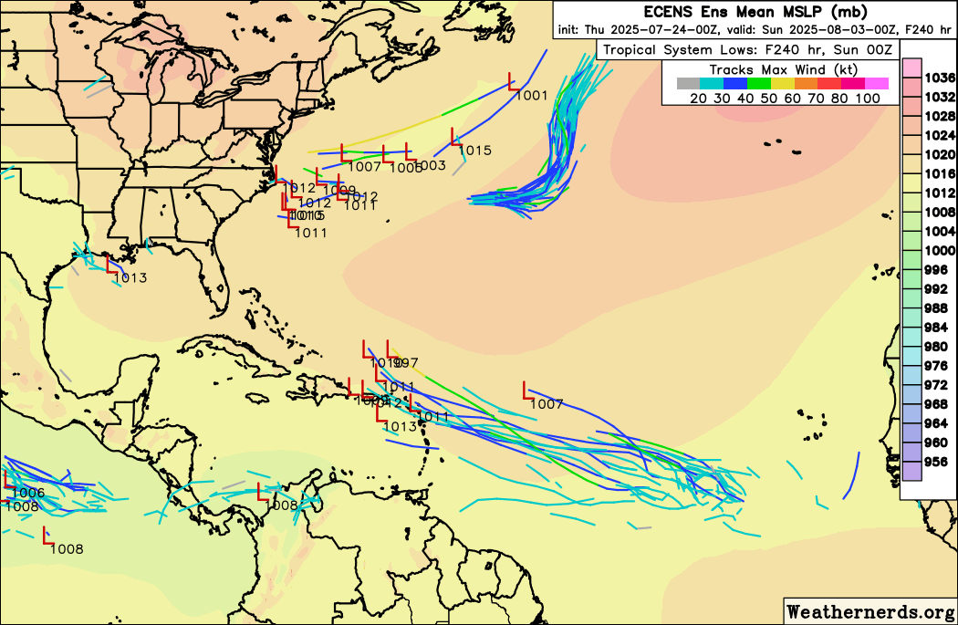
Since we need to watch the entire basin this time of the year, a front will sit off the southeast coast next week. Guidance for a couple days now is trying to develop something here that could take on tropical characteristics.

Jamie Arnold WMBF (@jamiearnoldwmbf) 's Twitter Profile Photo

HOME GROWN TROPICAL DEVELOPMENT NEXT WEEK? We're getting into the time of the year when these fall cold fronts can stall off shore and become a breeding ground for tropical systems. That may be the case early next week as the overall weather pattern suggests something may try

HOME GROWN TROPICAL DEVELOPMENT NEXT WEEK?  We're getting into the time of the year when these fall cold fronts can stall off shore and become a breeding ground for tropical systems.  That may be the case early next week as the overall weather pattern suggests something may try
Garrett Harvey (@weathergarrett) 's Twitter Profile Photo

Another indicator for decent strengthening with #Francine is vertical hot towers (VHTs hinted by very cold and deep convection) now beginning to develop (G16 Meso 1) and wrap around the cyclone. Makes for a very unpleasant ride for Hurricane Hunters and we'll see more data soon.

Eric Webb (@webberweather) 's Twitter Profile Photo

This sonde’s wind profile was pretty interesting to see a little while ago. Notice how much stronger the winds were closer to the surface, esp below 900mb. This was likely hinting at the onset of some top-down vortex weakening, with the mid-level vortex weakening slightly

This sonde’s wind profile was pretty interesting to see a little while ago. 

Notice how much stronger the winds were closer to the surface, esp below 900mb. This was likely hinting at the onset of some top-down vortex weakening, with the mid-level vortex weakening slightly
Mark Sudduth (@hurricanetrack) 's Twitter Profile Photo

So, somebody stole this equipment off of the bridge at Amelia that was set up to capture weather data during the hurricane. Absolutely bonkers that someone cares so little. If anybody sees either of those two pieces of equipment, please let me know. What a crying shame. And to

Eric Webb (@webberweather) 's Twitter Profile Photo

The overall structure of Hurricane #Francine has improved significantly over the last several hours, with subsidence warming from prior upshear convective bursts helping to clear the eye. The HDC radar also shows a lot of 95-100+ knot bins ~3km above ground level in #Francine’s

The overall structure of Hurricane #Francine has improved significantly over the last several hours, with subsidence warming from prior upshear convective bursts helping to clear the eye.

The HDC radar also shows a lot of 95-100+ knot bins ~3km above ground level in #Francine’s
Tim Buckley (@timbuckleywx) 's Twitter Profile Photo

Conditions deteriorating on Lake Pontchartrain in New Orleans. You can see the choppy waters spilling over as it begins to get gusty. #Francine #lawx

Conditions deteriorating on Lake Pontchartrain in New Orleans. 
You can see the choppy waters spilling over as it begins to get gusty.  #Francine #lawx
Tim Buckley (@timbuckleywx) 's Twitter Profile Photo

We are on track for some heavy rain across North Carolina on Tuesday. Still fine tuning how much and exactly where, but 1"+ is possible for some. Gusty winds more of an issue for E NC but 30+ gusts can't be ruled out in the Piedmont. Storm could be tropical or non-tropical.

We are on track for some heavy rain across North Carolina on Tuesday. 
Still fine tuning how much and exactly where, but 1"+ is possible for some. 
Gusty winds more of an issue for E NC but 30+ gusts can't be ruled out in the Piedmont. 
Storm could be tropical or non-tropical.
Shea Gibson (@sheagibsonwx) 's Twitter Profile Photo

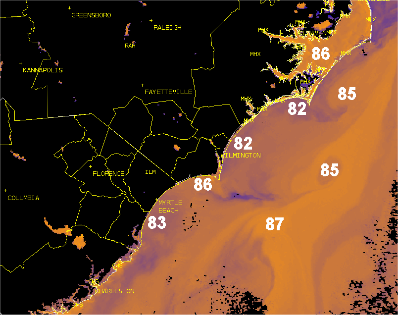
One problem I have with the GFS deepening a coastal Low to tropical status over the coastal shelf so quickly is the fact that SST's are only mid to upper 70's (74° at Cape Fear). The Gulf Stream is low 80's, but sits along the western flank of where cyclogenesis would occur.

One problem I have with the GFS deepening a coastal Low to tropical status over the coastal shelf so quickly is the fact that SST's are only mid to upper 70's (74° at Cape Fear). The Gulf Stream is low 80's, but sits along the western flank of where cyclogenesis would occur.
Ethan Clark wx (@ethanclarkwx) 's Twitter Profile Photo

Impressive video just shared with me from Bald Head Island of a waterspout moving onshore around 1145AM this morning. #ncwx NWS Wilmington, NC Video from a follower, Courtney Atkins

National Hurricane Center (@nhc_atlantic) 's Twitter Profile Photo

11pm EDT 9/15 Key Messages on Potential Tropical Cyclone #Eight: Tropical storm conditions are expected through tomorrow night for portions of coastal South & North Carolina, along with the possibility of flash flooding from heavy rainfall More: hurricanes.gov

11pm EDT 9/15 Key Messages on Potential Tropical Cyclone #Eight: Tropical storm conditions are expected through tomorrow night for portions of coastal South & North Carolina, along with the possibility of flash flooding from heavy rainfall

More: hurricanes.gov
Ethan Clark wx (@ethanclarkwx) 's Twitter Profile Photo

Significant Flash Flooding is ongoing across Bald Head Island; nearly 10 inches of rain has fallen since midnight. Flooding is beginning to enter some homes around the island, especially lower levels. Village of Bald Head Island NWS Wilmington, NC Video from my friend Jack Knott #ncwx

Ethan Clark wx (@ethanclarkwx) 's Twitter Profile Photo

Flash Flooding is ongoing across Village of Bald Head Island. I’ve received nearly 12 inches of rain since midnight at my station on the East End of Bald Head Island. #ncwx NWS Wilmington, NC Photos/Videos: Jack Knott