Tolga Gorum (@tolgagorum) 's Twitter Profile
Tolga Gorum

@tolgagorum

Geomorphologist / @itu1773 / @itu_aybe / @SLATE_Landslide / @shaken_g6190

ID: 2426110308

linkhttps://geohazard.itu.edu.tr/ calendar_today03-04-2014 19:52:07

889 Tweet

1,1K Followers

852 Following

Dave Petley (@davepetley) 's Twitter Profile Photo

This link provides amazing aerial imagery of the landslide accident in Switzerland on Friday, The quality of the imagery is extraordinary, providing real insight into the series of events.

Dave Petley (@davepetley) 's Twitter Profile Photo

Satellite images by @Planet show that a c.1.3 km long landslide has occurred at a heap leach pad at Eagle Gold Mine in the Yukon, Canada:- eos.org/thelandslidebl…

Satellite images by @Planet show that a c.1.3 km long landslide has occurred at a heap leach pad at Eagle Gold Mine in the Yukon, Canada:- eos.org/thelandslidebl…
Emrah Çoraman (@coraman) 's Twitter Profile Photo

6-8 Kasım tarihleri arasında 11. Türkiye Kuvaterner Sempozyumu için İTÜ'de (İTÜ - İstanbul Teknik Üniversitesi ) bir araya geliyoruz. Ekolojiden iklime, buzullardan sedimantolojiye kadar birçok farklı konuda konuşmalar olacak. Katılım ücretsiz. Haberdar olmak için hemen kaydolun🤗 turqua.itu.edu.tr/kayit

6-8 Kasım tarihleri arasında 11. Türkiye Kuvaterner Sempozyumu için İTÜ'de (<a href="/itu1773/">İTÜ - İstanbul Teknik Üniversitesi</a> ) bir araya geliyoruz. Ekolojiden iklime, buzullardan sedimantolojiye kadar birçok farklı konuda konuşmalar olacak. Katılım ücretsiz. Haberdar olmak için hemen kaydolun🤗 turqua.itu.edu.tr/kayit
Olivier Dewitte (@olivierdewitte3) 's Twitter Profile Photo

You need data on #landslide and #flashflood events? But #machineLearning does not work! Check out the work by Axel Deijns on our new #satellite based methodology developed in #Africa! The AfricaMuseum VUB Belgian Earth Observation #georiska

You need data on #landslide and #flashflood events? But #machineLearning does not work! 

Check out the work by <a href="/deijns_axel/">Axel Deijns</a> on our new #satellite based methodology developed in #Africa!

<a href="/africamuseumbe/">The AfricaMuseum</a> <a href="/VUBrussel/">VUB</a> <a href="/BelgianEO/">Belgian Earth Observation</a>
#georiska
Brian (@brianmenounos) 's Twitter Profile Photo

Here’s an elevation change map of the Chilcotin landslide using pre and post event lidar. Estimated volume about 6x10^6 m^3. Map and comparison by Hakai Institute, flown by KÎSIK, data GeoBC

Here’s an elevation change map of the Chilcotin landslide using pre and post event lidar. Estimated volume about 6x10^6 m^3. Map and comparison  by <a href="/HakaiInstitute/">Hakai Institute</a>, flown by KÎSIK, data GeoBC
Brent Ward 🇺🇦 (@geobrentatlarge) 's Twitter Profile Photo

Drone image from the Chilcotin landslide dam from the B.C. government site from August 4. Looking towards the headscarp and you can see the lake is getting close to overtopping. Some people for scale at the bottom of the image! It is big!

Drone image from the Chilcotin landslide dam from the B.C. government site from August 4. Looking towards the headscarp and you can see the lake is getting close to overtopping. Some people for scale at the bottom of the image! It is big!
Gönenç Göçmengil (@gonencgoc) 's Twitter Profile Photo

İTÜ 250. Yılı vesilesi ile bir büyük bir külliyat çıkardı, buradaki yayınlardan "Bilime Yön Veren İTÜ’lüler" de Celal Şengör, İhsan Ketin'i tanıtan ve çalışmalarını yorumlayan en kapsamlı makalelerden birini yazmış, ilgililer kaçırmasın polen.itu.edu.tr/items/1a328942… #ihsanketin

İTÜ 250. Yılı vesilesi ile bir büyük bir külliyat çıkardı, buradaki yayınlardan "Bilime Yön Veren İTÜ’lüler" de Celal Şengör, İhsan Ketin'i tanıtan ve çalışmalarını yorumlayan en kapsamlı makalelerden birini yazmış, ilgililer kaçırmasın polen.itu.edu.tr/items/1a328942…  #ihsanketin
Tolga Gorum (@tolgagorum) 's Twitter Profile Photo

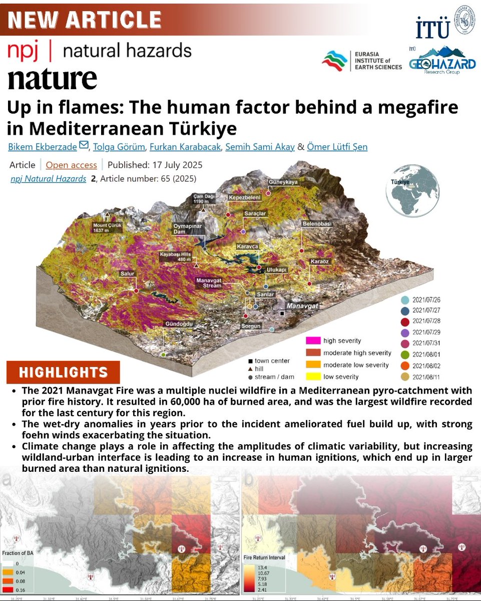
It is a nice piece of work that addresses the long-term erosional impact of wildfires from a Turkish perspective. A comprehensive approach to soil burn severity mapping for erosion sus... sciencedirect.com/science/articl…

It is a nice piece of work that addresses the long-term erosional impact of wildfires from a Turkish perspective. A comprehensive approach to soil burn severity mapping for erosion sus... sciencedirect.com/science/articl…
Tolga Gorum (@tolgagorum) 's Twitter Profile Photo

Bu yöndeki çabalarından dolayı TÜBİTAK TÜBİTAK/ARDEB/BİDEB sonsuz teşekkürler. Bu destekler kapsamında elde edilen çıktılardan çok şey ögrendik ve ögrenmeye devam ediyoruz.

Bu yöndeki çabalarından dolayı <a href="/Tubitak/">TÜBİTAK</a> <a href="/TArdebBideb/">TÜBİTAK/ARDEB/BİDEB</a> sonsuz teşekkürler. Bu destekler kapsamında elde edilen çıktılardan çok şey ögrendik ve ögrenmeye devam ediyoruz.
Nitheshnirmal Sadhasivam (@nitheshnirmal) 's Twitter Profile Photo

This before-and-after satellite image of the #Wayanad landslide shows how deadly the event was, killing nearly 500 people and injuring more than 400. #Kerala Source: Reuters. 😔

Robin Cole (@robmarkcole) 's Twitter Profile Photo

📢TorchGeo 0.6.0 is now released! This adds 18 new datasets, 15 new datamodules, and 27 new pre-trained models, encompassing 11 months of work by 23 contributors 🔥 The mission is for machine learning experts to work with geospatial data, and for remote sensing experts to

📢TorchGeo 0.6.0 is now released!
This adds 18 new datasets, 15 new datamodules, and 27 new pre-trained models, encompassing 11 months of work by 23 contributors 🔥

The mission is for machine learning experts to work with geospatial data, and for remote sensing experts to
Emrah Çoraman (@coraman) 's Twitter Profile Photo

Değerli Yer ve Doğa Bilimciler, Herkesin katılımına yeterli zaman tanımak amacıyla özet gönderim süresi 23 Eylül 2024 tarihine kadar uzatılmıştır. Bu mesajı ilgi duyabilecek meslektaş ve öğrencilerinizle de paylaşabilirseniz seviniriz. 🌍🔨🦇

Değerli Yer ve Doğa Bilimciler,
Herkesin katılımına yeterli zaman tanımak amacıyla özet gönderim süresi 23 Eylül 2024 tarihine kadar uzatılmıştır.
Bu mesajı ilgi duyabilecek meslektaş ve öğrencilerinizle de paylaşabilirseniz seviniriz. 🌍🔨🦇
Dr Robbi Bishop-Taylor 🛰️🌎🌊 (@satellitesci) 's Twitter Profile Photo

Happy to announce the fourth annual update of Geoscience Australia's #DEACoastlines coastal change dataset, featuring new annual shorelines for 2023! 🌊🛰️ Also new: a "layer selector" allowing you to easily switch between rates of change and annual shorelines at any level of zoom! 🗺

Prof. Dr. Hasan Mandal (@profhasanmandal) 's Twitter Profile Photo

✨🐝🔬 İTÜ'de Geleceği Hep Birlikte Geliştirmek ve Yeni Adımlar Atmak İçin Akademisyenlerimizle Bir Araya Geldik! 250 yılı aşkın köklü tarihiyle ülkemizin bilimsel ve akademik ilerleyişinde öncü rol üstlenen İstanbul Teknik Üniversitesi’nin gelişimine katkıda bulunmak ve hep

✨🐝🔬 İTÜ'de Geleceği Hep Birlikte Geliştirmek ve Yeni Adımlar Atmak İçin Akademisyenlerimizle Bir Araya Geldik!

250 yılı aşkın köklü tarihiyle ülkemizin bilimsel ve akademik ilerleyişinde öncü rol üstlenen İstanbul Teknik Üniversitesi’nin gelişimine katkıda bulunmak ve hep
Everest Today (@everesttoday) 's Twitter Profile Photo

A textbook ice avalanche here. Precursory signals before the collapse ‼️, disintegration of the structure 🎳 and transformation from solid mechanics 🧊 to fluid dynamics 🌊 - granular flow ❄️ - and finally: formation of a suspended powder cloud ❄️🌬💨.

Dave Petley (@davepetley) 's Twitter Profile Photo

A new paper in the journal Landslides (Singh and Sepúlveda 2024) suggests that the 12.5 million cubic metre 17 December 2017 Santa Lucía landslide in Chile was caused by an initial wedge failure that subsequently retrogressed through the rock mass. eos.org/thelandslidebl…

A new paper in the journal Landslides (Singh and Sepúlveda 2024) suggests that the 12.5 million cubic metre 17 December 2017 Santa Lucía landslide in Chile was caused by an initial wedge failure that subsequently retrogressed through the rock mass.
eos.org/thelandslidebl…