Drones Made Easy (@dronesmadeeasy) 's Twitter Profile
Drones Made Easy

@dronesmadeeasy

Drones Made Easy - Online map processing and hosting web services and retail with the most technical customer support available.

ID: 2411565452

linkhttp://www.DronesMadeEasy.com calendar_today25-03-2014 21:31:49

1,1K Tweet

1,1K Followers

666 Following

Maps Made Easy (@mapsmadeeasy) 's Twitter Profile Photo

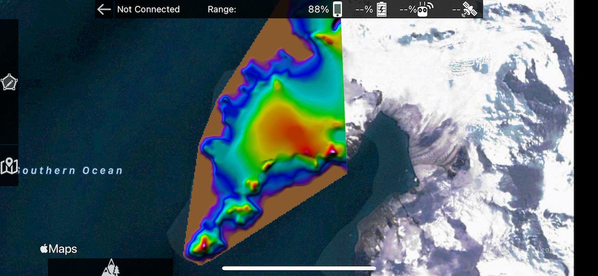
Our new Custom Terrain Data workflow seems to be working well for everyone who has used it. All of our paid subscriptions include a terrain processing that makes it easy to provide your own DEM data. #antarctica #countingpenguins

Our new Custom Terrain Data workflow seems to be working well for everyone who has used it. All of our paid subscriptions include a terrain processing that makes it easy to provide your own DEM data. #antarctica #countingpenguins
Maps Made Easy (@mapsmadeeasy) 's Twitter Profile Photo

Map Pilot Pro v5.1.0 with support for the Autel Robotics Autel EVOII has been released. We look forward to enabling these great cameras with the best data collection tools available.

Maps Made Easy (@mapsmadeeasy) 's Twitter Profile Photo

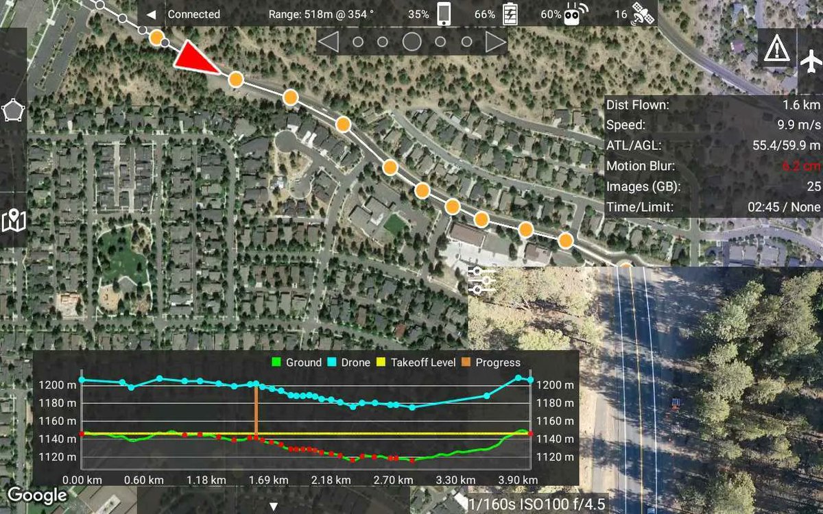
Based on the Autel Robotics EVOII flights being done with Map Pilot Pro it seems there was a pretty big need for Terrain Aware and multi-battery flight planning. Sundance Media Group Drones Made Easy #autel #mapping #drones

Maps Made Easy (@mapsmadeeasy) 's Twitter Profile Photo

Map Pilot Pro v 5.2.0 supports the DJI M300 with H20/H20T and P1 cameras. The dream of quick isothermal mapping and super high resolution photogrammetry is FINALLY here!

Maps Made Easy (@mapsmadeeasy) 's Twitter Profile Photo

Maps Made Easy subscribers now get an even bigger discount on their processing with new Tiered Discounts and the subscription quota counting towards all eligible jobs. Spend a couple bucks on a subscription and save big.

Maps Made Easy (@mapsmadeeasy) 's Twitter Profile Photo

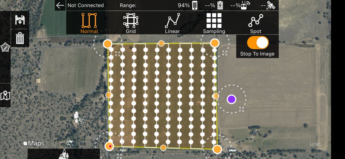
Map Pilot Pro 5.3.0 has been released with our new Stop To Image (STI) feature. This enables zero smear imaging for precision AG and the most demanding targets. apps.apple.com/us/app/map-pil…

Map Pilot Pro 5.3.0 has been released with our new Stop To Image (STI) feature. This enables zero smear imaging for precision AG and the most demanding targets. apps.apple.com/us/app/map-pil…
Maps Made Easy (@mapsmadeeasy) 's Twitter Profile Photo

New Feature Announcement - Team Sharing: Annual Pro and Elite subscribers can now share their Map Pilot Pro device allotment with other accounts. Devices can be shared with other users and recalled at any time. Data stays in the pilot's account.

Maps Made Easy (@mapsmadeeasy) 's Twitter Profile Photo

We are looking for beta testers for our new Virtual Stick mode which will enable us to support the Mavic Air 2 now, the Air 2S soon, and eventually the Mavic 3. Any currently supported aircraft can use this new mode. Email [email protected] for details.

Maps Made Easy (@mapsmadeeasy) 's Twitter Profile Photo

With the release of 5.4.0 Map Pilot Pro now officially supports the Mavic Air 2. We hope that with a DJI SDK update at the end of March we will be able to support the Mavic Mini 2 and Mavic Air 2S soon.

Maps Made Easy (@mapsmadeeasy) 's Twitter Profile Photo

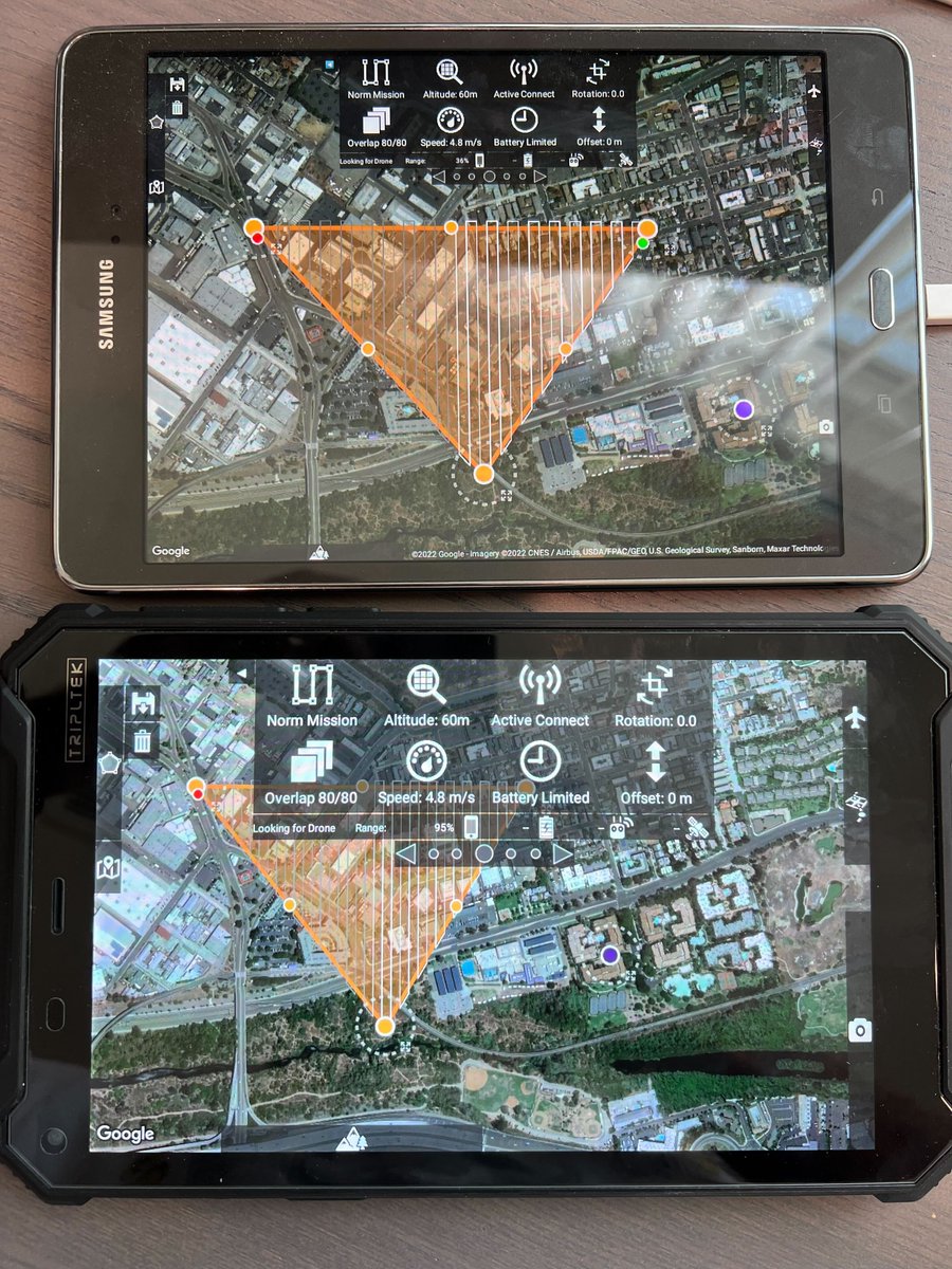
Android Beta Testers Wanted: We are looking for experienced Map Pilot Pro users that would like to try out the new Android version of Map Pilot Pro. We are looking for as much feedback as possible. Please email [email protected] for a beta release invitation.

Maps Made Easy (@mapsmadeeasy) 's Twitter Profile Photo

We are getting close to the public release of the new Map Pilot Pro for Android. Beta testing has been opened up to all users that want to give it a shot. Works on all high spec Android devices and Android based DJI controllers. Installation instructions: support.dronesmadeeasy.com/hc/en-us/artic…

We are getting close to the public release of the new Map Pilot Pro for Android. Beta testing has been opened up to all users that want to give it a shot. Works on all high spec Android devices and Android based DJI controllers. Installation instructions: support.dronesmadeeasy.com/hc/en-us/artic…
Maps Made Easy (@mapsmadeeasy) 's Twitter Profile Photo

Map Pilot Pro for Android is finally available in the Google Play Store! 15 Day Pro Trial for new users. play.google.com/store/apps/det… DJI DJI Enterprise #drones #mapping

Map Pilot Pro for Android is finally available in the Google Play Store! 15 Day Pro Trial for new users.  play.google.com/store/apps/det… <a href="/DJIGlobal/">DJI</a> <a href="/DJIEnterprise/">DJI Enterprise</a> #drones #mapping
Maps Made Easy (@mapsmadeeasy) 's Twitter Profile Photo

Map Pilot Pro is looking pretty good on the DJI Enterprise Mavic 3 Enterprise. Almost ready for full public release. Read more and download APKs: support.dronesmadeeasy.com/hc/en-us/commu…
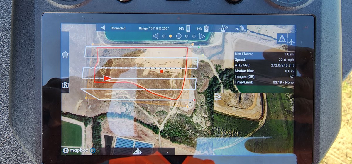
Map Pilot Pro is looking pretty good on the <a href="/DJIEnterprise/">DJI Enterprise</a> Mavic 3 Enterprise. Almost ready for full public release. Read more and download APKs: support.dronesmadeeasy.com/hc/en-us/commu…
Maps Made Easy (@mapsmadeeasy) 's Twitter Profile Photo

Map Pilot Pro support for the #Mavic 3 #Multispectral on the RC Pro Enterprise remote is up and running nicely. This was by far the easiest NDVI map we have ever created and we have been doing this a while. Nice work on the #M3M DJI Enterprise. View here: mapsmadeeasy.com/locations/publ…
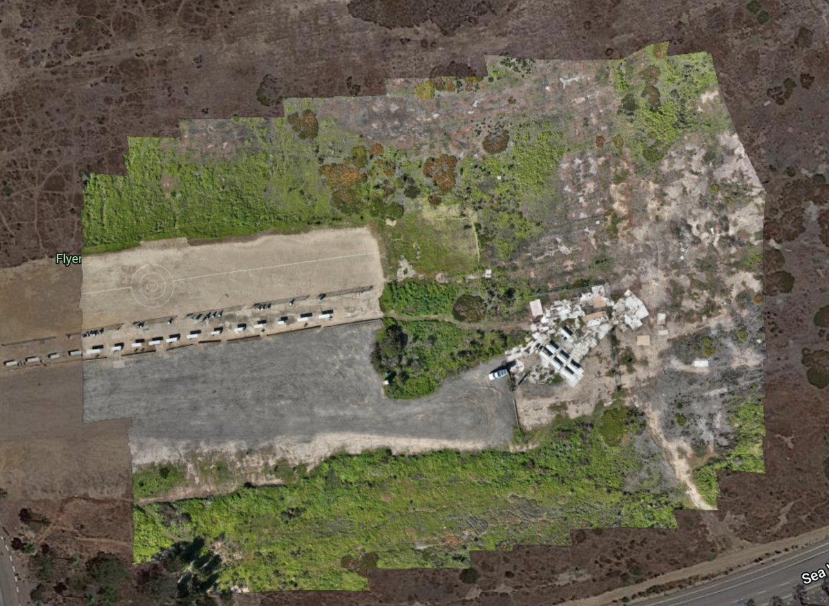
Map Pilot Pro support for the #Mavic 3 #Multispectral on the RC Pro Enterprise remote is up and running nicely. This was by far the easiest NDVI map we have ever created and we have been doing this a while. Nice work on the #M3M <a href="/DJIEnterprise/">DJI Enterprise</a>. View here: mapsmadeeasy.com/locations/publ…
Maps Made Easy (@mapsmadeeasy) 's Twitter Profile Photo

If you were to have any terrain data source available in Map Pilot Pro (aside from the standard SRTM) what would you like to see included?

Maps Made Easy (@mapsmadeeasy) 's Twitter Profile Photo

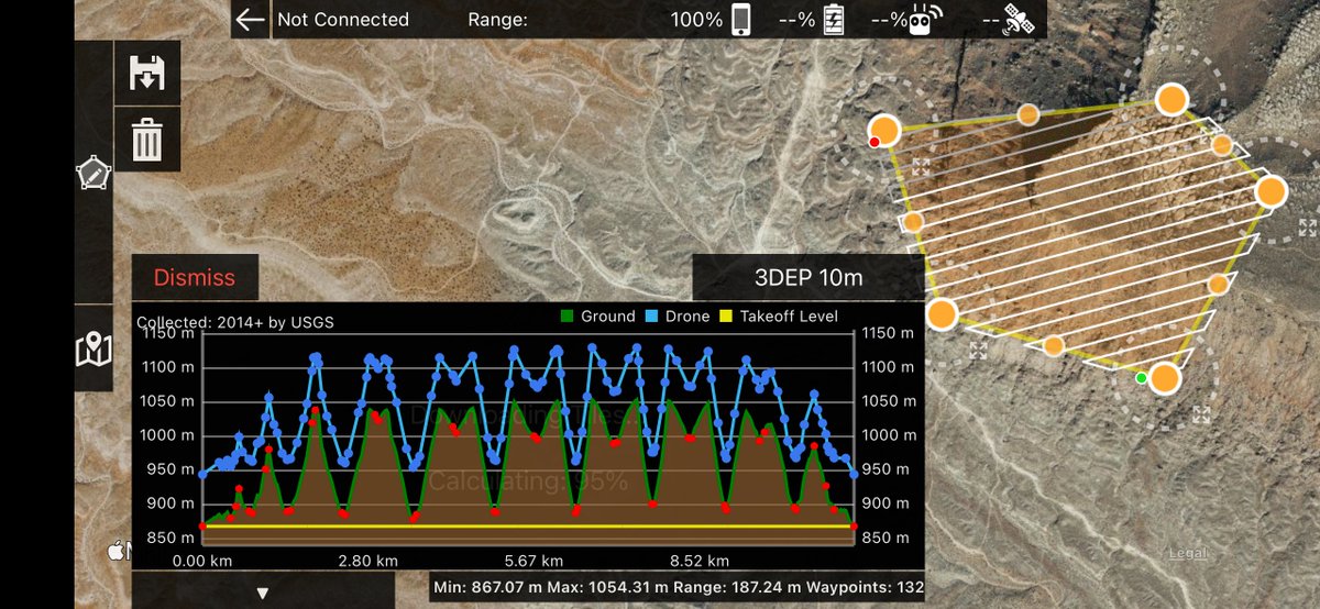
Map Pilot Pro 5.5.0 has been released with new high resolution terrain data sources from Copernicus, ASTER, 3DEP and others. Worldwide coverage. 10 meter per pixel data is available throughout the US. Having multiple sources ensures data availability at your site.

Map Pilot Pro 5.5.0 has been released with new high resolution terrain data sources from Copernicus, ASTER, 3DEP and others. Worldwide coverage. 10 meter per pixel data is available throughout the US. Having multiple sources ensures data availability at your site.