ANZMapS (@anzmaps) 's Twitter Profile
ANZMapS

@anzmaps

Australian and New Zealand Map Society is a society for map producers, users, collectors and curators interested in maps.

ID: 1288196558

linkhttp://www.anzmaps.org calendar_today22-03-2013 09:06:47

2,2K Tweet

433 Followers

134 Following

Imago Mundi (@imagomundiijhc) 's Twitter Profile Photo

Imago Mundi and @ISHMAP join forces to have a conversation in London about the future of map history at the Royal Geographical Society (with IBG) in early September. Event open online to @ISHMAP members. Join at ISHmap.Wordpress.Com!

Dr Katherine Parker (@katieparker18th) 's Twitter Profile Photo

Are you a member of @ISHMAP? If so, join us online for a FREE symposium on 2 September on ‘Where Does Map History Go Now?’ Not a member? Join to stay in touch with all things mappy, get a discount on Imago Mundi and attend events like this one! ishmap.com/where-does-map…

Map Library (@blmaps) 's Twitter Profile Photo

The J.B. Harley Research Fellowships in the History of Cartography is a funding opportunity for anyone who wishes to work with historical map collections in the UK. Deadline for applications is 1 November maphistory.info/harley.html

LOCMaps (@locmaps) 's Twitter Profile Photo

Check out this detailed map of Hwanghae province on the west coast of the Korean peninsula, part of modern North Korea. The abundant illustrated mountains give a sense of the terrain. Zoom in here: loc.gov/resource/g7908…

Check out this detailed map of Hwanghae province on the west coast of the Korean peninsula, part of modern North Korea. The abundant illustrated mountains give a sense of the terrain.

Zoom in here: loc.gov/resource/g7908…
@ISHMAP (@ishmap1) 's Twitter Profile Photo

ANN: Bodleian Libraries "Maps are too Exciting! Digital innovations in Cartography" symposium 10 Oct 2024. For schedule and info: visit.bodleian.ox.ac.uk/event/oct24/ma…
LOCMaps (@locmaps) 's Twitter Profile Photo

Our new research guide, from the Geography & Map and Rare Book & Special Collections Divisions, delves into Ptolemy's Geographia, a 2nd-century geographical work revived & revised in the Renaissance. Learn about the work & editions at LC! Explore it here: guides.loc.gov/ptolemaic-atla…

Our new research guide, from the Geography & Map and Rare Book & Special Collections Divisions, delves into Ptolemy's Geographia, a 2nd-century geographical work revived & revised in the Renaissance. Learn about the work & editions at LC!

Explore it here: guides.loc.gov/ptolemaic-atla…
David Rumsey (@davidrumseymaps) 's Twitter Profile Photo

60,000 new maps, views, texts, titles, diagrams, globes, timelines and more have been added to search for Text on Maps - doubling to 120,000 items from the original 60,000 we started with a year ago. Over 175 million words indexed! Try searching for Cairo davidrumsey.com/luna/servlet/s…

60,000 new maps, views, texts, titles, diagrams, globes, timelines and more have been added to search for Text on Maps - doubling to 120,000 items from the original 60,000 we started with a year ago. Over 175 million words indexed! Try searching for Cairo davidrumsey.com/luna/servlet/s…
Nick Millea (@milleanick) 's Twitter Profile Photo

Time for another Bodleian Libraries #Maps blog from #MartinDavis marking today's closure of #Britain's last #coal-fired power station. Read more at: blogs.bodleian.ox.ac.uk/maps & note the transfer towards #renewables, with maps from the C18 to the C21. British Cartographic Society BRICMICS @ISHMAP
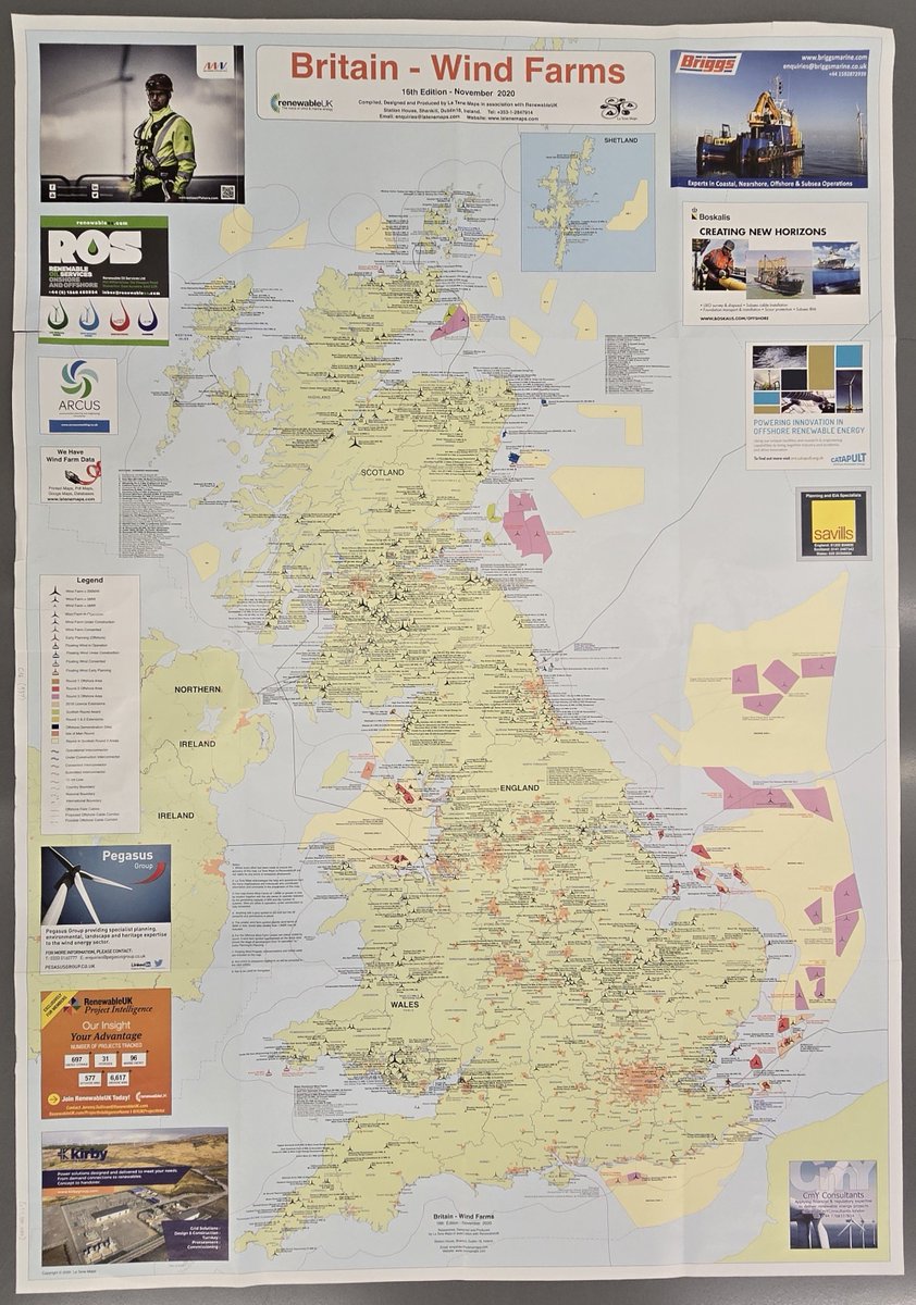
Time for another <a href="/bodleianlibs/">Bodleian Libraries</a> #Maps blog from #MartinDavis marking today's closure of #Britain's last #coal-fired power station. Read more at: blogs.bodleian.ox.ac.uk/maps &amp; note the transfer towards #renewables, with maps from the C18 to the C21. <a href="/bcsmaps/">British Cartographic Society</a> <a href="/_BRICMICS/">BRICMICS</a> <a href="/ISHMAP1/">@ISHMAP</a>
@ISHMAP (@ishmap1) 's Twitter Profile Photo

ANN: Newberry Library short term fellowship applications now available, incl A &J Holzheimer Fellowship/ History of Cartography for projects related to the history of cartography/ cartographic materials in the library's collection. for info and to apply: newberry.org/research/fello…

British Library (@britishlibrary) 's Twitter Profile Photo

All aboard for a journey through history! 🚂 The latest in our series, A History of Railways in 100 Maps, takes you from the first railways in England to those in fantasy literature, with 140 beautifully photographed maps from our archives. bit.ly/BLShopRailways

All aboard for a journey through history! 🚂

The latest in our series, A History of Railways in 100 Maps, takes you from the first railways in England to those in fantasy literature, with 140 beautifully photographed maps from our archives.

bit.ly/BLShopRailways
Washington Map Society (@wmsmapsociety) 's Twitter Profile Photo

What’s Different about Map Making in the Nineteenth Century? Mark your calendars now for the November 7th presentation from Matthew Edney, who will talk about the forthcoming Vol. 5 of The History of Cartography... Meeting via Zoom at 7:00 ET on 11/7. Sign up at WMS website.

What’s Different about Map Making in the Nineteenth Century?

Mark your calendars now for the November 7th presentation from Matthew Edney, who will talk about the forthcoming Vol. 5 of The History of Cartography...

Meeting via Zoom at 7:00 ET on 11/7. Sign up at WMS website.
ANU CartoGIS Services (@anucartogis) 's Twitter Profile Photo

🌐 Need help with your mapping project? Visit the @ANUCartoGIS website to explore GIS and mapping services available for ANU staff and HDRs! cartogis.anu.edu.au ANU Library

@ISHMAP (@ishmap1) 's Twitter Profile Photo

There is still time to submit an abstract for our 2025 Symposium and Workshop. Come join us in Paris this summer! For info and to submit an abstract: ishmap.com/ishmap-2025-pa…

LOCMaps (@locmaps) 's Twitter Profile Photo

This map of New Zealand was one of many cartographic products of the first Russian circumnavigation of the earth in the early 19th century. See it in the World Digital Library here: loc.gov/resource/gdclc…

This map of New Zealand was one of many cartographic products of the first Russian circumnavigation of the earth in the early 19th century.

See it in the World Digital Library here: loc.gov/resource/gdclc…
LOCMaps (@locmaps) 's Twitter Profile Photo

Measuring 3 feet by 6 feet, this "monstrous" 17th century world map has lots of fascinating details if you just zoom in and take a look! Zoom in closer here: loc.gov/resource/g3200…

Measuring 3 feet by 6 feet, this "monstrous" 17th century world map has lots of fascinating details if you just zoom in and take a look! 

Zoom in closer here: loc.gov/resource/g3200…
State Library of NSW (@statelibrarynsw) 's Twitter Profile Photo

Happy #MappyMonday! Come along and hear from some of the Library’s curators as they reveal the tales behind the maps recently added to the Library’s collections. 🗺️ Curator talk: Every map tells a story 🗓️ Wednesday 13 November, 6–7pm 🎟️ Free, book here: ow.ly/MFYs50TYWb7

Happy #MappyMonday! Come along and hear from some of the Library’s curators as they reveal the tales behind the maps recently added to the Library’s collections.

🗺️ Curator talk: Every map tells a story
🗓️ Wednesday 13 November, 6–7pm 
🎟️ Free, book here: ow.ly/MFYs50TYWb7