BRICMICS(@_BRICMICS) 's Twitter Profileg
BRICMICS

@_BRICMICS

BRICMICS represents libraries, archives, and organisations involved in all aspects of map work in Great Britain and Ireland

ID:864056181194723330

linkhttp://www.cartography.org.uk/about/special-interest-groups/mcg/bricmics/ calendar_today15-05-2017 09:53:41

7,3K Tweets

716 Followers

1,0K Following

Jon Dollery(@jrdollery) 's Twitter Profile Photo

Heads up to all Students. This years Carto-Cymru has a special £5 online offer for Students. This hybrid event has a range of excellent speakers (myself included 😜) on the theme of 'Maps and their Makers'. If your interested in all things & please do come along!

Heads up to all Students. This years Carto-Cymru has a special £5 online offer for Students. This hybrid event has a range of excellent speakers (myself included 😜) on the theme of 'Maps and their Makers'. If your interested in all things #Maps & #Wales please do come along!
account_circle
Durham University Collections(@DU_Collections) 's Twitter Profile Photo

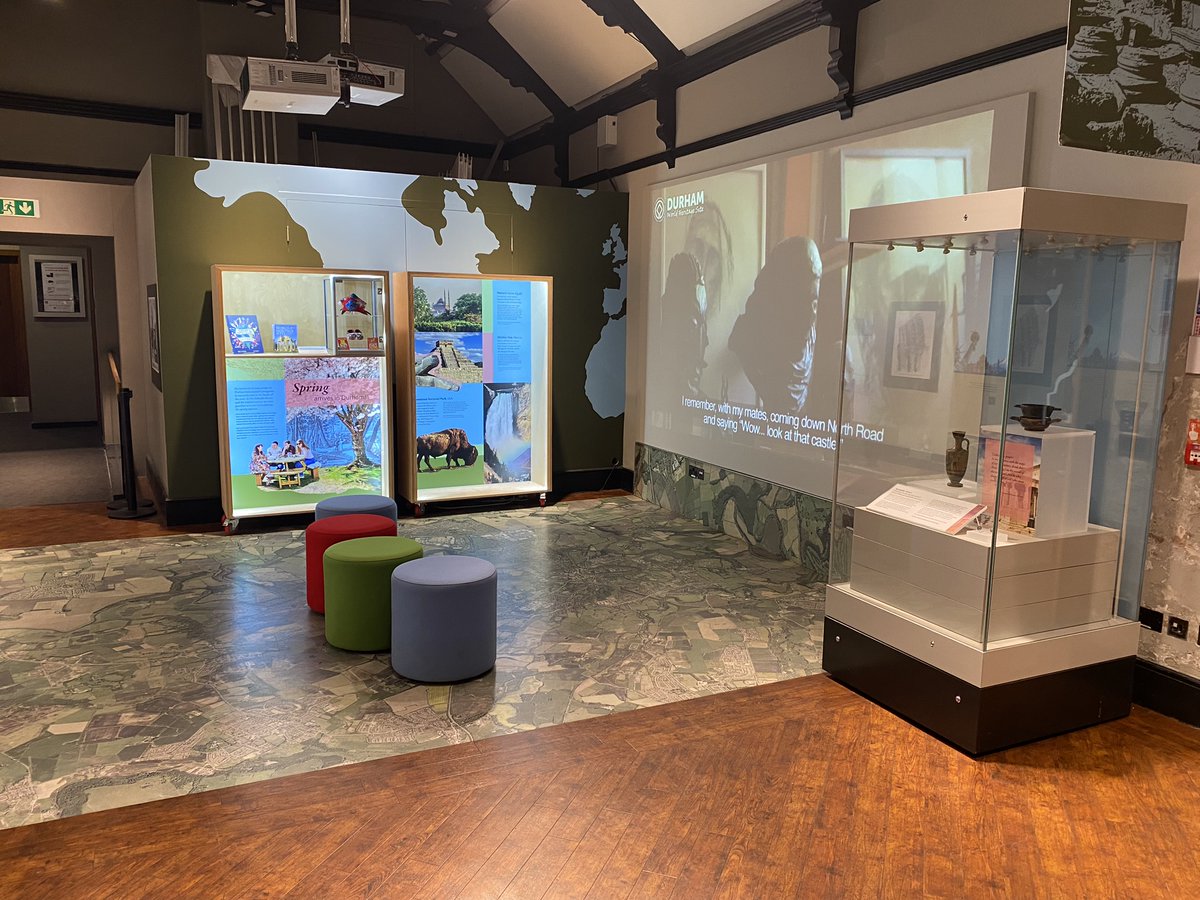
Come and see 👀 a new pop-up exhibition in the Map Room of the World Heritage Site Visitor Centre. All about Spring Festivals 🌸 linked to different UNESCO World Heritage Sites.

Come and see 👀 a new pop-up exhibition in the Map Room of the World Heritage Site Visitor Centre. All about Spring Festivals 🌸 linked to different UNESCO World Heritage Sites.
account_circle
Mappery(@MapsintheWild) 's Twitter Profile Photo

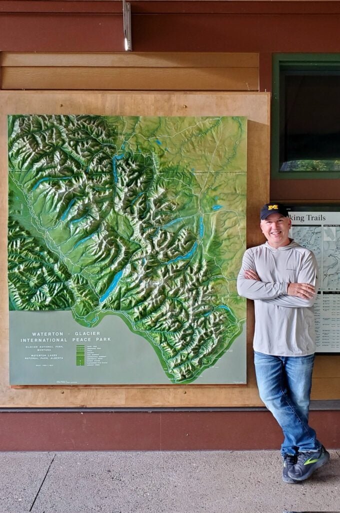
Maps in the Wild: Giant Relief Map, Why Not?: Matt Malone spotted this relief map at Waterton Glacier in Montana. He said “”Do you want your pic taken by the giant map?” isn’t really even a legit question for a geographer.”

MapsintheWild Giant Relief… dlvr.it/T59y68

Maps in the Wild: Giant Relief Map, Why Not?: Matt Malone spotted this relief map at Waterton Glacier in Montana. He said “”Do you want your pic taken by the giant map?” isn’t really even a legit question for a geographer.” MapsintheWild Giant Relief… dlvr.it/T59y68
account_circle
University of Exeter Heritage Collections(@UoEHeritageColl) 's Twitter Profile Photo

This is a copy of the earliest known printed map of Exeter. Commissioned by John Hooker, Chamblerlain of Exeter, from the engraver Remigius Hogenberg, it formed the basis for all printed maps of Exeter for more than a century.

📷 Townsend Maps T12

This is a copy of the earliest known printed map of Exeter. Commissioned by John Hooker, Chamblerlain of Exeter, from the engraver Remigius Hogenberg, it formed the basis for all printed maps of Exeter for more than a century. 📷 Townsend Maps T12 #MapMonday #MappingOurExeter
account_circle
Kelsall Village History(@GroupKelsall) 's Twitter Profile Photo

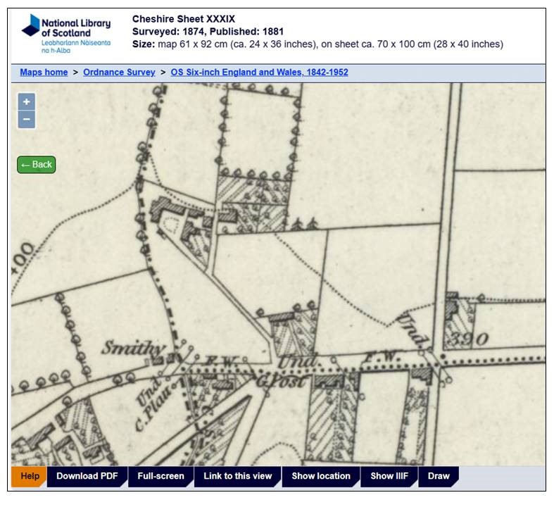
Monday This section of the O/S map for 1874 shows the tiny settlement on the edge of the village at a higher level named Kelsall Hill. Just a pub, PO, Smithy, houses & cultivated fields. Now joined to the main village by new housing. courtesy of NLS Map Collections

#MapMonday This section of the O/S map for 1874 shows the tiny settlement on the edge of the village at a higher level named Kelsall Hill. Just a pub, PO, Smithy, houses & cultivated fields. Now joined to the main village by new housing. #Map courtesy of @natlibscotmaps #maps
account_circle
UoD Archives & RM(@UoD_Archives_RM) 's Twitter Profile Photo

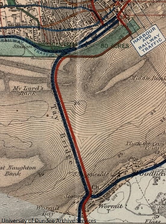
- Detail from 1918 plan accompanying James Thomson's report on his proposals to develop . This shows his proposed Tay Road Bridge built on the remains of the first Tay Railway Bridge UniCulture

#MapMonday - Detail from 1918 plan accompanying James Thomson's report on his proposals to develop #Dundee. This shows his proposed Tay Road Bridge built on the remains of the first Tay Railway Bridge #Archives #DundeeUniCulture
account_circle
British Cartographic Society(@bcsmaps) 's Twitter Profile Photo

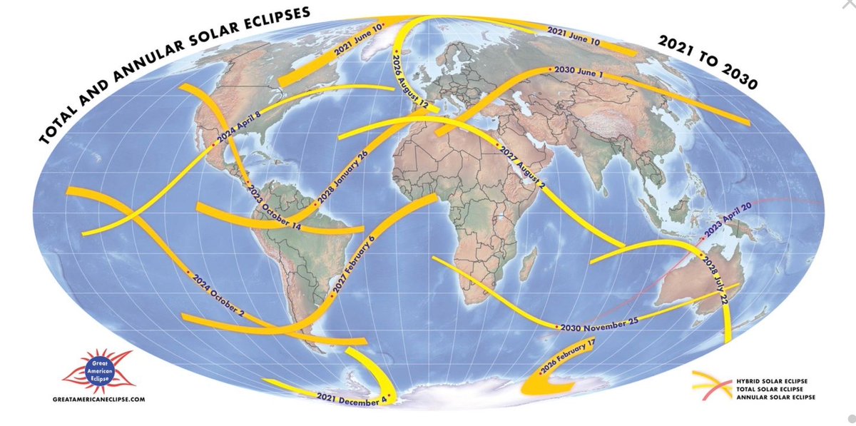
If you missed todays solar eclipse check out this map of the next eclipses due over our globe until 2030
bit.ly/3PU1StP

If you missed todays solar eclipse check out this map of the next eclipses due over our globe until 2030 bit.ly/3PU1StP
account_circle
RSGS(@RoyalScotGeoSoc) 's Twitter Profile Photo

We had a brilliant time on Saturday, hosting our latest Discovery Day on Ernest Shackleton! Be on the lookout for more Discovery Day's taking place this year.👀
In the meantime, we are running guided tours of the Fair Maid's House on 10th & 17th April- rsgs.org/events

We had a brilliant time on Saturday, hosting our latest Discovery Day on Ernest Shackleton! Be on the lookout for more Discovery Day's taking place this year.👀 In the meantime, we are running guided tours of the Fair Maid's House on 10th & 17th April- rsgs.org/events
account_circle
National Library of Wales(@NLWales) 's Twitter Profile Photo

🗺️Humphrey Llwyd’s 'Cambriae Typus' is the earliest printed map to show Wales as a separate region. Published in 1573, it’s one of a million and a half sheets of maps, charts and plans held in the National Library.

🔗library.wales/discover-learn…

🗺️Humphrey Llwyd’s 'Cambriae Typus' is the earliest printed map to show Wales as a separate region. Published in 1573, it’s one of a million and a half sheets of maps, charts and plans held in the National Library. 🔗library.wales/discover-learn… #MapMonday
account_circle
NLS Map Collections(@natlibscotmaps) 's Twitter Profile Photo

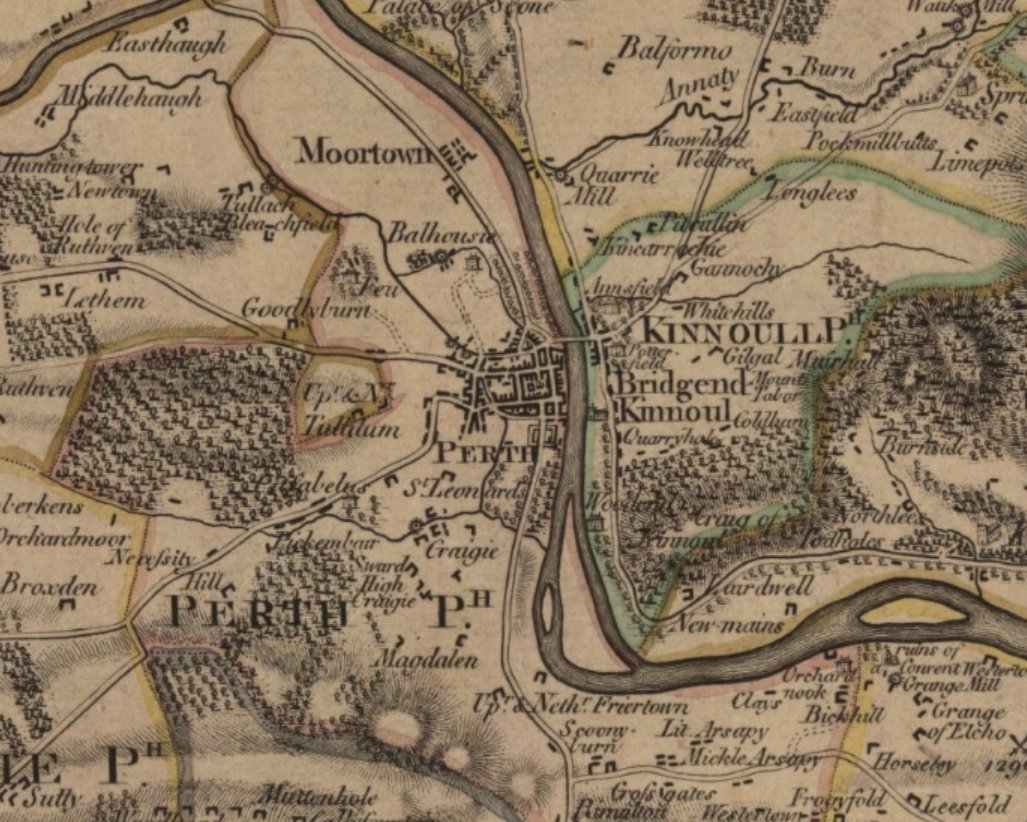
This we are admiring the fair city of Perth as shown on James Stobie's The counties of Perth and Clackmannan, published 1783.
maps.nls.uk/joins/664.html
shire

This #MapMonday we are admiring the fair city of Perth as shown on James Stobie's The counties of Perth and Clackmannan, published 1783. maps.nls.uk/joins/664.html #HistoricMaps #Perth #Perthshire
account_circle
Herts Archives(@HertsArchives) 's Twitter Profile Photo

For we have this delightful 1928 map showing parts of Hertfordshire produced by the North Metropolitan Electric Power Supply Company who provided electricity to the parts of London, Hertfordshire and Essex, from 1907 until 1948.

For #MapMonday we have this delightful 1928 map showing parts of Hertfordshire produced by the North Metropolitan Electric Power Supply Company who provided electricity to the parts of London, Hertfordshire and Essex, from 1907 until 1948. #ElectricitySupply #Utilities #Maps
account_circle
PRONI(@PRONI_DFC) 's Twitter Profile Photo

Happy !🗺️

Today we are sharing a map (PRONI Ref T1129/234) from 1807, illustrating the County of Antrim. This map features a key to help identify ancient and contemporary churches, parishes, and castles.
Image reproduced courtesy of the Trustees of the British Museum

Happy #MapMonday!🗺️ Today we are sharing a map (PRONI Ref T1129/234) from 1807, illustrating the County of Antrim. This map features a key to help identify ancient and contemporary churches, parishes, and castles. Image reproduced courtesy of the Trustees of the British Museum
account_circle
British Cartographic Society(@bcsmaps) 's Twitter Profile Photo

On this day in 1904, New York City changed the name of Longacre Square to Times Square, in honour of The New York Times moving to the area. Here's a map sourced from bit.ly/49ogGrv showing the area - very different to today!

#MapMonday On this day in 1904, New York City changed the name of Longacre Square to Times Square, in honour of The New York Times moving to the area. Here's a map sourced from bit.ly/49ogGrv showing the area - very different to today!
account_circle
North Yorkshire County Record Office(@nyccarchives) 's Twitter Profile Photo

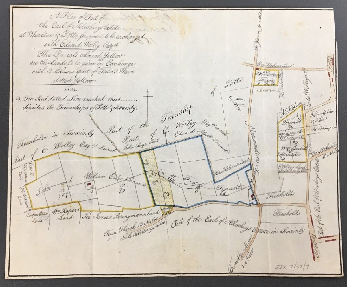
The maps we hold here vary hugely in size and shape! This tiny detailed plan of the Lord Ailesbury's lands at & (1804), to be exchanged with Edward Wolley, measures just 18.5 x 23cm

The maps we hold here vary hugely in size and shape! This tiny detailed plan of the Lord Ailesbury's lands at #Whorlton & #Potto (1804), to be exchanged with Edward Wolley, measures just 18.5 x 23cm #MapMonday
account_circle
Isle of Man Public Record Office(@IsleOfManPRO) 's Twitter Profile Photo

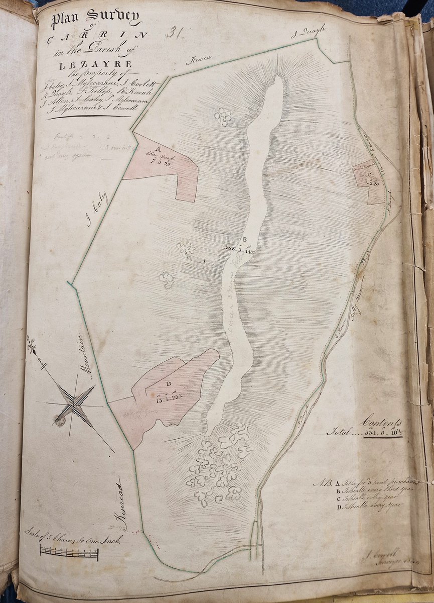
For today's , we've headed up into the hills for a breath of fresh air. Here's lofty Mount Karrin (Carrin) in the Parish of Lezayre, with the Sulby River winding through the valley far below.

For today's #TithePlanTuesday, we've headed up into the hills for a breath of fresh air. Here's lofty Mount Karrin (Carrin) in the Parish of Lezayre, with the Sulby River winding through the valley far below. #IOMPROArchives #IsleOfMan
account_circle
Isle of Man Public Record Office(@IsleOfManPRO) 's Twitter Profile Photo

Our Records Assistants often carry out restorative work on records in need of TLC. Here, they are cleaning up the streets of Douglas before the arrival of Queen Camilla... about 170 years before! Grated eraser was used to lift surface dirt from this 19th Century plan.

account_circle
West Sussex Archives(@WestSussexRO) 's Twitter Profile Photo

🗺️ - Today we are sharing a plan of the Borough of Arundel from 1785. As you'll see the castle is excluded from this rough sketch but it gives street names, names of inns and public houses. It also shows the River Arun, orchards and a nursery
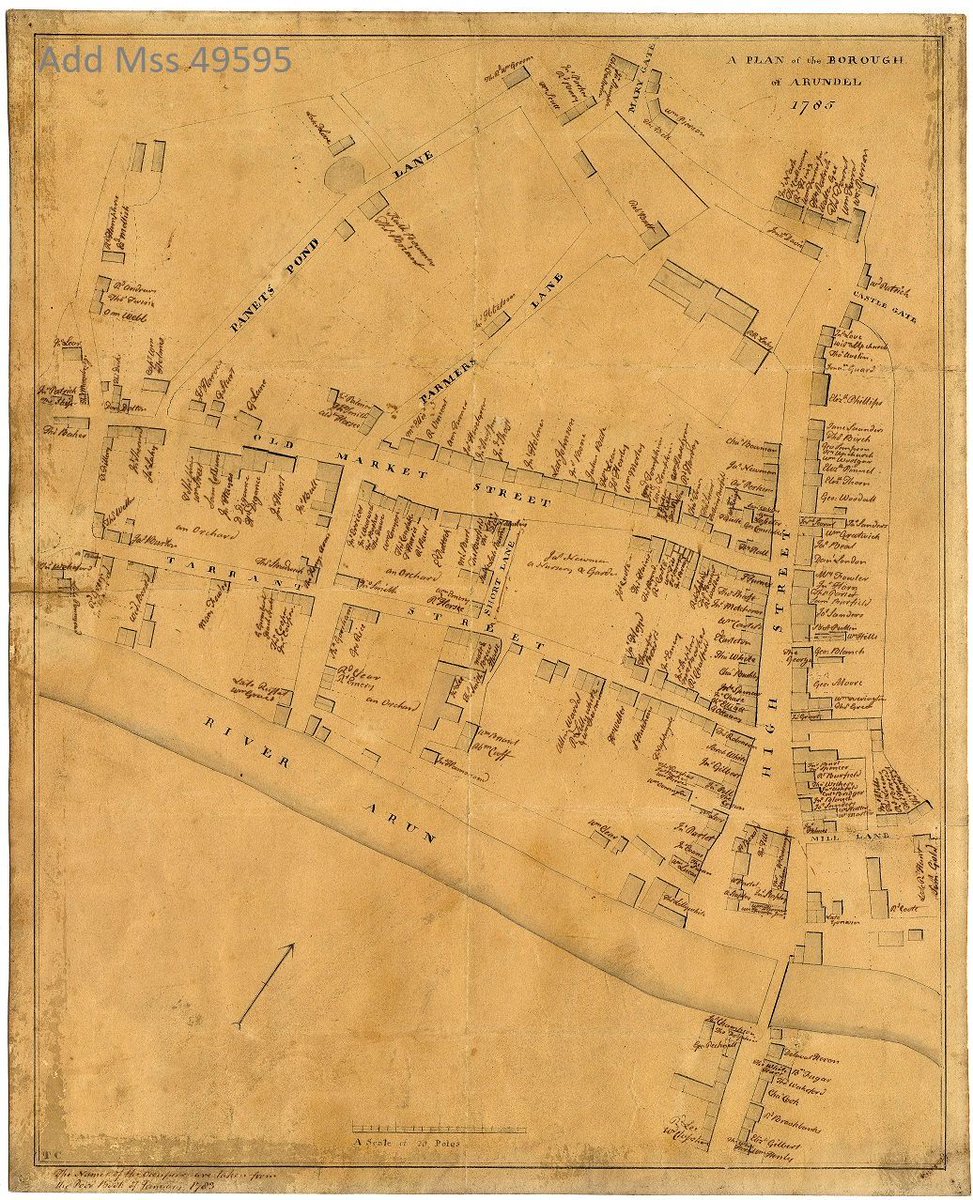
#MapMonday 🗺️ - Today we are sharing a plan of the Borough of Arundel from 1785. As you'll see the castle is excluded from this rough sketch but it gives street names, names of inns and public houses. It also shows the River Arun, orchards and a nursery
account_circle