ABG Safety (@abgsafety) 's Twitter Profile
ABG Safety

@abgsafety

Protecting our most valuable asset...You!

ID: 475176071

calendar_today26-01-2012 19:31:45

1,1K Tweet

477 Followers

582 Following
NWS Jacksonville (@nwsjacksonville) 's Twitter Profile Photo

The tornado threat will increase throughout our area this afternoon as outer rain bands from #Michael move into our region. Make sure you have multiple means to receive any potential tornado warnings. Know the difference between a watch and a warning! #flwx #gawx #jaxwx JaxReady

The tornado threat will increase throughout our area this afternoon as outer rain bands from #Michael move into our region. Make sure you have multiple means to receive any potential tornado warnings. Know the difference between a watch and a warning! #flwx #gawx #jaxwx <a href="/JaxReady/">JaxReady</a>
National Hurricane Center (@nhc_atlantic) 's Twitter Profile Photo

Hurricane #Michael has made landfall just northwest of Mexico Beach, Florida. The latest public advisory is available on the NHC website: nhc.noaa.gov/text/refresh/M…

U.S. EPA (@epa) 's Twitter Profile Photo

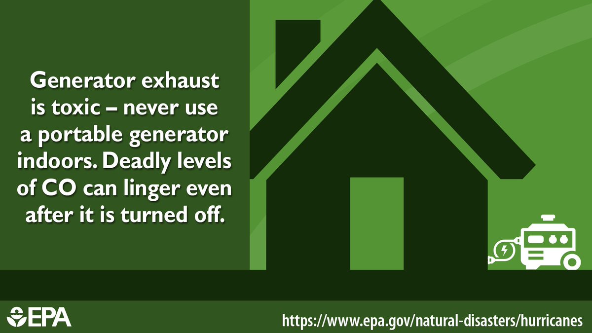
Has Hurricane / #TropicalStormMichael left you without power? Are you using a generator? Generator exhaust is toxic. ALWAYS put generators outside away from doors, windows, and vents. For more tips on safe generator usage visit: epa.gov/indoor-air-qua… #Michael

Has Hurricane / #TropicalStormMichael left you without power? Are you using a generator?  Generator exhaust is toxic. ALWAYS put generators outside away from doors, windows, and vents. For more tips on safe generator usage visit: epa.gov/indoor-air-qua… #Michael
Ed Piotrowski (@edpiotrowski) 's Twitter Profile Photo

Incredible video of the catastrophic damage done by Hurricane #Micahel in Mexico Beach, FL. Video via Brandon Clement/Live Storm Media #scwx #ncwx #flwx

Bay County, FL (@mybaycountyfl) 's Twitter Profile Photo

Lucille Moore Elementary, Bozeman Learning Center, Parker Elementary, Rosenwald Middle School, Cherry Street Elementary, and Super Wal-Mart on State 77 are distribution points for food and/or water. Please share this information with all your contacts.

FL Division of Emergency Management (@flsert) 's Twitter Profile Photo

If you are in the Panhandle, tune into your local #iHeartRadio station at the top of every hour for important #HurricaneMichael relief info. These stations have partnered with FLSERT to broadcast information for survivors who may not have access to other communications. #alert

USGS (@usgs) 's Twitter Profile Photo

While Hurricane Michael's winds and storm surge were devastating, the rains also left their mark, triggering flash floods and high waters all along the storm track. usgs.gov/michael #TurnAroundDontDrown #HurricaneMichael #flooding #waterdata #dataviz

FEMA (@fema) 's Twitter Profile Photo

We have created a rumor control page for Hurricane #Michael that will be updated regularly. Help us share this info and remember to always check with official sources like FL Division of Emergency Management, @GeorgiaEMA and FEMA Region 4. fema.gov/hurricane-mich…
We have created a rumor control page for Hurricane #Michael that will be updated regularly. Help us share this info and remember to always check with official sources like <a href="/FLSERT/">FL Division of Emergency Management</a>, @GeorgiaEMA and <a href="/femaregion4/">FEMA Region 4</a>.

fema.gov/hurricane-mich…
American Red Cross (@redcross) 's Twitter Profile Photo

The Red Cross is working with partners to prepare meals for communities affected by #Michael, and we’re reaching more neighborhoods each day. Here’s how you can help: rdcrss.org/2En9UJC

Bay County, FL (@mybaycountyfl) 's Twitter Profile Photo

*IMPORTANT* Bay County residents, you can now subscribe to receive safety information, everything from food and water points of distributions to utility updates. #850Strong

*IMPORTANT* Bay County residents, you can now subscribe to receive safety information, everything from food and water points of distributions to utility updates. #850Strong
NWS Eastern Region (@nwseastern) 's Twitter Profile Photo

Computer models are in agreement on the first nor'easter of the season this weekend. The storm will likely tap moisture from the remnants of Hurricane Willa. Heavy rains, strong gusty winds and minor-moderate coastal flooding is expected along the Eastern Seaboard this weekend.

Computer models are in agreement on the first nor'easter of the season this weekend. The storm will likely tap moisture from the remnants of Hurricane Willa. Heavy rains, strong gusty winds and minor-moderate coastal flooding is expected along the Eastern Seaboard this weekend.
NHC Eastern Pacific (@nhc_pacific) 's Twitter Profile Photo

Hurricane #Willa made landfall at 7 PM MDT near Isla Del Bosque, Sinaloa, or about 10 miles (15 km) south of Escuinapa. Maximum winds at landfall were estimated to be 120 mph (195 km/h), with a minimum central pressure of 965 mb (28.50 inches). nhc.noaa.gov/text/refresh/M…

National Hurricane Center (@nhc_atlantic) 's Twitter Profile Photo

Our break in storms is likely ending due to a low pressure area about 900 miles east of the northern Leeward Islands. The low has a 70% chance of becoming a tropical or subtropical cyclone through Monday, with the highest chances on Friday or Saturday. hurricanes.gov

Our break in storms is likely ending due to a low pressure area about 900 miles east of the northern Leeward Islands.  The low has a 70% chance of becoming a tropical or subtropical cyclone through Monday, with the highest chances on Friday or Saturday. hurricanes.gov
The Weather Channel (@weatherchannel) 's Twitter Profile Photo

#Oscar is likely to form in the Atlantic, but the late-October #weather pattern likely means it’s no concern for the U.S.: wxch.nl/2JkL3VG

#Oscar is likely to form in the Atlantic, but the late-October #weather pattern likely means it’s no concern for the U.S.: wxch.nl/2JkL3VG
Weather Underground (@wunderground) 's Twitter Profile Photo

As the #Noreaster looks to hamper many of your Saturday plans across the East, our experts will break down the wind, rain, & coastal flood threats hour by hour! But first, the #South will deal w/ rain & possible #severe storms Friday. We'll time it out LIVE on #WUTV @ 5-8pm ET!

As the #Noreaster looks to hamper many of your Saturday plans across the East, our experts will break down the wind, rain, &amp; coastal flood threats hour by hour! But first, the #South will deal w/ rain &amp; possible #severe storms Friday.  We'll time  it out LIVE on #WUTV @ 5-8pm ET!
National Hurricane Center (@nhc_atlantic) 's Twitter Profile Photo

NHC is monitoring a disturbance that is located east of the Leeward Islands. Environmental conditions are expected to gradually become more conducive for development over the next several days. More information at hurricanes.gov

NHC is monitoring a disturbance that is located east of the Leeward Islands. Environmental conditions are expected to gradually become more conducive for 
development over the next several days.  More information at hurricanes.gov
Weather Underground (@wunderground) 's Twitter Profile Photo

Winter storm Jayden prompts warnings in the deep south and will bring snow to the Northeast. Behind the storm, wind chills will drop below -50 for some. Tonight Tom Niziol and Alex Wilson breaks down your chance for snow. Plus Mike Bettes is live in Atlanta for the Big Game!
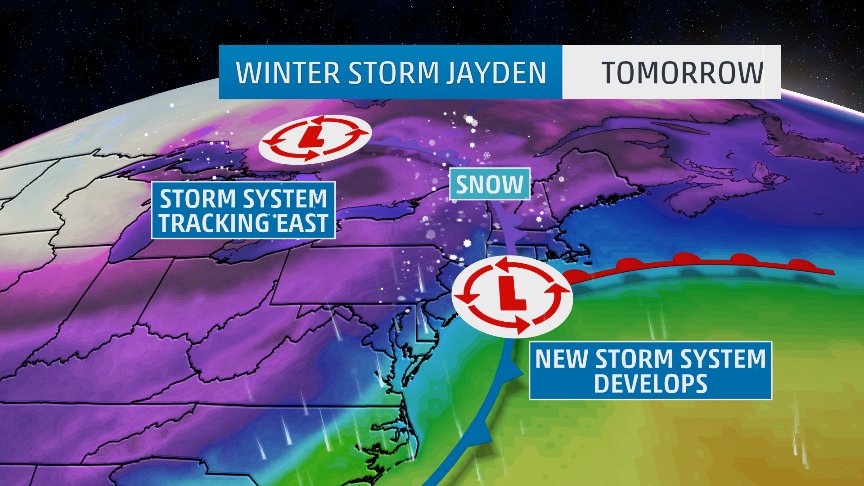
Winter storm Jayden prompts warnings in the deep south and will bring snow to the Northeast. Behind the storm, wind chills will drop below -50 for some. Tonight <a href="/TomNiziol/">Tom Niziol</a> and <a href="/TWCAlexWilson/">Alex Wilson</a> breaks down your chance for snow. Plus <a href="/mikebettes/">Mike Bettes</a> is live in Atlanta for the Big Game!
NHC Eastern Pacific (@nhc_pacific) 's Twitter Profile Photo

A disturbance south of Mexico has a high chance of becoming a tropical depression during the next day or two while it moves west-northwestward away from the coast. For the latest details go to: hurricanes.gov/gtwo.php?basin…

A disturbance south of Mexico has a high chance of becoming a tropical depression during the next day or two while it moves west-northwestward away from the coast. For the latest details go to:  hurricanes.gov/gtwo.php?basin…