DGFI-TUM
@dgfitum
Deutsches Geodätisches Forschungsinstitut der Technischen Universität München (DGFI-TUM)
ID: 1532253728002256897
http://www.dgfi.tum.de 02-06-2022 06:53:44
65 Tweet
201 Followers
62 Following
 's Twitter Profile Photo")
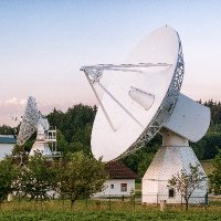
New film by GGOS - Global Geodetic Observing System on "Terrestrial Reference Frames - Connecting the World through Geodesy" with contributions by DGFI-TUM highlights the fundamental importance of highly precise #ReferenceFrames for a wide range of scientific and societal applications: bit.ly/trf-film
 on Twitter photo Coastal Assessment of Sentinel-6 Altimetry Data during the Tandem Phase with Jason-3:
Study within #ESA's S6-JTEX project highlights the improved monitoring capabilities of #Sentinel6's SAR #altimetry product compared to its predecessor mission #Jason3: doi.org/10.3390/rs1517…")
 's Twitter Profile Photo")
GIM International (GIM International) highlights "The importance of geodetic reference frames: A uniform basis to tackle current and future challenges" in its latest issue (7/2023, pp. 43-45): gim-international.com/magazines/gim-…. #ITRF #DTRF2020 #Geodesy
 on Twitter photo GIM International (<a href=\"/gim_intl/\">GIM International</a>) highlights \"The importance of geodetic reference frames: A uniform basis to tackle current and future challenges\" in its latest issue (7/2023, pp. 43-45): gim-international.com/magazines/gim-….
#ITRF #DTRF2020 #Geodesy")
 on Twitter photo For 30+ years, satellite #altimetry has observed oceans & water bodies. <a href=\"/DgfiTum/\">DGFI-TUM</a>'s Open Altimeter Database (openadb.dgfi.tum.de) offers free multi-mission #OceanData & high-level products like SSH and ocean tides. Explore OpenADB in our latest paper: doi.org/10.1002/gdj3.2…")
Uncertainties in relative Sea Level projections are underestimated. This is due to the effects of regional-scale and non-linear vertical land motion (VLM) as shown by a probabilistic reconstruction of VLM over 1995-2020: nature.com/articles/s4156… #NatureGeoscience Nature Portfolio
 on Twitter photo Uncertainties in relative Sea Level projections are underestimated. This is due to the effects of regional-scale and non-linear vertical land motion (VLM) as shown by a probabilistic reconstruction of VLM over 1995-2020: nature.com/articles/s4156…
#NatureGeoscience <a href=\"/NaturePortfolio/\">Nature Portfolio</a>")
 on Twitter photo High-res #WaterSurfaceSlope derived from Satellite #Altimetry for rivers in Poland shows an average RMSE of 27 mm/km (11 mm/km in lowlands) compared to slopes from gauge data. The method can be applied worldwide and benefit flow velocity & discharge: WRR, doi.org/10.1029/2023WR…")
 's Twitter Profile Photo")
Gridded #sealevel maps are the favorable #altimetry data format for #ocean & climate studies but lack effective resolution at higher temporal scales. We evaluated them w.r.t. a model and highlight the relation to #wind on the SW Atlantic Continental Shelf: link.springer.com/article/10.100…
 on Twitter photo Gridded #sealevel maps are the favorable #altimetry data format for #ocean & climate studies but lack effective resolution at higher temporal scales. We evaluated them w.r.t. a model and highlight the relation to #wind on the SW Atlantic Continental Shelf: link.springer.com/article/10.100…")
 on Twitter photo Annual Report 2023 of <a href=\"/DgfiTum/\">DGFI-TUM</a> is now available. It highlights our last year's research activities on #SpaceGeodesy, #ReferenceFrames, Satellite #Altimetry and Atmosphere/#SpaceWeather: mediatum.ub.tum.de/doc/1751072/17…")
 's Twitter Profile Photo")
@rachel_tilling NASA Goddard Univ. of Maryland Over to open water classification 🌊 with Cryosat, ICESat-2, and other altimetry missions with Felix L. Müller of DGFI-TUM
 on Twitter photo @rachel_tilling <a href=\"/NASAGoddard/\">NASA Goddard</a> <a href=\"/UofMaryland/\">Univ. of Maryland</a> Over to open water classification 🌊 with Cryosat, ICESat-2, and other altimetry missions with
Felix L. Müller of <a href=\"/DgfiTum/\">DGFI-TUM</a>")
 on Twitter photo New method estimates #ECV #RiverDischarge only from remote sensing - perfect for filling gaps in the global in-situ network. By combining 20 years of satellite #altimetry with high-res imagery, we model ungauged rivers down to <100 m width. Only 12% RMSE! doi.org/10.1016/j.rse.…")
🌍 GGOS - Global Geodetic Observing System Topical Meeting on the #Atmosphere 2024 wrapped up! Three days of great discussions on geodetic & geophysical tech for atmosphere & magnetosphere research. Thanks to all who participated & shared insights! IUGG IAG International Association of Geodesy IAGA GFZ DGFI-TUM
 on Twitter photo 🌍 <a href=\"/IAG_GGOS/\">GGOS - Global Geodetic Observing System</a> Topical Meeting on the #Atmosphere 2024 wrapped up! Three days of great discussions on geodetic & geophysical tech for atmosphere & magnetosphere research. Thanks to all who participated & shared insights!
<a href=\"/theIUGG/\">IUGG</a> <a href=\"/iag_geodesy/\">IAG International Association of Geodesy</a> <a href=\"/IAGA__AIGA/\">IAGA</a> <a href=\"/GFZ_Potsdam/\">GFZ</a> <a href=\"/DgfiTum/\">DGFI-TUM</a>")
New research on tides in complex coastal regions from the #SWOTsatellite! Results indicate impressive accuracy, particularly in areas where global tide models struggle, highlighting the potential of SWOT for future research & ocean modeling! doi.org/10.1029/2024GL… Michael Hart-Davis
 on Twitter photo New research on tides in complex coastal regions from the #SWOTsatellite! Results indicate impressive accuracy, particularly in areas where global tide models struggle, highlighting the potential of SWOT for future research & ocean modeling! doi.org/10.1029/2024GL… <a href=\"/hartdavismhd/\">Michael Hart-Davis</a>")
 on Twitter photo Caspian Sea on UN climate summit doorstep ebbs towards record low: Financial Times (@ft) reports on the drastic decline in the Caspian Sea level, citing data from <a href=\"/DgfiTum/\">DGFI-TUM</a>'s DAHITI database (dahiti.dgfi.tum.de): on.ft.com/4inbFVZ")
Arctic Data Center (Arctic Data Center) blog post highlights collaborative effort to develop the Arctic Tidal Constituent Atlas (ArcTiCA) by Michael Hart-Davis of DGFI-TUM and colleagues:
Bering Strait reversals of northward flow & Chukchi Sea circulation observed by satellite #altimetry: Reprocessed high-resolution dataset (10 days/8 km) enables to analyze their spatiotemporal development, variability and driving forces. OceanDyn, link.springer.com/article/10.100… #geodesy
 on Twitter photo Bering Strait reversals of northward flow & Chukchi Sea circulation observed by satellite #altimetry: Reprocessed high-resolution dataset (10 days/8 km) enables to analyze their spatiotemporal development, variability and driving forces. OceanDyn, link.springer.com/article/10.100…
#geodesy")