Dr Ana Prados
@aprados1
Scientist @UMBC working at the intersection of remote sensing, disasters, risk, wildfires, air pollution, and environmental policy aprados1.bsky.social
ID: 1656813116
http://linkedin.com/in/anaprados 09-08-2013 03:39:35
539 Tweet
630 Takipçi
1,1K Takip Edilen
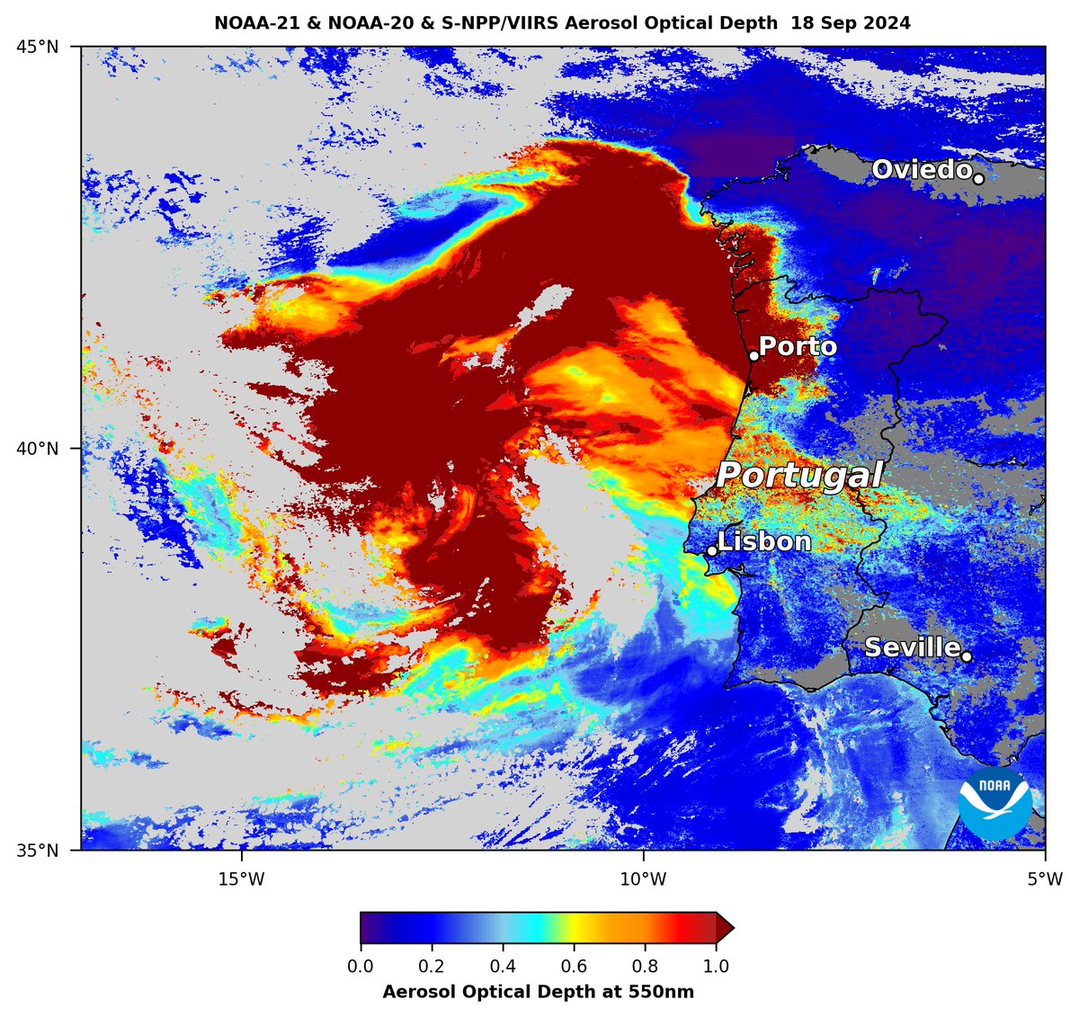
Deadly #wildfires in #Portugal continued to emit huge plumes of thick #smoke (dark red shading) on 18 Sep, which engulfed #Porto, observed by #VIIRS aerosol optical depth composite from Joint Polar Satellite System (JPSS) satellites. NOAA Satellites Mark Parrington Pierre Markuse

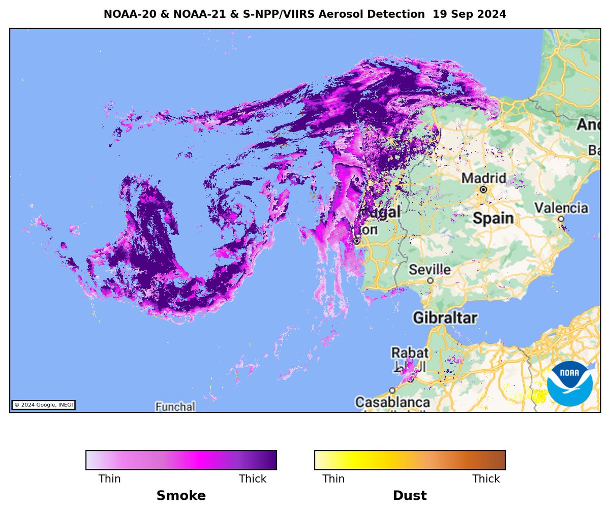
#Smoke (purple/lavender shading) from #Portugal #wildfires covered the north & west coasts of the Iberian Peninsula and was pulled into the circulation of low pressure over the Atlantic on 19 Sep, shown by VIIRS aerosol detection from Joint Polar Satellite System (JPSS) satellites. NOAA Satellites


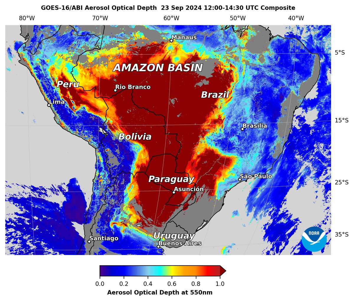
Unrelenting thick #smoke (dark red) from #Amazon #wildfires engulfing regions east of #Andes in #Brazil, #Peru, #Bolivia, #Paraguay & N. #Argentina this morning 23 Sep, shown by NOAA Satellites #GOESEast #ABI aerosol optical depth (AOD) composite. MetSul.com Dr Ana Prados Mark Parrington


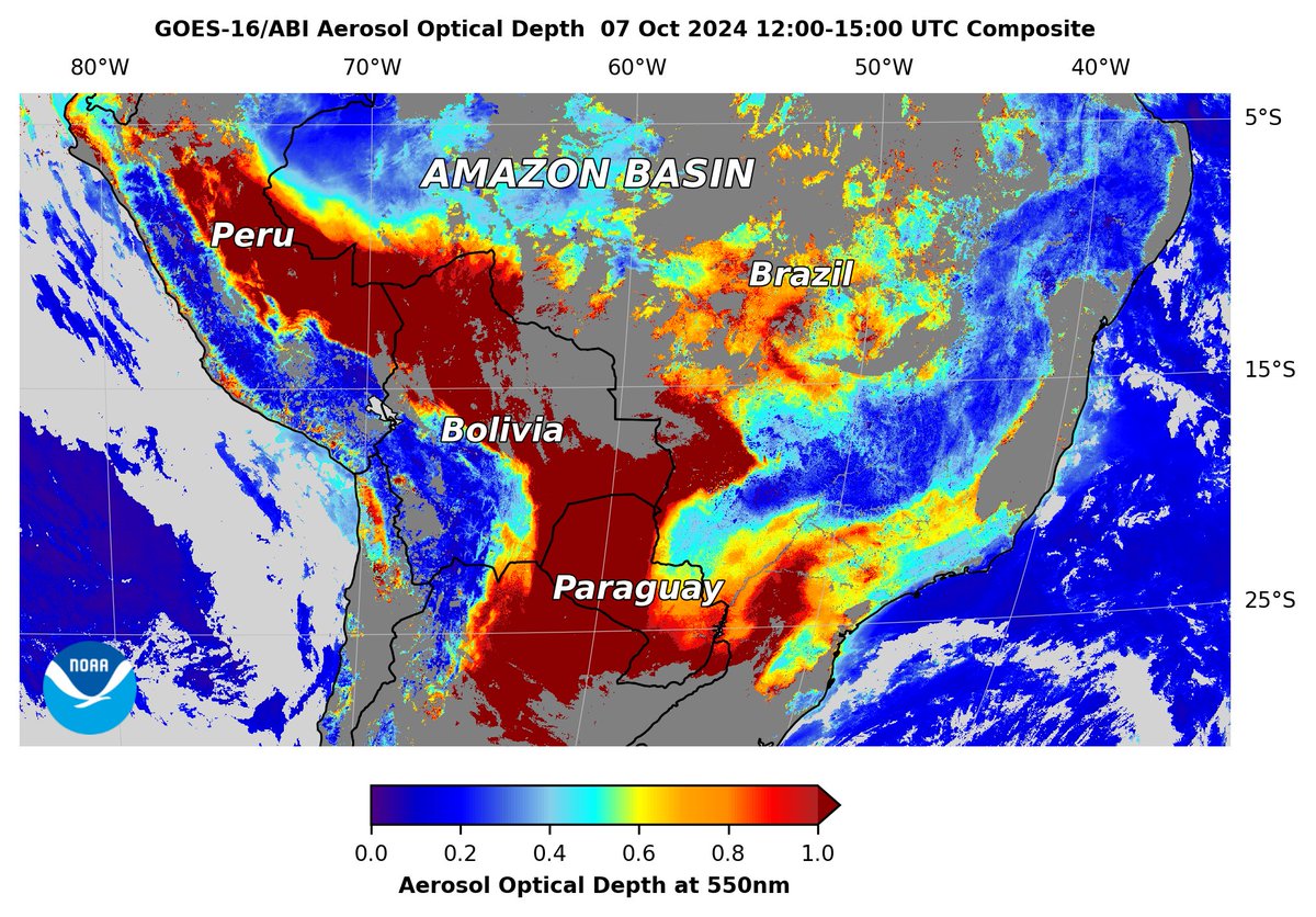
Thick #smoke (dark red) engulfing corridor east of #AndesMountains this morning 7 Oct including #Peru, #Bolivia, #Brazil, #Paraguay & northern #Argentina, shown by #GOESEast #ABI aerosol optical depth. Gaps in data coverage from clouds. NOAA Satellites Dr Ana Prados LFA


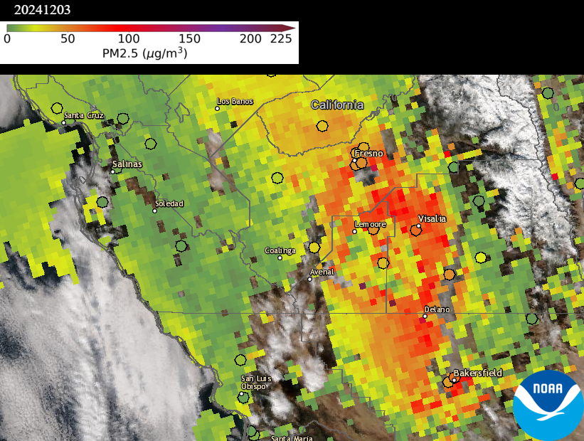
Daily PM2.5 #AirQuality in California’s #SanJoaquinValley was Unhealthy (Code Red) to USG (Code Orange) on 3 Dec, including cities of #Fresno, #Visalia & #Bakersfield, shown by airnow regulatory monitors (dots) & estimated from Joint Polar Satellite System (JPSS) #VIIRS AOD (shading). Valley Air District

Just published with Gareth Byatt and Ilan Kelman Collective Action on Resilience (page 18) issuu.com/irmglobal/docs… #DRR #disaster #disasters #DisastersAreNotNatural #DisastersAvoided #resilience #vulnerability #DisasterRisk

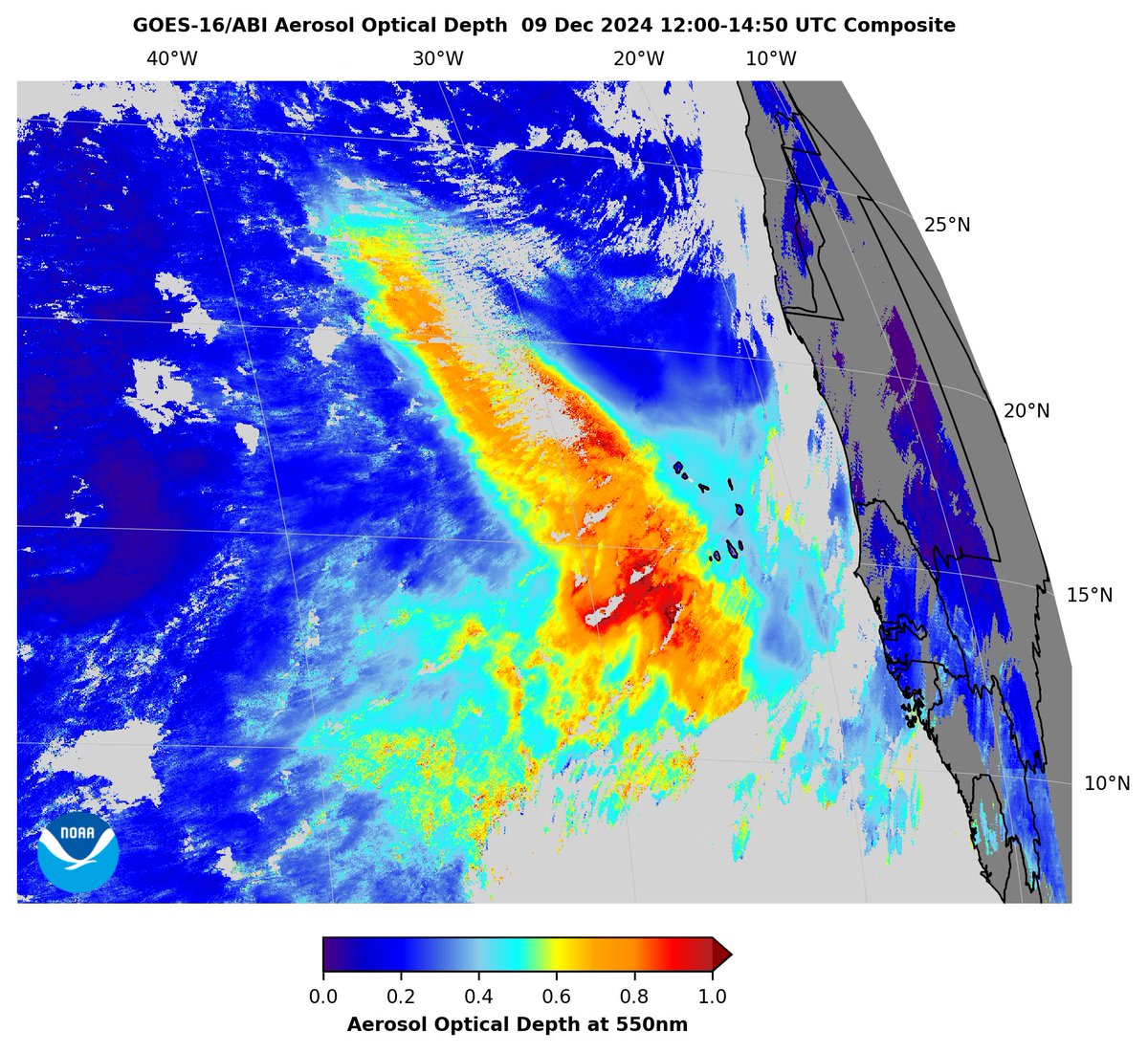
This morning 9 Dec, NOAA Satellites #GOESEast #ABI aerosol optical depth (AOD) observed a large, moderately thick plume of #SaharanDust (AOD ≥0.5) over the tropical eastern #AtlanticOcean, moving away from the coast of #WestAfrica & #CaboVerde. Dust Storm News Tim Schmit

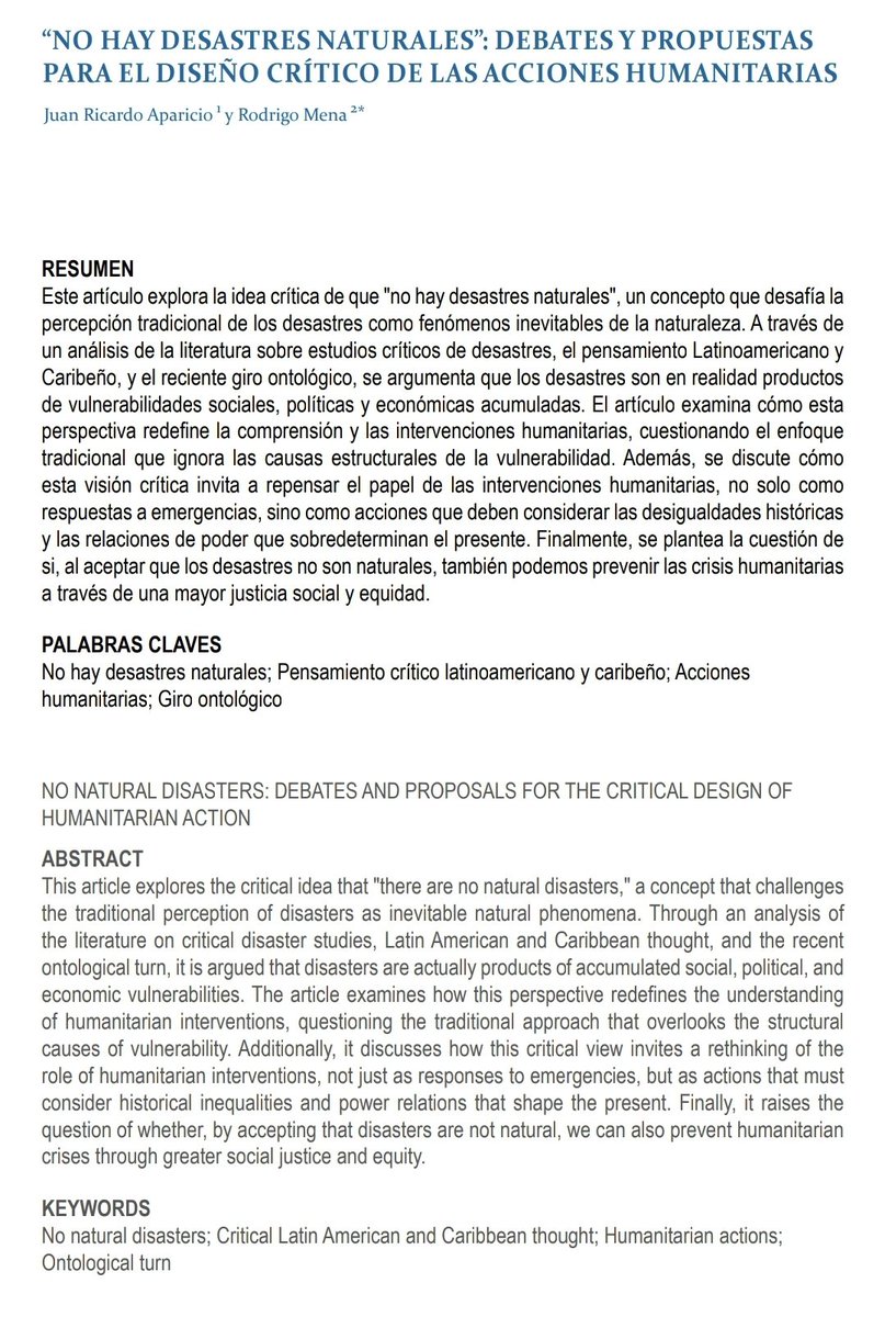
Nueva publicación con el gran Juan Ricardo Aparicio Cuervo "No hay Desastres Naturales: Debates y propuestas para el diseño crítico de las acciones humanitarias" en Revista REDER doi.org/10.55467/reder… #NoNaturalDisasters #NoNaturalDisasters LosDesastresNoSonNaturales ISS, The Hague The Hague Humanitarian Studies Centre European Research Council (ERC)


Key Governance Practices That Facilitate the Use of Remote Sensing Information for Wildfire Management: A Case Study in Spain mdpi.com/3181978 #mdpiremotesensing via Remote Sensing MDPI

The VIIRS sensor on Joint Polar Satellite System (JPSS) NOAA Satellites SNPP & NOAA-20 shows thick smoke (lavender/magenta shading), transported from the Manitoba wildfires, over southern ON/QC & NY, PA, NJ, DE, MD, VA & DC yesterday 3 Jun, causing hazy skies & vivid sunsets. Phurbu


