VITO Remote Sensing (@vito_rs_) 's Twitter Profile
VITO Remote Sensing

@vito_rs_

Specialized in image processing & fascinated by end-to end Earth
observation services, we provide the insights you need. See what Remote Sensing can do for you.

ID: 905169266512719872

linkhttp://remotesensing.vito.be calendar_today05-09-2017 20:42:25

3,3K Tweet

4,4K Takipçi

739 Takip Edilen

Sentinel Hub (@sentinel_hub) 's Twitter Profile Photo

🔵 Sentinel-1 monthly mosaics were recently added to #CopernicusBrowser 🙌 ☝️ Read the latest #CDSE blog post where we describe their access, use and interpretation together with the process of creating them, and plans for this dataset. 👀➡️ dataspace.copernicus.eu/news/2024-8-6-…

VITO Remote Sensing (@vito_rs_) 's Twitter Profile Photo

🆕 A #satellite view on Colville Foreland Basin, a remote area reaching in #Alaska #US. Discover more about this #Sentinel2 false color composite and the fragile landscape in the #CDSE image gallery 👉 dataspace.copernicus.eu/gallery/2024-6… #EUspace #Sentinel #Copernicus #DataSpaceEcosystem

🆕 A #satellite view on Colville Foreland Basin, a remote area reaching in #Alaska #US. 

Discover more about this #Sentinel2 false color composite and the fragile landscape in the #CDSE image gallery 👉 dataspace.copernicus.eu/gallery/2024-6…

#EUspace #Sentinel #Copernicus #DataSpaceEcosystem
EO AFRICA R&D Facility (@eoafricard1) 's Twitter Profile Photo

🔉Proud to announce our new #AdvisoryBoard: 4 remarkable colleagues from African Union , AfricanRemoteSensing National Space Research and Development Agency and SANSA who will support & advise us in developing capacity for #EO 🛰️in #Africa while staying connected with the needs of the continent 🌍EO OPEN SCIENCE

🔉Proud to announce our new #AdvisoryBoard:  4 remarkable colleagues from <a href="/_AfricanUnion/">African Union</a> , <a href="/AfriqueRS/">AfricanRemoteSensing</a> <a href="/NASRDA_Official/">National Space Research and Development Agency</a> and <a href="/SANSA7/">SANSA</a> who will support &amp; advise us in developing capacity for #EO 🛰️in #Africa while staying connected with the needs of the continent 🌍<a href="/EO_OPEN_SCIENCE/">EO OPEN SCIENCE</a>
ESA Earth Observation (@esa_eo) 's Twitter Profile Photo

A satellite image showing the burnt areas caused by the ongoing fires in the Attica region in Greece. red= vegetation brown=burnt area Copernicus EMS emergency mapping was activated for the affected area which exceeds 100 sq km. 📸 Copernicus EU #Sentinel2

A satellite image showing the burnt areas caused by the ongoing fires in the Attica region in Greece. 

red= vegetation
brown=burnt area

<a href="/CopernicusEMS/">Copernicus EMS</a> emergency mapping was activated for the affected area which exceeds 100 sq km. 
📸 <a href="/CopernicusEU/">Copernicus EU</a> #Sentinel2
Sentinel Hub (@sentinel_hub) 's Twitter Profile Photo

🤩 We are happy to share that the Sentinel-3 OLCI L2 data collections are now available for browsing and visualisation in the #CopernicusBrowser and are also accessible via Sentinel Hub APIs through the Copernicus Data Space Ecosystem. Read more here ➡️ dataspace.copernicus.eu/news/2024-8-13…
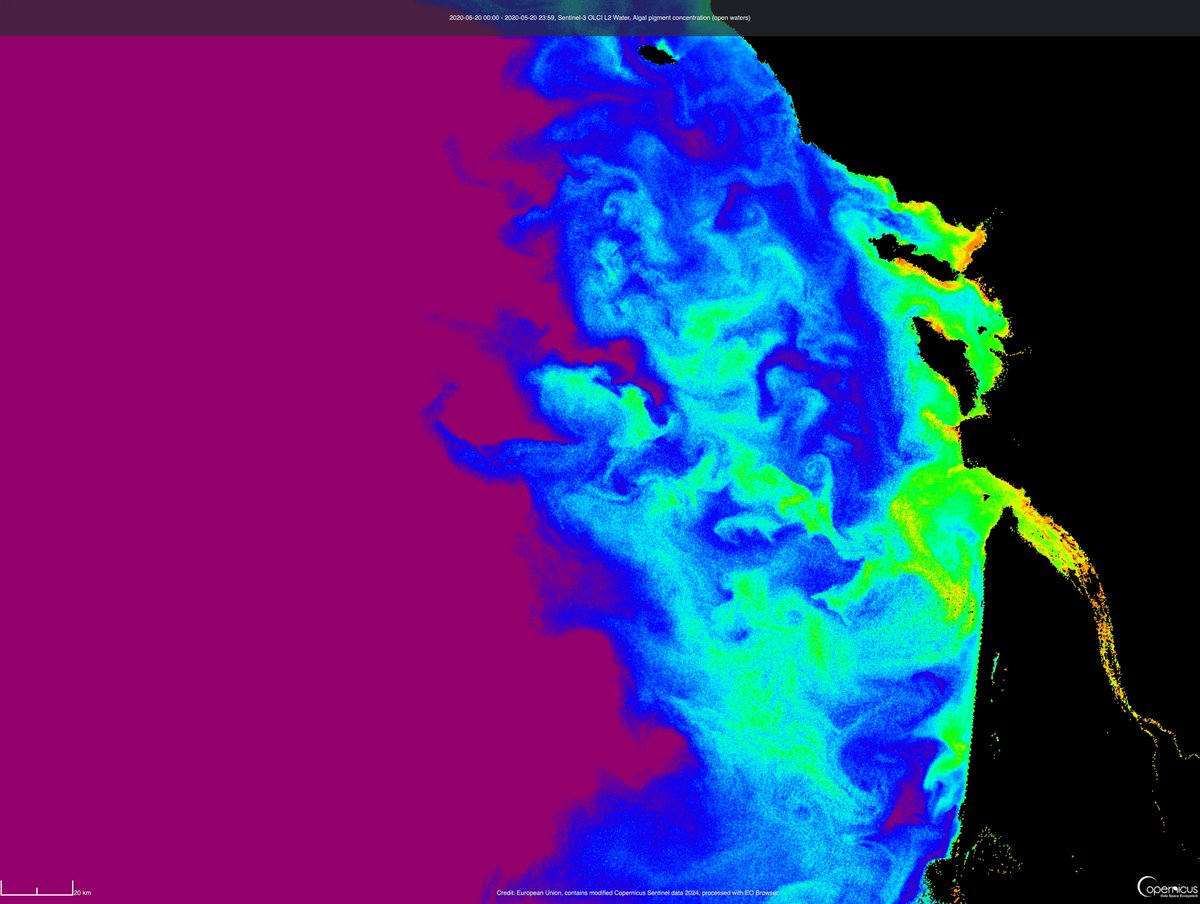

🤩 We are happy to share that the Sentinel-3 OLCI L2 data collections are now available for browsing and visualisation in the #CopernicusBrowser and are also accessible via <a href="/sentinel_hub/">Sentinel Hub</a> APIs through the Copernicus Data Space Ecosystem.
Read more here ➡️ dataspace.copernicus.eu/news/2024-8-13…
EU Grassland Watch (@eu_grasslands) 's Twitter Profile Photo

Extensively managed grasslands are commonly characterised by continuous vegetation 🌾& high biodiversity value throughout the year Mowing only occurs every few years to maintain the open character of the #grassland and promote #biodiversity❗️

Extensively managed grasslands are commonly characterised by continuous vegetation 🌾&amp; high biodiversity value throughout the year 

Mowing only occurs every few years to maintain the open character of the #grassland and promote #biodiversity❗️
VITO Remote Sensing (@vito_rs_) 's Twitter Profile Photo

🤟 Boosting #drone-based services in #agriculture 🌱🧑‍💻 ‼️ SAVE THE DATE OpsDrone workshop en hackathon: Drone Sampling & aanmaken taakkaarten voor landbouwapplicaties 🗓️ 26/9 ⏰ 9:30 - 17:30 📍 ILVO, Merelbeke Information & registration ⬇️ remotesensing.vito.be/events/opsdron…

🤟 Boosting #drone-based services in #agriculture 🌱🧑‍💻

‼️ SAVE THE DATE
OpsDrone workshop en hackathon: Drone Sampling &amp; aanmaken taakkaarten voor landbouwapplicaties
🗓️ 26/9
⏰ 9:30 - 17:30
📍 <a href="/ILVOvlaanderen/">ILVO</a>, Merelbeke  

Information &amp; registration ⬇️
remotesensing.vito.be/events/opsdron…
VITO (@vitobelgium) 's Twitter Profile Photo

🙏 We've been nominated for the EU Triple E Awards @ACEEU! We'd be so grateful for your support in the People's Choice Award. 1️⃣ Vote here: europe-africa2024.triple-e-awards.com/finalist/id/860 2️⃣ Like this post or RT with #2024Entry860 #ACEEU_Awards Thank you for your support! 💚 #EUTripleEAwards

🙏 We've been nominated for the EU Triple E Awards  @ACEEU! We'd be so grateful for your support in the People's Choice Award.

1️⃣ Vote here: europe-africa2024.triple-e-awards.com/finalist/id/860
2️⃣ Like this post or RT with #2024Entry860 #ACEEU_Awards

Thank you for your support! 💚
#EUTripleEAwards
CENTAUR (@centaur_eu) 's Twitter Profile Photo

#DYK that our #CENTAUR consortium is composed of 1⃣4⃣ high-profile European partners❓ It includes: 🌐Service developers from Copernicus EMS & 🛡️#CopernicusSESA 💻#AI technologies providers 🧑‍🤝‍🧑Socioeconomic experts ⛈️Weather model providers 🌱Land indicators experts

#DYK that our #CENTAUR consortium is composed of 1⃣4⃣ high-profile European partners❓

It includes:

🌐Service developers from <a href="/CopernicusEMS/">Copernicus EMS</a> &amp;
🛡️#CopernicusSESA
💻#AI technologies providers
🧑‍🤝‍🧑Socioeconomic experts
⛈️Weather model providers
🌱Land indicators experts
VITO Remote Sensing (@vito_rs_) 's Twitter Profile Photo

Proud to announce that the INSPIRE project has been endorsed by the Ocean Best Practices for UN Ocean Decade Programme! 🤩 More information about the INSPIRE project and it's innovative #solutions for #plastic free European rivers 💙🌊 ➡️ inspire-europe.org

ESA Space Transport (@esa_transport) 's Twitter Profile Photo

It's the final countdown for Vega. The launch chronology has started for tonight's Vega rocket launch, setting up for liftoff of #VV24 on 4 September 2024, 02:50 BST/03:50 CEST. Watch live: esa.int/Applications/O…

It's the final countdown for Vega. 
The launch chronology has started for tonight's Vega rocket launch, setting up for liftoff of #VV24 on 4 September 2024, 02:50 BST/03:50 CEST.
Watch live: esa.int/Applications/O…
European Space Agency (@esa) 's Twitter Profile Photo

#VV24 update: the launch of Copernicus EU #Sentinel2C from Europe’s Spaceport in French Guiana has been postponed. Checks are being conducted to confirm a new launch attempt on 5 September at 02:50 BST/03:50 CEST. More details from Arianespace ⬇️

VITO Remote Sensing (@vito_rs_) 's Twitter Profile Photo

🚀 #Copernicus #Sentinel2C is successfully launched! Already looking forward to see the data available via the #Copernicus Data Space Ecosystem #CDSE after calibration phase. Congrats to the entire team! 🛰 🌍 👏 ➡️ esa.int/Applications/O… Copernicus EU ESA Earth Observation 🇪🇺 DG DEFIS #StrongerTogether

VITO Remote Sensing (@vito_rs_) 's Twitter Profile Photo

👩‍🏫 #BackToSchool with #CDSE! Are you a #teacher or #student interested to use #satellite images for e.g. geography? Use the #CopernicusBrowser! You can easily search, visualize, download, compare, ... #EOdata Read more and spice up your lessons ⤵️ dataspace.copernicus.eu/news/2024-9-2-…

👩‍🏫 #BackToSchool with #CDSE!

Are you a #teacher or #student interested to use #satellite images for e.g. geography? Use the #CopernicusBrowser! You can easily search, visualize, download, compare, ... #EOdata

Read more and spice up your lessons ⤵️ dataspace.copernicus.eu/news/2024-9-2-…
INSPIRE (@inspire_europe) 's Twitter Profile Photo

🌊 Your expertise can help restore our rivers and ocean! 💙🌍 Share your experiences in the Stakeholder #Survey on #plasticpollution in Rivers & be a part of the solution! ⬇️ inspire-europe.org/news/inspire-s… Deadline: September, 15! EU Mission Ocean #EUMissions

🌊 Your expertise can help restore our rivers and ocean! 💙🌍

Share your experiences in the Stakeholder #Survey on #plasticpollution in Rivers &amp; be a part of the solution! 
⬇️
 inspire-europe.org/news/inspire-s…

Deadline: September, 15!

<a href="/eumissionocean/">EU Mission Ocean</a> #EUMissions
VITO Remote Sensing (@vito_rs_) 's Twitter Profile Photo

Next #PATH2DEAnewsletter 📨is coming up in December! Subscribe now & we'll keep you posted about the PATH2DEA project, connecting EU initiatives and platforms in #agroecology and #digital #technology. 🌱🧑‍💻🌽👨‍🌾🌾 ⬇️ path2dea.eu/communication/…

VITO Remote Sensing (@vito_rs_) 's Twitter Profile Photo

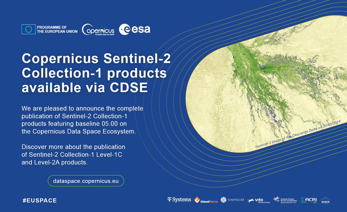
🆕 #CDSE announces the publication of #Sentinel2 Collection-1 L1C & L2A products featuring baseline 05.00! 🛰️ Read more about the publication, product generation and proceedings of the reprocessing ⤵️ dataspace.copernicus.eu/news/2024-9-2-… #EUspace #Copernicus #CopernicusEU #CDSE

🆕 #CDSE announces the publication of #Sentinel2 Collection-1 L1C &amp; L2A products featuring baseline 05.00! 🛰️

Read more about the publication, product generation and proceedings of the reprocessing ⤵️
dataspace.copernicus.eu/news/2024-9-2-…

#EUspace #Copernicus #CopernicusEU #CDSE
VITO Remote Sensing (@vito_rs_) 's Twitter Profile Photo

🔥 Ready to discover our game-changing 'Drone Sampling' technology which breaks down traditional barriers (complexity & costs) and boosts the efficiency of #drone applications? Check our latest blog! ➡️ blog.vito.be/remotesensing/… Join us for a live demo ➡️ remotesensing.vito.be/events/opsdron…

🔥 Ready to discover our game-changing 'Drone Sampling' technology which breaks down traditional barriers (complexity &amp; costs) and boosts the efficiency of #drone applications?

Check our latest blog!
➡️ blog.vito.be/remotesensing/…

Join us for a live demo
➡️ remotesensing.vito.be/events/opsdron…
European Space Agency (@esa) 's Twitter Profile Photo

📷 This week's ESA Earth Observation #EarthFromSpace is a Copernicus EU #Sentinel2 image of, well, Sentinel-2! Europe’s Spaceport in French Guiana seen on 2 September, just ahead of the #Sentinel2C launch.

📷 This week's <a href="/ESA_EO/">ESA Earth Observation</a> #EarthFromSpace is a <a href="/CopernicusEU/">Copernicus EU</a> #Sentinel2 image of, well, Sentinel-2! 
Europe’s Spaceport in French Guiana seen on 2 September, just ahead of the #Sentinel2C launch.
VITO Remote Sensing (@vito_rs_) 's Twitter Profile Photo

📣 Are you going to #TerraemFoco, the Portuguese #earthobservation & #GIS conference? Join us 👇 & learn more about #CDSE, the use of #Copernicus #EOdata & #APIs 🔸 12/9: keynote 🔸 13/9: workshop on visualizing & analysing data using #SentinelHub #APIs lnkd.in/e7GDDqf8

📣 Are you going to #TerraemFoco, the Portuguese #earthobservation &amp; #GIS conference?

Join us 👇 &amp; learn more about #CDSE, the use of #Copernicus #EOdata &amp; #APIs

🔸 12/9: keynote
🔸 13/9: workshop on visualizing &amp; analysing data using #SentinelHub #APIs

lnkd.in/e7GDDqf8