Oregon Hazards Lab (@uohazardslab) 's Twitter Profile
Oregon Hazards Lab

@uohazardslab

Using science, technology, and community engagement to understand, detect, and mitigate multi-hazards in the Pacific Northwest.

ID: 1582821587526352896

linkhttp://ohaz.uoregon.edu calendar_today19-10-2022 19:52:51

827 Tweet

415 Followers

112 Following

Oregon Hazards Lab (@uohazardslab) 's Twitter Profile Photo

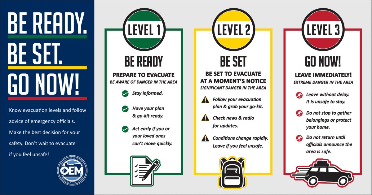
🔥 It's #WildfireWednesday! As we enter fire season, it's important to understand Oregon's different evacuation levels and what they mean for you. 🟢Level 1: Be Ready 🟡Level 2: Be Set 🔴Level 3: Go Learn more about Oregon evacuation levels at oralert.gov

🔥 It's #WildfireWednesday!

As we enter fire season, it's important to understand Oregon's different evacuation levels and what they mean for you.

🟢Level 1: Be Ready 
🟡Level 2: Be Set
đź”´Level 3: Go

Learn more about Oregon evacuation levels at oralert.gov
NWS Portland (@nwsportland) 's Twitter Profile Photo

May is National Wildfire Awareness Month! This week's posts highlight campfire safety. If camping and planning to start a campfire, it's important to know restrictions and to have a solid way of receiving alerts. Some outdoor activities could be prohibited in your area.

May is National Wildfire Awareness Month! This week's posts highlight campfire safety. If camping and planning to start a campfire, it's important to know restrictions and to have a solid way of receiving alerts. Some outdoor activities could be prohibited in your area.
USGS Volcanoes🌋 (@usgsvolcanoes) 's Twitter Profile Photo

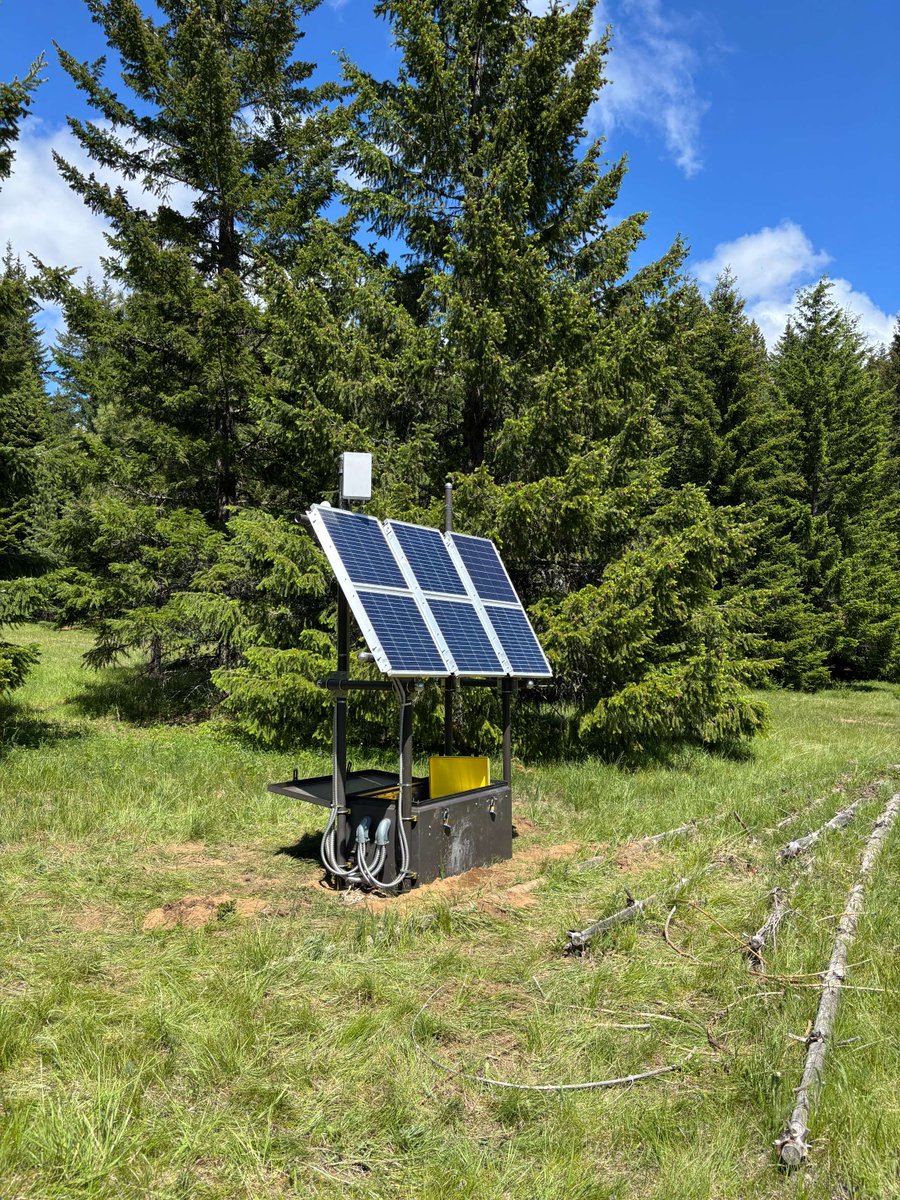
Cascade Range volcanoes at normal background levels of activity this week: ow.ly/Ib7r50VWPs7. New radio shelter installed in early May near Kapowsin, WA, west of Mt. Rainier, will provide more robust radio connectivity with Rainier Lahar Detection System stations.

Cascade Range volcanoes at normal background levels of activity this week: ow.ly/Ib7r50VWPs7.

New radio shelter installed in early May near Kapowsin, WA, west of Mt. Rainier, will provide more robust radio connectivity with Rainier Lahar Detection System stations.
OregonOEM (@oregonoem) 's Twitter Profile Photo

Know Your Evacuation Levels 🚨 When wildfire strikes, every second counts. Be ready to act by understanding Oregon’s evacuation levels: 🔴 Level 3 – GO NOW 🟡 Level 2 – BE SET 🟢 Level 1 – BE READY

Know Your Evacuation Levels 🚨

When wildfire strikes, every second counts. Be ready to act by understanding Oregon’s evacuation levels:

🔴 Level 3 – GO NOW
🟡 Level 2 – BE SET
🟢 Level 1 – BE READY
Oregon Hazards Lab (@uohazardslab) 's Twitter Profile Photo

The #ShakeAlert #EEW System has a new alert delivery partner! Genasys Inc is now licensed to deliver USGS ShakeAlert alerts to clients through its Protective Communications platform. Find a full list of licensed alert delivery partners at ohaz.uoregon.edu/shakealert-lic….

Oregon Hazards Lab (@uohazardslab) 's Twitter Profile Photo

It's #WildfireWednesday 🔥 Oregon’s first large wildfire of 2025, the Butte Creek Fire, was captured by our Shaniko wildfire detection camera. Smoke is visible by day, and its glow lights up the night. 🔗 Watch live at ALERTWest.live and on the Watch Duty App.

It's #WildfireWednesday 🔥

Oregon’s first large wildfire of 2025, the Butte Creek Fire, was captured by our Shaniko wildfire detection camera. Smoke is visible by day, and its glow lights up the night.

đź”— Watch live at ALERTWest.live and on the Watch Duty App.
Oregon Hazards Lab (@uohazardslab) 's Twitter Profile Photo

Happy #FieldWorkFriday! OHAZ partnered with Umpqua National Forest to deploy a mobile wildfire camera near Toketee Ranger Station this week! This tool will help Forest Service NW monitor a prescribed fire. đź”—Learn more about lightweight portable wildfire camera kits: ohaz.uoregon.edu/mobile-cameras.

Happy #FieldWorkFriday!

OHAZ partnered with <a href="/UmpquaNF/">Umpqua National Forest</a> to deploy a mobile wildfire camera near Toketee Ranger Station this week! This tool will help <a href="/ForestServiceNW/">Forest Service NW</a> monitor a prescribed fire.

đź”—Learn more about lightweight portable wildfire camera kits: ohaz.uoregon.edu/mobile-cameras.
USGS Volcanoes🌋 (@usgsvolcanoes) 's Twitter Profile Photo

Cascade Range volcanoes remain normal this week: ow.ly/HvAc50VY9rl. Congrats to Dr. Richard Waitt, who retires from CVO on May 31 after a 50-year career that included work on Mount St. Helens, the Missoula Floods, and writing “In the Path of Destruction" about 1980 events.

Cascade Range volcanoes remain normal this week: ow.ly/HvAc50VY9rl. Congrats to Dr. Richard Waitt, who retires from CVO on May 31 after a 50-year career that included work on Mount St. Helens, the Missoula Floods, and writing “In the Path of Destruction" about 1980 events.
USGS Volcanoes🌋 (@usgsvolcanoes) 's Twitter Profile Photo

Cascade Range volcanoes at normal background levels of activity this week: ow.ly/ZE8550W5gSq. Seismic station HORC at Mt. Adams was converted to a permanent site last week—the first of several permitted installations that will expand monitoring at the volcano.

Cascade Range volcanoes at normal background levels of activity this week: ow.ly/ZE8550W5gSq.

Seismic station HORC at Mt. Adams was converted to a permanent site last week—the first of several permitted installations that will expand monitoring at the volcano.
PNSN (@pnsn1) 's Twitter Profile Photo

Happy #FieldworkFriday! As part of our preventative maintenance, sites that experience high temp fluctuations, like station HTW, have a gravel-backed wall built along the southern side. This sun blocking barrier helps keep the equipment cool and extends the life of our equipment.

Happy #FieldworkFriday! As part of our preventative maintenance, sites that experience high temp fluctuations, like station HTW, have a gravel-backed wall built along the southern side. This sun blocking barrier helps keep the equipment cool and extends the life of our equipment.
Oregon Hazards Lab (@uohazardslab) 's Twitter Profile Photo

Happy #FieldWorkFriday! This week, we upgraded WOOD, a @pnsn1 seismic station in the southern Cascades. We retired the site's older equipment and installed new broadband and strong motion sensors. WOOD contributes ground motion data to USGS ShakeAlert and earthquake research.

Happy #FieldWorkFriday! This week, we upgraded WOOD, a @pnsn1 seismic station in the southern Cascades. We retired the site's older equipment and installed new broadband and strong motion sensors. WOOD contributes ground motion data to <a href="/USGS_ShakeAlert/">USGS ShakeAlert</a> and earthquake research.
Oregon Hazards Lab (@uohazardslab) 's Twitter Profile Photo

It's #WildfireWednesday!🔥 30–40% of homes in Oregon are located in the Wildland Urban Interface (WUI). If you're in the WUI, protect your home by creating defensible space and using home hardening methods. 🔗Learn more wildfire preparedness tips at bit.ly/3Z5Gtmg.

It's #WildfireWednesday!🔥

30–40% of homes in Oregon are located in the Wildland Urban Interface (WUI). If you're in the WUI, protect your home by creating defensible space and using home hardening methods.

đź”—Learn more wildfire preparedness tips at bit.ly/3Z5Gtmg.
Oregon Hazards Lab (@uohazardslab) 's Twitter Profile Photo

It's #FieldWorkFriday! This week, OHAZ did maintenance at PETE. Notice anything different about PETE? This @pnsn1 seismic station is co-located with an EarthScope Consortium geodetic station! Learn how geodetic stations also send data to USGS ShakeAlert at ohaz.uoregon.edu/project/gfast-….
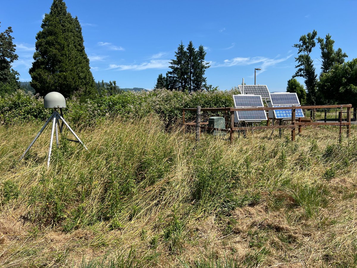
It's #FieldWorkFriday! This week, OHAZ did maintenance at PETE.

Notice anything different about PETE? This @pnsn1 seismic station is co-located with an <a href="/EarthScope_sci/">EarthScope Consortium</a> geodetic station!

Learn how geodetic stations also send data to <a href="/USGS_ShakeAlert/">USGS ShakeAlert</a> at ohaz.uoregon.edu/project/gfast-….
USGS Volcanoes🌋 (@usgsvolcanoes) 's Twitter Profile Photo

Cascade Range volcanoes at normal background levels of activity this week: ow.ly/MPNw50W9l1C. Telemetry systems allow CVO to retrieve monitoring data from remote locations. In this video, CVO engineers replace a telemetry system at a Mount St. Helens monitoring station.

Oregon Hazards Lab (@uohazardslab) 's Twitter Profile Photo

OHAZ stands at the forefront of research and innovation at University of Oregon, offering critical real-time data from our wildfire detection cameras and seismic sensors. Learn more about the value of OHAZ’s research and the impact of other labs at UO🔗research.uoregon.edu/research-trans…

OHAZ stands at the forefront of research and innovation at <a href="/uoregon/">University of Oregon</a>, offering critical real-time data from our wildfire detection cameras and seismic sensors. 

Learn more about the value of OHAZ’s research and the impact of other labs at UO🔗research.uoregon.edu/research-trans…
Oregon Hazards Lab (@uohazardslab) 's Twitter Profile Photo

The #AlderSpringsFire in Jefferson County is visible on multiple OHAZ wildfire cameras. Watch live with Watch Duty and ALERTWest: alertwest.live. Get official fire and evacuation info from Central OR Fire Info: centraloregonfire.org. #OHAZ #FireCams #FireYear2025

The #AlderSpringsFire in Jefferson County is visible on multiple OHAZ wildfire cameras.

Watch live with <a href="/watchdutyapp/">Watch Duty</a> and <a href="/ALERTWestCams/">ALERTWest</a>: alertwest.live.

Get official fire and evacuation info from <a href="/CentralORFire/">Central OR Fire Info</a>: centraloregonfire.org.

#OHAZ #FireCams #FireYear2025