TangWei (@swifttang) 's Twitter Profile
TangWei

@swifttang

ID: 744007799630237696

calendar_today18-06-2016 03:24:17

45 Tweet

41 Followers

119 Following

Mahdi Motagh (@mahdimotagh) 's Twitter Profile Photo

#Hambach Forest in West #Germany has been adversely affected by #mining. As the process continues, so does instability due to compaction of waste material and excavation, as seen by #Sentinel1 & #TerraSARX #InSAR in our new paper. EU EnvironmentAgency sciencedirect.com/science/articl…
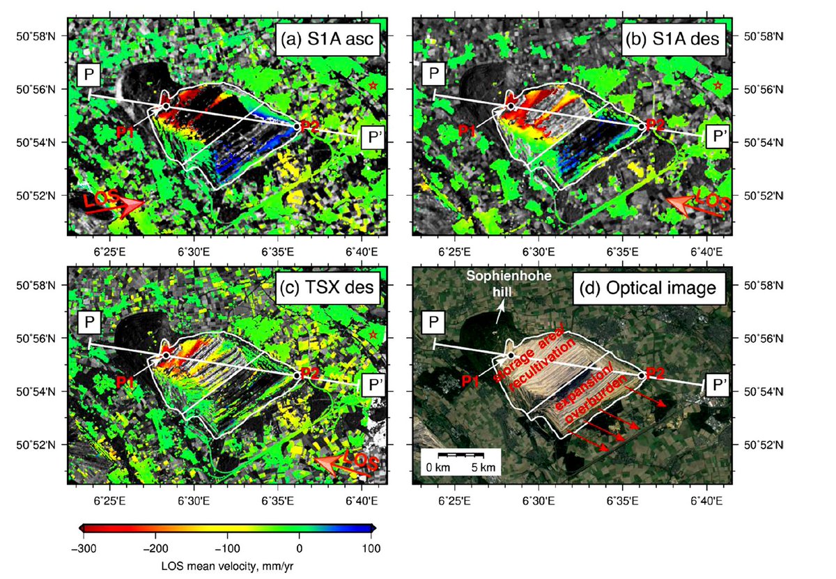
#Hambach Forest in West #Germany has been adversely affected by #mining. As the process continues, so does instability due to compaction of waste material and excavation, as seen by #Sentinel1 &amp; #TerraSARX #InSAR in our new paper. <a href="/EUEnvironment/">EU EnvironmentAgency</a>  
sciencedirect.com/science/articl…
Mahdi Motagh (@mahdimotagh) 's Twitter Profile Photo

Another German TV report about our recent work for mining induced deformation in #Hambach. This time they show #InSAR maps from our paper and discuss about the advantage of using such a technology for mining industry. TangWei

Mahdi Motagh (@mahdimotagh) 's Twitter Profile Photo

Using #InSAR, #GPS, and #tidegauge to evaluate spatial variability of relative sea level rise(#SLR & #RSLR) along the coastline of #Tianjin, #China, and its implication for sustainable development there, see paper by TangWei ieeexplore.ieee.org/document/93362…

Using #InSAR, #GPS, and #tidegauge to evaluate  spatial variability of relative sea level rise(#SLR &amp; #RSLR) along the coastline of #Tianjin, #China, and its implication for sustainable development there, see paper by <a href="/SwiftTang/">TangWei</a> 

ieeexplore.ieee.org/document/93362…
The Groundwater Project (@groundwaterproj) 's Twitter Profile Photo

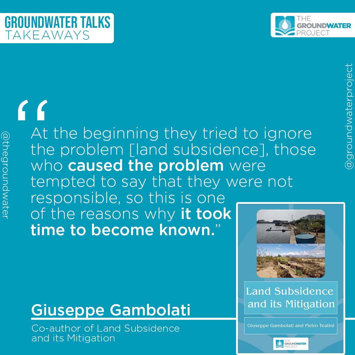
Learn about the subject by downloading our most recent release, the book Land Subsidence and its Mitigation: cutt.ly/GWP_LandSubsid… Share it with your colleagues and friends. Every share makes groundwater more visible!

Learn about the subject by downloading our most recent release, the book Land Subsidence and its Mitigation: cutt.ly/GWP_LandSubsid…

Share it with your colleagues and friends. Every share makes groundwater more visible!
Mahdi Motagh (@mahdimotagh) 's Twitter Profile Photo

A news article in The Gaurdian about our recent work at #RSE journal for #subsidence and #rebound in #Taiyuan, #China. Elsevier Environment People's Daily, China The Watchers sciencedirect.com/science/articl… Terrawatch: what the world can learn from China’s sinking city theguardian.com/science/2021/d…

Kirk Borne (@kirkdborne) 's Twitter Profile Photo

[Free PDF Download] Introduction to #Probability for Data Science: probability4datascience.com by Stanley H. Chan ————— #StatisticalLiteracy #Mathematics #AI #BigData #MachineLearning #DataScience #DataScientists #DataLiteracy #Statistics

[Free PDF Download] Introduction to #Probability for Data Science: probability4datascience.com by <a href="/stanley_h_chan/">Stanley H. Chan</a> 
—————
#StatisticalLiteracy #Mathematics #AI #BigData #MachineLearning #DataScience #DataScientists #DataLiteracy #Statistics
RS4GeoHZ (@gfzremote) 's Twitter Profile Photo

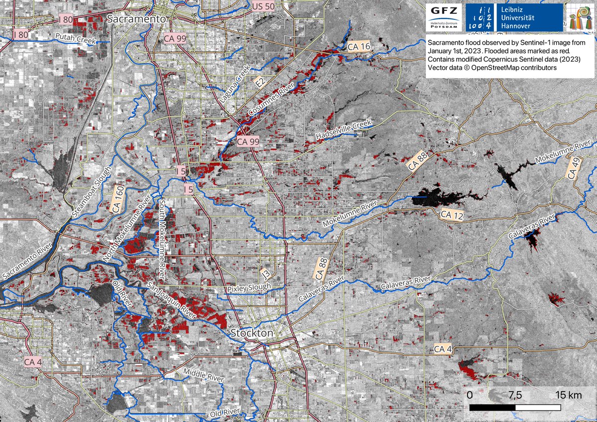
"When disaster strikes, our team is always ready to jump into action. Thanks to the hard work of Mahmud Haghshenas, Mahdi Motagh, and Shagun Garg, we've been able to closely monitor the recent #California #flooding using satellite imagery to create detailed flood maps. (1/4)
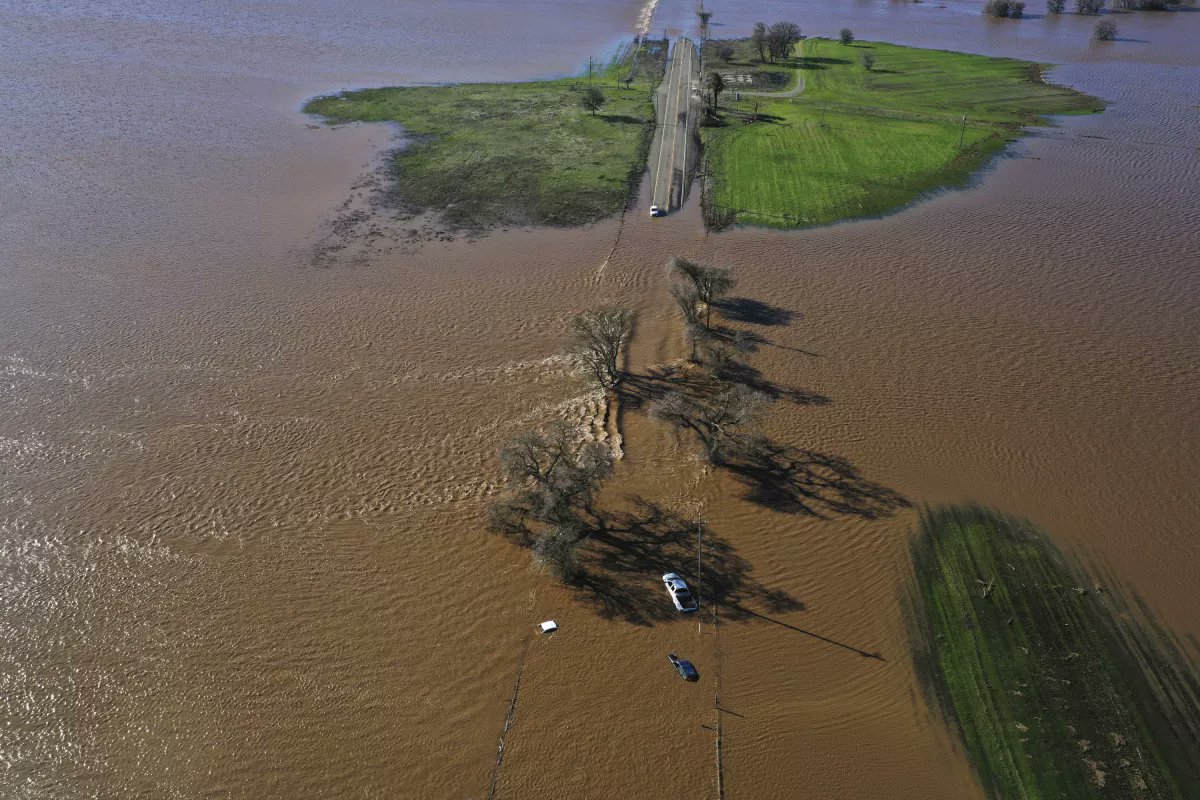

"When disaster strikes, our team is always ready to jump into action. Thanks to the hard work of <a href="/Mahmudhh/">Mahmud Haghshenas</a>, <a href="/MahdiMotagh/">Mahdi Motagh</a>, and <a href="/ShagunGarg1511/">Shagun Garg</a>, we've been able to closely monitor the recent #California  #flooding using satellite imagery to create detailed flood maps. (1/4)
RS4GeoHZ (@gfzremote) 's Twitter Profile Photo

The map below is derived using #SAR-based #Sentinel -1 image on 1st Jan 2023. Flooded areas are depicted in red; Blue color represents water bodies. #Highway99 (depicted as CA99) can be seen flooded in the map. (3/4)

The map below is derived using #SAR-based #Sentinel -1 image on 1st Jan 2023. Flooded areas are depicted in red; Blue color represents water bodies. 

#Highway99 (depicted as CA99) can be seen flooded in the map.  (3/4)
Mahdi Motagh (@mahdimotagh) 's Twitter Profile Photo

Can we rely on #checkdams for #flood control in face of changing climate? See the lessons we learned from the 28 July 2022 #flood in northwestern #Tehran

Mahdi Motagh (@mahdimotagh) 's Twitter Profile Photo

A methodology developed by Zhuge to characterize 4D post-failure #slope #instability using a combination of #SAR and #optical #remotesensing data with a feature extraction technique & a relaxation model. #landslide #Aniangzhai #China

China 'N Asia Spaceflight 🚀𝕏 🛰️ (@cnspaceflight) 's Twitter Profile Photo

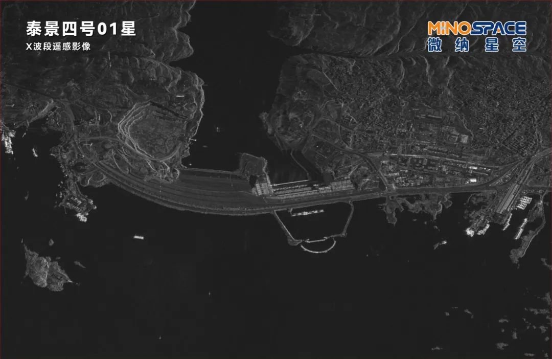
SAR images look so cool! Here are some taken by China's first commercial X-band SAR satellite: MINOSPACE's Taijing-4-01: The Space City Houston and home of Rockets; Verrazzano-Narrows Bridge connecting Staten Island and Brooklyn; Aswan High Dam of Egypt

SAR images look so cool! Here are some taken by China's first commercial X-band SAR satellite: MINOSPACE's Taijing-4-01:
The Space City Houston and home of Rockets;
Verrazzano-Narrows Bridge connecting Staten Island and Brooklyn;
Aswan High Dam of Egypt
RS4GeoHZ (@gfzremote) 's Twitter Profile Photo

First day of European Geosciences Union General Assembly #EGU23 conference! Our group will be presenting two talks today about #Aniangzhai #landslide & tectonics of the #Tianshan orogenic belt Zhuge Xia, April 24, NH3.2, 14:23-14:33 Xiaohang Wang, April 24, TS3.7, 16:15-16:25
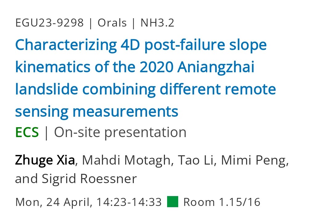
First day of <a href="/EuroGeosciences/">European Geosciences Union</a> General Assembly #EGU23 conference! 
Our group will be presenting two talks today about #Aniangzhai #landslide &amp; tectonics of the #Tianshan orogenic belt

Zhuge Xia, April 24, NH3.2, 14:23-14:33

Xiaohang Wang, April 24, TS3.7, 16:15-16:25
RS4GeoHZ (@gfzremote) 's Twitter Profile Photo

Congratulations to Zhuge Xia for a successful defense of his PhD dissertation entitled 'Characterizing #slope #instability #kinematics by integrating multi-sensor #satellite #remotesensing observations

Congratulations to  Zhuge Xia for a successful defense of his PhD dissertation entitled 'Characterizing #slope #instability #kinematics by integrating multi-sensor #satellite #remotesensing observations
RS4GeoHZ (@gfzremote) 's Twitter Profile Photo

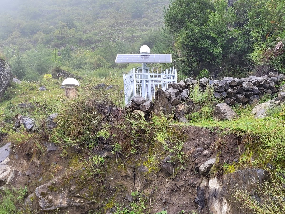
Our team from GFZ visited today the natural laboratory that we have made at #Huangtupo #landslide in #China in cooperation with Wuhan University to evaluate the performance of various types of #CornerReflectors (CR) to assess surface deformation using #CR #InSAR

Our team from <a href="/GFZ_Potsdam/">GFZ</a>  visited today the natural laboratory that we have made at #Huangtupo #landslide in #China in cooperation with <a href="/WuHanUniv/">Wuhan University</a>  to evaluate the performance of various types of #CornerReflectors (CR) to assess surface deformation using #CR #InSAR
RS4GeoHZ (@gfzremote) 's Twitter Profile Photo

Visiting our CR-based monitoring system at #Aniangzhai landslide, a large, deep-seated ancient #landslide that was partially reactivated in June 2020 in #China after a chain of other hazards nearby. For more details see ieeexplore.ieee.org/document/99411… link.springer.com/article/10.100…

Visiting our CR-based monitoring system at #Aniangzhai landslide, a large, deep-seated ancient #landslide that was partially reactivated in June 2020 in #China after a chain of other hazards nearby. For more details see
ieeexplore.ieee.org/document/99411…

link.springer.com/article/10.100…
RS4GeoHZ (@gfzremote) 's Twitter Profile Photo

New paper out! Tang Wei's article on analyzing 3D #groundmotion at #Liaohe oilfield in #China using multi-track #InSAR & #geomechanical modeling, published at International Journal of Rock Mechanics and Mining Sciences. TangWei UNESCO Land Subsidence International Initiative authors.elsevier.com/c/1iRt~4sPjBxw…
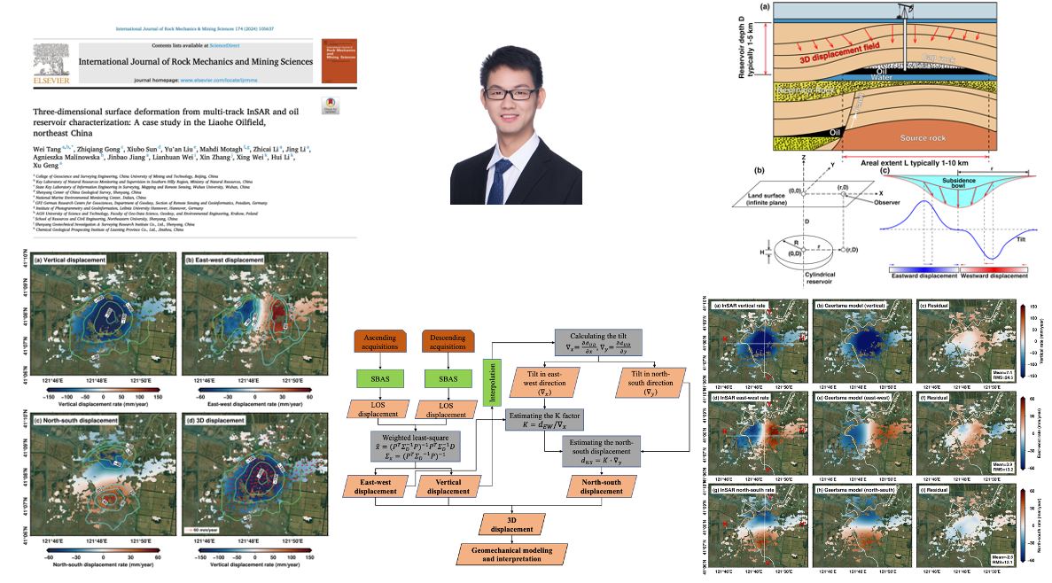
New paper out! Tang Wei's article  on analyzing 3D #groundmotion at #Liaohe oilfield in #China using multi-track #InSAR &amp; #geomechanical modeling, published at International Journal of Rock Mechanics and Mining Sciences.
<a href="/SwiftTang/">TangWei</a> 
<a href="/Land_Subsidence/">UNESCO Land Subsidence International Initiative</a> 

authors.elsevier.com/c/1iRt~4sPjBxw…
RS4GeoHZ (@gfzremote) 's Twitter Profile Photo

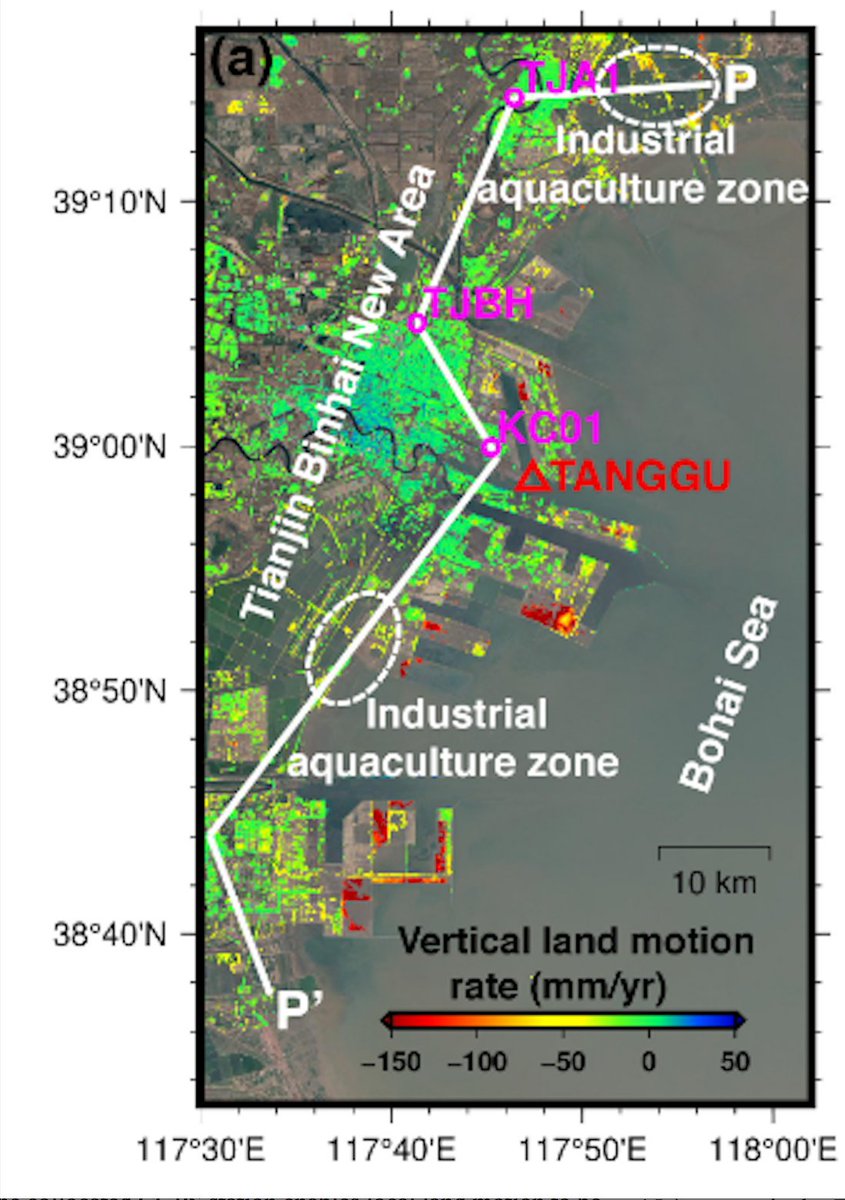
New Paper Alert! In this publication at the #Journal of #Hydrology, led by TangWei, we have shown how decades of effective #water management stategies in northern #China led to reversal of land #subsidence UNESCO Land Subsidence International Initiative Mahdi Motagh Link--> authors.elsevier.com/c/1jZqg52cufA80

New Paper Alert! 
In this publication at the #Journal of #Hydrology, led by <a href="/SwiftTang/">TangWei</a>, we have shown how decades of effective #water management stategies in northern #China led to reversal of land #subsidence
<a href="/Land_Subsidence/">UNESCO Land Subsidence International Initiative</a>
<a href="/MahdiMotagh/">Mahdi Motagh</a>
Link--&gt;
authors.elsevier.com/c/1jZqg52cufA80
RS4GeoHZ (@gfzremote) 's Twitter Profile Photo

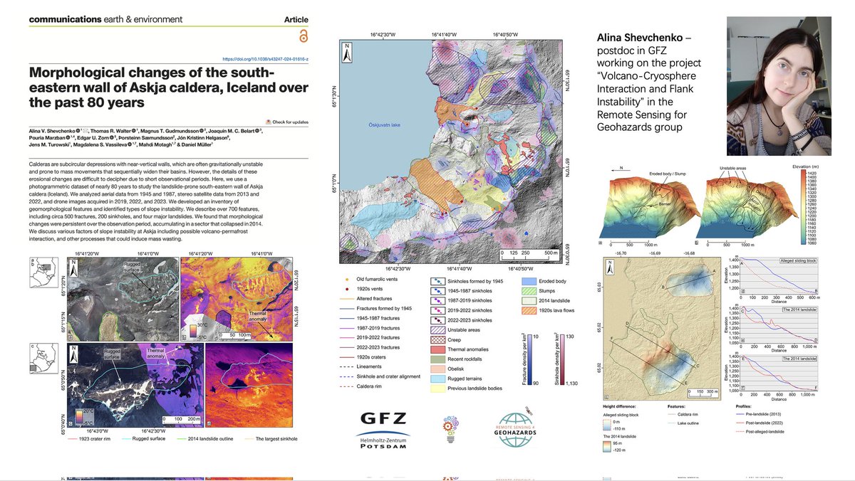
New paper alert! #Photogrammetry meets #Volcanology See the new paper by our posdoc, Alina, published at Communications Earth & Environment. TR Walter Link to the paper--> nature.com/articles/s4324…

New paper alert!
#Photogrammetry meets #Volcanology 
See the new paper by our posdoc, Alina, published at <a href="/CommsEarth/">Communications Earth & Environment</a>.
 <a href="/VOLCAPSE/">TR Walter</a> 

Link to the paper--&gt;
nature.com/articles/s4324…