NWS Key West (@nwskeywest) 's Twitter Profile
NWS Key West

@nwskeywest

Extending the reach of NWS information to the Florida Keys. Visit goo.gl/C9g6i for details & feedback. Cover photo credit to Merideth Rue 6/16/17.

ID: 590300532

linkhttp://www.weather.gov/key calendar_today25-05-2012 18:42:41

27,27K Tweet

57,57K Followers

531 Following

NWS Key West (@nwskeywest) 's Twitter Profile Photo

Aviso Especial Marítimo incluye Lado de Bahía y lado del Golfo desde Craig Key hasta el Final Oeste del Puente Seven Mile y Golfo de América desde el Final Oeste del Puente Seven Mile a Halfmoon Shoal mås allå de 5 Fathoms hasta las 4:00 PM EDT

Aviso Especial Marítimo incluye Lado de Bahía y lado del Golfo desde Craig Key hasta el Final Oeste del Puente Seven Mile y Golfo de América desde el Final Oeste del Puente Seven Mile a Halfmoon Shoal mås allå de 5 Fathoms hasta las 4:00 PM EDT
NWS Key West (@nwskeywest) 's Twitter Profile Photo

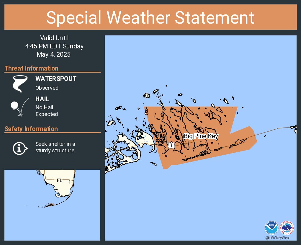
Special Marine Warning including the Bayside and Gulfside from Craig Key to West End of Seven Mile Bridge and Gulf of America from West End of Seven Mile Bridge to Halfmoon Shoal out to 5 Fathoms until 4:45 PM EDT

Special Marine Warning including the Bayside and Gulfside from Craig Key to West End of Seven Mile Bridge and Gulf of America from West End of Seven Mile Bridge to Halfmoon Shoal out to 5 Fathoms until 4:45 PM EDT
NWS Key West (@nwskeywest) 's Twitter Profile Photo

Aviso Especial Marítimo incluye Lado de Bahía y lado del Golfo desde Craig Key hasta el Final Oeste del Puente Seven Mile y Golfo de América desde el Final Oeste del Puente Seven Mile a Halfmoon Shoal mås allå de 5 Fathoms hasta las 4:45 PM EDT

Aviso Especial Marítimo incluye Lado de Bahía y lado del Golfo desde Craig Key hasta el Final Oeste del Puente Seven Mile y Golfo de América desde el Final Oeste del Puente Seven Mile a Halfmoon Shoal mås allå de 5 Fathoms hasta las 4:45 PM EDT
NWS Key West (@nwskeywest) 's Twitter Profile Photo

Special Marine Warning continues for the Bayside and Gulfside from Craig Key to West End of Seven Mile Bridge and Gulf of America from West End of Seven Mile Bridge to Halfmoon Shoal out to 5 Fathoms until 4:45 PM EDT

Special Marine Warning continues for the Bayside and Gulfside from Craig Key to West End of Seven Mile Bridge and Gulf of America from West End of Seven Mile Bridge to Halfmoon Shoal out to 5 Fathoms until 4:45 PM EDT
NWS Key West (@nwskeywest) 's Twitter Profile Photo

Aviso Especial MarĂ­timo continĂșa Lado de BahĂ­a y lado del Golfo desde Craig Key hasta el Final Oeste del Puente Seven Mile y Golfo de AmĂ©rica desde el Final Oeste del Puente Seven Mile a Halfmoon Shoal mĂĄs allĂĄ de 5 Fathoms hasta las 4:45 PM EDT

Aviso Especial MarĂ­timo continĂșa Lado de BahĂ­a y lado del Golfo desde Craig Key hasta el Final Oeste del Puente Seven Mile y Golfo de AmĂ©rica desde el Final Oeste del Puente Seven Mile a Halfmoon Shoal mĂĄs allĂĄ de 5 Fathoms hasta las 4:45 PM EDT
NWS Key West (@nwskeywest) 's Twitter Profile Photo

A little bit of inclement weather formed today over the Lower Keys: Waterspouts. Multiple Keys locals sent in photos and video of the waterspout families near Big Pine Key today, seen below. Thank you everyone that reported the waterspouts! #keywest #flkeys #flwx #floridakeys

A little bit of inclement weather formed today over the Lower Keys: Waterspouts. Multiple Keys locals sent in photos and video of the waterspout families near Big Pine Key today, seen below. Thank you everyone that reported the waterspouts!

#keywest #flkeys #flwx #floridakeys
NWS Key West (@nwskeywest) 's Twitter Profile Photo

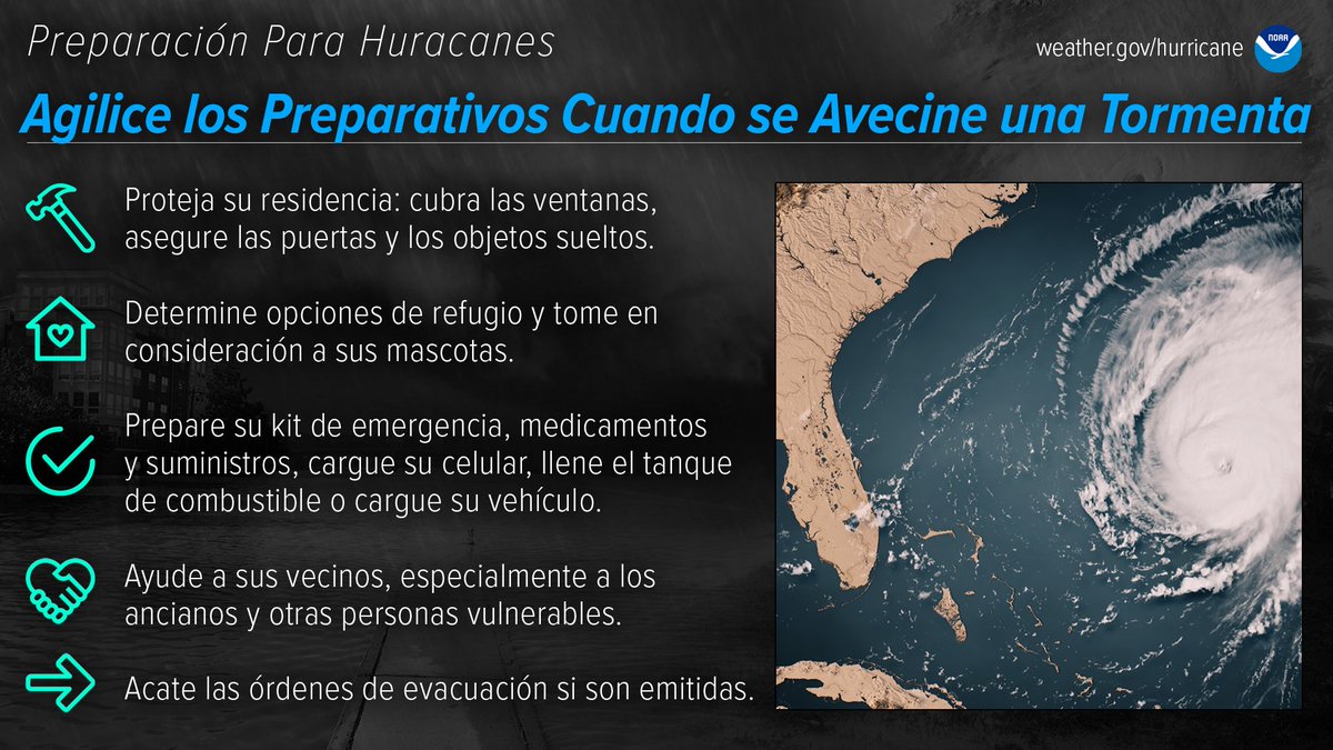
Monday May 5th: The best time to prepare for hurricanes is BEFORE hurricane season begins. Avoid having to rush through potentially life-saving preparations by waiting until it’s too late. #HurricanePrep #HurricaneStrong Spanish image is also included.

Monday May 5th: The best time to prepare for hurricanes is BEFORE hurricane season begins. Avoid having to rush through potentially life-saving preparations by waiting until it’s too late. #HurricanePrep #HurricaneStrong

Spanish image is also included.
NWS Key West (@nwskeywest) 's Twitter Profile Photo

5 Day Outlook for the Florida Keys is below. Expect warm and dry weather until the weekend! #flwx #flkeys #floridakeys #keylargo #keywest #MarathonFL

5 Day Outlook for the Florida Keys is below. Expect warm and dry weather until the weekend!

#flwx #flkeys #floridakeys #keylargo #keywest #MarathonFL
NWS Key West (@nwskeywest) 's Twitter Profile Photo

Tuesday May 6th: Prepare for hurricane season by knowing how to understand forecasts. They can tell you a lot about what is expected, including the storm’s path, rainfall amounts, wind speeds, and more. #HurricanePrep #HurricaneStrong Spanish image is also included.

Tuesday May 6th: Prepare for hurricane season by knowing how to understand forecasts. They can tell you a lot about what is expected, including the storm’s path, rainfall amounts, wind speeds, and more. #HurricanePrep #HurricaneStrong

Spanish image is also included.
NWS Key West (@nwskeywest) 's Twitter Profile Photo

Wednesday May 7th: Do you know what to do when a storm threatens? Prepare for hurricane season by taking the time now to understand the actions needed when time is of the essence. #HurricanePrep #HurricaneStrong noaa.gov/get-moving-whe
 Spanish image is also included.

Wednesday May 7th: Do you know what to do when a storm threatens? Prepare for hurricane season by taking the time now to understand the actions needed when time is of the essence. #HurricanePrep #HurricaneStrong

noaa.gov/get-moving-whe


Spanish image is also included.
NWS Key West (@nwskeywest) 's Twitter Profile Photo

A bit late, but here is a 2025 April Weather Overview for the Florida Keys. Nutshell, it was warmer and drier than normal. More rain would be appreciated! #keylargo #keywest #MarathonFL #flwx #flkeys #floridakeys

A bit late, but here is a 2025 April Weather Overview for the Florida Keys.  Nutshell, it was warmer and drier than normal. More rain would be appreciated!

#keylargo #keywest #MarathonFL #flwx #flkeys #floridakeys
NWS Key West (@nwskeywest) 's Twitter Profile Photo

#FloridaKeys. Today is the 2nd NOAA Hurricane webinar (Spanish) in a series of 5 webinars. Today's webinar starts at 1 PM EDT with Krizia Negron, NWS Language Program Lead & Meteorologist, Office of Science & Technology Integration being the presenter. #flwx

#FloridaKeys.

Today is the 2nd NOAA Hurricane webinar (Spanish) in a series of 5 webinars. Today's webinar starts at 1 PM EDT with Krizia Negron, NWS Language Program Lead & Meteorologist, Office of Science & Technology Integration being the presenter. 

#flwx
NWS Key West (@nwskeywest) 's Twitter Profile Photo

Thursday May 8th: Be prepared for hurricane season by knowing what to do during a storm. Whether you’ve evacuated or are sheltering in place, know what to expect from the hazards you may face. #HurricanePrep #HurricaneStrong noaa.gov/stay-protected
 Spanish image also included.

Thursday May 8th: Be prepared for hurricane season by knowing what to do during a storm. Whether you’ve evacuated or are sheltering in place, know what to expect from the hazards you may face. #HurricanePrep #HurricaneStrong

noaa.gov/stay-protected


Spanish image also included.
NWS Key West (@nwskeywest) 's Twitter Profile Photo

8:15PM #FloridaKeys⚠Per Miami-Dade FR, US-1 has been closed between Card Sound Rd and Key Largo due to the fire.

8:15PM  #FloridaKeys⚠Per Miami-Dade FR, US-1 has been closed between Card Sound Rd and Key Largo due to the fire.
NWS Key West (@nwskeywest) 's Twitter Profile Photo

Friday May 9th: You can play a large role in how your neighbors fare before, during and after a hurricane. #HurricanePrep #HurricaneStrong noaa.gov/use-caution-af
 Spanish image is also included.

Friday May 9th: You can play a large role in how your neighbors fare before, during and after a hurricane. #HurricanePrep #HurricaneStrong
noaa.gov/use-caution-af


Spanish image is also included.