MetroStormChaser(@MetroStrmChaser) 's Twitter Profileg
MetroStormChaser

@MetroStrmChaser

Storm chase team for Central and Southern MS. Stringer with @SevereStudios. Based in Jackson, MS. Chases on freq 146.52, 151.82, and FRS/GMRS 7.7

ID:1537578313677279232

linkhttps://metrostormchaser.com calendar_today16-06-2022 23:30:42

901 Tweet

274 Takipçi

388 Takip Edilen

MetroStormChaser(@MetroStrmChaser) 's Twitter Profile Photo

There is a lot of at Jackson State U. with students shouting at minority students in passing on campus, 'go back up north', 'you don't belong here', 'leave our else.' This bullying has been taking place on campus as these minority students walk to class.

account_circle
WJTV 12 News(@WJTV) 's Twitter Profile Photo

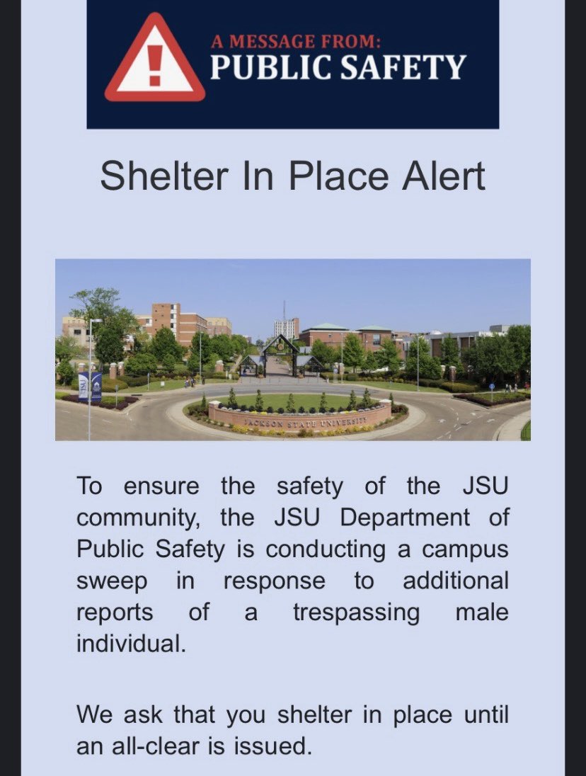
: Jackson State has issued another 'Shelter in Place' alert for authorities to conduct a campus sweep. trib.al/jiH4rPS
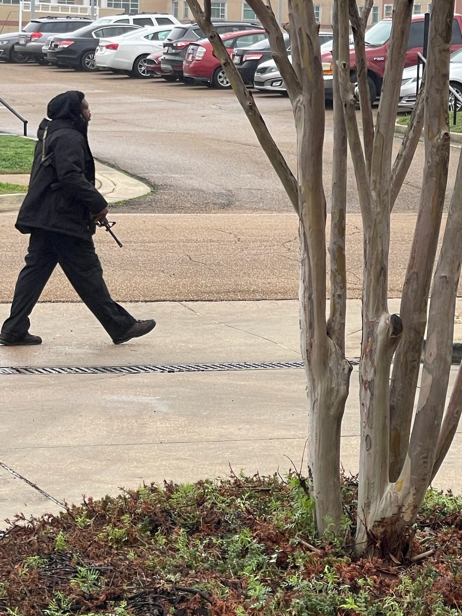
#BREAKINGNEWS: Jackson State has issued another 'Shelter in Place' alert for authorities to conduct a campus sweep. trib.al/jiH4rPS
account_circle
Jake Dalton(@jdaltonwx) 's Twitter Profile Photo

Large hail, damaging winds and tornadoes are possible - especially along the I-20 corridor today. Stay safe!

account_circle
NWS Jackson MS(@NWSJacksonMS) 's Twitter Profile Photo

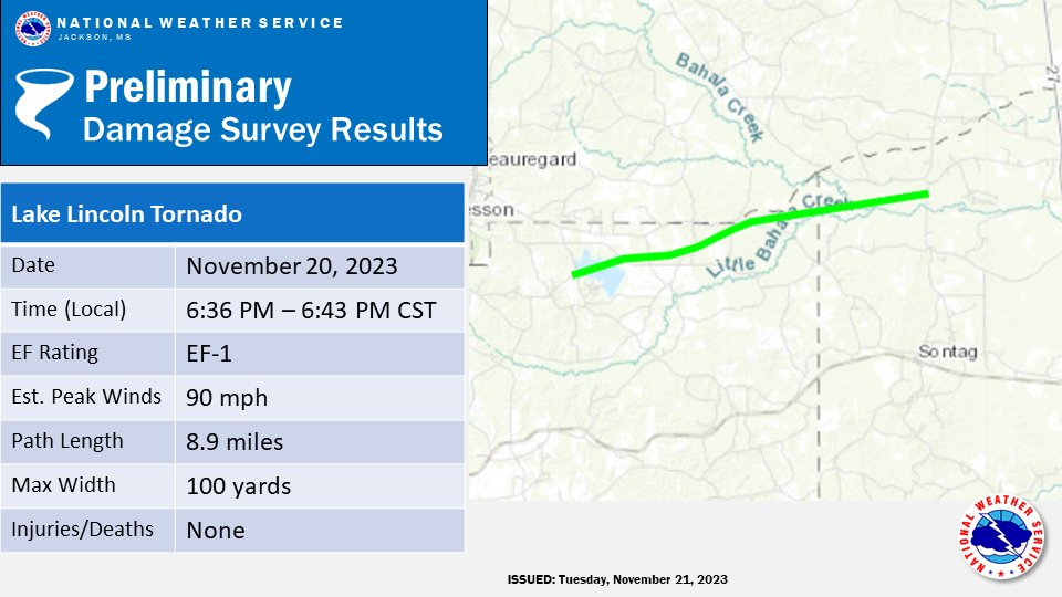
Here are the preliminary results of our surveys today of the 11/20 event. Surveys are still ongoing, so expect more results as we continue our assessments.

Here are the preliminary results of our surveys today of the 11/20 event. Surveys are still ongoing, so expect more results as we continue our assessments.
account_circle
Craig Ceecee, Ph.D.(@CC_StormWatch) 's Twitter Profile Photo

The shelter map that I continue to improve and expand at findyourtornadoshelter.com has just had a makeover. The icons were re-colored to make it easier for users by identifying their capacity without differentiation by type. It's to make it easier for the public to use.

The #tornado shelter map that I continue to improve and expand at findyourtornadoshelter.com has just had a makeover. The icons were re-colored to make it easier for users by identifying their capacity without differentiation by type. It's to make it easier for the public to use.
account_circle
Peyton Garrison WLBT(@peytongwx) 's Twitter Profile Photo

⚠️First Alert Weather Day Monday

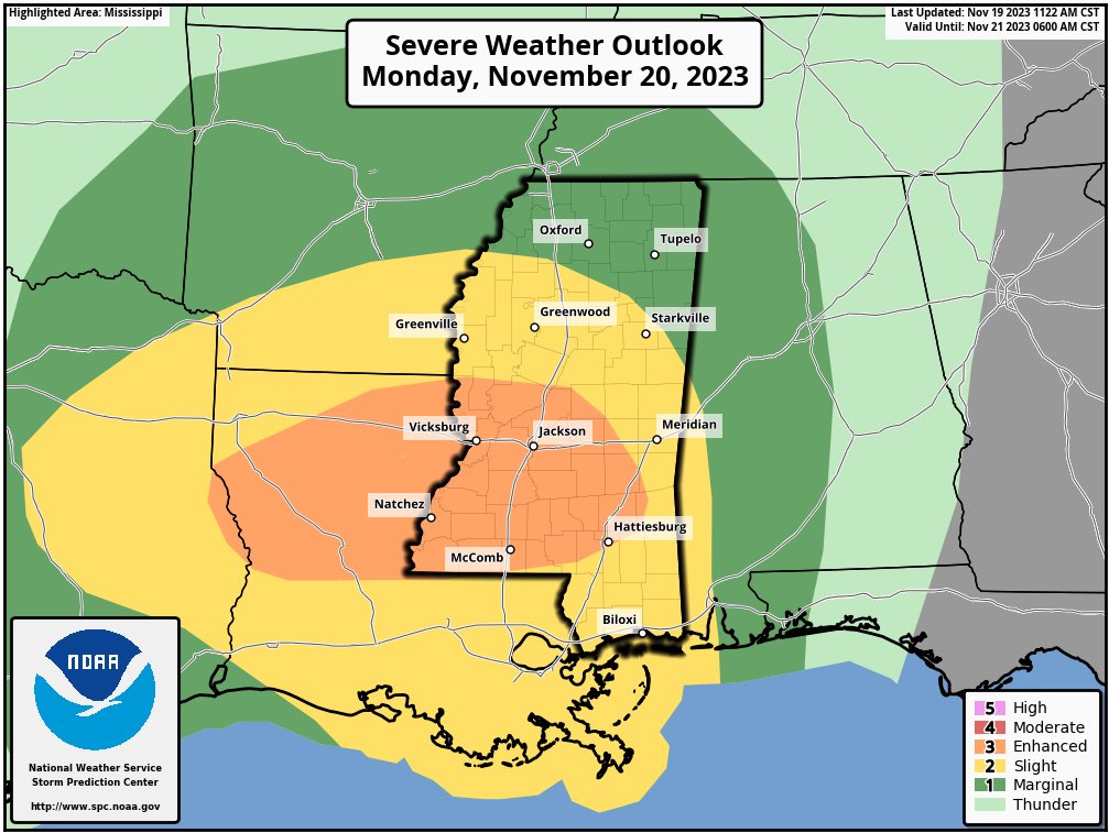
An ‘Enhanced 3/5 Risk’ is now in place for most of central MS for the threat of severe weather late Monday. Threats will include damaging wind gusts, tornadoes, & hail. Continue to stay weather aware & have a way to receive weather alerts!

⚠️First Alert Weather Day Monday An ‘Enhanced 3/5 Risk’ is now in place for most of central MS for the threat of severe weather late Monday. Threats will include damaging wind gusts, tornadoes, & hail. Continue to stay weather aware & have a way to receive weather alerts! #mswx
account_circle
NWS Jackson MS(@NWSJacksonMS) 's Twitter Profile Photo

Here is our updated graphic. Severe thunderstorms are likely tomorrow afternoon and night. For areas along and south of I-20, damaging winds up to 70 mph along with tornadoes likely. Some strong tornadoes are possible. Elsewhere, damaging wind and tornadoes will be possible.

Here is our updated graphic. Severe thunderstorms are likely tomorrow afternoon and night. For areas along and south of I-20, damaging winds up to 70 mph along with tornadoes likely. Some strong tornadoes are possible. Elsewhere, damaging wind and tornadoes will be possible.
account_circle
Peyton Garrison WLBT(@peytongwx) 's Twitter Profile Photo

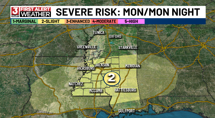
An incoming cold front will feature a chance for scattered showers and possible strong storms Monday into Monday night. ⛈️

The SPC has now highlighted most of central MS under a 'Slight 2/5 Risk' for the risk of strong to severe storms. Stay tuned for more specifics!

An incoming cold front will feature a chance for scattered showers and possible strong storms Monday into Monday night. ⛈️ The SPC has now highlighted most of central MS under a 'Slight 2/5 Risk' for the risk of strong to severe storms. Stay tuned for more specifics! #mswx
account_circle
Peyton Garrison WLBT(@peytongwx) 's Twitter Profile Photo

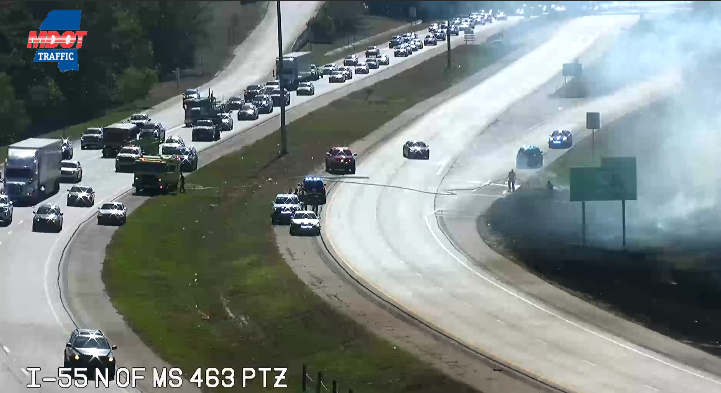
A large grass fire is having a big impact on the north and southbound lanes of I-55 in Madison. Avoid this area is possible!

Burn bans remain in effect for most of central MS!

A large grass fire is having a big impact on the north and southbound lanes of I-55 in Madison. Avoid this area is possible! Burn bans remain in effect for most of central MS! #mswx
account_circle
NWS Jackson MS(@NWSJacksonMS) 's Twitter Profile Photo

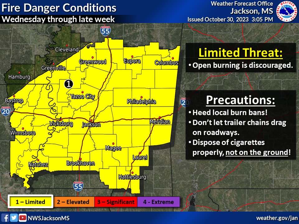
Rain will end this evening into tonight with colder and drier conditions returning. This will create both conditions conducive for wildfires as well as temperatures near to below freezing tomorrow night and Wednesday night. 🥶&🔥That's a pair of emojis you don't see everyday!

Rain will end this evening into tonight with colder and drier conditions returning. This will create both conditions conducive for wildfires as well as temperatures near to below freezing tomorrow night and Wednesday night. 🥶&🔥That's a pair of emojis you don't see everyday!
account_circle