Maps Made Easy (@mapsmadeeasy) 's Twitter Profile
Maps Made Easy

@mapsmadeeasy

Cloud-based aerial imagery stitching and hosting service. Create up-to-date high resolution maps and 3D models from drone-taken images.

ID: 2835564560

linkhttp://www.mapsmadeeasy.com calendar_today29-09-2014 14:28:46

688 Tweet

1,1K Followers

3 Following

Maps Made Easy (@mapsmadeeasy) 's Twitter Profile Photo

We have a few more openings available for the hands-on DJI L1 LiDAR seminar we are hosting for the ESRI User Conference this week. If you are in San Diego and would like to attend please email for a spot. #EsriUC #esriuc2022 DJI

Maps Made Easy (@mapsmadeeasy) 's Twitter Profile Photo

Android Beta Testers Wanted: We are looking for experienced Map Pilot Pro users that would like to try out the new Android version of Map Pilot Pro. We are looking for as much feedback as possible. Please email [email protected] for a beta release invitation.

Maps Made Easy (@mapsmadeeasy) 's Twitter Profile Photo

We are getting close to the public release of the new Map Pilot Pro for Android. Beta testing has been opened up to all users that want to give it a shot. Works on all high spec Android devices and Android based DJI controllers. Installation instructions: support.dronesmadeeasy.com/hc/en-us/artic…

We are getting close to the public release of the new Map Pilot Pro for Android. Beta testing has been opened up to all users that want to give it a shot. Works on all high spec Android devices and Android based DJI controllers. Installation instructions: support.dronesmadeeasy.com/hc/en-us/artic…
Neil Golding (@nautical_neil) 's Twitter Profile Photo

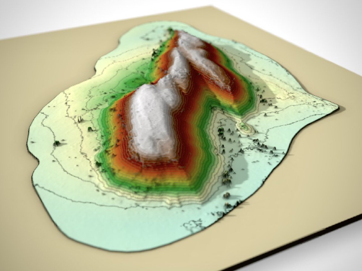
Today we got our 1st proper #albatross eye-view looking down from the Base of #TristanDaCunha. Terrain-following capability provided by Drones Made Easy allowed us to collect some stunning data! Anna Hicks got VERY excited seeing the 1st ever close-ups of this section of the cliff
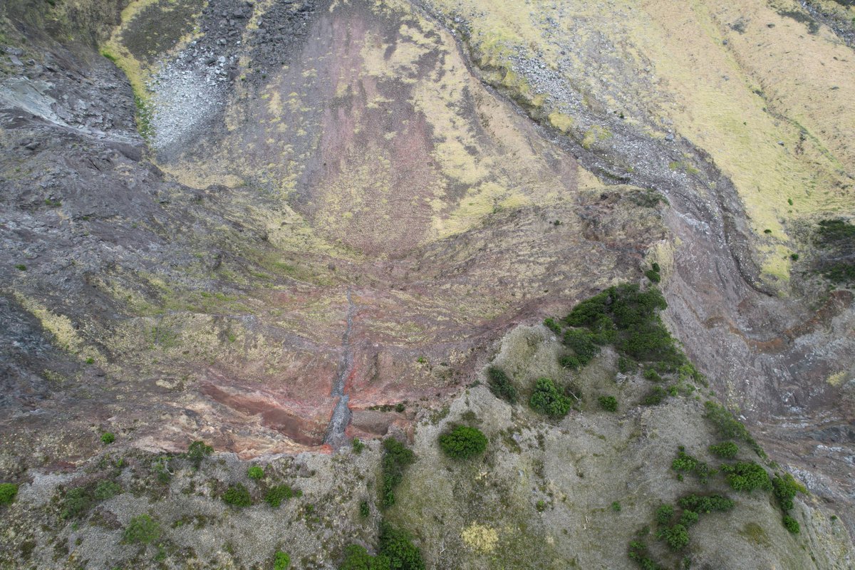
Today we got our 1st proper #albatross eye-view looking down from the Base of #TristanDaCunha. Terrain-following capability provided by <a href="/DronesMadeEasy/">Drones Made Easy</a> allowed us to collect some stunning data! <a href="/volcanna/">Anna Hicks</a> got VERY excited seeing the 1st ever close-ups of this section of the cliff
Maps Made Easy (@mapsmadeeasy) 's Twitter Profile Photo

Map Pilot Pro for Android is finally available in the Google Play Store! 15 Day Pro Trial for new users. play.google.com/store/apps/det… DJI DJI Enterprise #drones #mapping

Map Pilot Pro for Android is finally available in the Google Play Store! 15 Day Pro Trial for new users.  play.google.com/store/apps/det… <a href="/DJIGlobal/">DJI</a> <a href="/DJIEnterprise/">DJI Enterprise</a> #drones #mapping
Maps Made Easy (@mapsmadeeasy) 's Twitter Profile Photo

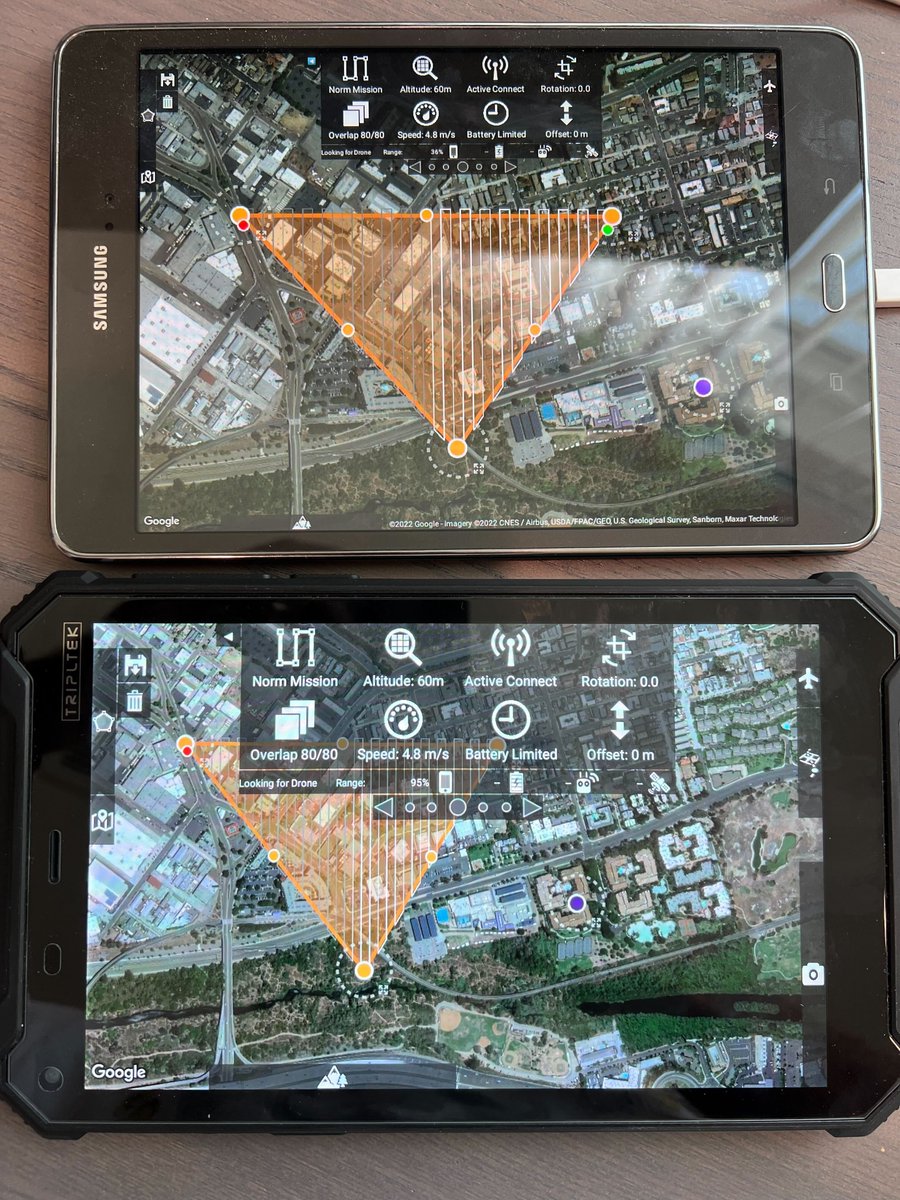
Map Pilot Pro is looking pretty good on the DJI Enterprise Mavic 3 Enterprise. Almost ready for full public release. Read more and download APKs: support.dronesmadeeasy.com/hc/en-us/commu…
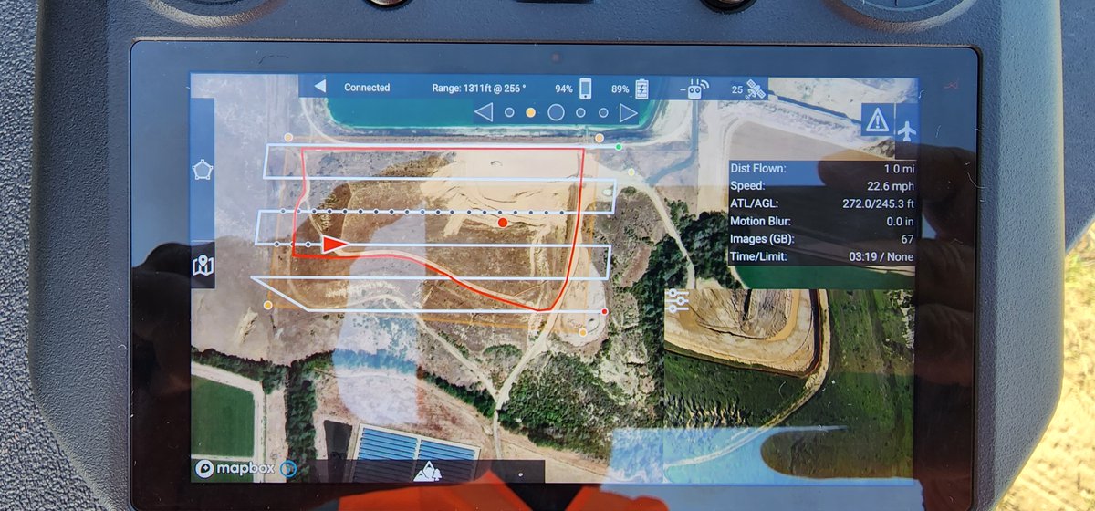
Map Pilot Pro is looking pretty good on the <a href="/DJIEnterprise/">DJI Enterprise</a> Mavic 3 Enterprise. Almost ready for full public release. Read more and download APKs: support.dronesmadeeasy.com/hc/en-us/commu…
Charlie Verdel (@csverdel) 's Twitter Profile Photo

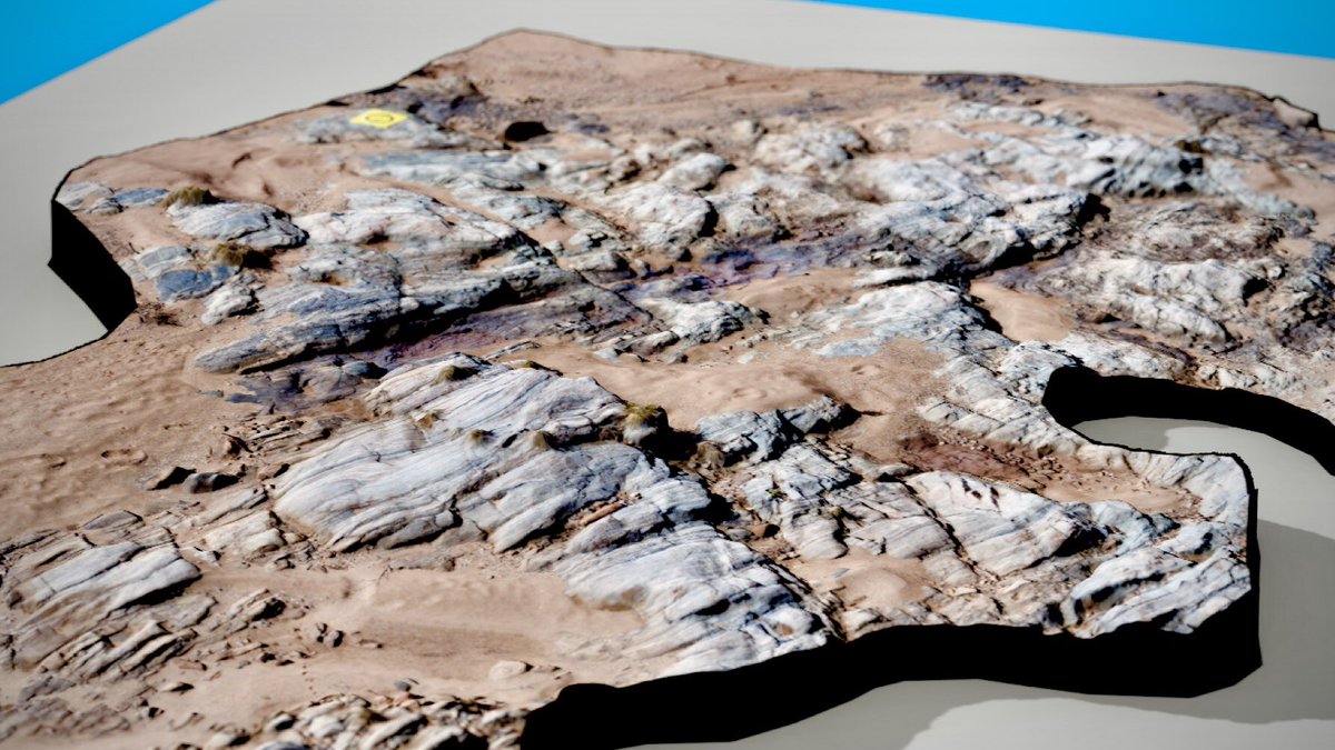
Drone survey from central Australia consisting of 349 photos from a DJI Mavic Air 2. Digital elevation model and stitched image created with Maps Made Easy. Topographic contours made with QGIS. Flyover created with the rayshader package in Rstats

Maps Made Easy (@mapsmadeeasy) 's Twitter Profile Photo

Map Pilot Pro support for the #Mavic 3 #Multispectral on the RC Pro Enterprise remote is up and running nicely. This was by far the easiest NDVI map we have ever created and we have been doing this a while. Nice work on the #M3M DJI Enterprise. View here: mapsmadeeasy.com/locations/publ…
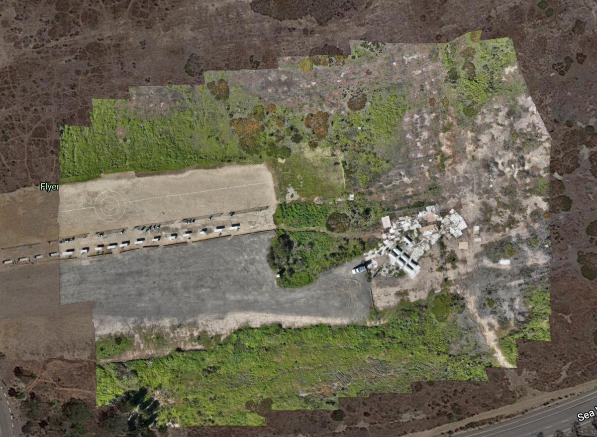
Map Pilot Pro support for the #Mavic 3 #Multispectral on the RC Pro Enterprise remote is up and running nicely. This was by far the easiest NDVI map we have ever created and we have been doing this a while. Nice work on the #M3M <a href="/DJIEnterprise/">DJI Enterprise</a>. View here: mapsmadeeasy.com/locations/publ…
Maps Made Easy (@mapsmadeeasy) 's Twitter Profile Photo

If you were to have any terrain data source available in Map Pilot Pro (aside from the standard SRTM) what would you like to see included?

Maps Made Easy (@mapsmadeeasy) 's Twitter Profile Photo

Support for the DJI Mini 3 and Mini 3 Pro have been added to Map Pilot Pro. Look for the Enterprise variant of the app on our installation page: support.dronesmadeeasy.com/hc/en-us/artic…

Charlie Verdel (@csverdel) 's Twitter Profile Photo

Drone survey from central Australia. Data collected by @RockDrCait with a DJI Mavic Air 2. Photogrammetry by Maps Made Easy. GIS with #QGIS. Rendered with the #rayshader package in #rstats
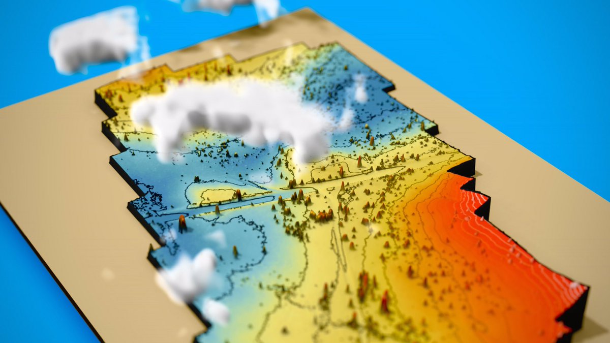
Drone survey from central Australia. Data collected by @RockDrCait with a DJI Mavic Air 2. Photogrammetry by <a href="/MapsMadeEasy/">Maps Made Easy</a>. GIS with #QGIS. Rendered with the #rayshader package in #rstats
Maps Made Easy (@mapsmadeeasy) 's Twitter Profile Photo

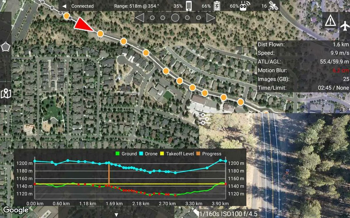
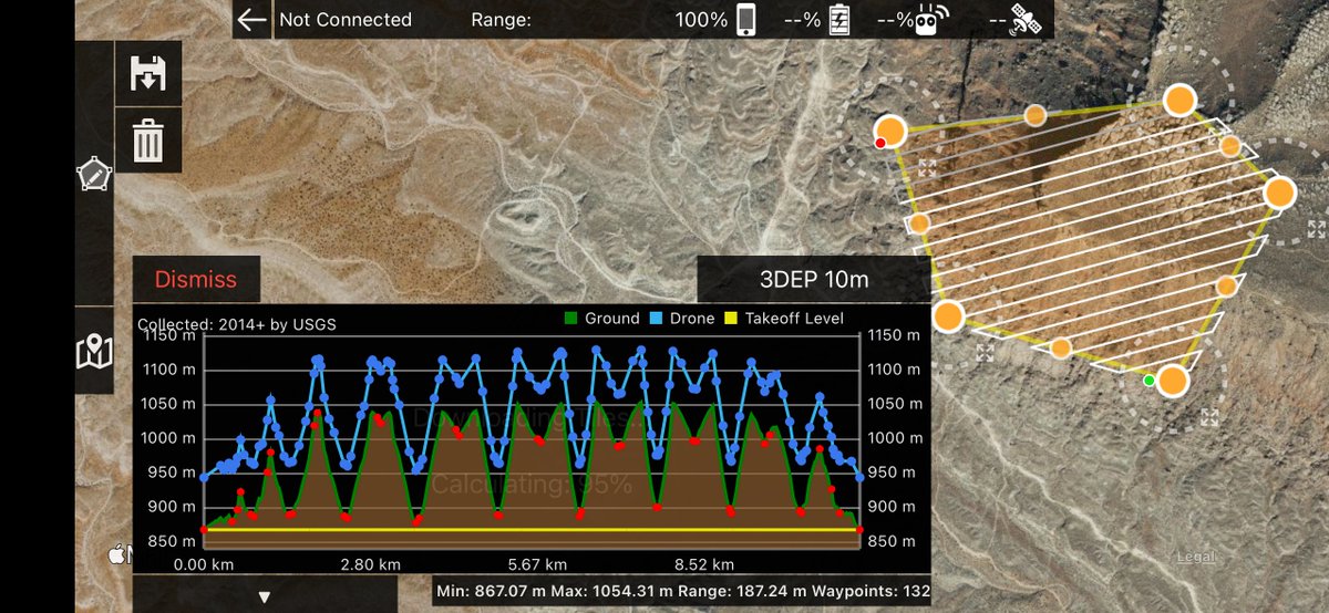
Map Pilot Pro 5.5.0 has been released with new high resolution terrain data sources from Copernicus, ASTER, 3DEP and others. Worldwide coverage. 10 meter per pixel data is available throughout the US. Having multiple sources ensures data availability at your site.

Map Pilot Pro 5.5.0 has been released with new high resolution terrain data sources from Copernicus, ASTER, 3DEP and others. Worldwide coverage. 10 meter per pixel data is available throughout the US. Having multiple sources ensures data availability at your site.
Charlie Verdel (@csverdel) 's Twitter Profile Photo

Drone survey from the eastern Amadeus Basin, central Australia. Photos taken with a DJI Air 2S #rayshader #QGIS #rstats #ntaustralia Maps Made Easy
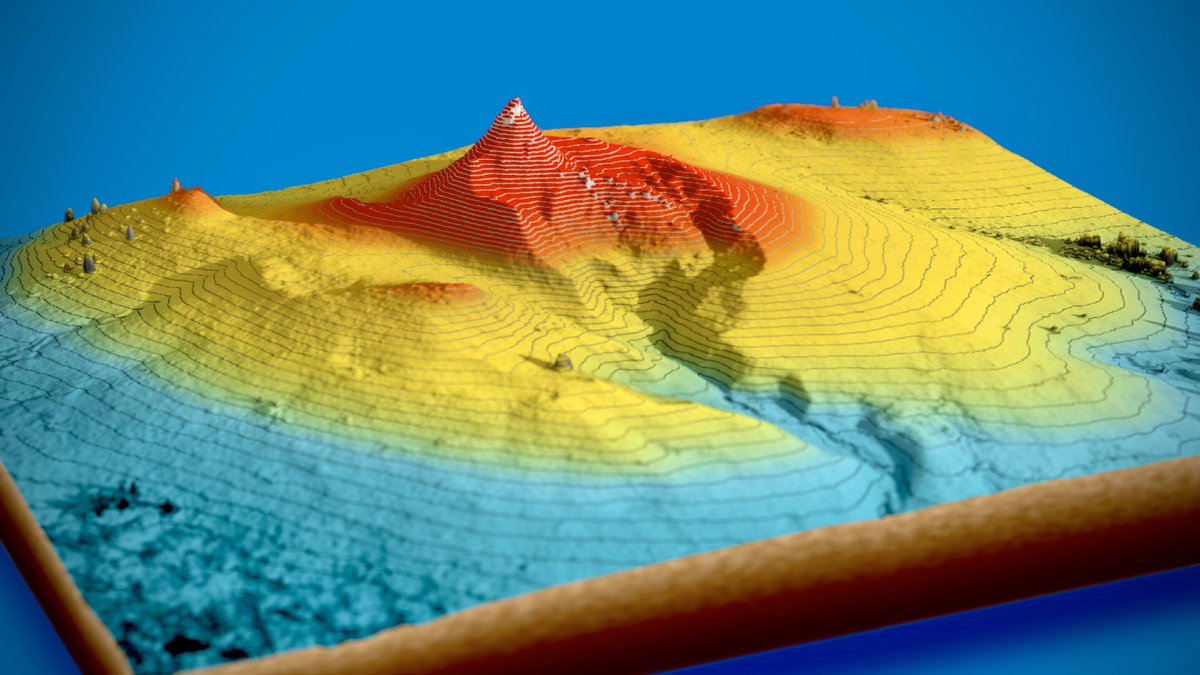
Drone survey from the eastern Amadeus Basin, central Australia. Photos taken with a DJI Air 2S #rayshader #QGIS #rstats #ntaustralia <a href="/MapsMadeEasy/">Maps Made Easy</a>
Maps Made Easy (@mapsmadeeasy) 's Twitter Profile Photo

We will likely be leaving Twitter soon since the feed we had embedded in our site only displays the feed if you are logged into Twitter. Sad. Logged in vs not logged in screenshots. We can't have a blank spot on our main page.

We will likely be leaving Twitter soon since the feed we had embedded in our site only displays the feed if you are logged into Twitter. Sad. Logged in vs not logged in screenshots. We can't have a blank spot on our main page.