Chief Meteorologist Lisa Teachman(@LisaTeachman) 's Twitter Profileg
Chief Meteorologist Lisa Teachman

@LisaTeachman

Chief Meteorologist KSNW-Wichita / Proud Kansan / BS Geosciences, Mississippi State / BA Communication, Wichita State / Emmy Award Winner / AMS Seal of Approval

ID:1375977096

linkhttp://KSN.com/weather calendar_today24-04-2013 02:40:52

34,9K Tweets

10,9K Followers

2,4K Following

Chief Meteorologist Lisa Teachman(@LisaTeachman) 's Twitter Profile Photo


Harper County TORNADO - Rated EF-2:

Estimated Peak Wind: 125 mph
Path Length /statute/: 6.5842 miles
Path Width /maximum/: 100.0 yards
Fatalities: 0
Injuries: 0
Start Date: 05/25/2024
Start Time: 07:29 PM CDT
Start

#kswx Harper County TORNADO - Rated EF-2: Estimated Peak Wind: 125 mph Path Length /statute/: 6.5842 miles Path Width /maximum/: 100.0 yards Fatalities: 0 Injuries: 0 Start Date: 05/25/2024 Start Time: 07:29 PM CDT Start
account_circle
Chief Meteorologist Lisa Teachman(@LisaTeachman) 's Twitter Profile Photo

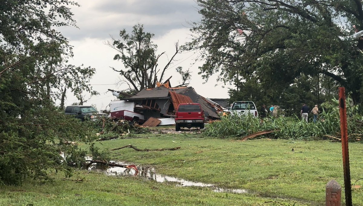
Still waiting for additional storm survey information from Saturday night’s storms. This was just released from National Weather Service Dodge City.
KSN News Wichita KSN Storm Track 3

Still waiting for additional storm survey information from Saturday night’s storms. This was just released from National Weather Service Dodge City. @KSNNews @KSNStormTrack3 #kswx
account_circle
Chief Meteorologist Lisa Teachman(@LisaTeachman) 's Twitter Profile Photo


STORM TRACK 3 FORECAST: Multiple TORNADO and SEVERE THUNDERSTORM watches are in effect through early tonight. Please be weather aware and have different ways to receive warnings. The KSN Storm Track 3 weather team and I will keep you advised on-air and

#KSWX #OKWX #NEWX STORM TRACK 3 FORECAST: Multiple TORNADO and SEVERE THUNDERSTORM watches are in effect through early tonight. Please be weather aware and have different ways to receive warnings. The KSN Storm Track 3 weather team and I will keep you advised on-air and
account_circle
Chief Meteorologist Lisa Teachman(@LisaTeachman) 's Twitter Profile Photo


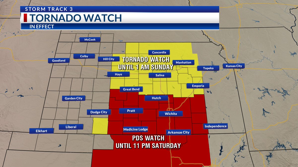
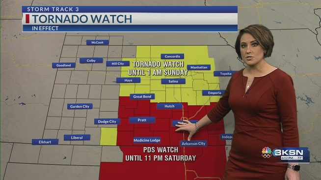
An additional TORNADO WATCH has been issued for Northcentral into Northeast Kansas until 1 AM Sunday.

There is also a PARTICULARLY DANGEROUS SITUATION TORNADO WATCH in effect until 11 PM Saturday farther south.

Stay with KSN News Wichita KSN Storm Track 3 for updates.

#kswx An additional TORNADO WATCH has been issued for Northcentral into Northeast Kansas until 1 AM Sunday. There is also a PARTICULARLY DANGEROUS SITUATION TORNADO WATCH in effect until 11 PM Saturday farther south. Stay with @KSNNews @KSNStormTrack3 for updates.
account_circle
Chief Meteorologist Lisa Teachman(@LisaTeachman) 's Twitter Profile Photo


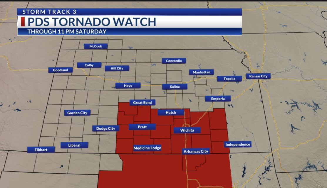
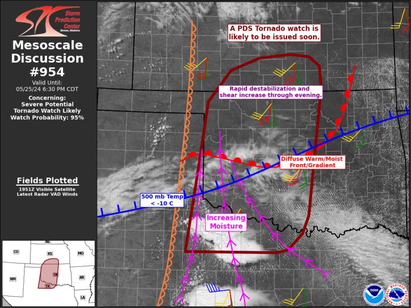
A PARTICULARLY DANGEROUS SITUATION OR PDS TORNADO WATCH will be issued shortly. This looks to include parts of southern Kansas. We will update you when it is posted.

KSN News Wichita KSN Storm Track 3
Ksn.com/weather

#kswx #okwx A PARTICULARLY DANGEROUS SITUATION OR PDS TORNADO WATCH will be issued shortly. This looks to include parts of southern Kansas. We will update you when it is posted. @KSNNews @KSNStormTrack3 Ksn.com/weather
account_circle
Chief Meteorologist Lisa Teachman(@LisaTeachman) 's Twitter Profile Photo


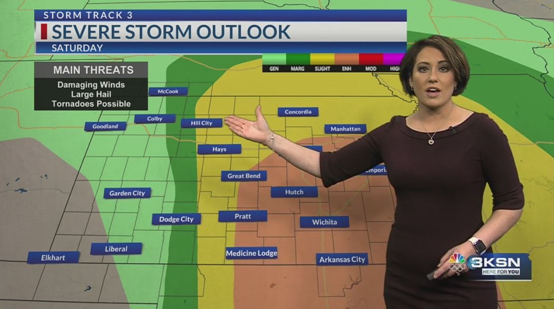
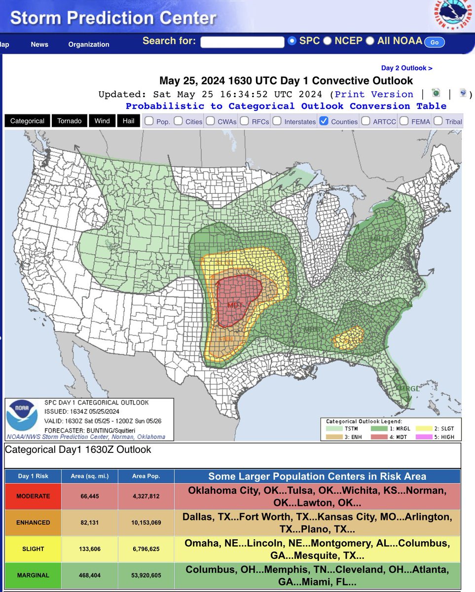
MIDDAY SATURDAY SEVERE UPDATE: It is a holiday weekend, but DO NOT UNPLUG! The set-up is in place for a severe weather outbreak this evening into the overnight for portions of Kansas into Oklahoma and northern Texas. There are several factors that must come together for

#kswx MIDDAY SATURDAY SEVERE UPDATE: It is a holiday weekend, but DO NOT UNPLUG! The set-up is in place for a severe weather outbreak this evening into the overnight for portions of Kansas into Oklahoma and northern Texas. There are several factors that must come together for
account_circle
Doppler on Wheels (DOW)(@DOWFacility) 's Twitter Profile Photo

Reflectivity loop from DOW8 (the slacker DOW for uploading data) from the Olustee/Duke, OK tornado on Thursday, May 23, 2024 as part of the ⁦⁦U.S. National Science Foundation project.

account_circle
Chief Meteorologist Lisa Teachman(@LisaTeachman) 's Twitter Profile Photo


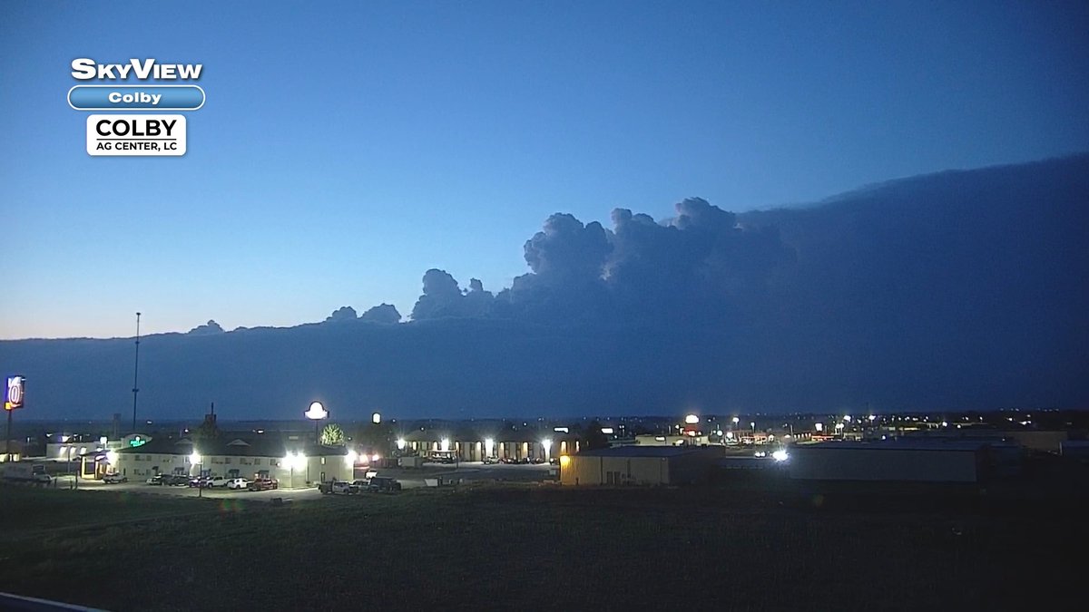
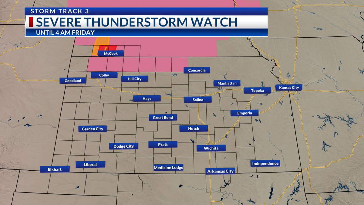
A SEVERE THUNDERSTORM WATCH is in effect until 4 AM Friday for a sliver of counties near the Kansas/Nebraska state line. Damaging winds are primary, but a quick spin-up tornado along the leading edge cannot be ruled out. The local fire department in Stratton,

#kswx #newx A SEVERE THUNDERSTORM WATCH is in effect until 4 AM Friday for a sliver of counties near the Kansas/Nebraska state line. Damaging winds are primary, but a quick spin-up tornado along the leading edge cannot be ruled out. The local fire department in Stratton,
account_circle
Chief Meteorologist Lisa Teachman(@LisaTeachman) 's Twitter Profile Photo


STORM TRACK 3 FORECAST: Isolated severe storms are possible tonight. Many more strong to severe storms will line up over Kansas early this holiday weekend. Here is the latest...

ksn.com/weather/weathe…
KSN News Wichita KSN Storm Track 3

#kswx #okwx #newx STORM TRACK 3 FORECAST: Isolated severe storms are possible tonight. Many more strong to severe storms will line up over Kansas early this holiday weekend. Here is the latest... ksn.com/weather/weathe… @KSNNews @KSNStormTrack3
account_circle
Chief Meteorologist Lisa Teachman(@LisaTeachman) 's Twitter Profile Photo


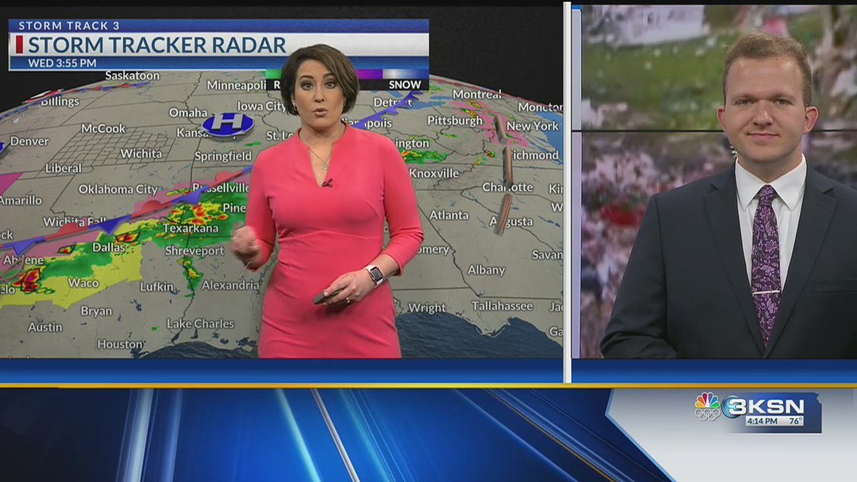
STORM TRACK 3 FORECAST: Such a pleasant Wednesday evening across Kansas! Severe storms come back Thursday at two different times. Here is the latest along with a look at data collected from an intense tornado in Iowa from Meteorologist Jack Maney KSN .

#kswx #okwx #newx STORM TRACK 3 FORECAST: Such a pleasant Wednesday evening across Kansas! Severe storms come back Thursday at two different times. Here is the latest along with a look at data collected from an intense tornado in Iowa from @JackmanWx .
account_circle
Chief Meteorologist Lisa Teachman(@LisaTeachman) 's Twitter Profile Photo

It was a picture perfect day for a weather talk at Avita Rolling Hills Assisted Living and Memory Care in West Wichita.

I took them through the decades of Kansas twisters and how technology changed, helping save lives and property. I also discussed my weather journey and what

It was a picture perfect day for a weather talk at Avita Rolling Hills Assisted Living and Memory Care in West Wichita. I took them through the decades of Kansas twisters and how technology changed, helping save lives and property. I also discussed my weather journey and what
account_circle
Chief Meteorologist Lisa Teachman(@LisaTeachman) 's Twitter Profile Photo


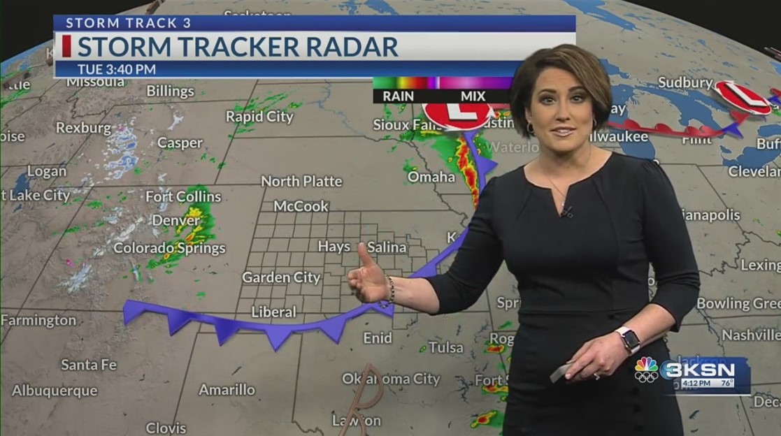
STORM TRACK 3 FORECAST: Scattered showers from Colorado spill over into Kansas tonight. Next shot for severe weather will be on Thursday. Here is the latest...

ksn.com/weather/weathe…
KSN News Wichita KSN Storm Track 3

#kswx #okwx #newx STORM TRACK 3 FORECAST: Scattered showers from Colorado spill over into Kansas tonight. Next shot for severe weather will be on Thursday. Here is the latest... ksn.com/weather/weathe… @KSNNews @KSNStormTrack3
account_circle