danylaksono
@laksonodany
Geoinformatician.
Mostly retweet stuffs on (geo)data vis and geospatial data science.
ID: 797269102385500160
http://github.com/danylaksono 12-11-2016 02:45:41
3,3K Tweet
497 Takipçi
4,4K Takip Edilen
 's Twitter Profile Photo")
 on Twitter photo 🔥The 9th Round of Easy Loan, Earn $40 Reward is in progress❗️
⏰ Promotion Period: January 15th - Feburary 15th, 2025
👉 Register now and check more details at gate.io/campaigns/358")
 's Twitter Profile Photo")
 's Twitter Profile Photo")
 on Twitter photo Last week I was playing around with a new \"tree ring plot\" to visualize daily global temperature anomalies from ERA5.
I thought it would be neat to make a version of the plot for daily global absolute temperatures (rather than anomalies):")
 's Twitter Profile Photo")
 's Twitter Profile Photo")
 on Twitter photo I've been thinking a lot about the current discussion in the #dataviz community about innovation and the future of the field. I agree with some points others have made, but I also have some disagreements.
My read my rather-too-long post here: policyviz.com/2025/05/01/whe…")
 's Twitter Profile Photo")
 on Twitter photo You've heard of the studies where they give the same dataset/research question to a bunch of researchers and they tend to get different answers, right?
Why is that?
This new working paper shows that it has a lot to do with data cleaning.
This is consistent with Gelman's")
 's Twitter Profile Photo")
Want to use the #PyQGIS API from VS Code or a Jupyter Notebook? Thanks to the availability of #QGIS recipes on conda-forge, it is now very easy to setup any code editor to use QGIS APIs. See the step-by-step guides courses.spatialthoughts.com/pyqgis-masterc… and courses.spatialthoughts.com/pyqgis-masterc…
 on Twitter photo Want to use the #PyQGIS API from VS Code or a Jupyter Notebook? Thanks to the availability of #QGIS recipes on conda-forge, it is now very easy to setup any code editor to use QGIS APIs. See the step-by-step guides courses.spatialthoughts.com/pyqgis-masterc… and courses.spatialthoughts.com/pyqgis-masterc…")
 's Twitter Profile Photo")
 on Twitter photo New dataset alert 🛰️
ALOS-2 ScanSAR imagery from JAXA is now accessible via NASA Earthdata. Use it to study flooding, landslides, forest health, and more.
Read the details at earthdata.nasa.gov/news/alos-2-sc…
#RemoteSensing #ALOS2 #SAR")
 's Twitter Profile Photo")
 's Twitter Profile Photo")
 's Twitter Profile Photo")
 on Twitter photo Popular methods like UMAP & t-SNE are stochastic and distort data structure.
Bonsai - a novel method - builds trees to relate high-dimensional objects, accounting for measurement noise.
biorxiv.org/content/10.110…")
 's Twitter Profile Photo")
 's Twitter Profile Photo")
 's Twitter Profile Photo")
 's Twitter Profile Photo")
 on Twitter photo 📢 Big news for inequality researchers & policy-makers!
<a href=\"/UNUWIDER/\">UNU-WIDER</a> has just released a major update to the World Income Inequality Database (WIID) — the most comprehensive source of global income inequality data.
wider.unu.edu/news/unu-wider…
🧵👇")
 's Twitter Profile Photo")
 on Twitter photo This paper solves a fundamental problem in 3D vision: how to get accurate depth maps by combining sparse but precise measurements with dense but relative predictions from neural nets 🧵")
 's Twitter Profile Photo")
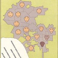
#QGIS expression - geometry generator - little spider cc Andrea Giudiceandrea
 's Twitter Profile Photo")
 on Twitter photo My favorite #Python package to use is spopt, a library for spatial optimization.
It helps you with:
📊 Facility location planning;
📊 Sales territory design;
📊 Maximizing market share;
And much more! Check it out here:
pysal.org/spopt/")
 's Twitter Profile Photo")
Meet the new Microsoft PostgreSQL extension for Visual Studio Code - packed with powerful tools to supercharge your PostgreSQL workflow, like: 🤖 Agent mode integration 💡 Schema visualization ⚡ Instant Docker PostgreSQL 🔎 IntelliSense-powered queries Learn more: aka.ms/Blog/PostgreSQ…
 's Twitter Profile Photo")
 on Twitter photo 📢Just published: New paper about #QGIS
\"The QGIS project: Spatial without compromise\" by Anita Graser, Tim Sutton (Kartoza co-founder), Marco Bernasocchi
👏A must-read on QGIS's evolution and community!
Read paper here: cell.com/patterns/fullt…
#QGIS #OpenSourceGIS #kartoza")