Cyle Dickens (@cyledickens) 's Twitter Profile
Cyle Dickens

@cyledickens

KWQC-TV6 Meteorologist | Branding Coordinator and Motion Graphic Designer for KWQC & Gray Design Group

ID: 2738900328

linkhttp://kwqc.com calendar_today17-08-2014 03:36:13

558 Tweet

458 Followers

982 Following

Cyle Dickens (@cyledickens) 's Twitter Profile Photo

9:30PM UPDATE: There have been many reports of weather related crashes across the area tonight. In Scott, Clinton and Cedar Counties, there is a no-tow situation as of 9 p.m. Highway 61 is closed due to crashes between Welton, Iowa and Highway 136 to the north. Travel is not

Cyle Dickens (@cyledickens) 's Twitter Profile Photo

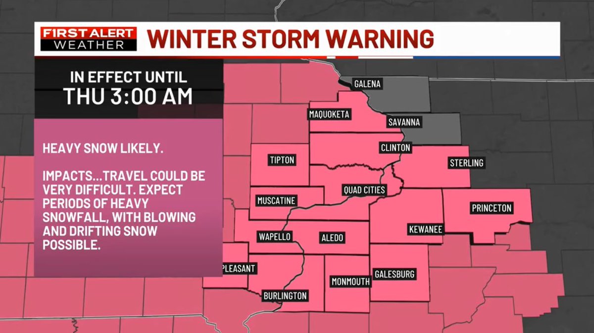
A WINTER STORM WARNING has been issued for portions of the TV6 viewing area until 2/13 3:00AM. Hazardous to dangerous travel conditions are likely within the next 24 hours. Stay with the TV6 First Alert weather team, we'll keep you advised. #iawx #ilwx

A WINTER STORM WARNING has been issued for portions of the TV6 viewing area until 2/13 3:00AM. Hazardous to dangerous travel conditions are likely within the next 24 hours. Stay with the TV6 First Alert weather team, we'll keep you advised. #iawx #ilwx
Cyle Dickens (@cyledickens) 's Twitter Profile Photo

It’s a little lonely in here…. Kyle J. Bales is off this weekend, so I offered to pull double duty. Watch this weekend, because I’m sure I’ll make a mistake 😂 #helloquadcities

It’s a little lonely in here…. <a href="/kylejbales/">Kyle J. Bales</a>  is off this weekend, so I offered to pull double duty. Watch this weekend, because I’m sure I’ll make a mistake 😂
#helloquadcities
Cyle Dickens (@cyledickens) 's Twitter Profile Photo

We will be keeping a close eye on the potential for a potent storm system moving into the Midwest come Friday. While it is too early to pinpoint exactly where the area of concern will be, some of our long-range models are putting the TV6 viewing area in the threat area. Here are

We will be keeping a close eye on the potential for a potent storm system moving into the Midwest come Friday. While it is too early to pinpoint exactly where the area of concern will be, some of our long-range models are putting the TV6 viewing area in the threat area. Here are
Cyle Dickens (@cyledickens) 's Twitter Profile Photo

1PM UPDATE: A majority of the weather models we look at have us fairly locked into the 6PM-12AM timeframe (from west to east) In addition, you'll notice quite a bit of agreement on positioning and overall formation of the line, indicating the likelihood for a line of damaging to

1PM UPDATE: A majority of the weather models we look at have us fairly locked into the 6PM-12AM timeframe (from west to east) In addition, you'll notice quite a bit of agreement on positioning and overall formation of the line, indicating the likelihood for a line of damaging to
Cyle Dickens (@cyledickens) 's Twitter Profile Photo

FIRST ALERT DAY: While a few morning storms will be possible, we are closely monitoring the potential for strong to severe storms come this afternoon between 2PM-5PM, mainly along and east of the river. The SPC has outlined most of the region in a level 2 risk with a level 3 risk

FIRST ALERT DAY: While a few morning storms will be possible, we are closely monitoring the potential for strong to severe storms come this afternoon between 2PM-5PM, mainly along and east of the river. The SPC has outlined most of the region in a level 2 risk with a level 3 risk
NWS Lubbock (@nwslubbock) 's Twitter Profile Photo

The dust we saw yesterday has now made it all the way to the Great Lakes region. It's not often you see a dust plume stretching from the lower Rio Grande to the Upper Mississippi River! #lubwx #txwx

The dust we saw yesterday has now made it all the way to the Great Lakes region. It's not often you see a dust plume stretching from the lower Rio Grande to the Upper Mississippi River! #lubwx #txwx
Cyle Dickens (@cyledickens) 's Twitter Profile Photo

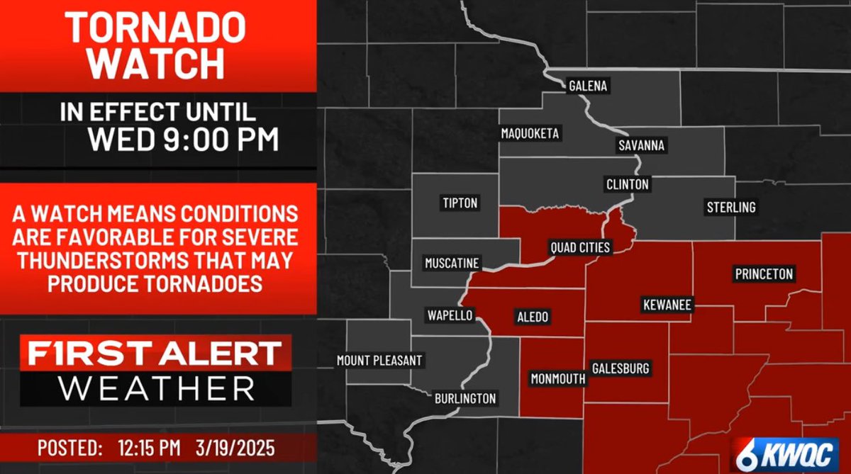
A TORNADO WATCH has been issued for portions of the TV6 viewing area. Download the QC Weather App and stay with the TV6 First Alert Weather team, we'll keep you advised.

A TORNADO WATCH has been issued for portions of the TV6 viewing area.
Download the QC Weather App and stay with the TV6 First Alert Weather team, we'll keep you advised.
Cyle Dickens (@cyledickens) 's Twitter Profile Photo

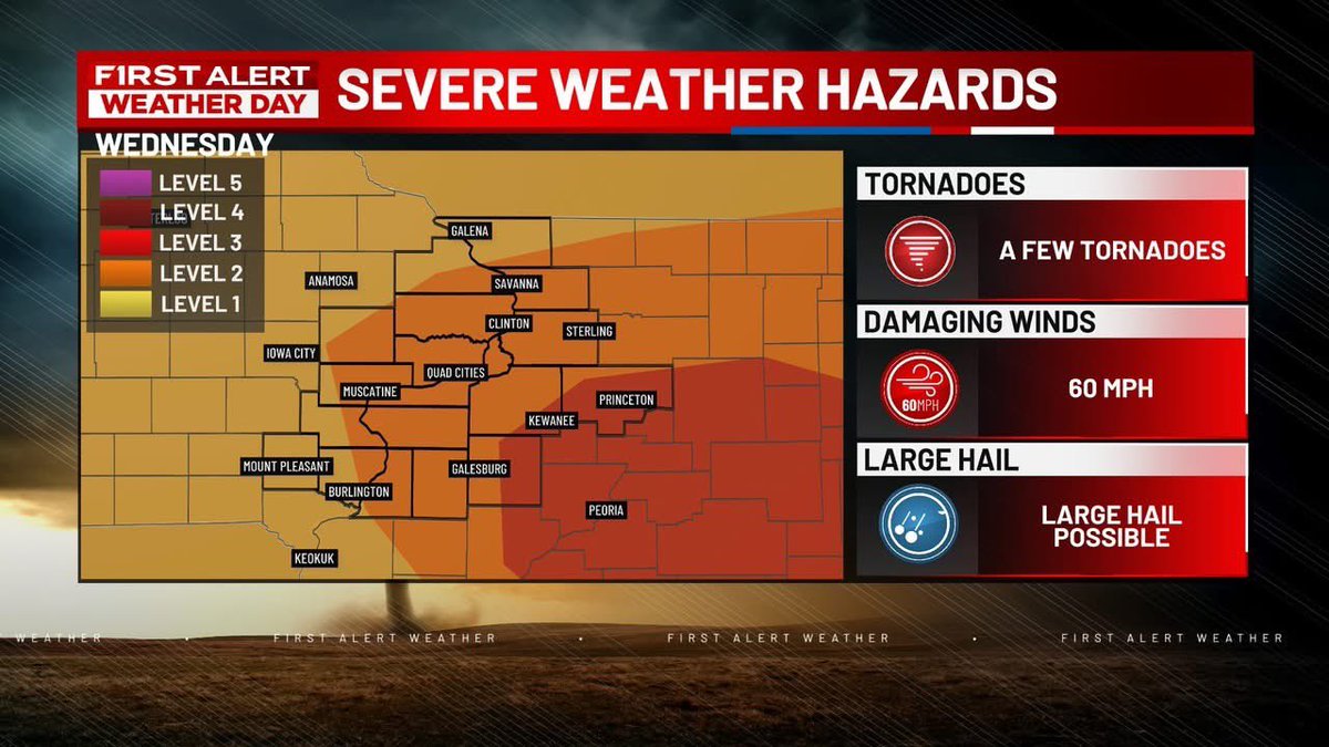
I am concerned about Wednesday afternoon. I am seeing a continued increase in tornado potential for eastern Iowa and Northern Illinois. This includes the chance for strong, long-track, and potentially violent tornadoes. If we can get the cloud cover and morning storms to linger

Cyle Dickens (@cyledickens) 's Twitter Profile Photo

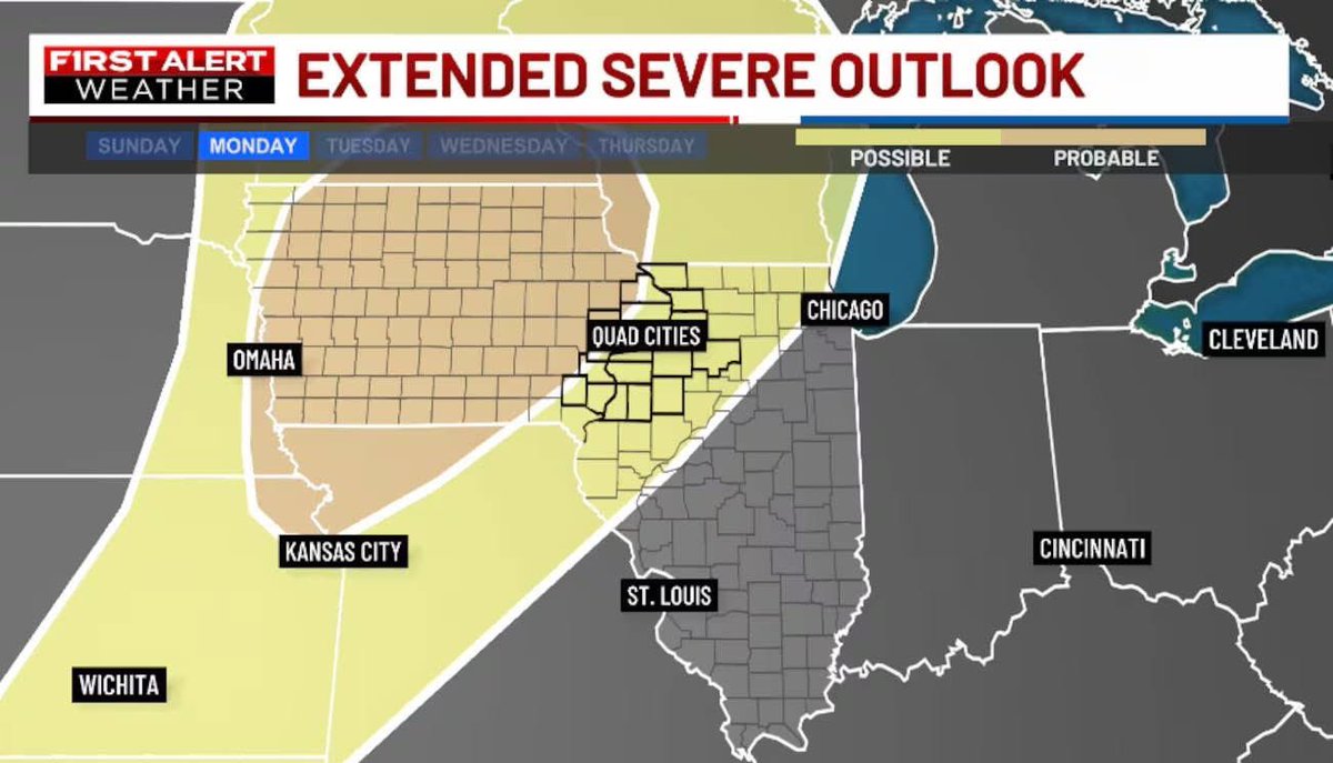
MONDAY: I’m growing more and more concerned about Monday. The potential is there for dangerous storms for our area. The long-range models have been fairly consistent, which is usually a sign that they have a good lock on this storm placement. Monday’s system has all the

MONDAY: I’m growing more and more concerned about Monday. The potential is there for dangerous storms for our area. The long-range models have been fairly consistent, which is usually a sign that they have a good lock on this storm placement. 

Monday’s system has all the
Cyle Dickens (@cyledickens) 's Twitter Profile Photo

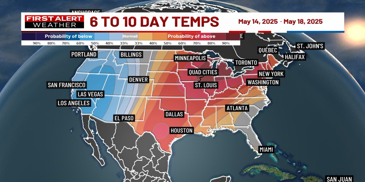
So…who’s ready for some mid to upper 80s next week? It’s going to get quite warm, especially towards next Wednesday and Thursday. #iawx #ilwx

So…who’s ready for some mid to upper 80s next week? It’s going to get quite warm, especially towards next Wednesday and Thursday. 

#iawx #ilwx
Cyle Dickens (@cyledickens) 's Twitter Profile Photo

#BREAKING The National Weather Service confirms an EF2 tornado hit southwest Davenport Friday evening. This is the first strong tornado the metro has seen in quite some time.