Jeff Clark - Salish Sea Map Now Available!
@ClarkGeomatics
Award-winning Cartographer / Geophysicist / GIS Guy
#SalishSeaMap #Cartography #GIS #BC #Backcountry #Mapping #Geography
ID:224703148
http://www.clarkgeomatics.ca 09-12-2010 17:17:09
1,4K Tweets
697 Followers
922 Following

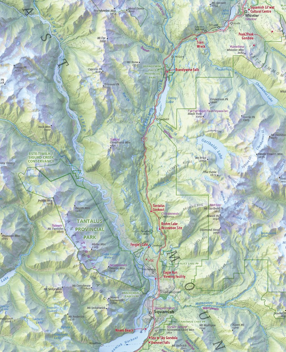
Hey, map people — Who out there thinks the effort to taper rivers on their #maps is worth it? I'll start... me.
The effect is subtle, and, at certain scales, well worth the time.
#WIP - upcoming Sea to Sky map
#cartography #vancouver #squamish
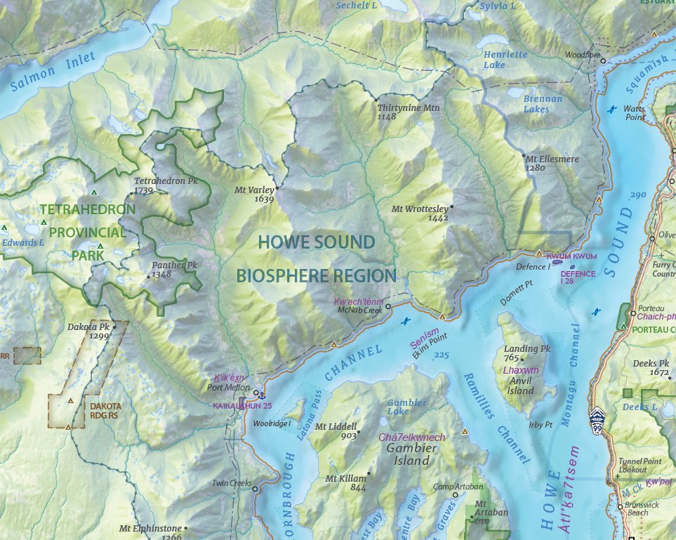

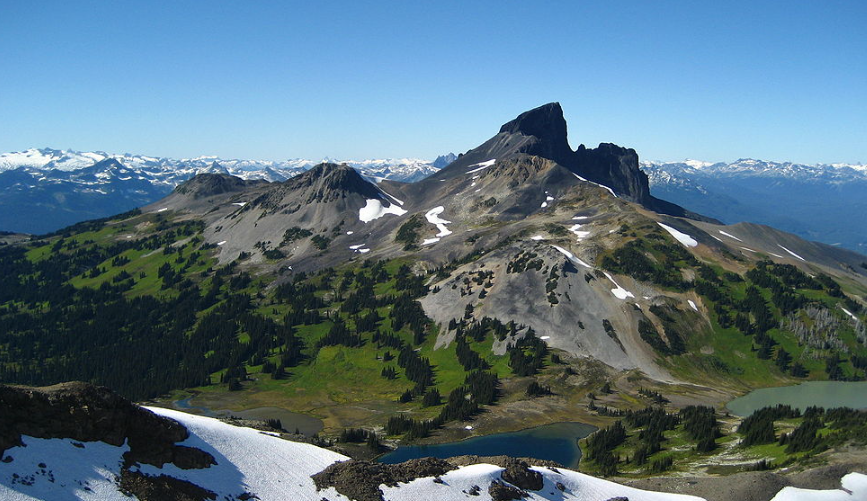
#DYK - The Squamish name for the Black Tusk translates to the 'landing place of the Thunderbird' - best place name ever!
#maps #cartography #squamish #whistler #vancouver clarkgeomatics.ca

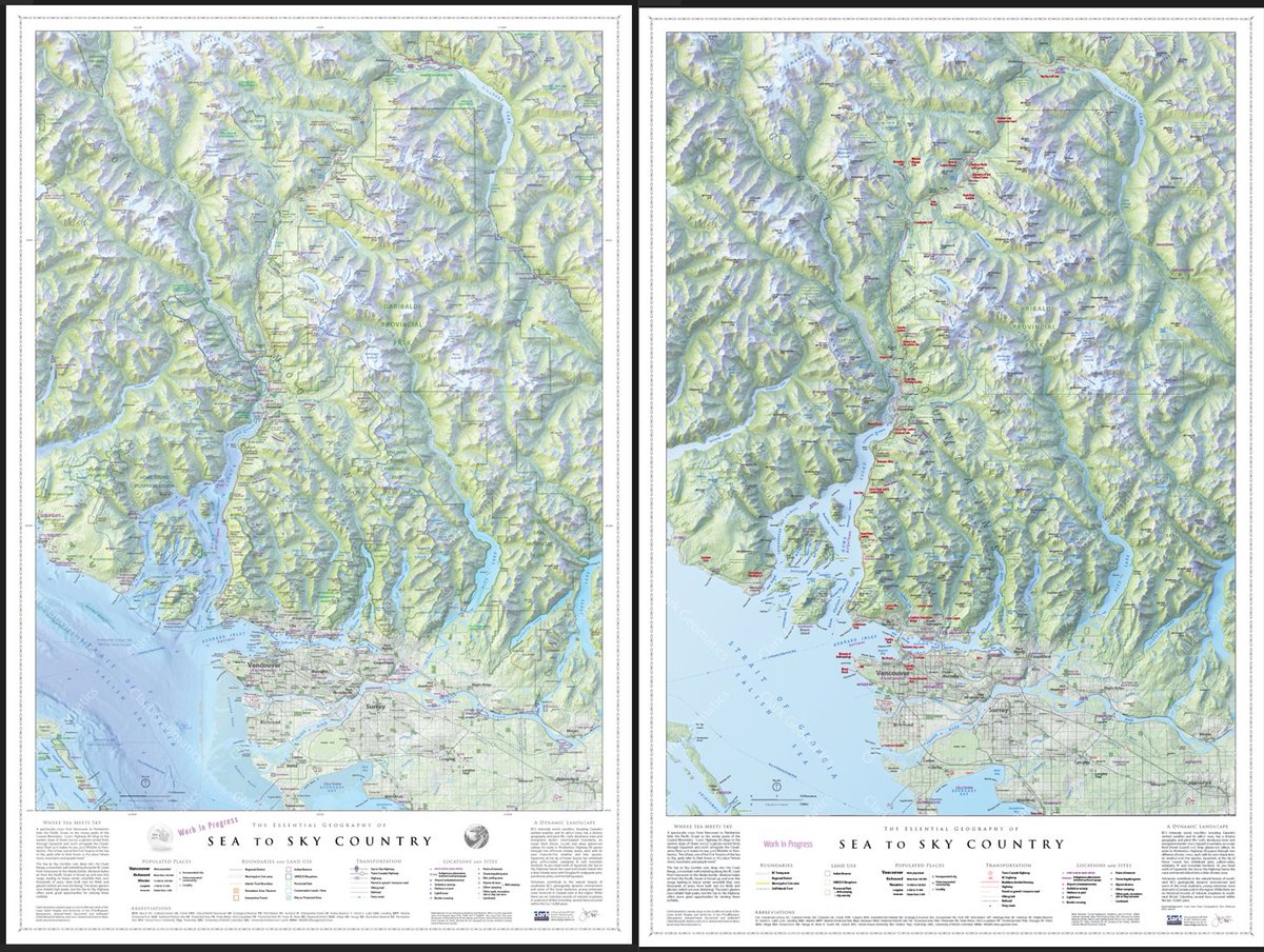
Slow progress is still progress, right? Added bathymetry, First Nation reserves and place names, a bunch of boundaries, among other things. Still on track for a spring release. Map on left is most recent. #cartography #maps #vancouver #squamish #whistler
A musical spin on M74! 🎵
This new sonification features data from Hubble (optical light), Chandra Observatory (X-rays), and @nasawebb (infrared light).
Scientists assigned musical elements to this spiral galaxy image to represent the information as sound. ⬇️


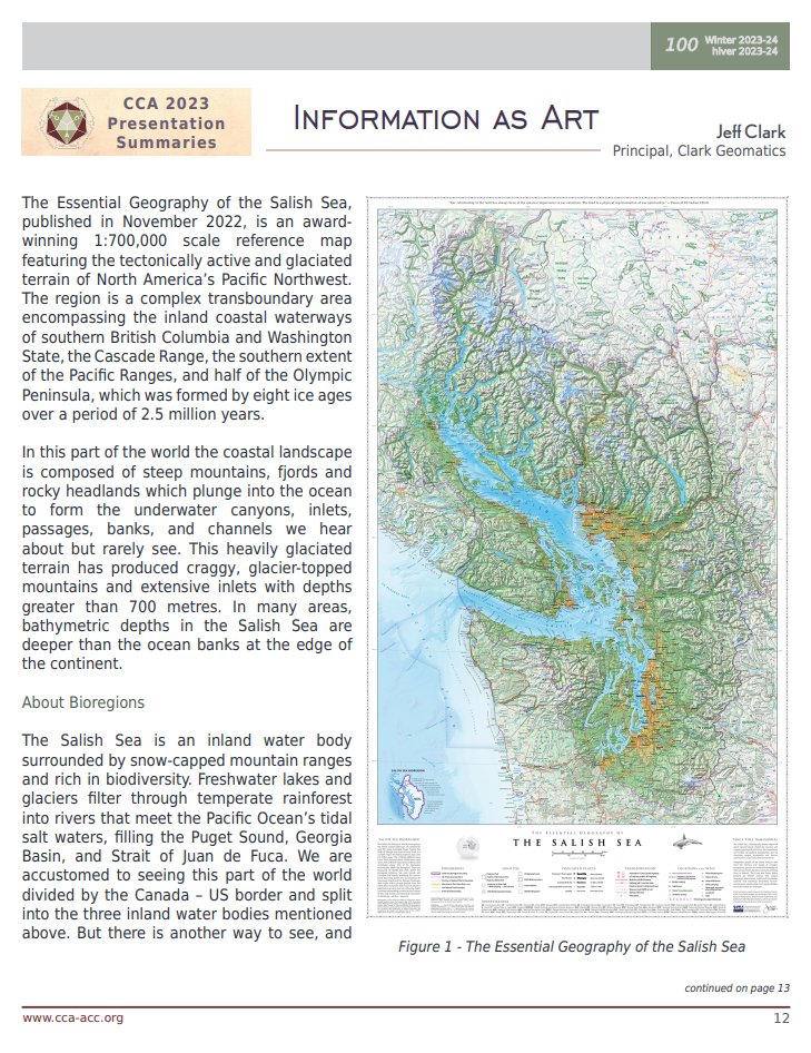
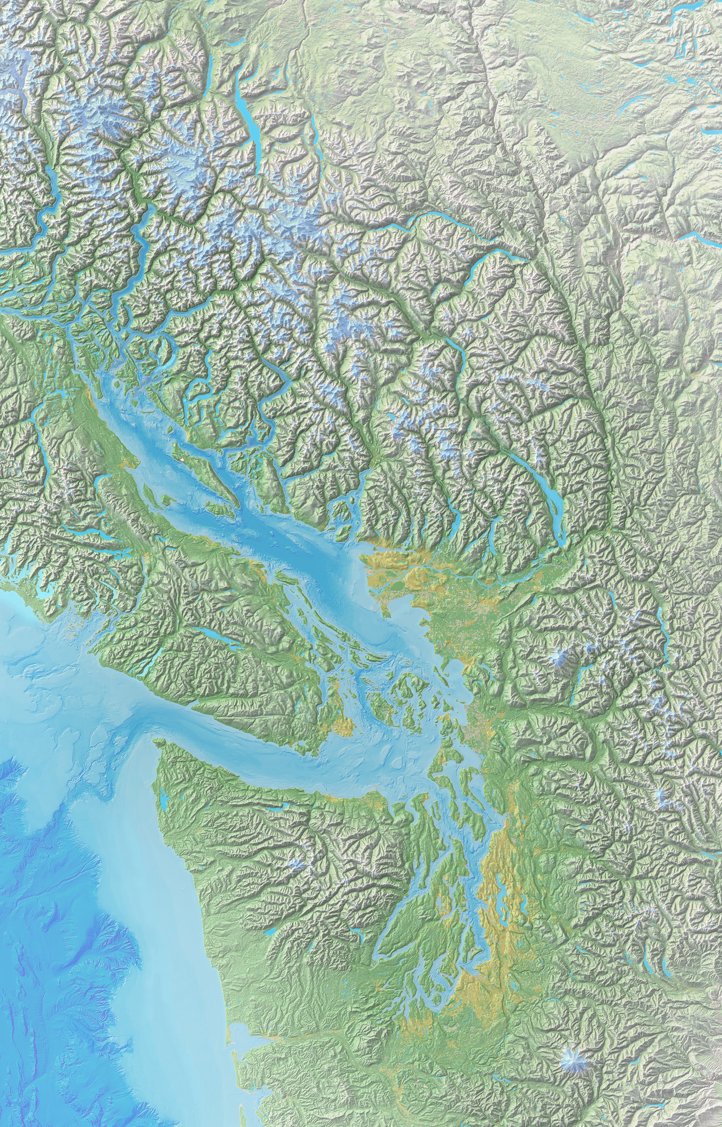
Look who's hanging around the SalishSeaCentre these days! My #SalishSea #map , front and centre, at their new exhibit.
clarkgeomatics.ca/products/essen…


Swiss-style shaded relief + 'regular' shaded relief = just what I needed.
Katie Contreras #shadedWithEduard #SalishSea
clarkgeomatics.ca

A Steven Bernard debut on mapsdotcom!
No surprise to see his maps on a site celebrating the best in cartography!


Work-in-progress. Will be dropping a new #map soon for BC's Sea To Sky Corridor. Similar style to our popular Salish Sea map.
Please RT to let fellow map-lovers know. Thx!
clarkgeomatics.ca
#cartography #BritishColumbia #Squamish #Vancouver #Whistler


Have a map lover in your family? 🗺️ This Christmas, surprise them with 'The Essential Geography of the Salish Sea' map! 🎄🎁 It's a gift they'll love!🎅
clarkgeomatics.ca
#Seattle #Vancouver #BritishColumbia #WashingtonState


Armchair geographers, here's the perfect gift - a map! 🌍🎁 Dive into the wonders of the Salish Sea from the comfort of your home.
#ChristmasGifts #Vancouver #Seattle #britishcolumbia #washingtonstate


