Connor Croff
@chasingwconnor
Storm Chaser Connor Croff | Team Dominator |20| loves to get stuck in mud/ditches | Business Contact : [email protected]
ID: 1244369546657648643
29-03-2020 21:03:26
14,14K Tweet
18,18K Followers
643 Following
 on Twitter photo Wow big time setup for hailers tomorrow across southern Minnesota. Upscale growth into a significant windbag also appears possible. We will likely chase this and also Tuesday which may have some tornado potential depending on how Monday evolves.")
 on Twitter photo Quick oil change then we’re so BACK.")
 on Twitter photo Nah I’m about to crash out")
 on Twitter photo Despite a 0% tornado risk tomorrow from the SPC (I guess post frontal supercells have a better chance at producing tornadoes), it’s not a day I would want to miss. Pending storm mode and evolution, high ceiling for a very pretty storm and a tornado or two!")
 's Twitter Profile Photo")
 on Twitter photo Could be some pretty happy structure hipsters (and tornado aficionados?) tomorrow in the Dakotas. Some signal for pesky mid-levels given moist 700s, but I've seen some wild stuff with this hodograph and dry air combo being pumped into a tail-end Charlie through the evening hours.")
 on Twitter photo Hot diggity dog")
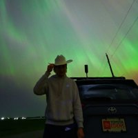
 on Twitter photo Just wow")
 on Twitter photo Gearing up for todays chase")
 's Twitter Profile Photo")
From about 7:55pm to 8:15pm CDT, storm chasers Brandon Copic, Corey Gerken, and Connor Croff documented this tornado in South Dakota from multiple vantage points! #SDwx
At around 6:15pm CDT, storm chaser Connor Croff (Connor Croff) captured this view of a tornado-warned thunderstorm in western Wisconsin! #WIwx
 's Twitter Profile Photo")
our brains are connected 💀 Connor Croff
 on Twitter photo Great survey from NWS Aberdeen. Note the deviant motion with the tornado moving SE originally and by the end of its path moving NE. This is why I had to observe the tornado from a distance near the red X for much it it’s lifespan and kept telling my chat that it wasn’t a tornado")