Allyson Rae (@allysonraewx) 's Twitter Profile
Allyson Rae

@allysonraewx

Chief Meteorologist Gulf Coast News. CBM/AMS approved. PSU grad. Adopt don’t shop. 🐶

ID: 325050734

calendar_today27-06-2011 17:16:06

13,13K Tweet

8,8K Takipçi

2,2K Takip Edilen

Allyson Rae (@allysonraewx) 's Twitter Profile Photo

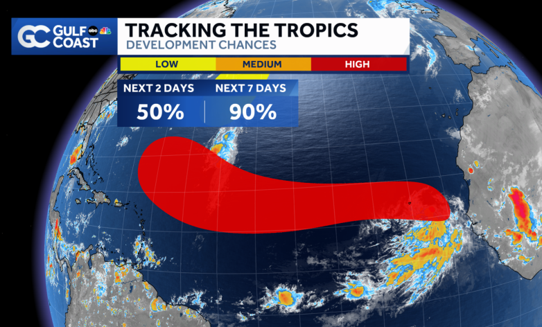
Erin is likely to form in the next few days, and models suggest it could become our first hurricane while still over the open Atlantic. When looking at computer model tracks, keep in mind the end of the forecast lines are ending on Monday, August 18, over a week away, and at

Erin is likely to form in the next few days, and models suggest it could become our first hurricane while still over the open Atlantic.

When looking at computer model tracks, keep in mind the end of the forecast lines are ending on Monday, August 18, over a week away, and at
Eric Webb (@webberweather) 's Twitter Profile Photo

Invest #97L has likely become a bonafide tropical cyclone this afternoon near the Cabo Verde Islands with a deep, consolidated, & persistent convective burst just after diurnal minimum.

Invest #97L has likely become a bonafide tropical cyclone this afternoon near the Cabo Verde Islands with a deep, consolidated, & persistent convective burst just after diurnal minimum.
Allyson Rae (@allysonraewx) 's Twitter Profile Photo

Tropical Storm Erin has formed and is forecast to become not only the first hurricane of the season, but also the first major hurricane. By Saturday, it’s expected to still be east of Puerto Rico. There’s still a long way to go beyond the current forecast, so we’ll be tracking it

Tropical Storm Erin has formed and is forecast to become not only the first hurricane of the season, but also the first major hurricane. By Saturday, it’s expected to still be east of Puerto Rico. There’s still a long way to go beyond the current forecast, so we’ll be tracking it
Allyson Rae (@allysonraewx) 's Twitter Profile Photo

Erin is showing more organized storms near its center and winds have increased to 50 mph. The storm will remain in a marginal environment for about 12 hours before moving over warmer waters, where it’s expected to strengthen becoming a hurricane within 36 hours and possibly a

Erin is showing more organized storms near its center and winds have increased to 50 mph.
The storm will remain in a marginal environment for about 12 hours before moving over warmer waters, where it’s expected to strengthen becoming a hurricane within 36 hours and possibly a
Allyson Rae (@allysonraewx) 's Twitter Profile Photo

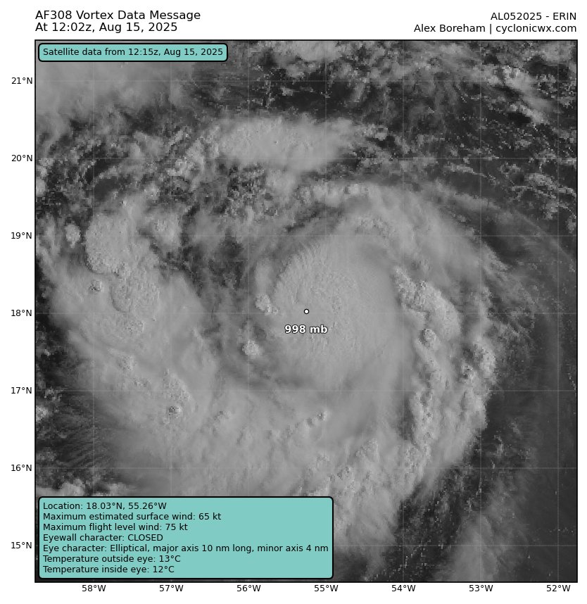
Erin's pressure has dropped below 1000 mb and further strengthening is expected overnight to hurricane status. For now, the Gulf Coast outlook remains favorable, but we’re keeping a close eye whenever a potential major hurricane is in our general neighborhood.

Erin's pressure has dropped below 1000 mb and further strengthening is expected overnight to hurricane status. For now, the Gulf Coast outlook remains favorable, but we’re keeping a close eye whenever a potential major hurricane is in our general neighborhood.
Alex Boreham (@cyclonicwx) 's Twitter Profile Photo

After some restructuring last night, #Erin has become a hurricane with a convection pattern suggestive of more strengthening today. We'll see what it can do before shear begins increasing. Will need to beef up SW side as well. Light winds there this pass

After some restructuring last night, #Erin has become a hurricane with a convection pattern suggestive of more strengthening today. We'll see what it can do before shear begins increasing. Will need to beef up SW side as well. Light winds there this pass
National Hurricane Center (@nhc_atlantic) 's Twitter Profile Photo

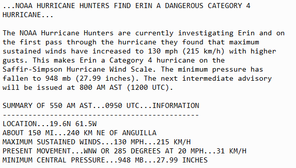
Aug 16 6AM AST: NOAA Aircraft Operations Center find #Erin has strengthened into a dangerous Category 4 hurricane with maximum sustained winds of 130mph. Stay up to date with the latest forecast at hurricanes.gov
Aug 16 6AM AST: <a href="/NOAA_HurrHunter/">NOAA Aircraft Operations Center</a> find #Erin has strengthened into a dangerous Category 4 hurricane with maximum sustained winds of 130mph. Stay up to date with the latest forecast at hurricanes.gov
Philip Klotzbach (@philklotzbach) 's Twitter Profile Photo

#Erin has rapidly intensified and is now a Category 4 #hurricane with max winds of 145 mph. Since 1970, only 5 Atlantic hurricanes have had 145+ mph max winds by Aug. 16: Allen (1980), Charley (2004), Dennis (2005), Emily (2005) and Beryl (2024).

National Hurricane Center (@nhc_atlantic) 's Twitter Profile Photo

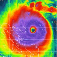
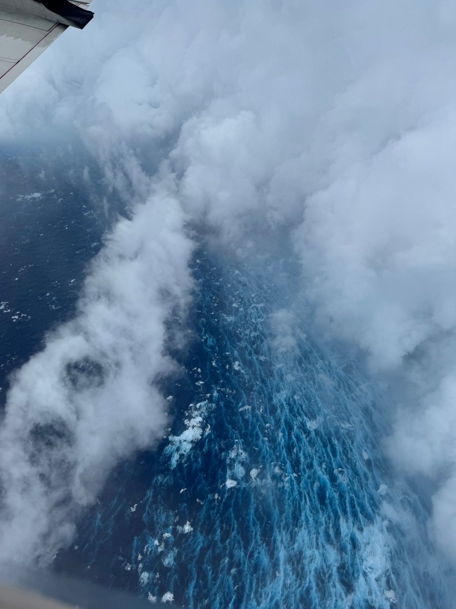
Aug 16: Images from NOAA Aircraft Operations Center and the NOAA Satellites Ocean Winds team show an intense eyewall in Hurricane #Erin This photo shows the ocean surface calm in the eye and roaring in the eyewall. For the latest forecast visit hurricanes.gov
Aug 16: Images from <a href="/NOAA_HurrHunter/">NOAA Aircraft Operations Center</a> and the <a href="/NOAASatellites/">NOAA Satellites</a> Ocean Winds team show an intense eyewall in Hurricane #Erin This photo shows the ocean surface calm in the eye and roaring in the eyewall. For the latest forecast visit hurricanes.gov
John Morales (@johnmoralestv) 's Twitter Profile Photo

155 mph (250 km/hr)‼️sustained winds at 11 AM. #Erin is on the edge of becoming yet another Category 5 #hurricane. The pinhole eye is visible on the NWS San Juan radar, even though it's 230 miles away. Mercy.

155 mph (250 km/hr)‼️sustained winds at 11 AM. #Erin is on the edge of becoming yet another Category 5 #hurricane. The pinhole eye is visible on the <a href="/NWSSanJuan/">NWS San Juan</a> radar, even though it's 230 miles away. Mercy.
Hurricane Hunters (@53rdwrs) 's Twitter Profile Photo

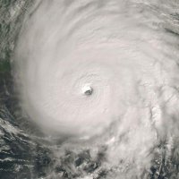
Last night, the 53rd Weather Reconnaissance Squadron flew into the eye of Hurricane Erin—and captured imagery of the breathtaking stadium effect. These missions provide critical data to the NHC to improve forecasts, helping keep communities safe before the storm makes

National Hurricane Center (@nhc_atlantic) 's Twitter Profile Photo

8/17 evening: In addition to #Erin, the tropical wave in the eastern Atlantic now has a medium🟠chance of tropical cyclone formation within the next 7 days. The system should approach the NE Caribbean or SW Atlantic by the end of this week. More info: hurricanes.gov

8/17 evening: In addition to #Erin, the tropical wave in the eastern Atlantic now has a medium🟠chance of tropical cyclone formation within the next 7 days. The system should approach the NE Caribbean or SW Atlantic by the end of this week.  More info: hurricanes.gov
Michael Lowry (@michaelrlowry) 's Twitter Profile Photo

Former NHC Branch Chief James Franklin shared these verification plots tonight from all publicly available models for Hurricane Erin. Google DeepMind (GDMI) crushed it, even besting the consensus aids. We'll see if this holds the rest of the season, but color me impressed.

Former NHC Branch Chief James Franklin shared these verification plots tonight from all publicly available models for Hurricane Erin. <a href="/GoogleDeepMind/">Google DeepMind</a> (GDMI) crushed it, even besting the consensus aids. We'll see if this holds the rest of the season, but color me impressed.
Michael Ferragamo (@ferragamowx) 's Twitter Profile Photo

This photo, 20 years later, remains one of the greatest images ever taken inside Hurricane KATRINA. The Hurricane Hunters view of KATRINA’s eye, with the eyewall visible. At the time, it packed winds of 150 kts (175 mph) and a pressure of 902 mb.

This photo, 20 years later, remains one of the greatest images ever taken inside Hurricane KATRINA.

The Hurricane Hunters view of KATRINA’s eye, with the eyewall visible. At the time, it packed winds of 150 kts (175 mph) and a pressure of 902 mb.
Hurricane Hunters (@53rdwrs) 's Twitter Profile Photo

Today, we honored the Gulf Coast community with a flyover in Gulfport, Mississippi, marking the 20th anniversary of Hurricane Katrina. This tribute remembers the resilience of those impacted and the dedication of all who answered the call in the storm’s aftermath.✈️

Today, we honored the Gulf Coast community with a flyover in Gulfport, Mississippi, marking the 20th anniversary of Hurricane Katrina. This tribute remembers the resilience of those impacted and the dedication of all who answered the call in the storm’s aftermath.✈️
Hohonu (@hohonuinc) 's Twitter Profile Photo

GulfCoastNews Allyson Rae Mahalo for reporting on Lee County's water level gauge network, powered by Hohonu gulfcoastnewsnow.com/article/lee-co… "Hawaii-based company Hohonu is introducing affordable, cutting-edge sensors that provide real-time data."

Allyson Rae (@allysonraewx) 's Twitter Profile Photo

As we track our two tropical waves this morning, the eastern one, 93L, looks the most likely to develop soon and could become Humberto. The bigger challenge is how 94L evolves in response to 93L. If both systems develop, they could interact and rotate around a common center,

As we track our two tropical waves this morning, the eastern one, 93L, looks the most likely to develop soon and could become Humberto. The bigger challenge is how 94L evolves in response to 93L.

 If both systems develop, they could interact and rotate around a common center,
Andy Hazelton (@andyhazelton) 's Twitter Profile Photo

#94L has increased convective coverage south of Puerto Rico this afternoon. The wave axis looks a little more amplified as well. This particular vort max may not be long for this world, though, since it is heading right for the mountainous terrain of Hispaniola. We may not have a

#94L has increased convective coverage south of Puerto Rico this afternoon. The wave axis looks a little more amplified as well. This particular vort max may not be long for this world, though, since it is heading right for the mountainous terrain of Hispaniola. We may not have a