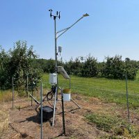
Wisconsin Mesonet
@wisconet
A growing network of weather & soil monitoring stations across Wisconsin. Funded by USDA Rural Partnerships Institute and Wisconsin Alumni Research Foundation.
ID: 1645592189328564224
https://wisconet.wisc.edu 11-04-2023 01:00:12
2,2K Tweet
759 Followers
185 Following
Not much change to the NWS Storm Prediction Center severe weather outlook at 11:30 am. All severe weather types are possible for Wisconsin including 2+” hail, tornadoes, and damaging winds. The SPC did highlight central - southeast Wisconsin between 1 and 5 pm for higher tornado risk.
 on Twitter photo Not much change to the <a href=\"/NWSSPC/\">NWS Storm Prediction Center</a> severe weather outlook at 11:30 am.
All severe weather types are possible for Wisconsin including 2+” hail, tornadoes, and damaging winds.
The SPC did highlight central - southeast Wisconsin between 1 and 5 pm for higher tornado risk.")
 on Twitter photo Have you used our Outdoor Activities Dashboard yet?
Enter your city and stay up-to-date on the current conditions from Wisconet, Airport, and Fire Weather stations, get the latest hazardous weather outlooks, and any active watches or warnings.
wisconet.wisc.edu/tools/outdoor_…")
 on Twitter photo The first Tornado Watch of the day has been issued across west-central and northwestern Wisconsin until 8 pm.
Hail up to 3\" in diameter and tornadoes (including strong tornadoes) are possible in the watch area.")
 on Twitter photo A new Tornado Watch will likely be issued for southwestern and south-central Wisconsin in the next couple hours.
Hail larger than tennis balls and strong tornadoes will be possible.
Stay weather aware this afternoon - and especially between 4 and 8 pm.")
 on Twitter photo Most of Wisconsin is now under a Tornado Watch until late this evening.
Tornado warnings are ongoing between River Falls and Eau Claire and new storms are starting to develop in southwestern Wisconsin.
Stay weather aware this afternoon and evening!")
 's Twitter Profile Photo")
 on Twitter photo <a href=\"/NWSTwinCities/\">NWS Twin Cities</a> just south and east of New Richmond WI just now. #wiwx")
 on Twitter photo The severe weather threat continues across northern and eastern Wisconsin this evening.
There have been numerous tornado and large hail reports so far.
Continue to stay weather aware and heed warnings!")
 on Twitter photo It was an active severe weather day across Wisconsin yesterday - here are reports that made it to the Storm Prediction Center.
The tornado reports from Columbia and Dodge Counties are not on the map, but the National Weather Service is completing storm surveys in Dodge today.")
 's Twitter Profile Photo")
 on Twitter photo Southern Wisconsin saw its first 90°F temps of the year yesterday – and it’s only mid-May!
🟠Wisconet stations near Walworth, Porter, Verona & Richland Center saw 90°F+
🟠Monroe and Janesville-Beloit hit 91°F & Boscobel broke 93°F
🟠90s usually don’t arrive until mid-June
#wiwx")
 on Twitter photo Warm and sunny across the state right now, but we're keeping an eye on the potential for some thunderstorms to develop this afternoon.
Not looking at widespread severe weather, but there could be some strong wind gusts and small hail, especially east of I-39.")
 on Twitter photo Scattered showers and thunderstorms developing ahead of a cold front this afternoon.
A couple storms may turn severe, with gusty winds and small hail possible.
Stay alert for warnings and with every thunderstorm: When thunder roars, go indoors!")
 on Twitter photo A chilly night is forecast tonight - even freezing conditions in the Northwoods! A Freeze Warning is in place for the northern third of the state.
If you have sensitive plants, cover them up or bring them inside!")
 on Twitter photo One more cool and dry day today and then rain comes into the state this evening.
Looking like a good soaker along and south of I-94, with 1-2 inches of rain expected. The Weather Prediction Center has highlighted this area in a level 1/4 risk of excessive rainfall for tomorrow.")
 on Twitter photo Our station in Soldiers Grove has bore the brunt of the rain so far today, with continuous rain for almost 8 hours now.
They’re up to 2.3 inches of rain with a temperature around 40.
Lousy Smarch weather.")
 on Twitter photo A nice widespread soaking rain. Haven’t seen this in a little bit and it’s nice to see.
Full data: wisconet.wisc.edu")
 on Twitter photo Statewide rain the last few days, but southern Wisconsin really picked up a healthy soaking - numerous locations over 2” of rainfall.
We will probably see this reflected in the Drought Monitor next week.")
 on Twitter photo Beautiful morning for Take Your Brat to Work Day. Picked up a sack of 10 for the Wisconet team this morning.")
 on Twitter photo A Frost Advisory is in effect for central and northern Wisconsin overnight. Temperatures in the mid-30s and lower will allow for the formation of frost. Cover any sensitive plants or bring them inside.
Patchy frost is possible over portions of southeastern Wisconsin as well.")