Ian Mutschler (@tropicalupdater) 's Twitter Profile
Ian Mutschler

@tropicalupdater

Meteorology B.S., current M.S. student at @FloridaState / Moodys RMS @hwind Hurricane Analyst / All opinions expressed here are mine alone

ID: 899788415251697664

linkhttps://www.youtube.com/channel/UChtE17T8pyl26skkrLaHpDw calendar_today22-08-2017 00:20:50

4,4K Tweet

952 Followers

551 Following

National Hurricane Center (@nhc_atlantic) 's Twitter Profile Photo

Aug 16: Images from NOAA Aircraft Operations Center and the NOAA Satellites Ocean Winds team show an intense eyewall in Hurricane #Erin This photo shows the ocean surface calm in the eye and roaring in the eyewall. For the latest forecast visit hurricanes.gov
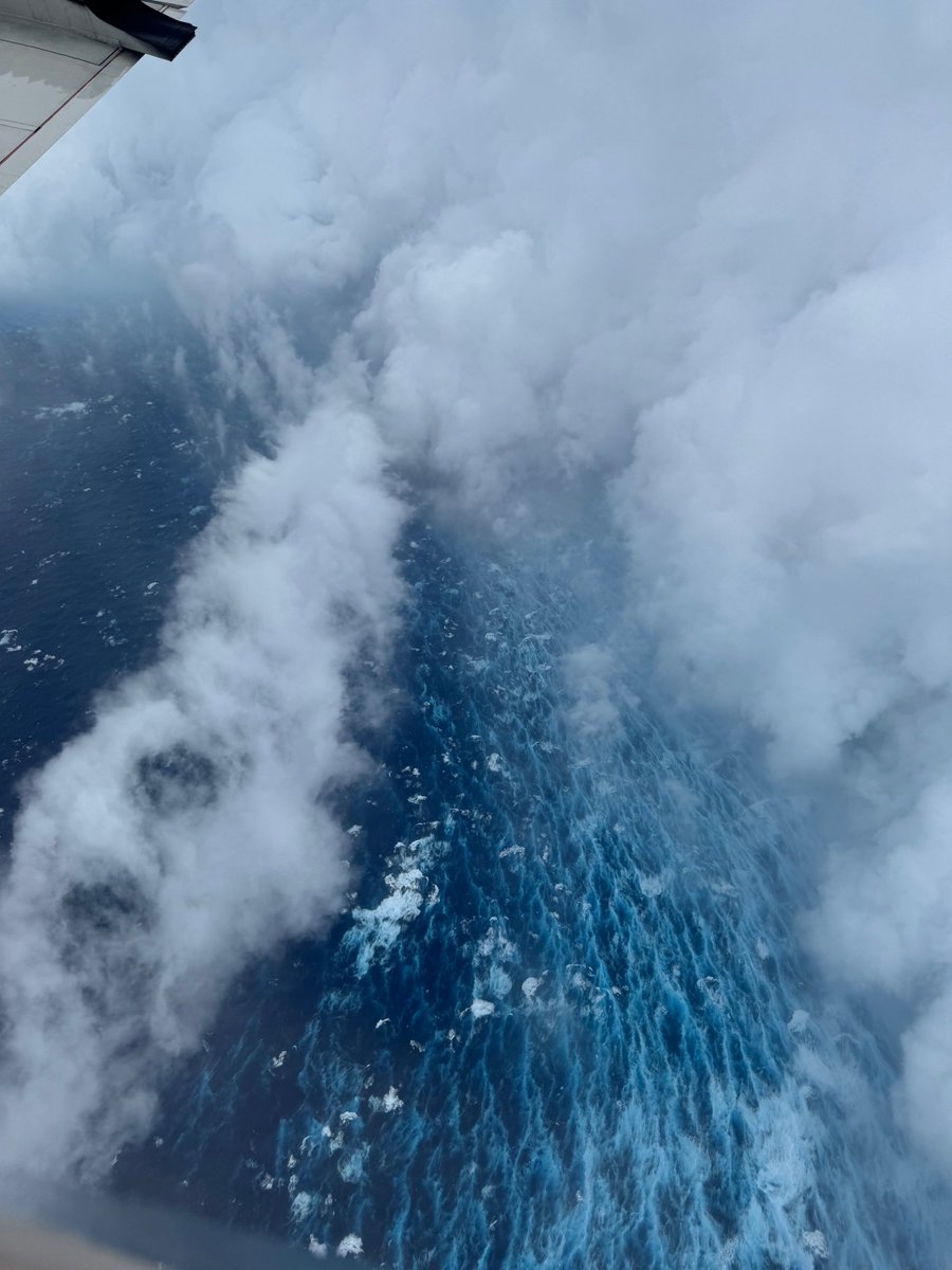
Aug 16: Images from <a href="/NOAA_HurrHunter/">NOAA Aircraft Operations Center</a> and the <a href="/NOAASatellites/">NOAA Satellites</a> Ocean Winds team show an intense eyewall in Hurricane #Erin This photo shows the ocean surface calm in the eye and roaring in the eyewall. For the latest forecast visit hurricanes.gov
Moody's HWind (@hwind) 's Twitter Profile Photo

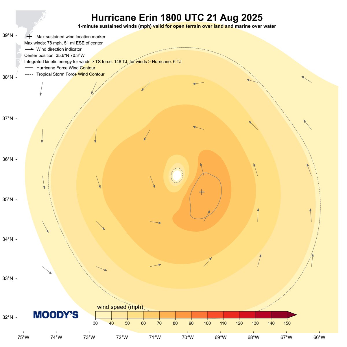
Our latest (and final) Snapshot of #HurricaneErin shows TS-force integrated kinetic energy (IKE) of 148 TJ. Considering its complete track IKE, it now sits at about the 90th percentile for Atlantic TCs 2002–present. TIKE will substantially rise through the weekend.

Our latest (and final) Snapshot of #HurricaneErin shows TS-force integrated kinetic energy (IKE) of 148 TJ. Considering its complete track IKE, it now sits at about the 90th percentile for Atlantic TCs 2002–present. TIKE will substantially rise through the weekend.
Moody's HWind (@hwind) 's Twitter Profile Photo

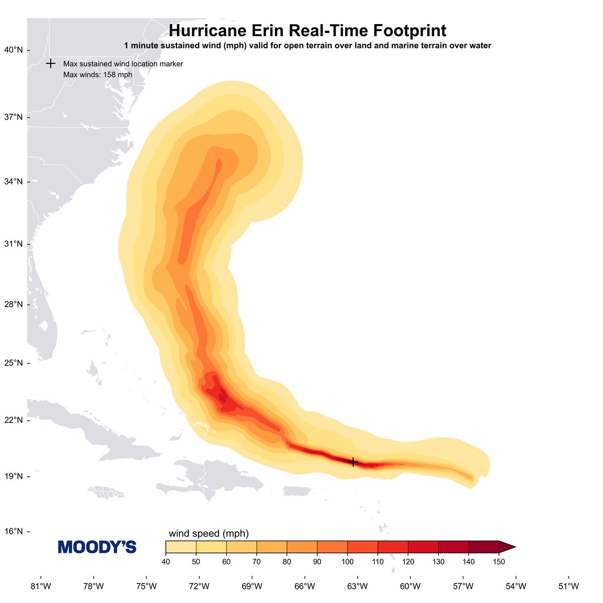
Hurricane Erin totaled 2809 TJ of TIKE - that ranks 19th of 420 North Atlantic TCs since 2002! Our coverage of #HurricaneErin spanned 16–21 August. Here's the final Footprint swath.

Hurricane Erin totaled 2809 TJ of TIKE - that ranks 19th of 420 North Atlantic TCs since 2002! Our coverage of #HurricaneErin spanned 16–21 August. Here's the final Footprint swath.
Jeremy DeHart (@jeremydehartwx) 's Twitter Profile Photo

From a crewmember on yesterday's Teal 74 mission into now-Category 5 Hurricane #Melissa. As clear of an eye as you will see in the Atlantic basin.

Dr. Levi Cowan (@tropicaltidbits) 's Twitter Profile Photo

All-time eyewall dropsonde right here from Hurricane #Melissa. 219 kt instantaneous wind above the surface, with a mean value of 188 kt in the lowest 150 meters, roughly supporting the estimated 1-minute mean surface wind of 160 kt (185 mph)

All-time eyewall dropsonde right here from Hurricane #Melissa. 219 kt instantaneous wind above the surface, with a mean value of 188 kt in the lowest 150 meters, roughly supporting the estimated 1-minute mean surface wind of 160 kt (185 mph)