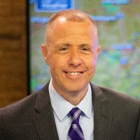
Shane Smith (@ssmithweather) 's Twitter Profile
Shane Smith

@ssmithweather

Kentucky based Meteorologist, Media Educator, and Nerd.

ID: 1137824011

linkhttps://www.youtube.com/channel/UCTy-HFpf8_NHV1DjmSao-uQ calendar_today31-01-2013 20:14:26

11,11K Tweet

3,3K Takipçi

2,2K Takip Edilen

NWS New Orleans (@nwsneworleans) 's Twitter Profile Photo

Wow, what a snow day! ❄️ It's safe to say this was a historic snowfall for much of the area. We're still gathering updated snow totals—check out the previous post for the updated PNS. We'll continue adding new totals here as they come in! #lawx #mswx

Wow, what a snow day! ❄️ It's safe to say this was a historic snowfall for much of the area. We're still gathering updated snow totals—check out the previous post for the updated PNS. We'll continue adding new totals here as they come in! #lawx #mswx
Shane Smith (@ssmithweather) 's Twitter Profile Photo

Wow, I wasn’t expecting much from Section 31, but that was the worst Trek movie ever. I would rather binge watch TMP, Final Frontier and Nemisis in a row than ever watch that hot mess again. Star Trek on Paramount+ this is not what your fans want. #Section31

Ryan Hall, Y’all (@ryanhallyall) 's Twitter Profile Photo

From my interpretation, Oklahoma SB 158 would require storm chasers to work with TV stations only. Digital platforms like mine (often with bigger audiences than local TV) aren't included. The bill needs updating for modern weather coverage! legiscan.com/OK/text/SB158/…

Ryan Hall, Y’all (@ryanhallyall) 's Twitter Profile Photo

For just $3 of your tax dollars a year, the National Weather Service (part of #NOAA) save countless lives and billions in damage with their forecasts! Best bang for your buck in government spending if you ask me!

NWS Jackson KY (@nwsjacksonky) 's Twitter Profile Photo

Between midnight and 9am on Thursday morning, isolated severe thunderstorms are possible across Eastern #KYwx. Confidence is highest in areas south of the Mountain Parkway, with damaging winds the primary hazard. Hail and an isolated brief tornado cannot be entirely ruled out.

Between midnight and 9am on Thursday morning, isolated severe thunderstorms are possible across Eastern #KYwx. Confidence is highest in areas south of the Mountain Parkway, with damaging winds the primary hazard. Hail and an isolated brief tornado cannot be entirely ruled out.
Ryan Hall, Y’all (@ryanhallyall) 's Twitter Profile Photo

Heads up Kentucky & Tennessee: Severe storms with tornado potential rolling through overnight. 1.2M people under Slight Risk, including Bowling Green & Richmond. 8M more under Marginal Risk across Nashville, Louisville & Knoxville areas.

Heads up Kentucky & Tennessee: Severe storms with tornado potential rolling through overnight. 1.2M people under Slight Risk, including Bowling Green & Richmond. 8M more under Marginal Risk across Nashville, Louisville & Knoxville areas.