Jeff Jumper (@jeffjumperwx) 's Twitter Profile
Jeff Jumper

@jeffjumperwx

ID: 225252953

calendar_today11-12-2010 03:21:49

11,11K Tweet

4,4K Takipçi

2,2K Takip Edilen

Jeff Jumper (@jeffjumperwx) 's Twitter Profile Photo

⚠️Severe t'storms and flash flooding are possible late today into tonight 🌪️🌬️⚪️🌊 Have at least 2⃣ ways to receive severe weather alerts, including one to wake you overnight. 📺📻📱 Pennsylvania Emergency Management Agency #PAWX
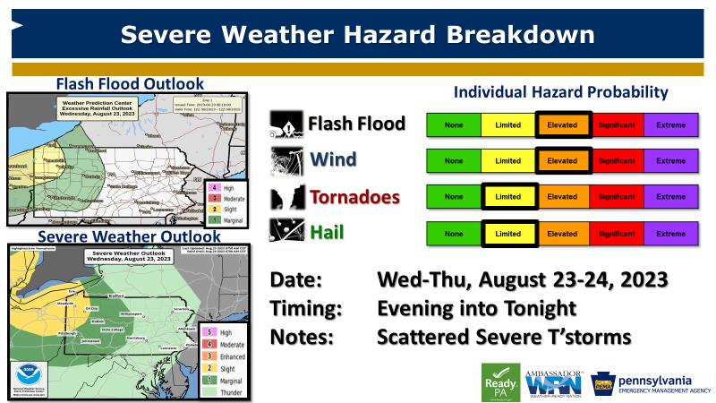
⚠️Severe t'storms and flash flooding are possible late today into tonight 🌪️🌬️⚪️🌊

Have at least 2⃣ ways to receive severe weather alerts, including one to wake you overnight.

📺📻📱

<a href="/PEMAHQ/">Pennsylvania Emergency Management Agency</a> #PAWX
Jeff Jumper (@jeffjumperwx) 's Twitter Profile Photo

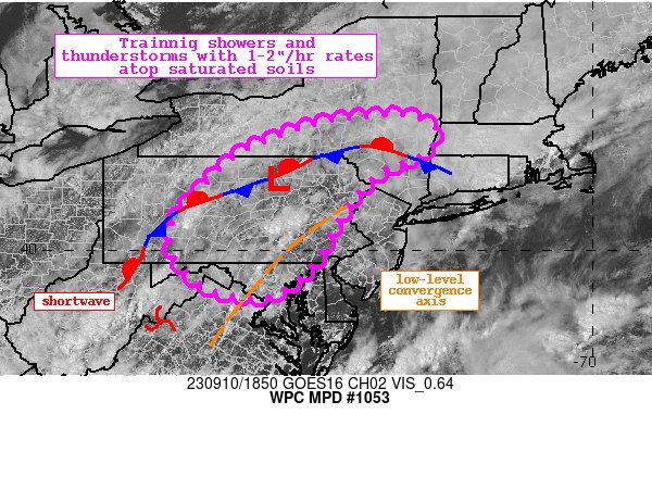
⏭️Another round of heavy rain & severe t'storms are expected later this Friday. ⚠️Be alert and have multiple methods to get severe weather alerts this evening. Pennsylvania Emergency Management Agency #PAWX
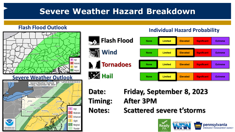
⏭️Another round of heavy rain &amp; severe t'storms are expected later this Friday.

⚠️Be alert and have multiple methods to get severe weather alerts this evening.

<a href="/PEMAHQ/">Pennsylvania Emergency Management Agency</a> #PAWX
NWS Storm Prediction Center (@nwsspc) 's Twitter Profile Photo

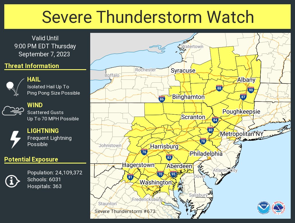
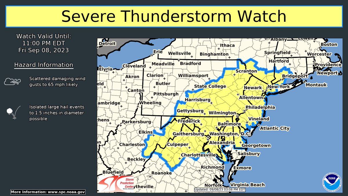
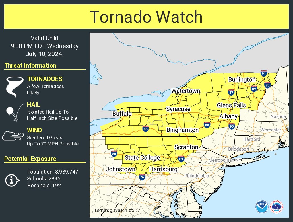
Severe Thunderstorm Watch #674 has been issued for portions of the Mid Atlantic and New England until 11 pm EDT. Damaging wind gusts and isolated hail are possible with strong to severe storms through this afternoon and evening. Please see spc.noaa.gov for more info.

Severe Thunderstorm Watch #674 has been issued for portions of the Mid Atlantic and New England until 11 pm EDT. Damaging wind gusts and isolated hail are possible with strong to severe storms through this afternoon and evening. Please see spc.noaa.gov for more info.
NWS Weather Prediction Center (@nwswpc) 's Twitter Profile Photo

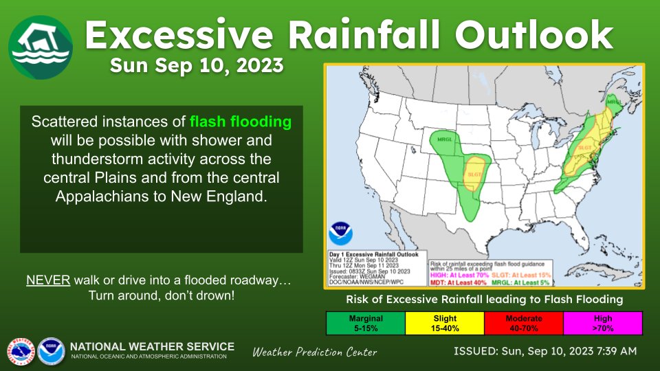
Heavy rain may lead to scattered instances of flash flooding today across the central Plains, as well as much of the Northeast and central Appalachians. Remain weather aware and be sure to avoid driving through flooded roadways.

Heavy rain may lead to scattered instances of flash flooding today across the central Plains, as well as much of the Northeast and central Appalachians. Remain weather aware and be sure to avoid driving through flooded roadways.
NWS State College (@nwsstatecollege) 's Twitter Profile Photo

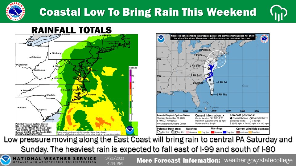
After a dry day on Friday, a coastal storm will bring steady and at times heavy rain to parts of central PA Saturday and Sunday. Localized flooding will be possible along with gusty winds. The heaviest rain (1-3 inches) is expected east of I-99 and south of I-80. #PAwx

After a dry day on Friday, a coastal storm will bring steady and at times heavy rain to parts of central PA Saturday and Sunday. Localized flooding will be possible along with gusty winds. The heaviest rain (1-3 inches) is expected east of I-99 and south of I-80. #PAwx
NWS Mount Holly (@nws_mountholly) 's Twitter Profile Photo

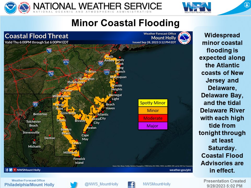
⚠️🌧️ Heavy rain potentially leading to significant flash flooding and river flooding is possible across portions of northern and central NJ beginning tonight through Friday. View our latest briefing package for details: ow.ly/77O750HGktZ #NJwx #DEwx #MDwx #PAwx

⚠️🌧️ Heavy rain potentially leading to significant flash flooding and river flooding is possible across portions of northern and central NJ beginning tonight through Friday. View our latest briefing package for details: ow.ly/77O750HGktZ #NJwx #DEwx #MDwx #PAwx
NWS Pittsburgh (@nwspittsburgh) 's Twitter Profile Photo

Preparation for winter storms begins with an emergency kit for your car. We recommend having the following items whenever you travel! #WinterPrepPA

NWS State College (@nwsstatecollege) 's Twitter Profile Photo

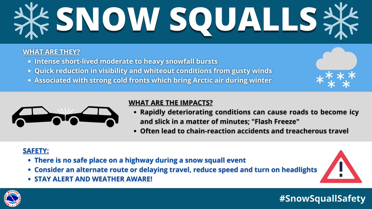
Snow squalls are often associated with strong cold fronts and are a key winter weather hazard. Sudden whiteout conditions, gusty winds, and falling temperatures produce icy roads in just a few minutes. There is no safe place on a highway during a snow squall. #SnowSquallSafetyPA

Snow squalls are often associated with strong cold fronts and are a key winter weather hazard. Sudden whiteout conditions, gusty winds, and falling temperatures produce icy roads in just a few minutes. There is no safe place on a highway during a snow squall. #SnowSquallSafetyPA
NWS State College (@nwsstatecollege) 's Twitter Profile Photo

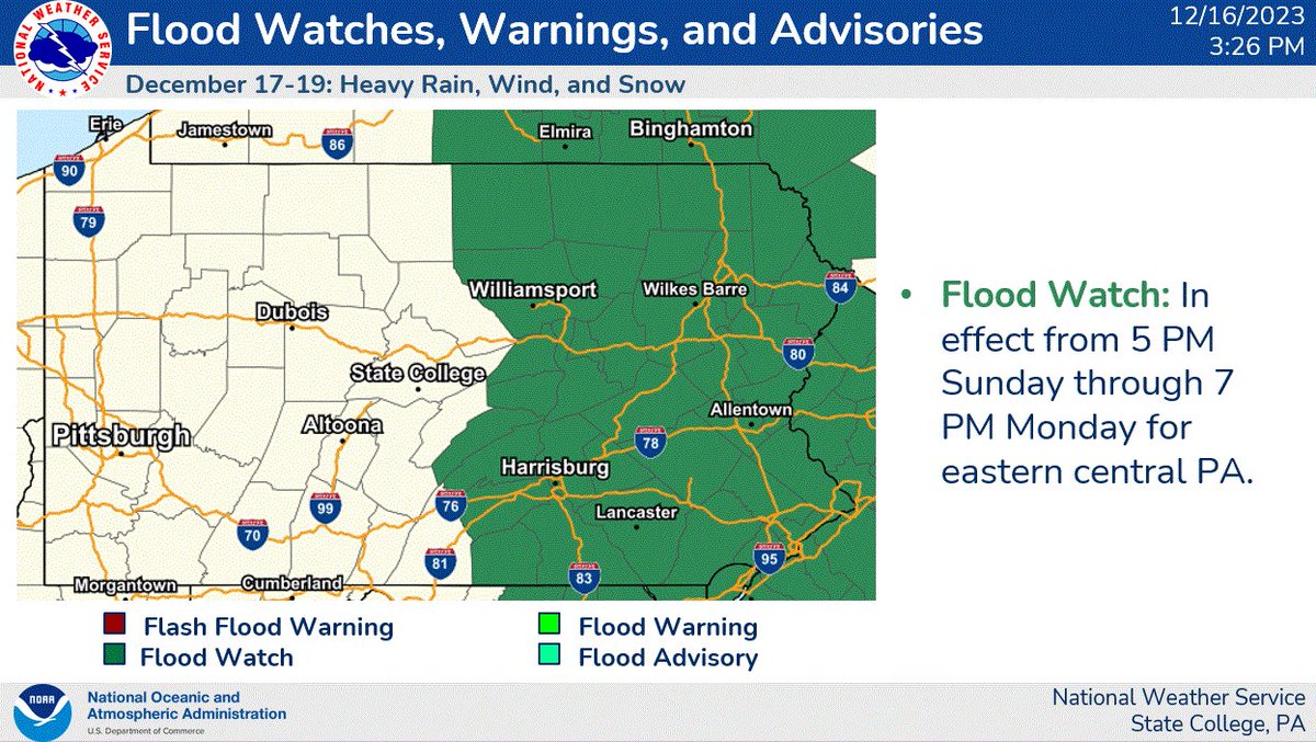
We have issued a Flood Watch in effect from 5 PM Sunday through 7 PM Monday for eastern central Pennsylvania. This is in advance of the heavy rain event that will impact the state tomorrow and is subject to change. #pawx

We have issued a Flood Watch in effect from 5 PM Sunday through 7 PM Monday for eastern central Pennsylvania. This is in advance of the heavy rain event that will impact the state tomorrow and is subject to change. #pawx
Jeff Jumper (@jeffjumperwx) 's Twitter Profile Photo

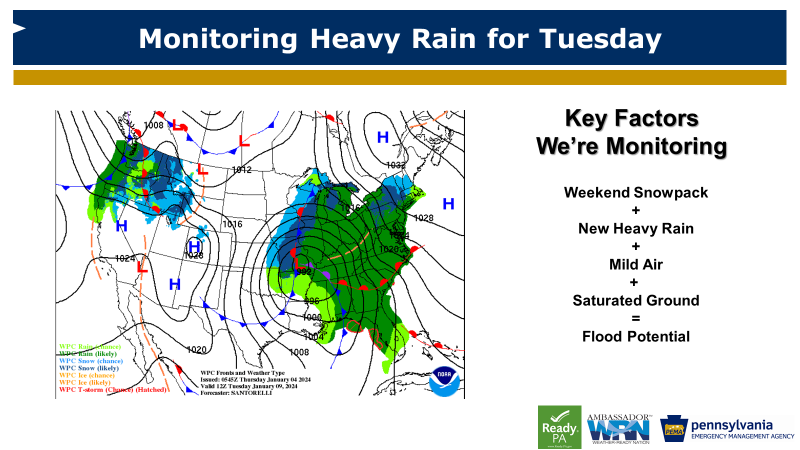
👋Parade of storms to monitor... 🗓️Sat-Sun: Accumulating snow and a mix ⚠️Treacherous travel conditions ⏭️Tue: Heavy rain potential, windy ⚠️Flood and utility outage concerns Monitor your local National Weather Service office accounts for the latest updates in your area. Pennsylvania Emergency Management Agency #PAWX

👋Parade of storms to monitor...

🗓️Sat-Sun: Accumulating snow and a mix
⚠️Treacherous travel conditions

⏭️Tue: Heavy rain potential, windy
⚠️Flood and utility outage concerns

Monitor your local <a href="/NWS/">National Weather Service</a> office accounts for the latest updates in your area.

<a href="/PEMAHQ/">Pennsylvania Emergency Management Agency</a> #PAWX
Jeff Jumper (@jeffjumperwx) 's Twitter Profile Photo

A fast, but potent storm system races through PA Tuesday Expect heavy rain & strong wind We’ll see flash flooding and flooding of creeks and streams Tue-Wed Utility outages and downed trees/limbs are expected too Be weather aware and stay safe! #PAWX Pennsylvania Emergency Management Agency

PA Emergency Management Agency (@pemahq) 's Twitter Profile Photo

We love hanging out with Pennsylvania seniors and helping them up their preparedness game. 💪✅ We visited the good folks at Windy Hill to help residents create an emergency plan. 📸 In this picture: Jeff Jumper

We love hanging out with Pennsylvania seniors
and helping them up their preparedness game. 💪✅

We visited the good folks at <a href="/WindyHillOTC/">Windy Hill</a> to help
residents create an emergency plan.

📸 In this picture: <a href="/JeffJumperWX/">Jeff Jumper</a>
NWS Pittsburgh (@nwspittsburgh) 's Twitter Profile Photo

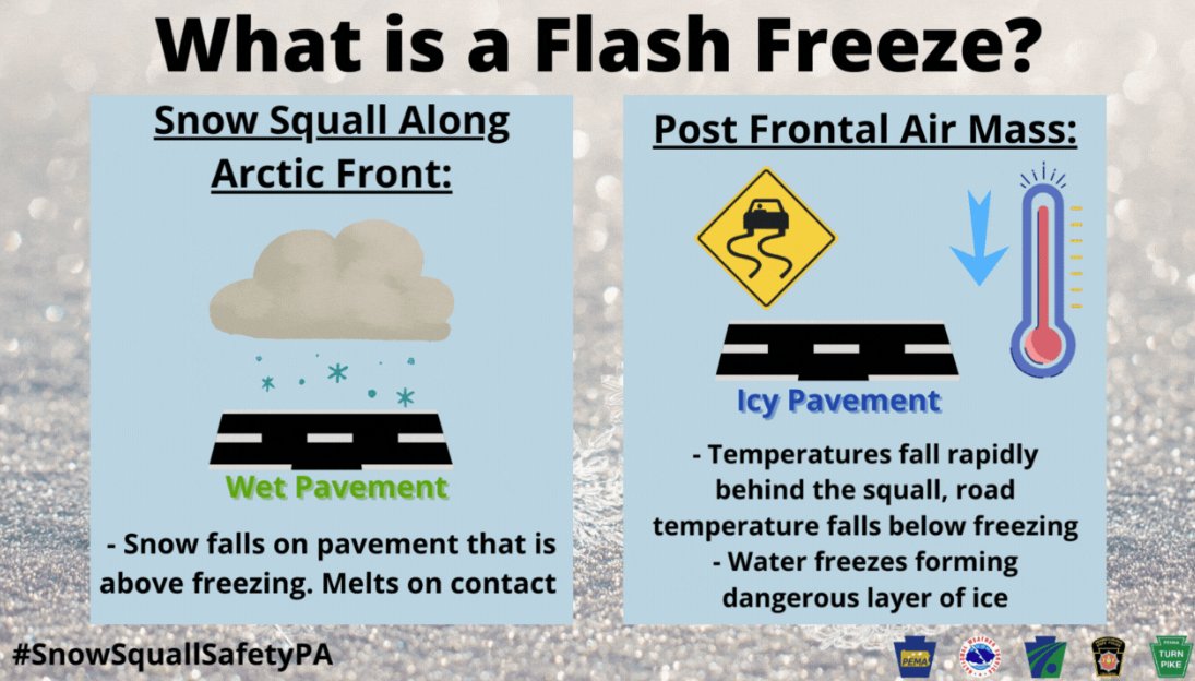
A common hazard associated with snow squalls is a “flash freeze”. Rapidly-falling temperatures along with melting snow on high-traffic roads can cause untreated highways to turn into a sheet of ice. Heavy Snow Bursts + Flash Freezes = Extreme Impacts. #SnowSquallSafetyPA #PAwx

A common hazard associated with snow squalls is a “flash freeze”. Rapidly-falling temperatures along with melting snow on high-traffic roads can cause untreated highways to turn into a sheet of ice.

Heavy Snow Bursts + Flash Freezes = Extreme Impacts.
#SnowSquallSafetyPA #PAwx