Tim I ๐Ÿ‡ณ๐Ÿ‡ฟ๐Ÿ‡ช๐Ÿ‡บ๐Ÿ‡ธ๐Ÿ‡ช (@timiles_) 's Twitter Profile
Tim I ๐Ÿ‡ณ๐Ÿ‡ฟ๐Ÿ‡ช๐Ÿ‡บ๐Ÿ‡ธ๐Ÿ‡ช

@timiles_

Data Engineer @overstoryai - Love remote sensing, geology, earth and environmental sciences and the combination of all of the above. ๐Ÿ‡ณ๐Ÿ‡ฟ๐Ÿ‡ฉ๐Ÿ‡ช๐Ÿ‡ต๐Ÿ‡ฑ๐Ÿ‡ฆ๐Ÿ‡น๐Ÿ‡ธ๐Ÿ‡ช

ID: 941994043906646016

calendar_today16-12-2017 11:30:56

66 Tweet

379 Takipรงi

1,1K Takip Edilen

NASA JPL (@nasajpl) 's Twitter Profile Photo

NISAR, a joint NASA-@ISRO Earth-observing mission, will track subtle changes in our planetโ€™s surface and spot warning signs of volcanic eruptions. The satellite will monitor these changes using a level of resolution in space and time that hasnโ€™t been done before.

NASA Earth (@nasaearth) 's Twitter Profile Photo

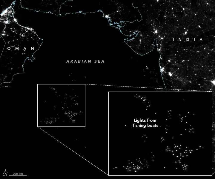
Researchers have found another use for #VIIRS night lights imagery: tracking unregulated and under-reported fishing. earthobservatory.nasa.gov/images/148307/โ€ฆ

Researchers have found another use for #VIIRS night lights imagery: tracking unregulated and under-reported fishing. earthobservatory.nasa.gov/images/148307/โ€ฆ
Anthony Goldbloom (@antgoldbloom) 's Twitter Profile Photo

Kaggle is famous for machine learning competitions. Less well known is our datasets platform, which is a treasure-trove of great datasets (kaggle.com/datasets). Over the coming months, I'm going to be Tweeting interesting data from it to showcase what's there.

Papers with Code (@paperswithcode) 's Twitter Profile Photo

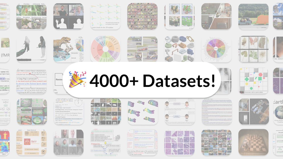
๐ŸŽ‰ We've just crossed 4000 Datasets! ๐ŸŽ‰ A huge thanks to the community for their ongoing contributions. Since launch: ๐Ÿ†• 1000+ new datasets added ๐Ÿ”— Dataset links now show on arXiv ๐Ÿ‘ฉโ€๐Ÿ’ป Dataset loaders Browse full catalogue here: paperswithcode.com/datasets

๐ŸŽ‰ We've just crossed 4000 Datasets! ๐ŸŽ‰

A huge thanks to the community for their ongoing contributions.

Since launch:
๐Ÿ†• 1000+ new datasets added
๐Ÿ”— Dataset links now show on arXiv
๐Ÿ‘ฉโ€๐Ÿ’ป Dataset loaders

Browse full catalogue here: paperswithcode.com/datasets
Earth-i (@earthi_) 's Twitter Profile Photo

Come and join the Earth-i team! Are you a GIS Developer or a Junior Data Processing Engineer who likes a challenge? Info here: buff.ly/2TRluF4 #geospatial #geotechnical #remotesensing #ai #supplychainrisk #datascience #bigdata #ml #sar Sustainability & Education Policy Network UK Space Agency European Space Agency

Come and join the Earth-i team!  Are you a GIS Developer or a Junior Data Processing Engineer who likes a challenge? Info here: buff.ly/2TRluF4
#geospatial #geotechnical #remotesensing #ai #supplychainrisk #datascience #bigdata #ml #sar <a href="/SEPNetwork/">Sustainability & Education Policy Network</a> <a href="/spacegovuk/">UK Space Agency</a> <a href="/esa/">European Space Agency</a>
DLR - English (@dlr_en) 's Twitter Profile Photo

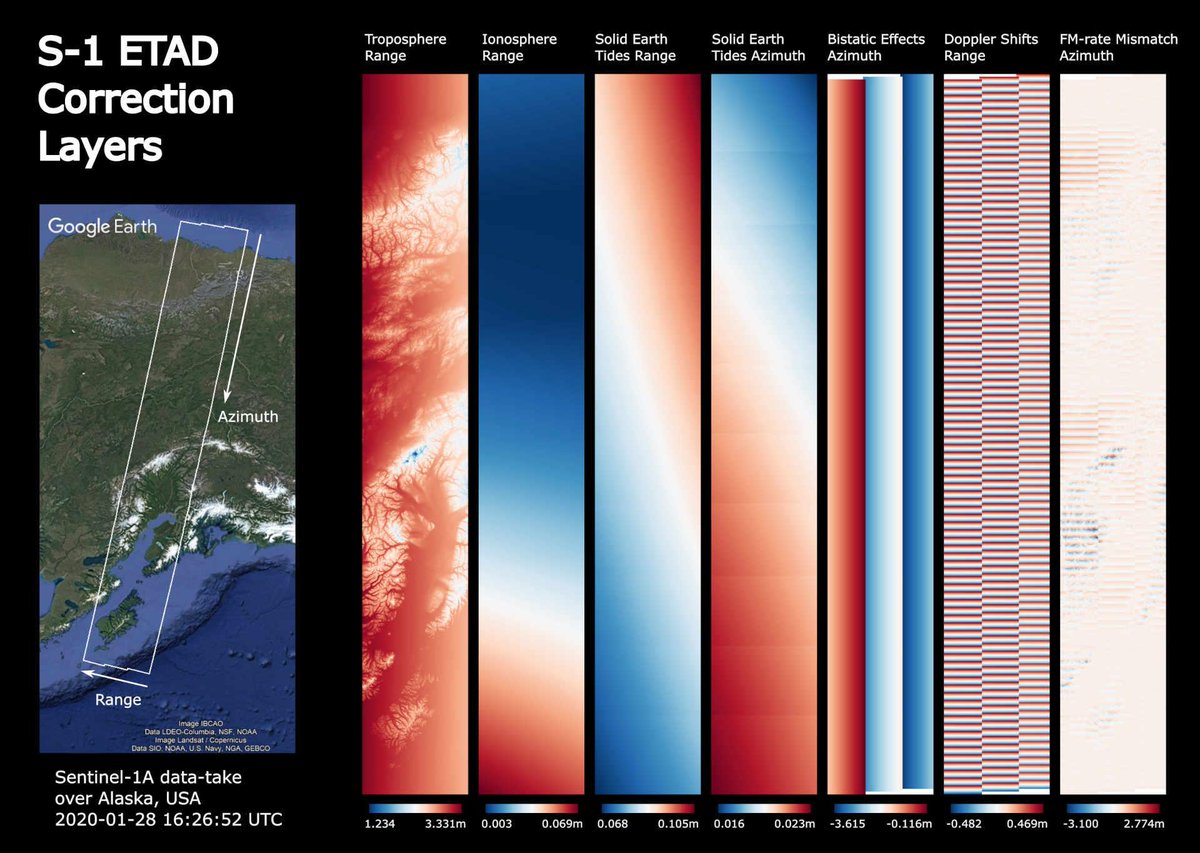
Higher accuracy for ๐Ÿ›ฐ๏ธ images! First developed by researchers at DLR_de for the TerraSAR-X mission, the correction processor is now being tested at European Space Agency to improve the geometric measurement accuracy of the #Sentinel1 image data down to at least 20 cm: dlr.de/content/en/artโ€ฆ

Higher accuracy for ๐Ÿ›ฐ๏ธ images! 
First developed by researchers at <a href="/DLR_de/">DLR_de</a> for the TerraSAR-X mission, the correction processor is now being tested at <a href="/esa/">European Space Agency</a> to improve the geometric measurement accuracy of the #Sentinel1 image data down to at least 20 cm: dlr.de/content/en/artโ€ฆ
Ujaval Gandhi (@spatialthoughts) 's Twitter Profile Photo

Happy to announce a major update to my 'Mastering GDAL Tools' course. The course now includes OGR tools and has new sections for downloading WMS layers, Working with KML files, and much more. Completely free and shared under an open license. Check out courses.spatialthoughts.com/gdal-tools.html

Happy to announce a major update to my 'Mastering GDAL Tools' course. The course now includes OGR tools and has new sections for downloading WMS layers, Working with KML files, and much more. Completely free and shared under an open license. Check out courses.spatialthoughts.com/gdal-tools.html
vineet kumar (@vineetk008) 's Twitter Profile Photo

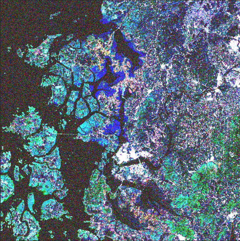
Interested in a Sentinel-1 SAR database for 800,000 crop parcels of the Netherlands. Here comes Agricultural SandboxNL: For details please do join upcoming #IGARSS2021 Precision Ag Session II-15 July: igarss2021.com/view_session.pโ€ฆ IGARSS 2021 Sisters of SAR ESA Earth Observation #EarthEngine Bot
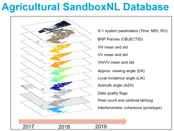
Interested in a Sentinel-1 SAR database for 800,000 crop parcels of the Netherlands. Here comes Agricultural SandboxNL: For details please do join upcoming #IGARSS2021 Precision Ag Session II-15 July: igarss2021.com/view_session.pโ€ฆ <a href="/Igarss2021/">IGARSS 2021</a> <a href="/SistersofSAR/">Sisters of SAR</a> <a href="/ESA_EO/">ESA Earth Observation</a> <a href="/EarthEngineBot/">#EarthEngine Bot</a>
GRSG (@grsg_geolsoc) 's Twitter Profile Photo

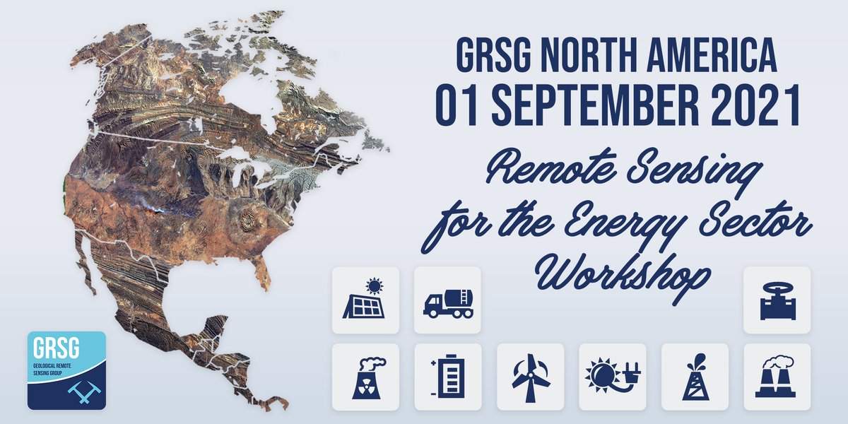
Tickets for the GRSG North America '#RemoteSensing for the #Energy Sector' Workshop are now available! Visit: bit.ly/3lQuB4D & join us online in September. #geology #earthobservation #energytransition #oilandgas #renewables #climateaction #industry

Tickets for the <a href="/GRSG_GeolSoc/">GRSG</a> North America '#RemoteSensing for the #Energy Sector' Workshop are now available! Visit: bit.ly/3lQuB4D &amp; join us online in September. 

#geology #earthobservation #energytransition #oilandgas #renewables #climateaction #industry
Franรงois Chollet (@fchollet) 's Twitter Profile Photo

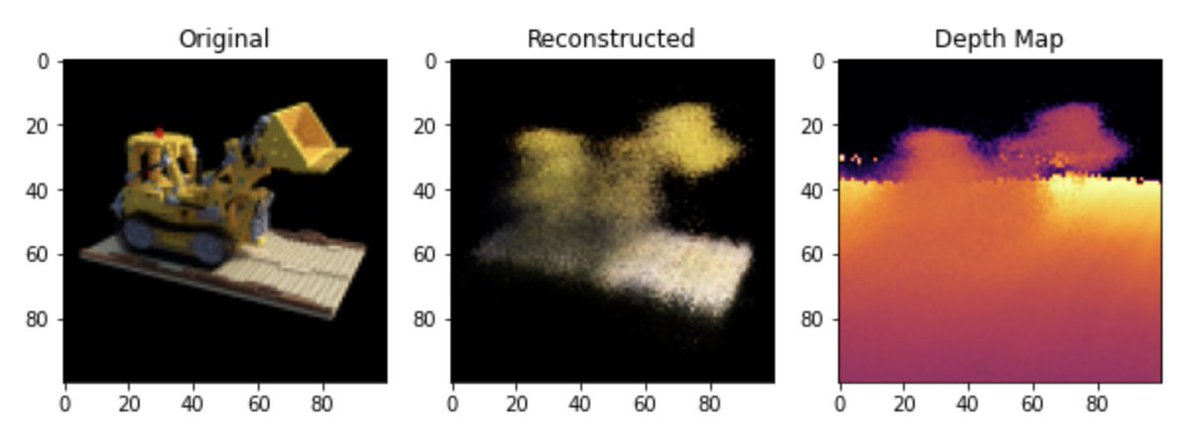
New code walkthrough on keras.io: 3D volumetric rendering with Neural Radiance Fields (NeRF). keras.io/examples/visioโ€ฆ Synthesize novel views of a 2D scene by learning the volumetric scene function.

New code walkthrough on keras.io: 3D volumetric rendering with Neural Radiance Fields (NeRF). 

keras.io/examples/visioโ€ฆ

Synthesize novel views of a 2D scene by learning the volumetric scene function.
CEOS (@ceosdotorg) 's Twitter Profile Photo

30 yrs of SPOT satellite imagery now available! CNES Currently nonorthorectified L1A format, but users can soon process the data on-demand to an orthorectified L1C product. Also working on providing CEOS Analysis Ready Data for Land (CARD4L) products too! regards.cnes.fr/user/swh/modulโ€ฆ

30 yrs of SPOT satellite imagery now available! <a href="/CNES/">CNES</a> Currently nonorthorectified L1A format, but users can soon process the data on-demand to an orthorectified L1C product. Also working on providing CEOS Analysis Ready Data for Land (CARD4L) products too! regards.cnes.fr/user/swh/modulโ€ฆ
USGS EROS (@usgs_eros) 's Twitter Profile Photo

Now available: USGS Landsat 9 data! Read the headline - Landsat 9 Data Release Extends Unparalleled Earth Observation Archive: ow.ly/jl8r50HRZQ3 Get the imagery: ow.ly/CaeT50HRZRN
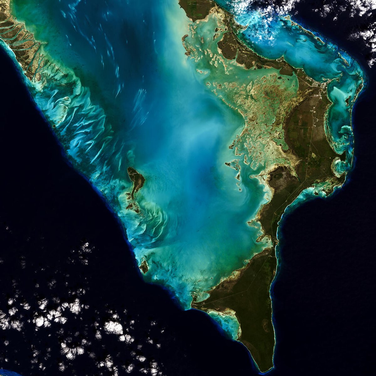
Now available: <a href="/USGSLandsat/">USGS Landsat</a> 9 data!
Read the headline - Landsat 9 Data Release Extends Unparalleled Earth Observation Archive: ow.ly/jl8r50HRZQ3
Get the imagery: ow.ly/CaeT50HRZRN