Tawana Andrew WAVE (@tawanaandrew) 's Twitter Profile
Tawana Andrew WAVE

@tawanaandrew

WAVE News Meteorologist. #notaweathergirl MAPB Award Winner. Weather geek, movie aficionado, and lover of big words. Racing Louisville and Lou City fan #GoNoles

ID: 885537392

linkhttp://wave3.com calendar_today16-10-2012 23:21:24

19,19K Tweet

2,2K Takipçi

1,1K Takip Edilen

Tawana Andrew WAVE (@tawanaandrew) 's Twitter Profile Photo

6:25 AM Radar: Another morning, another round of scattered showers moving through the region. The light to moderate rain could slow down your morning commute.

6:25 AM Radar: Another morning, another round of scattered showers moving through the region. The light to moderate rain could slow down your morning commute.
Tawana Andrew WAVE (@tawanaandrew) 's Twitter Profile Photo

5:02 AM Radar (Fri): Widespread heavy rain has taken over the region. We'll keep widespread rainfall in the forecast throughout the morning; a few strong storms are possible along and south of the Parkways.

5:02 AM Radar (Fri): Widespread heavy rain has taken over the region. We'll keep widespread rainfall in the forecast throughout the morning; a few strong storms are possible along and south of the Parkways.
WAVE Weather (@wave3weather) 's Twitter Profile Photo

SEVERE T-STORM WARNING for Marion, Green, Larue, Taylor until 5/30 6:30AM EDT. Stay indoors! #WAVEWeather app: qrco.de/bcAP8x

SEVERE T-STORM WARNING for Marion, Green, Larue, Taylor until 5/30 6:30AM EDT. Stay indoors! #WAVEWeather app: qrco.de/bcAP8x
WAVE Weather (@wave3weather) 's Twitter Profile Photo

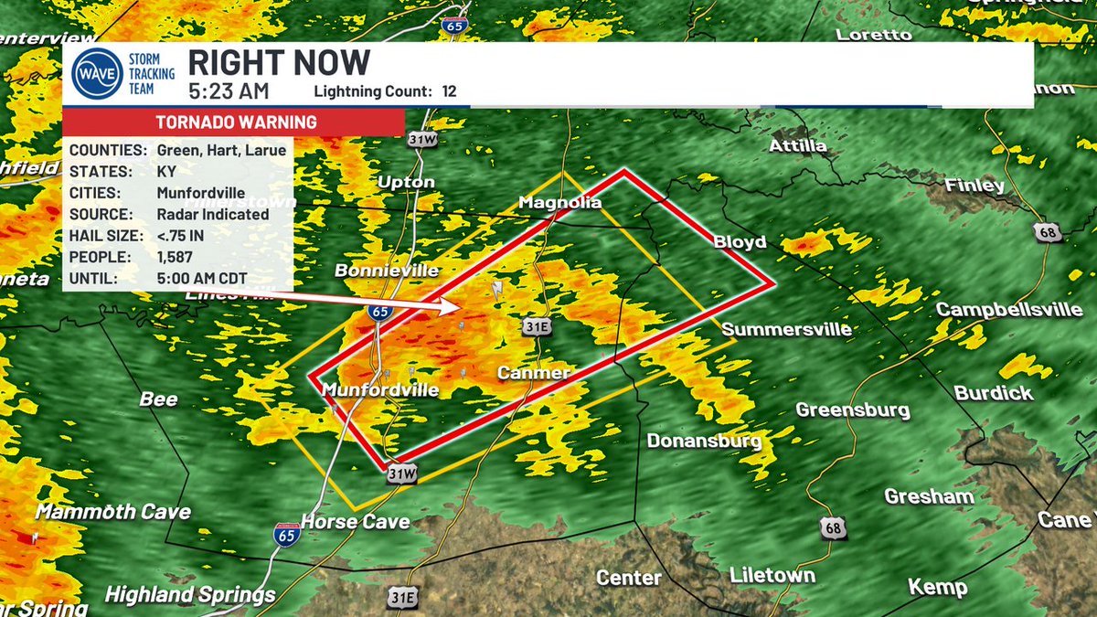
TORNADO WARNING for Marion, Green, Larue, Taylor until 5/30 6:30AM EDT. Take cover immediately! #WAVEWeather app: onelink.to/7ysptn

TORNADO WARNING for Marion, Green, Larue, Taylor until 5/30 6:30AM EDT. Take cover immediately! #WAVEWeather app: onelink.to/7ysptn
WAVE Weather (@wave3weather) 's Twitter Profile Photo

SEVERE T-STORM WARNING for Mercer, Boyle, Washington, Marion until 5/30 7:15AM EDT. Stay indoors! #WAVEWeather app: qrco.de/bcAP8x

SEVERE T-STORM WARNING for Mercer, Boyle, Washington, Marion until 5/30 7:15AM EDT. Stay indoors! #WAVEWeather app: qrco.de/bcAP8x
WAVE Weather (@wave3weather) 's Twitter Profile Photo

TORNADO WARNING for Boyle, Marion, Mercer, Washington until 5/30 7:15AM EDT. Take cover immediately! #WAVEWeather app: onelink.to/7ysptn

TORNADO WARNING for Boyle, Marion, Mercer, Washington until 5/30 7:15AM EDT. Take cover immediately! #WAVEWeather app: onelink.to/7ysptn
WAVE Weather (@wave3weather) 's Twitter Profile Photo

SEVERE T-STORM WARNING for Hancock, Ohio, Breckinridge until 5/30 2:30PM CDT. Stay indoors! #WAVEWeather app: qrco.de/bcAP8x

SEVERE T-STORM WARNING for Hancock, Ohio, Breckinridge until 5/30 2:30PM CDT. Stay indoors! #WAVEWeather app: qrco.de/bcAP8x