NWS Salt Lake City(@NWSSaltLakeCity) 's Twitter Profile Photo

We've gotten many videos and photos this morning that we've confirmed as a Landspout in Herriman. An NWS employee surveyed the approximate location and talked to several witnesses in the area, but could not locate any damage, and no damage has been reported.

account_circle
Renee(@kelandren3) 's Twitter Profile Photo

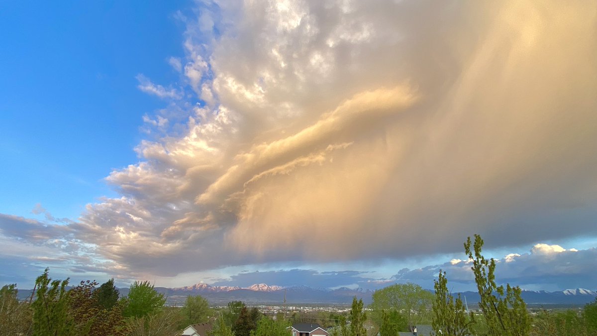
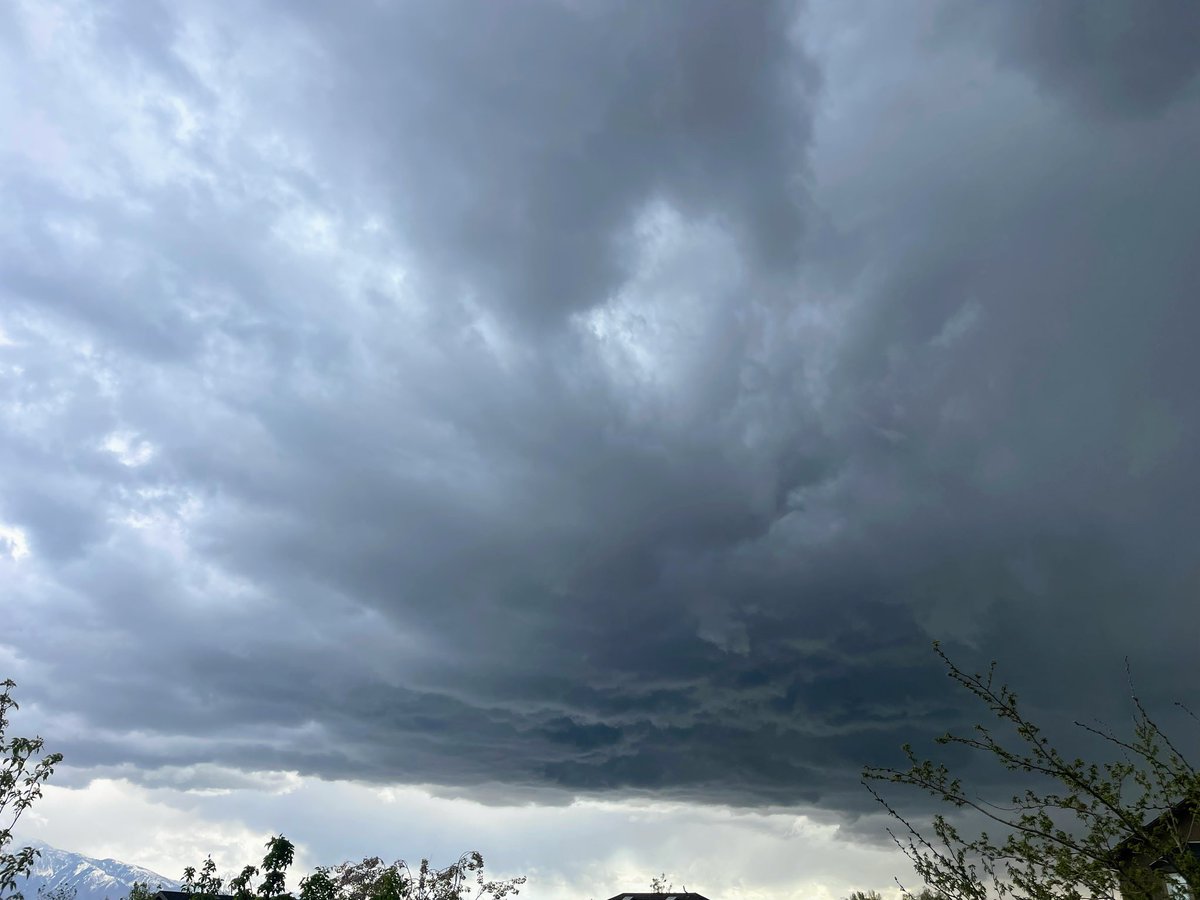
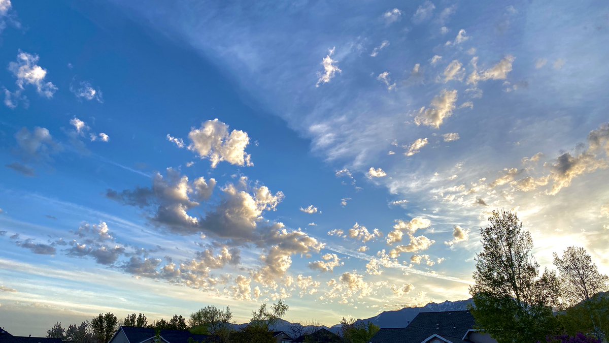
For as much as I love sunshine and warm days...I'm a sucker for rain mixed with rumbling thunderstorms and moody weather. β›ˆοΈ

For as much as I love sunshine and warm days...I'm a sucker for rain mixed with rumbling thunderstorms and moody weather. β›ˆοΈ #utwx
account_circle
NWS Salt Lake City(@NWSSaltLakeCity) 's Twitter Profile Photo

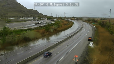
This morning, a heavy rain shower has left a portion of SR 201 between I-80 Jct and 9100 S. closed due to standing water. Any additional heavier showers can lead to localized flooding like this for the remainder of the morning hours.

This morning, a heavy rain shower has left a portion of SR 201 between I-80 Jct and 9100 S. closed due to standing water. Any additional heavier showers can lead to localized flooding like this for the remainder of the morning hours. #UTwx
account_circle
NWS Grand Junction(@NWSGJT) 's Twitter Profile Photo

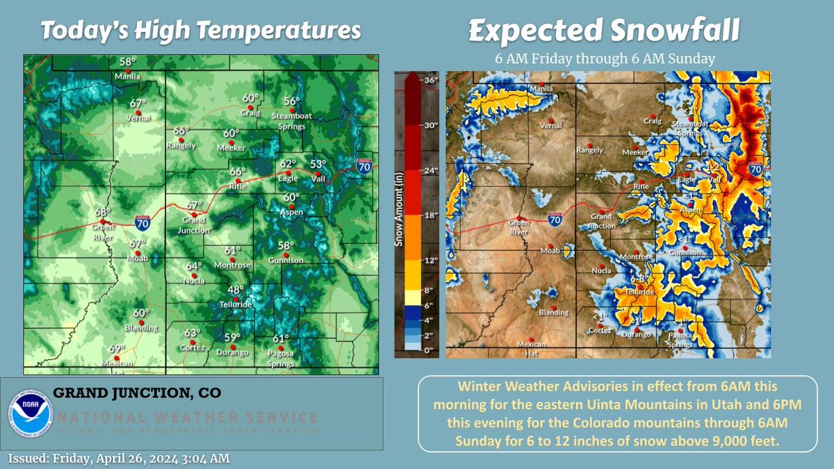
Look for another day of showers πŸ™΄ storms with some snow for the higher terrain. The next system will bring valley rain and mountain snow through Sunday morning. Winter Wx Advisories remain in effect for 6-12 inches of snow for most of the higher terrain.

Look for another day of showers πŸ™΄ storms with some snow for the higher terrain. The next system will bring valley rain and mountain snow through Sunday morning. Winter Wx Advisories remain in effect for 6-12 inches of snow for most of the higher terrain. #cowx #utwx
account_circle
Matthew Johnson(@KSL_Matt) 's Twitter Profile Photo

After not seeing any measurable rainfall in 11 days, this is a great drink of water! 🌧️

More coming today & tomorrow.

After not seeing any measurable rainfall in 11 days, this is a great drink of water! #utwx 🌧️

More coming today & tomorrow.
account_circle
Dan Pope(@Dan_Pope_FOX13) 's Twitter Profile Photo

A Landspout formed in West Daybreak, SW Salt Lake Valley around 11:00 AM. NWS Salt Lake City Scott T. Taylor Brian Williams Andy Hyer Andy Hyer Steve Baron cajaaw Chris Williams

Photos: Allison Hill Kunz, Jacquse Marie Coclovo, Lisa Ayres-Merlotti & several other Fox13 News Viewers.
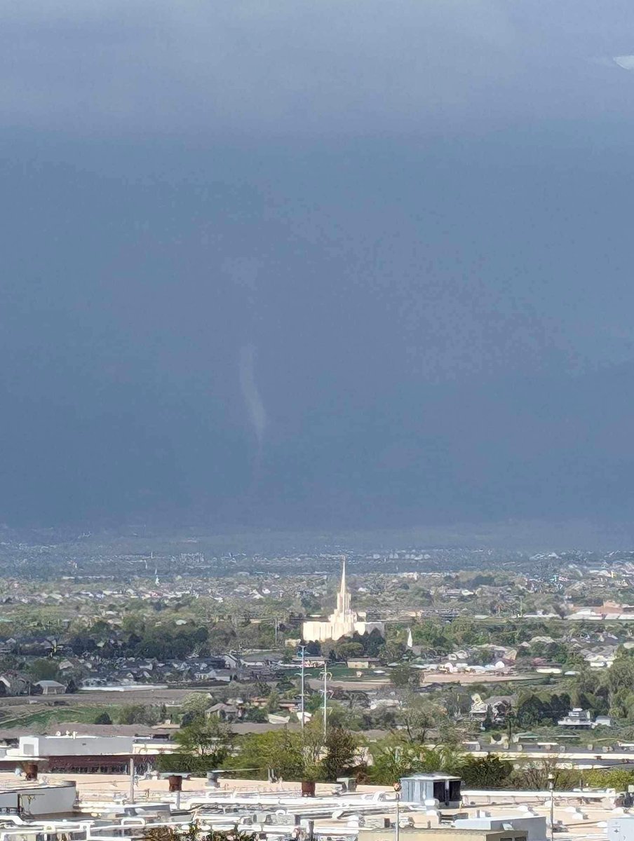
A Landspout #Tornado formed in West Daybreak, SW Salt Lake Valley around 11:00 AM. @NWSSaltLakeCity @Grallon  @brianwusa @dannahyer @dannahyer @stevebaron @cajaaw #utwx

Photos: Allison Hill Kunz, Jacquse Marie Coclovo, Lisa Ayres-Merlotti & several other Fox13 News Viewers.
account_circle
NWS Salt Lake City(@NWSSaltLakeCity) 's Twitter Profile Photo

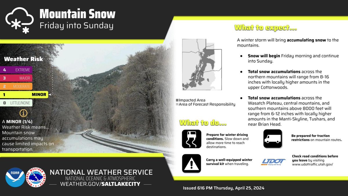
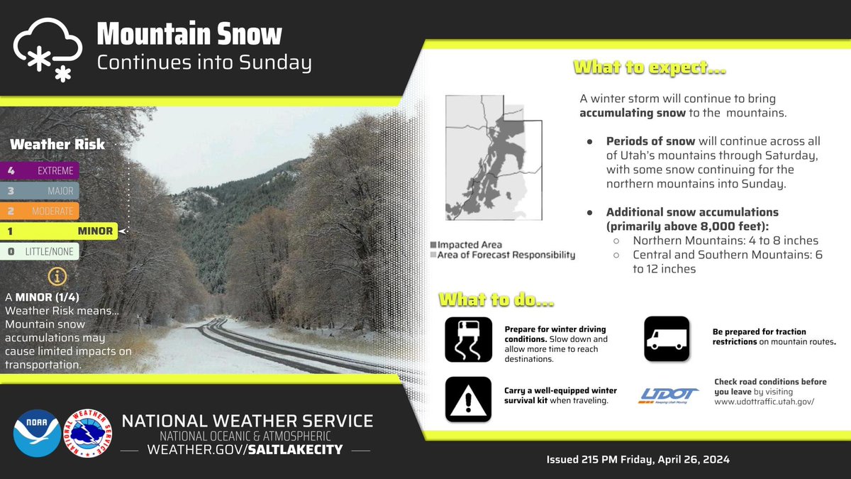
Mountain snow will start Friday and continue through Saturday and into Sunday. The highest accumulations will be in the Wasatch and Uinta Mountains above 8000 feet. The Wasatch Plateau, central, and southern mountains above 8000 feet will receive 6-12 inches of snowfall.

Mountain snow will start Friday and continue through Saturday and into Sunday. The highest accumulations will be in the Wasatch and Uinta Mountains above 8000 feet. The Wasatch Plateau, central, and southern mountains above 8000 feet will receive 6-12 inches of snowfall. #utwx
account_circle
Nate Larsen(@NateLarsenWX) 's Twitter Profile Photo

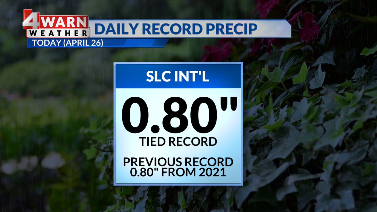
RECORD RAIN! We've now tied the current record for SLC International with 0.80' reported.


ABC4 News
@alanabrophywx
@thomasgeboywx

RECORD RAIN! We've now tied the current record for SLC International with 0.80' reported. 
#utwx

@abc4utah
@alanabrophywx
@thomasgeboywx
account_circle
Chase Thomason(@ChaseThomason) 's Twitter Profile Photo

Check out this landspout πŸŒͺ️ taken today around noon. Spin originates near the ground and not within the storm like a normal tornado. Pretty cool!

πŸ“ Daybreak, South Jordan, Utah
πŸ“· Brandon Isom

Check out this landspout πŸŒͺ️ taken today around noon. Spin originates near the ground and not within the storm like a normal tornado. Pretty cool! #utwx 

πŸ“ Daybreak, South Jordan, Utah
πŸ“· Brandon Isom
account_circle
NWS Salt Lake City(@NWSSaltLakeCity) 's Twitter Profile Photo

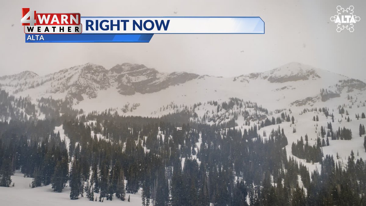
Periods of snow will continue through Saturday for all of Utah's mountains, with the mountains of northern Utah seeing additional snow through Sunday. Snow levels will be relatively high, with the best accumulations primarily occurring above 8,000 feet.

Periods of snow will continue through Saturday for all of Utah's mountains, with the mountains of northern Utah seeing additional snow through Sunday. Snow levels will be relatively high, with the best accumulations primarily occurring above 8,000 feet. #utwx
account_circle