NWS Milwaukee(@NWSMilwaukee) 's Twitter Profile Photo

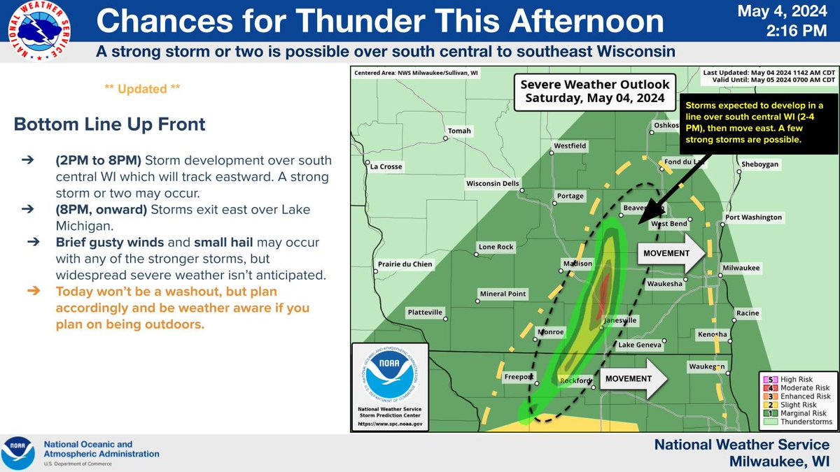
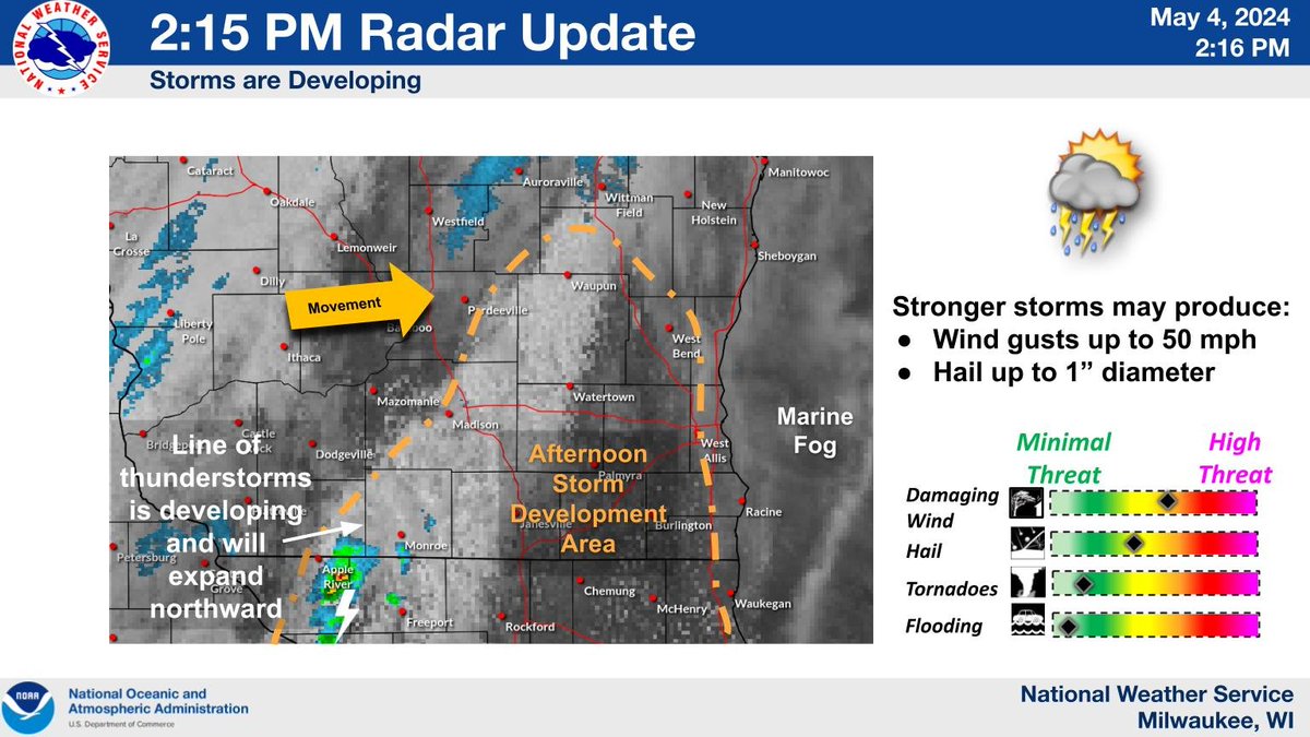
Thunderstorms are developing into a broken line that will track across south central and southeast WI through early evening. A strong storm or two is possible.

Thunderstorms are developing into a broken line that will track across south central and southeast WI through early evening. A strong storm or two is possible. #swiwx #wiwx
account_circle
NWS Milwaukee(@NWSMilwaukee) 's Twitter Profile Photo

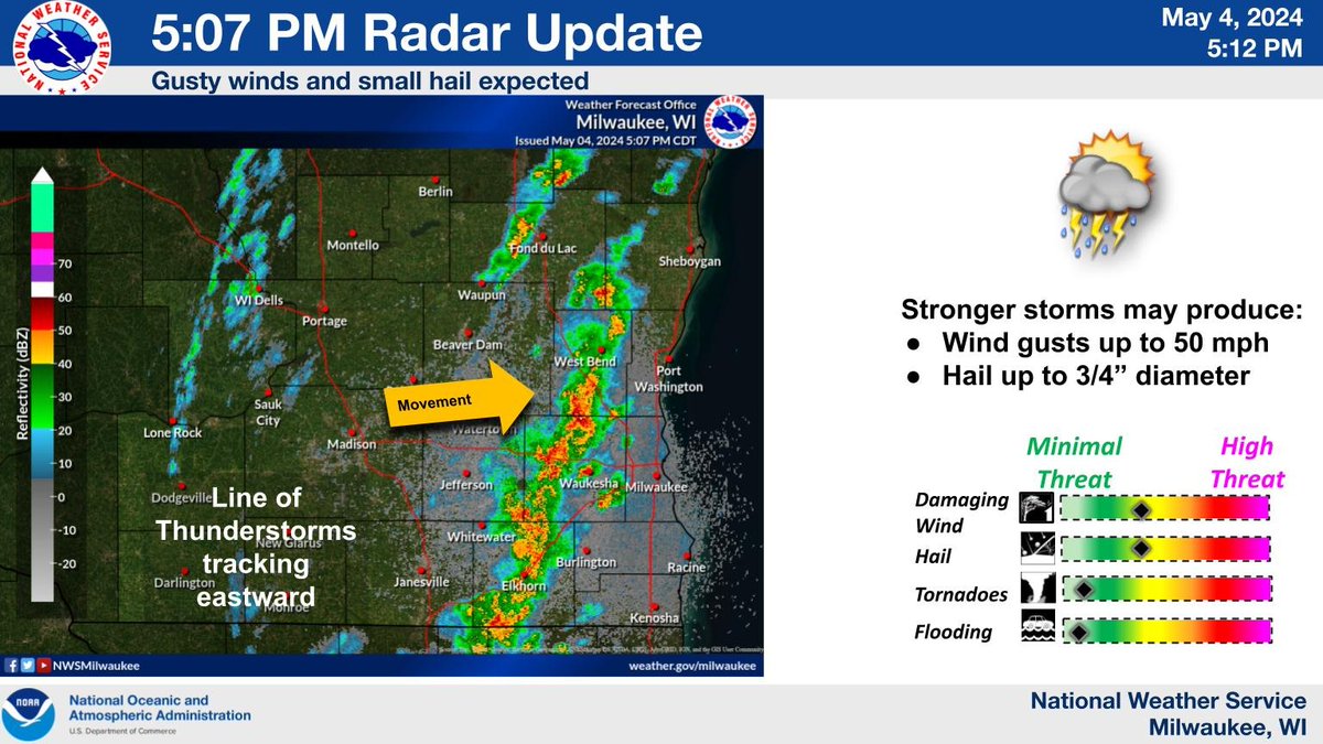
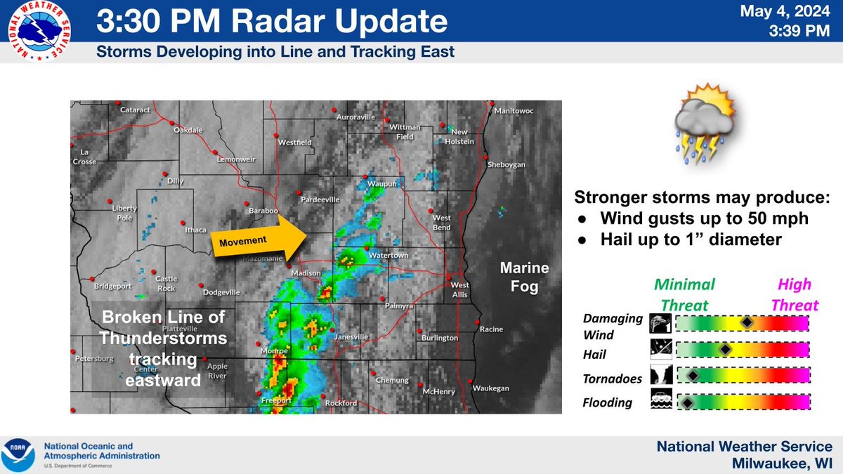
3:30 PM Radar Update: Line of storms developed this afternoon and are tracking eastward. A few stronger storms are possible.

3:30 PM Radar Update: Line of storms developed this afternoon and are tracking eastward. A few stronger storms are possible. #swiwx #wiwx
account_circle
Christopher J. Lee(@leemarkcom) 's Twitter Profile Photo

The sun broke through the clouds during the 'golden hour' this evening, casting an orange glow on the Wisconsin Air National Guard's 115th Fighter Wing buildings at Truax Field in Madison.

115th Fighter Wing MSN Airport NWS Milwaukee

The sun broke through the clouds during the 'golden hour' this evening, casting an orange glow on the Wisconsin Air National Guard's 115th Fighter Wing buildings at Truax Field in Madison.

#MadisonWI @115thWing @MSN_Airport #AVGeek #sunset #Airport #Truax @NWSMilwaukee #swiwx
account_circle
NWS Milwaukee(@NWSMilwaukee) 's Twitter Profile Photo

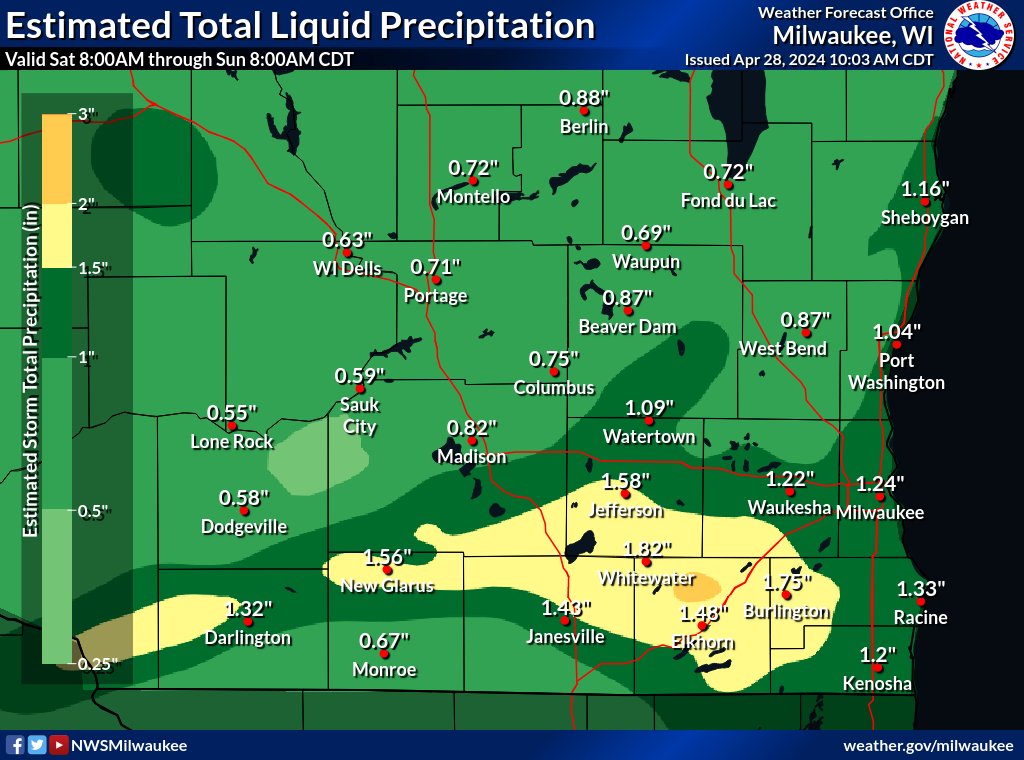
Here is the estimated rainfall totals from Saturday 4/27 across southern WI. Highest amounts of around 2 inches were in north central Walworth County.

Here is the estimated rainfall totals from Saturday 4/27 across southern WI. Highest amounts of around 2 inches were in north central Walworth County. #swiwx #wiwx
account_circle
Teri Barr(@TeriBarrMedia) 's Twitter Profile Photo

We have a WARNING + sirens going off in Dane County, right now until 9:40pm

Lightning and a 'warmish'' feel outside.
Please be safe!

account_circle
NWS Milwaukee(@NWSMilwaukee) 's Twitter Profile Photo

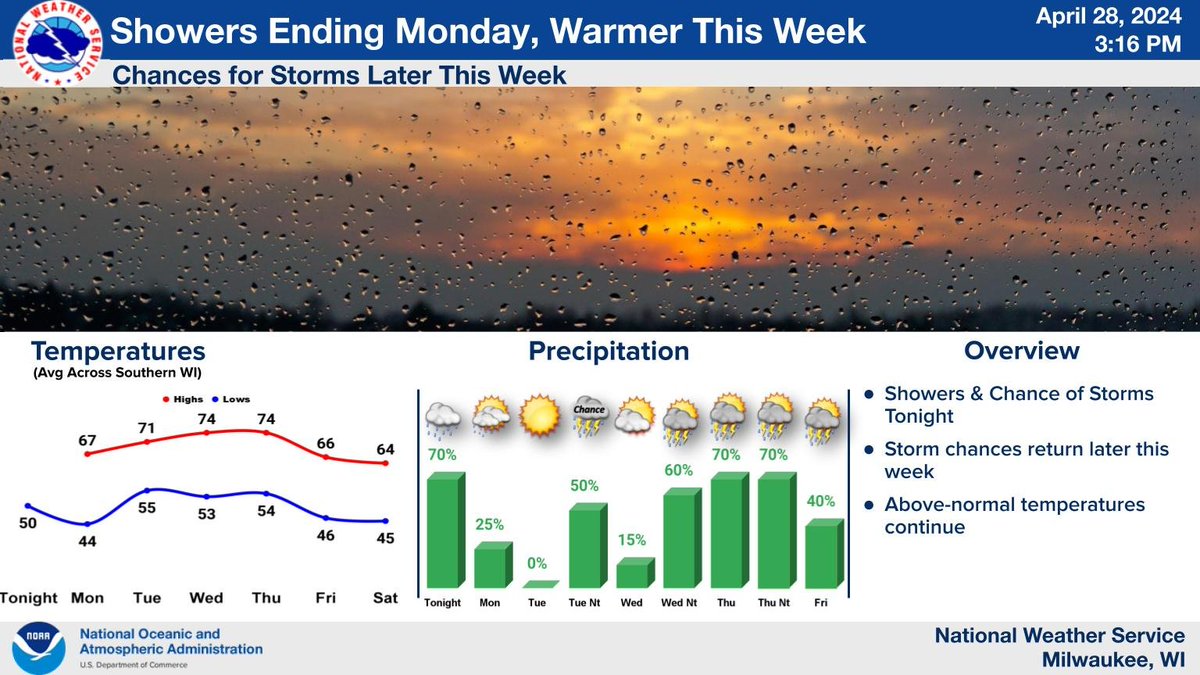
Temperatures will rise back into the 70s by Tuesday, with above normal temperatures continuing through late week before diminishing next weekend. After rain exits tomorrow morning, a few chances for showers and thunderstorms develop Wednesday night through Friday.

Temperatures will rise back into the 70s by Tuesday, with above normal temperatures continuing through late week before diminishing next weekend. After rain exits tomorrow morning, a few chances for showers and thunderstorms develop Wednesday night through Friday. #swiwx #wiwx
account_circle
NWS Milwaukee(@NWSMilwaukee) 's Twitter Profile Photo

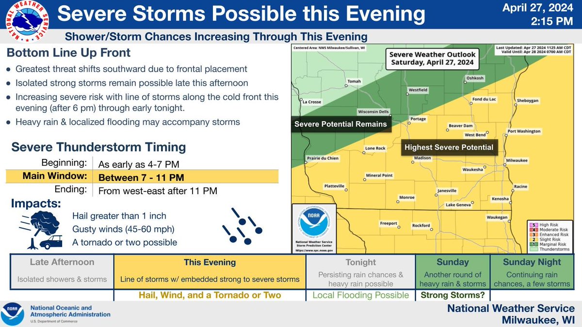
Showers and storms are expected to develop late this afternoon into early this evening, persisting through at least early tonight. Some storms may be severe, with large hail and damaging winds the main threats. A tornado or two remains possible. Remain weather aware!

Showers and storms are expected to develop late this afternoon into early this evening, persisting through at least early tonight. Some storms may be severe, with large hail and damaging winds the main threats. A tornado or two remains possible. Remain weather aware! #swiwx #wiwx
account_circle
NWS Milwaukee(@NWSMilwaukee) 's Twitter Profile Photo

Scattered showers and a chance of thunderstorms can be expected through tonight. The chance for severe storms is diminishing.

Scattered showers and a chance of thunderstorms can be expected through tonight. The chance for severe storms is diminishing. #swiwx #wiwx
account_circle
NWS Milwaukee(@NWSMilwaukee) 's Twitter Profile Photo

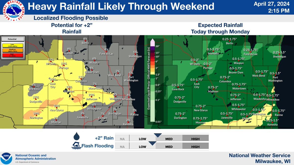
Rounds of showers and storms will lead to locally heavy rainfall this weekend into Monday. Highest rainfall totals still expected along and south of I-94. Potential for urban and small stream flooding, with ponding of water in low lying areas.

Rounds of showers and storms will lead to locally heavy rainfall this weekend into Monday. Highest rainfall totals still expected along and south of I-94. Potential for urban and small stream flooding, with ponding of water in low lying areas. #wiwx #swiwx
account_circle
Christopher J. Lee(@leemarkcom) 's Twitter Profile Photo

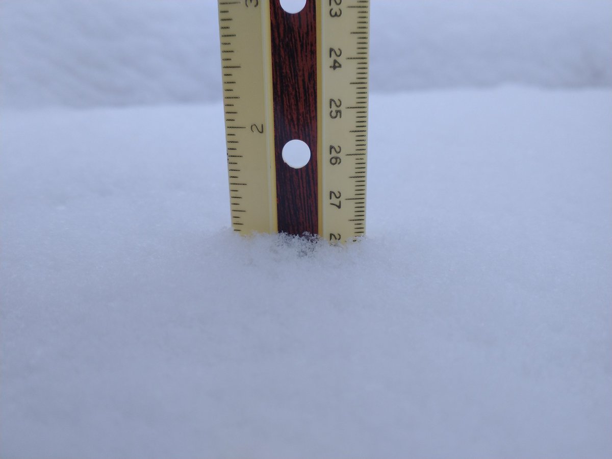
It started snowing before 10:30 last night on the far-east side of Madison, Wisconsin.

So far we have about one inch of fairly heavy, wet snow. (Photo taken at 8:04 a.m. on Friday, 3/22/2024)

Some schools canceled, some not.

NWS Milwaukee

It started snowing before 10:30 last night on the far-east side of Madison, Wisconsin.

So far we have about one inch of fairly heavy, wet snow. (Photo taken at 8:04 a.m. on Friday, 3/22/2024)

Some schools canceled, some not.

@NWSMilwaukee #swiwx #wiwx #MadisinWI #snowreport
account_circle
NWS Milwaukee(@NWSMilwaukee) 's Twitter Profile Photo

11:15 AM Radar Update: Weakening line of showers πŸ™΄ storms moving into the Dells area. Additional development expected this afternoon east of Madison and south of Fond du Lac. A few stronger storms are possible.

11:15 AM Radar Update: Weakening line of showers πŸ™΄ storms moving into the Dells area. Additional development expected this afternoon east of Madison and south of Fond du Lac. A few stronger storms are possible. #swiwx #wiwx
account_circle
John the Owl Whisperer πŸ¦‰(@JohnKivikoski) 's Twitter Profile Photo

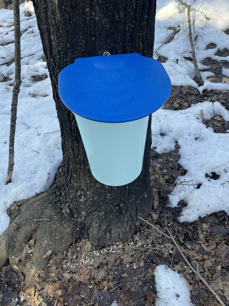
Feels early, but the forecast is 20’s night 40’s (50’s?) day for the next 10 days and the sap is flowing. πŸ€·πŸΌβ€β™‚οΈ

Feels early, but the forecast is 20’s night 40’s (50’s?) day for the next 10 days and the sap is flowing. πŸ€·πŸΌβ€β™‚οΈ

#swiwx
account_circle