Logan Co: (UPDATE) Hwy. 10 WB right shoulder remains blocked due to an accident just west of Booneville. Monitor at IDriveArkansas.com. #artraffic #swatraffic #nwatraffic
twitter.com/IDriveArkansas…


Advisory: The Nat’l Weather Service has issued a Tornado Watch until 2am for much of southern Arkansas. Details/possible warnings at weather.gov/lzk. #swatraffic #seatraffic


Advisory: The Nat’l Weather Service says severe thunderstorms are possible in Arkansas today/tonight. Details/updates at weather.gov/lzk. #artraffic #cnatraffic #nwatraffic #neatraffic #swatraffic #seatraffic


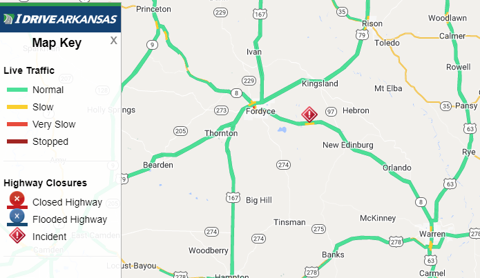
Cleveland Co: (UPDATE) Hwy 8 all lanes remain blocked 3.3 miles East of State Highway 205 (Fordyce) due to an accident involving a tractor-trailer. Monitor IDriveArkansas.com for the latest information. #artraffic #swatraffic #seatraffic

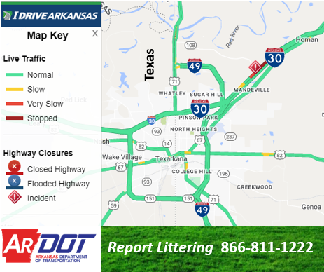
Miller Co: (UPDATE) I-30 WB right lane/shoulder remain blocked due to a multi-vehicle accident near Hwy. 108 Exit 7 in Texarkana. Monitor at IDriveArkansas.com. #artraffic #swatraffic
twitter.com/IDriveArkansas…

Hot Spring Co: (UPDATE) I-30 EB right shoulder remains blocked due to a 2-vehicle accident 1.3 miles west of Malvern (mm 94.4). Monitor at IDriveArkansas.com. #artraffic #cnatraffic #swatraffic
twitter.com/IDriveArkansas…


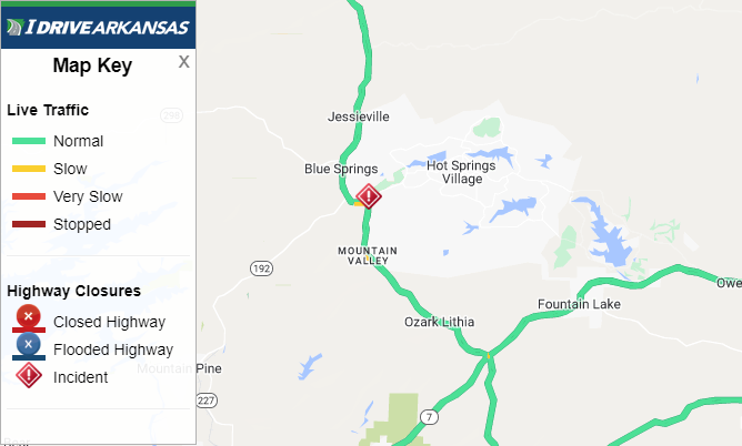
Garland Co: (UPDATE) Hwy. 7 remains blocked due to an accident 7.3 miles north of Hot Springs. Monitor at IDriveArkansas.com. #artraffic #cnatraffic #swatraffic
twitter.com/IDriveArkansas…


Miller Co: (UPDATE) I-30 WB right shoulder remains blocked due to a multi-vehicle accident near Hwy. 108 Exit 7 in Texarkana. Travel lanes are open. Monitor at IDriveArkansas.com. #artraffic #swatraffic
twitter.com/IDriveArkansas…

Advisory: The Nat’l Weather Service has issued a Tornado Watch until 2am for much of southern Arkansas. Details/possible warnings at weather.gov/lzk. #artraffic #cnatraffic #swatraffic #seatraffic


Advisory: The Nat’l Weather Service has issued a Flood Watch until Monday (7am) for most of Arkansas. Details/updates at weather.gov/lzk. Hwy conditions at IDriveArkansas.com. #artraffic #cnatraffic #nwatraffic #swatraffic #neatraffic #seatraffic

Advisory: The Nat’l Weather Service says areas of dense fog is developing in Arkansas overnight and will continue into the morning. Use caution if traveling. Details at weather.gov/lzk. #artraffic #cnatraffic #nwatraffic #neatraffic #swatraffic #seatraffic


Advisory: The Nat’l Weather Service has issued a Tornado Watch until 11pm for much of western Arkansas. Details/possible warnings at weather.gov/lzk. #artraffic #nwatraffic #swatraffic #cnatraffic


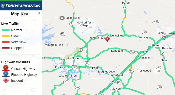
Saline Co: (UPDATE) Hwy 5 SB right shoulder remains blocked 1.8 miles West of State Highway 9 (Fountain Lake) due to an accident with injury. Monitor IDriveArkansas.com for the latest information. #artraffic #swatraffic


Garland Co: (UPDATE) Hwy 7 NB right shoulder remains blocked 0.7 miles SE of State Highway 192 (Hot Springs) due to an accident. Monitor IDriveArkansas.com for the latest information. #artraffic #swatraffic

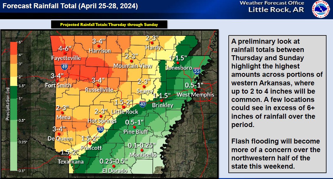
Advisory: The Nat'l Weather Service says storms will occur in Arkansas today through Sunday. All types of severe weather is possible including flash flooding. Details/updates at weather.gov/lzk. #artraffic #cnatraffic #nwatraffic #neatraffic #swatraffic #seatraffic

Advisory: The Nat’l Weather Service says areas of dense fog will develop in Arkansas overnight and continue into the morning. Use caution if traveling. Details at weather.gov/lzk. #artraffic #cnatraffic #nwatraffic #neatraffic #swatraffic #seatraffic


Garland Co: (UPDATE) Hwy 128 EB all lanes remain blocked 3.6 miles NW of U.S. Highway 70 (Fountain Lake) due to an accident. Monitor IDriveArkansas.com for the latest information. #artraffic #swatraffic

Advisory: The Nat'l Weather Service says thunderstorms with all modes of severe weather are possible in Arkansas (Friday - Sunday). Use caution if traveling. Details/updates at weather.gov/lzk. #artraffic #cnatraffic #nwatraffic #neatraffic #swatraffic #seatraffic


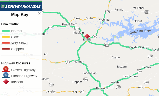
Montgomery Co: (UPDATE) Hwy 270 EB all lanes remain blocked 0.4 miles SE of State Highway 27 (Mount Ida) due to a two-vehicle accident. Monitor IDriveArkansas.com for the latest information. #artraffic #swatraffic

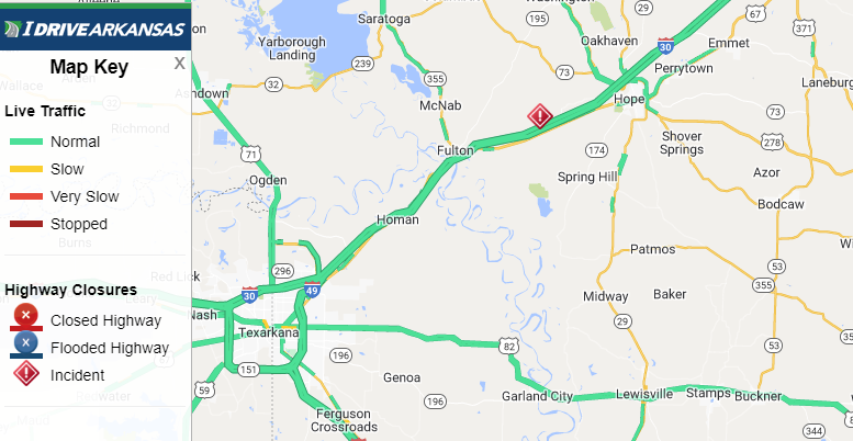
Hempstead Co: (UPDATE) I-30 WB left shoulder remains blocked at Mile Marker 23.5 (Hope) due to a single vehicle accident in the median. Monitor IDriveArkansas.com for the latest information. #artraffic #swatraffic
