
Excuse me what...LOL?!
#PolarVortex #PNW #BCWx #BCStormWatch #HereWeGo #Weathernews #Trending #WinterWatch


Another Climate Change Claim Exposed: Polar Bears #climateadaptation #ClimateScam #PolarVortex #GretaThunberg #autism #ClimateAction #factcheckingfails #tcnt


🥶We still ‘polar vortexing’ up in dis bich🥶👎 beautiful #StonerFam #CannaLand #CannabisCommunity #Mmemberville 🤟💚 Be careful out there guys🥶Know the signs of cold illnesses🥶Check on neighbours🥶 #BeSafe #PolarVortex #Hypothermia #DogMom #Frostbite


Only a watch designed in Cupertino would have a weather widget that stops working when it hits below -30. 🥶 #PolarVortex


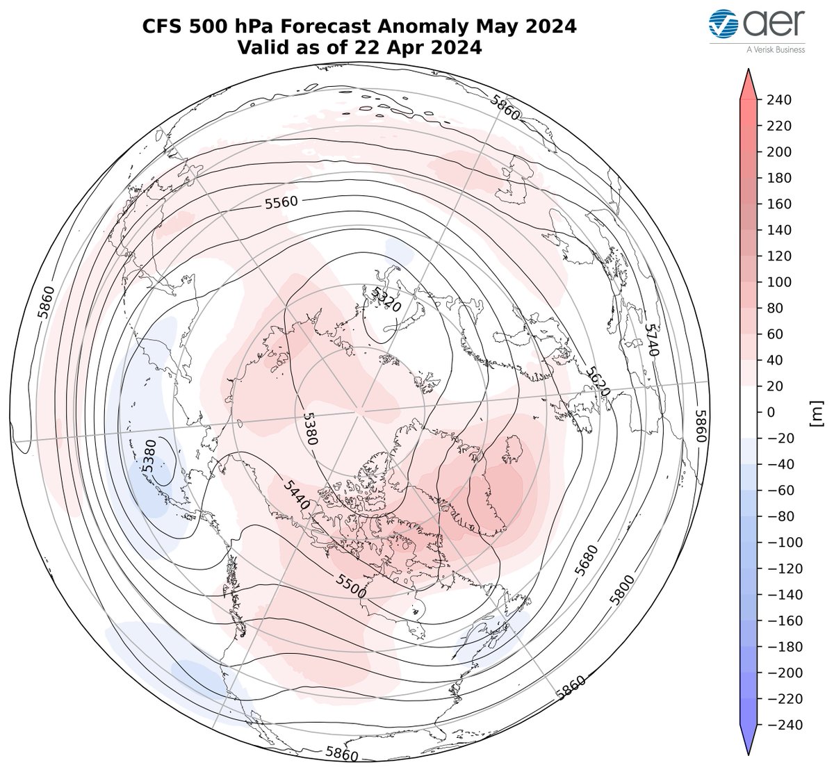
The large #PolarVortex disruption from early March is still influencing our weather and will get an assist from the Final Warming next week (positive PCHs in the stratosphere). This may result in a long lasting Greenland blocking event that the models predict will last into May.


Spoiler Alert: #PolarVortex disruption in January.
Mid-term weather forecasts hint at a significant Stratospheric Warming developing. Stay tuned for an update later this week.
Video: wxcharts - a MetDesk Company

This morning's North Atlantic regional geopotential polar cap height plot showing something unique. Downward influence from #PolarVortex disruption in early March reaching the troposphere resulting in Greenland blocking & simultaneously signs of Final Warming in the stratosphere!


Santa Delivers a Gift for All Snow Lovers...
The 0z EPS Control Run.
It shows an even more extreme Sudden Stratospheric Warming Event ( #SSWE ) than yesterday's run with a full split of the #PolarVortex and one piece coming to North America.
Are you excited yet?
#WinterIsComing


